Bengaluru Fort: The Fort at the Core of Kempe Gowda’s Capital
Site at a Glance
- Country
- India
- Primary era
- Early Modern
- Eras represented
- Early Modern
- Civilizations
- Vijayanagara
- Site type
- Military
- Remains
- Citadel
On this page17 sections
History
Bengaluru Fort, in Bengaluru, India, was begun in 1537 by Kempe Gowda I, a chieftain serving the Vijayanagara Empire, a major South Indian kingdom. It became the fortified core of Bengaluru Pete, the capital Kempe Gowda established after leaving his ancestral territory at Yelahanka.
Foundation and the new capital
Kempe Gowda received permission and financial support from King Achyuta Deva Raya. The king granted revenue from 12 hoblis, or administrative subdivisions, worth 30,000 varahas, gold coins, each year. The planned settlement was to combine a fort with military quarters, water reservoirs and temples, protecting residents as well as traders and craftspeople. A separate gathering place, Kempegowda Hajara, at the foot of Shivagange hill, served for special judicial hearings, public grievances and discussions with ministers.
Traditions connect the choice of the fort’s site with a hunting trip Kempe Gowda made with his adviser Gidde Gowda. In one story, a hare that chased a hunting dog was considered a favourable sign; another says a dream of Lakshmi, a Hindu goddess associated with prosperity, confirmed the choice. A ritual marking the start of building took place on an auspicious day in 1537.
A story about the southern gate claims that predictions of its collapse led Kempe Gowda’s daughter-in-law, Lakshamma, to sacrifice herself, after which a temple was raised in her memory at Koramangala. The story has no support in known chronicles or inscriptions, and its chronology is doubtful because Kempe Gowda’s eldest son was only six in 1538. Another version says an unidentified pregnant woman volunteered instead.
Bijapur and Wodeyar rule
In 1637–38, during the rule of Kempe Gowda III, Bijapur forces moved against Bengaluru after taking Sira Fort. Their commander, Randaula Khan, also known as Rustam-i-Zaman, was persuaded not to storm Bengaluru by Kasturi Ranga Nayak, who had been assigned Sira. Nayak later helped bring about the fort’s surrender without a battle. Randaula took control and entrusted its administration to Shahaji Bhonsle, a Maratha commander in the service of Deccan rulers. Bengaluru then became the headquarters of the territories Randaula had recently conquered.
Chikkadeva Raya, a ruler of Mysore’s Wodeyar dynasty, enlarged the fort during his reign, between 1673 and 1704.
Hyder Ali and Tipu Sultan
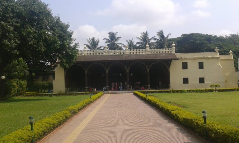
Hyder Ali, a ruler of Mysore, and his son Tipu Sultan shaped the fort’s later history. British forces bombarded it during fighting against Tipu, who subsequently repaired it. Under his rule, the fort served as a center of power and contained his summer palace and armoury. One tradition says Tipu ordered much of the fort demolished to improve the view from his palace; the Wodeyar rulers later restored it.
British capture and dismantling
On 21 March 1791, during the Third Mysore War, a conflict between Mysore and the British East India Company, British troops under Lord Cornwallis captured the fort. The Company was a British trading corporation that also maintained an army and exercised territorial power in India. Its forces broke through the wall near the Delhi Gate. Mysore troops under commandant Bahadur Khan resisted, and more than 2,000 Mysore soldiers were killed. The capture replenished British supplies and provided a base for the later attack on Srirangapatna, Tipu Sultan’s capital.
The British began dismantling the fort after taking it, a process that continued into the 1930s. Roads replaced parts of its walls and ramparts, while arsenals, barracks and other older buildings gave way to institutions such as colleges, schools, bus stands and hospitals.
Plans and drawings from the late eighteenth century show the fort, its gates and Tipu’s palace, including the British attacks. James Hunter, a Royal Artillery lieutenant, part of the British Army’s artillery corps, and military artist, sketched Bengaluru and the fort. His work was published in London between 1802 and 1805.
Church, school and memorials
After Tipu Sultan’s fall, British soldiers built the Fort Church, first known in early records as the Drummer’s Chapel. It was Bengaluru’s first Protestant church. The building was later demolished to make way for Vani Vilas Hospital. The Government of Mysore provided land in Chamrajpet for a replacement church, now St. Luke’s Church.
From the late nineteenth century, the Fort Church maintained the Fort School, providing furniture and maps and managing its accounts through a school committee. The Fort Cemetery, just outside the church, held the graves of officers killed in the 1791 siege. By 1912, records of the fallen had been transferred to a cenotaph, a memorial that does not contain the dead, erected by the Government of Mysore. The cenotaph was vandalised on 28 October 1964 and completely destroyed.
Remains
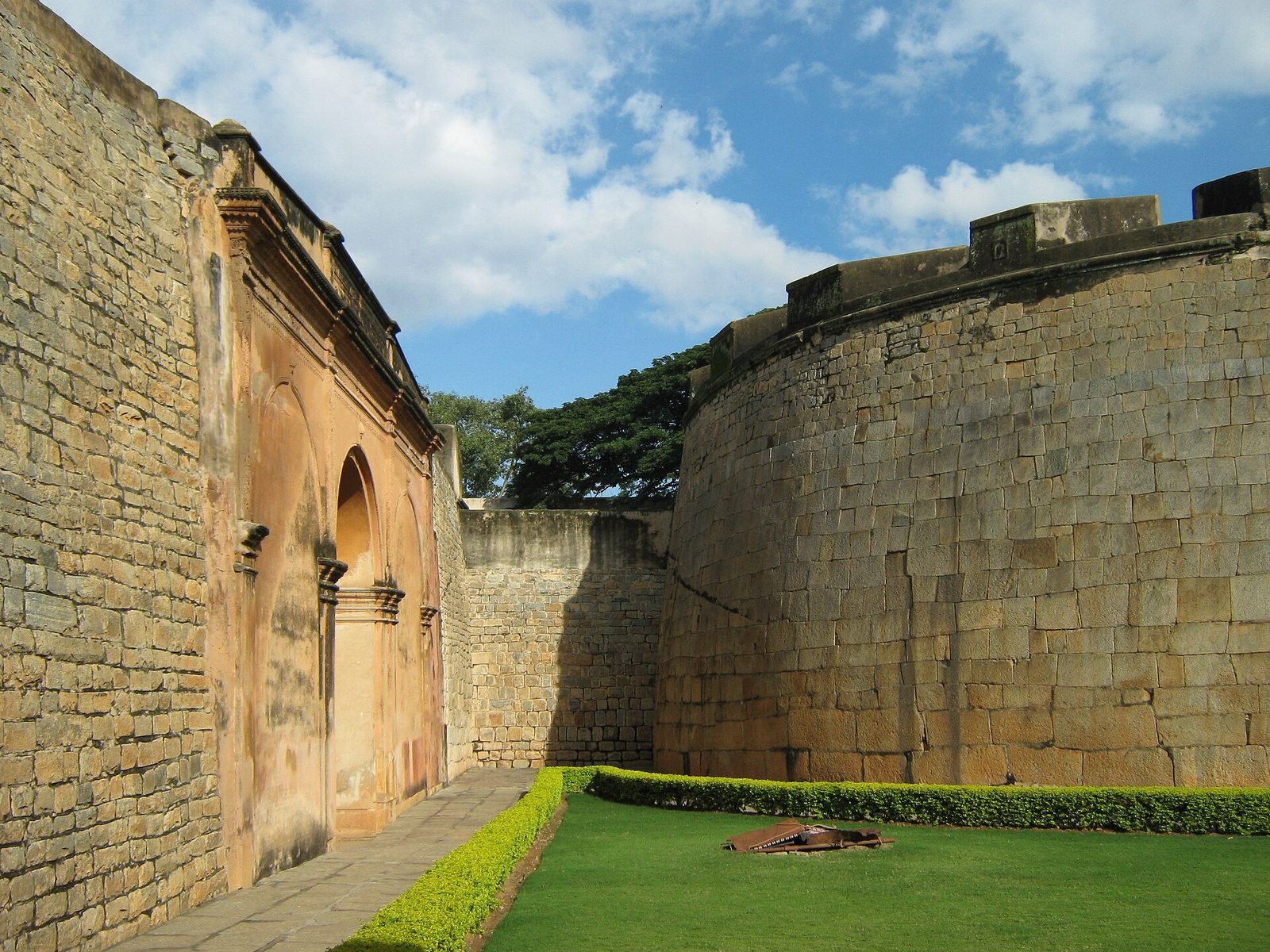
The fort began as an oval enclosure of compacted earth, reinforced with stone on its inner and outer faces. It extended about one kilometre from the Delhi Gate toward the present Kempegowda Institute of Medical Sciences campus; around 1791, its perimeter was about one mile. By the late eighteenth century, it had stone or granite walls set in mortar, a broad ditch and 26 towers along its defenses.
Defensive remains
Enclosure and gates
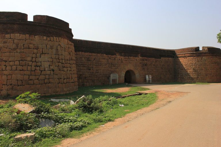
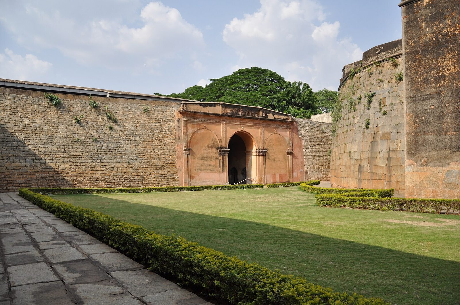
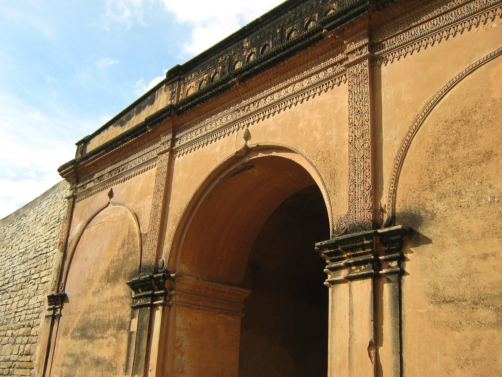
The original enclosure had four bastions, projecting sections that strengthened the defensive wall, and nine gates: four principal entrances and five smaller ones. The named gates included eastern and western entrances, the Delhi Gate to the north, the Mysore Gate and the southern Anekal Gate. Of the military works, the Delhi Gate and remains of two bastions survive. The Delhi Gate stands on Krishnarajendra Road.
Delhi Gate breach marker
A marble plaque marks the place where British troops broke through the fort wall in 1791. The breach was made near the Delhi Gate during the capture of the fort.
Fort plan and urban fabric
Town and street plan
The fortified town north of the fort extended for several miles around it. Its defenses included a comparatively weak rampart, a deep belt of thorn and cactus, and a small ditch. Within the fort, four principal streets ran east–west and north–south, meeting at the palace site near present-day Chikkapete Circle. Sun Street and Moon Street correspond to today’s Avenue Road and B.V.K. Iyengar Road.
Markets, palace and offices
Residential areas and markets occupied land inside and beyond the enclosure, with some quarters organized around occupations or communities. Markets handled wholesale and retail trade in rice, millet, textiles, jewellery, bangles, flowers, produce, salt, lime and leaves used to serve food. Doddapete functioned as a wholesale center and Chikkapete as a retail center.
The palace complex included an audience hall for durbars, or formal court assemblies, and judicial meetings. A treasury, police station, cattle office and customs offices also formed part of the fort’s civic layout.
Temples and later institutions
Twelve temples stood within the fort, including shrines to Ganapathy, a name for the Hindu god Ganesha, and Venkataramana, a name for Vishnu. The former precinct also included Kote Venkataramana Swamy Temple, Tipu Sultan’s Summer Palace and armoury, Makkala Koota park, Victoria Hospital, Bangalore Medical College, Fort High School, Minto Ophthalmic Hospital and the present KIMS campus and hospital.
School building and archaeological finds
Fort School
The Fort School building in Chamrajpet dates to 1907 and was formerly called the English Vernacular School. It stands opposite Bangalore Medical College and near Tipu Sultan’s Summer Palace.
Iron cannons
In November 2012, workers at a nearby Bengaluru Metro construction site uncovered two iron cannons, each weighing about a ton, along with cannonballs. The weapons date to Tipu Sultan’s period.