Beijing City Fortifications: Defenses of China’s Capital
Site at a Glance
- Country
- China
- Primary era
- Medieval
- Eras represented
- Medieval, Early Modern
- Civilizations
- Ming, Qing, Yuan
- Site type
- Military
- Remains
- Wall
On this page20 sections
History
Beijing city fortifications are the successive defensive enclosures of China’s capital, first laid out for Yuan Dadu in 1264 and expanded under the Ming and Qing dynasties. Beijing served as China’s capital for most of the Yuan, Ming, and Qing periods, and as a secondary capital under the earlier Liao and Jin dynasties. Its defenses surrounded four nested urban zones: the Forbidden City, the Imperial City, the Inner City, and the Outer City.
Yuan Dadu and the early Ming rebuilding
Yuan Dadu, the predecessor of the later Ming and Qing capital, had eleven gates distributed along its four walls. In August 1368, Ming general Xu Da captured the city. He judged its broad northern defenses difficult to hold in a siege and ordered a replacement wall built about 2.8 kilometres farther south. Hua Jilong directed construction of the new wall, which was made of earth compacted in layers and later strengthened with stone and brick.
The old northern wall was abandoned after 1372, and material from it was used to reinforce the new defenses. Some stretches continued to serve as a secondary line during the Ming, including in the period of An Da’s rebellion. Small portions of the earlier city’s walls and moat, along with part of the fortified enclosure at Suqingmen, survive.
Beijing becomes the Ming capital
In 1370, the Hongwu Emperor made his fourth son, Zhu Di, King of Yan, with Beiping as his capital. A palace was completed there in 1379, and Zhu Di moved into it the following year. After becoming emperor, he renamed the city Beijing in 1403 and began planning the transfer of the imperial capital from Nanjing in 1406. Repeated Mongol incursions from the north made stronger defenses a central concern.
Ming construction began in 1406 with Xinei, a project built on the foundations of the Yan king’s palace and completed the next year. Work on the Forbidden City began in 1416, following the model of Nanjing’s imperial palace. To make room for the future Imperial City, the southern wall was moved about 0.8 kilometres south. The capital formally shifted from Nanjing to Beijing in 1421. The Temple of Heaven, Temple of Earth, and Xiannong Temple were established in the southern suburbs. One interpretation proposes that the city’s central axis was moved east to counter the preceding dynasty’s qi, a traditional concept of vital force, though this explanation remains a cosmological interpretation.
Between 1436 and 1445, a major building phase strengthened walls and gates, added four corner guard towers, and placed ceremonial archways outside principal gates. Workers replaced wooden bridges over the moats with stone ones and added water-control passages and stone-and-brick facing. These works completed the Inner City’s wall and moat defenses. Its circuit then measured about 22.5 kilometres. During a siege, the capital could also draw on supply facilities, forces at Changping and other outlying positions, and sections of the Great Wall.
The Outer City and Qing Beijing
After repeated Mongol incursions, officials proposed an Outer City by 1476. Work on three smaller fortified districts began in 1550 but stopped after residents objected to the demolition of their homes and shops. A larger project was approved in 1553, and construction began the following year under the supervision of Yan Song. The southern defenses were built first to protect the busy commercial area south of Zhengyangmen. Military pressure on the northern frontier and a major fire in the Forbidden City in 1557 diverted soldiers, workers, and funds. The gates’ fortified outer enclosures, called barbicans, were built in 1564, and the resulting city plan remained in use for nearly four centuries.
The Qing largely retained the Ming walls and moats but changed the use and population of the enclosed districts. Former Ming residences and government buildings in the Imperial City became housing or storage. Han Chinese were assigned to the Outer City or areas beyond it, while Inner City housing was allocated to the Eight Banners, the Qing military and administrative organization for Manchu, Mongol, and Han forces. Additional homes were built for imperial relatives, and Gelug Buddhist temples and imperial gardens developed in the western suburbs.
Ming forces in and around Beijing were organized into several formations, including firearm troops and allied Mongol soldiers. The Tumu Crisis of 1449, a military disaster in which the Zhengtong emperor was captured by Oirat Mongols, destroyed the capital’s main army. Yu Qian then assembled about 100,000 trained troops into ten battalions, later increased to twelve. Under the Qing, permanent garrisons and Eight Banner forces guarded the city’s gates and other strategic locations. Barracks were built at Inner City gates in 1728, and further housing and storage were added in 1835 as earlier facilities deteriorated.
Sieges, attacks, and military use
Later Jin forces besieged Beijing in 1629. Ming general Yuan Chonghuan defeated them at Guangqumen, and defenders used cannon against the attackers. In 1644, Li Zicheng’s rebel forces besieged the city. When they withdrew, Li ordered the Ming palace complex and major gates set on fire.
During the Second Opium War, a conflict between Qing China and Britain and France from 1856 to 1860, invading forces stationed outside Beijing abandoned a direct assault in view of the city’s extensive defenses. During the Boxer Rebellion, an anti-foreign uprising followed by intervention from foreign powers, fighting in 1900 damaged several gates and towers. Boxer forces burned Zhengyangmen’s gate tower, Indian troops destroyed its watchtower, and Japanese and British artillery damaged the Chaoyangmen and Chongwenmen watchtowers. Russian artillery struck the Inner City’s northwest corner tower. British troops also demolished stretches of the Outer City wall to extend railway lines toward Zhengyangmen and Tongzhou.
The fortifications still served a military purpose in the 1930s. On 25 July 1937, Japanese troops based at Fengtai tried to advance through Guang’anmen, saying they intended to protect Japanese residents and the embassy district. About twenty Chinese soldiers fired from the gate tower, and the Japanese troops abandoned the attempt.
Demolition, preservation, and restoration
After the Qing government fell in 1911, the Beiyang and Nationalist governments made further changes. Railway construction in 1915 led to the removal of corner towers, new passages through walls, and the dismantling of several barbicans and water passages. The Imperial City walls were almost entirely taken down. New openings were made at Hepingmen in 1924 and at sites later known as Jianguomen and Fuxingmen.
After 1949, planners treated the old walls and moats as obstacles to traffic and urban growth. Outer City wall demolition took place in the 1950s, while work on the Inner City walls began in 1953. Architect Liang Sicheng and other preservation advocates proposed retaining the walls and adapting them for traffic and public use, but their campaign failed to halt demolition. By the end of the Great Leap Forward, a state-led economic and social campaign of 1958–1961, much of the Outer City wall had been removed and the Inner City wall substantially reduced.
Beijing Subway construction began on 1 July 1965. The route followed the wall-and-moat corridors to limit house demolition and resident relocation, and construction required further removal of walls, gates, and moat sections. From 1972, eastern, southern, and western moat channels were filled or converted to sewers to accommodate the Second Ring Road and nearby development. In 1979, the government halted demolition of the remaining walls and designated them cultural heritage sites.
Restoration later returned some sections to use as preserved historic fabric. The wall south of Beijing railway station and the southeast corner tower were restored as part of Ming City Wall Ruins Park between 2001 and 2003, with further wall sections added in 2005 and 2006. Yongdingmen’s gate tower was reconstructed in 2004, slightly north of its original position.
Remains
The fortifications formed a series of nested enclosures, from the palace precinct at the centre to the Outer City projecting south of the Inner City. Walls, gates, towers, fortified gate enclosures, water passages, and moats made up the system. The Inner and Outer City defenses together traced an outline of roughly 60 kilometres. Wall construction combined an earth core with stone and brick facing, while the city’s northern setting also incorporated nearby mountains and sections of the Great Wall into its defensive geography.
City walls and surviving sections
Inner City walls
The Inner City was approximately square, though its east and west sides were somewhat longer after the northern and southern walls shifted. Its northwest corner followed a diagonal line where the original alignment crossed wetland, leaving a small triangular area outside the enclosure. This shape was also associated with the Nüwa myth, in which the goddess repairs a damaged sky. The wall incorporated earlier Yuan stretches on its eastern and western sides, while its northern and southern stretches were built under early Ming rulers. A rammed-earth core was faced with stone and finished in brick on both sides. The wall averaged 12 to 15 metres high; its northern and southern sides were thicker, measuring about 19 to 20 metres at the base and 16 metres across the top. A moat ran outside the wall, and the defenses included nine gates, corner towers, water passages, enemy-observation towers, and notched defensive parapets.
Outer City walls
The Outer City extended south from the Inner City and had a circuit of about 28 kilometres. Its walls generally measured 6 to 7 metres high, 10 to 11 metres across the top, and 11 to 15 metres at the base, with narrower western stretches. The exterior facing used large stone blocks, while smaller blocks were used in later work. The southern wall enclosed the south side of the Temple of Heaven; the eastern and western walls ran roughly parallel to the Inner City walls, about two kilometres away. The southeast corner turned diagonally to avoid low, swampy ground. Seven gates and four corner towers were associated with this defensive circuit.
Yuan Dadu remains
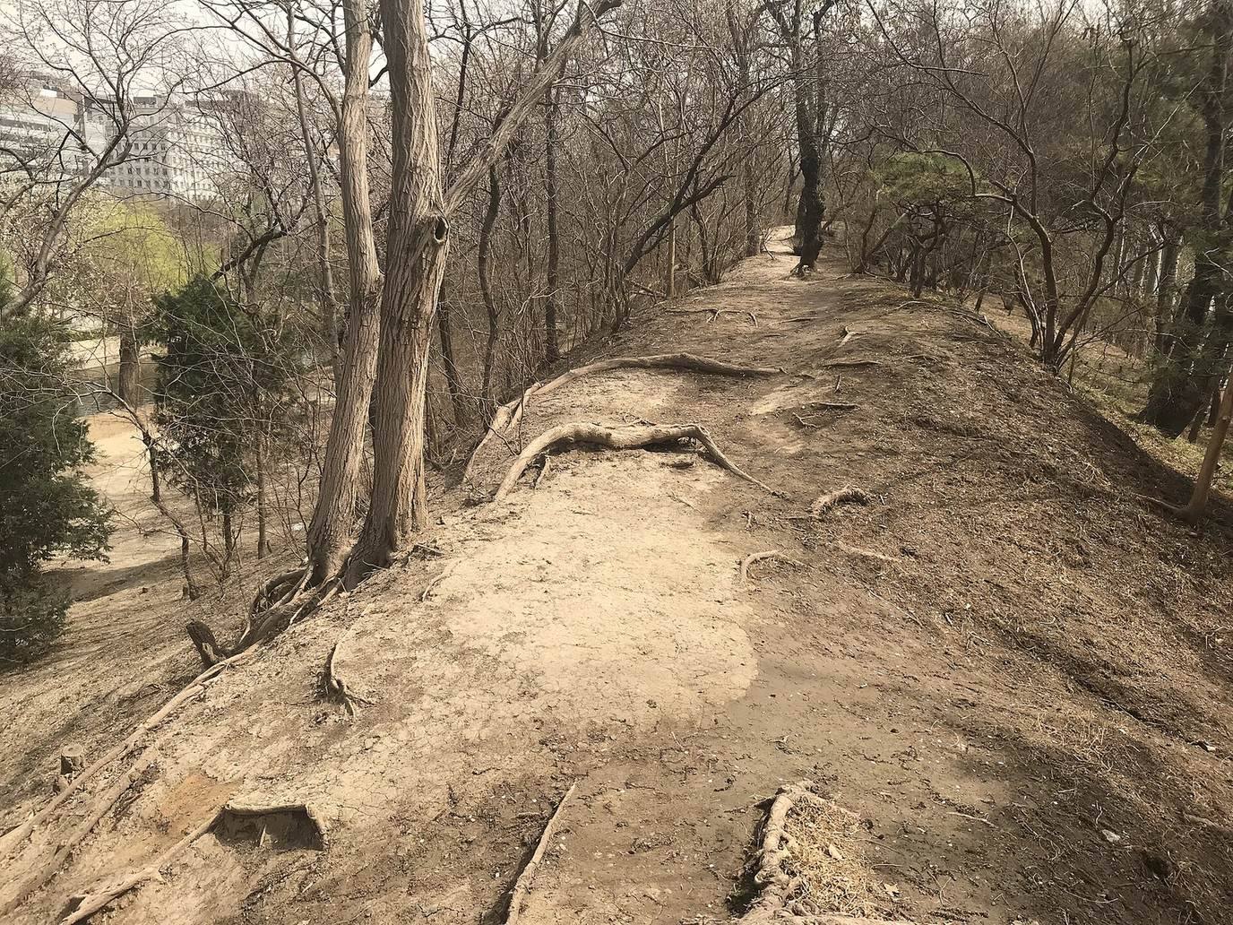
Small remnants of Dadu’s northern and western walls and moat survive. At Suqingmen, the southern half of a fortified enclosure built from rammed earth also remains. These fragments belong to the earlier city that preceded the Ming and Qing capital.
Gates and defensive towers
Inner City gates
Inner City gate towers stood on rectangular platforms integrated with the walls. Most were two-storey buildings with roofs that combined sloping ends and gabled sides, covered in grey tiles with green glazed tiles. Each principal gate had a watchtower in front, linked to the wall by a barbican. The nine barbicans had individual plans, including square forms at Dongzhimen and Xizhimen, rectangular forms at Zhengyangmen and Deshengmen, and rounded corners at many Inner City gates. Temples also stood within several of them. The gate towers varied in size, and their upper floors gave soldiers positions from which to watch for approaching forces.
Zhengyangmen
Zhengyangmen stood at the centre of the Inner City’s southern wall. Completed in 1419 and first called Lizhengmen, it was renamed during the Zhengtong era. Its gate tower rose 27.76 metres from a platform 13.2 metres high. The south-facing watchtower, commonly called Qianmen and reserved for the emperor, stood on a 12-metre platform and measured 38 metres high, 52 metres wide, and 32 metres deep. The adjoining barbican measured 108 by 85 metres. The gate and watchtower are among the surviving structures of the old city defenses.
Deshengmen and the southeast corner tower
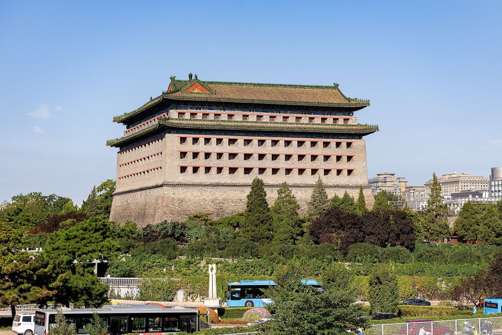
Deshengmen’s gate tower stood on the western part of the Inner City’s north wall and measured 31.5 by 16.8 metres, rising 36 metres high. Its large barbican measured 70 by 118 metres and contained a south-facing temple to Zhenwu, a Daoist martial deity. Deshengmen’s watchtower survives. The southeast corner guard tower also remains. It is one of four towers that shared a multi-storey design, with outward-facing arrow slits and internal platforms and stairs. Its preservation was aided by a subway route diverted away from the tower and adjoining wall.
Outer City gates
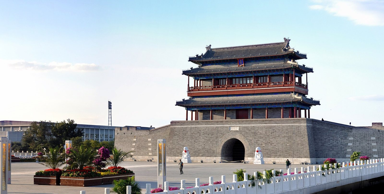
Yongdingmen was the central southern gate of the Outer City, aligned with Zhengyangmen, Tiananmen, and Wumen along the north–south axis. Its gate tower was built in 1766 and stood about 26 metres high. The rectangular barbican measured 42 metres east to west and 36 metres north to south. The gate tower was reconstructed in 2004 slightly north of its original position. At the Outer City’s northwest corner, sections of the Xibianmen barbican wall also survive.
Imperial and palace precinct walls
Imperial City
The Imperial City surrounded the Forbidden City and formed an additional walled zone. Its walls averaged 7 to 8 metres high, with red outer surfaces and imperial-yellow glazed tiles along the top. Tiananmen, the principal southern gate, stood on the main approach to the palace. Its 13-metre platform had a stepped pedestal and five archways; the tower rose 33.7 metres and was rebuilt in 1958. Duanmen, directly north of Tiananmen, served as an outer gate to Wumen. The Imperial City’s other gates included Damingmen to the south, Dong’anmen and Xi’anmen on the eastern and western sides, and Beianmen to the north.
Forbidden City
The Forbidden City was the imperial palace precinct enclosed by a wall 3.4 kilometres long, 10 metres high, and up to 8.62 metres thick at its base. Brick facing enclosed a stone and rammed-earth core, and two rows of imperial-yellow roof tiles topped the wall. Four corner guard towers reinforced its corners, and four principal gates controlled access. Wumen, the south-facing main gate, aligned with the gates and approaches to its south. Its high platform supported a large central tower, side pavilions, and projecting wings, while three central archways formed the main passage through the gate.
Moats and water passages
The moat network began under the Yuan and expanded with the Ming city. Water diverted from springs at Mount Yuquan and Baifuquan flowed through channels that fed the Inner City moat, the imperial garden lakes, and the Outer City circuit before joining the Tonghui River. The Inner City moat varied in width from about 10 metres to as much as 50 metres and reached three metres deep. Water passages through the walls were built with earth foundations faced by stone slabs and brick, and protected by iron railings. The channels served transport as well as drainage: boats carried food along southern sections toward Dongbianmen and the Tonghui River. Moat use later changed as sections were filled, covered, or converted into underground channels, while remnants of the northern Inner City and of other city enclosures survive.