Fort Ticonderoga: A French Fort and Revolutionary War Stronghold
Site at a Glance
- Country
- United States
- Primary era
- Early Modern
- Eras represented
- Early Modern, Modern
- Civilizations
- British, French
- Site type
- Military
- Remains
- Fort
On this page18 sections
History
Fort Ticonderoga is an eighteenth-century French fortification in the United States, built beside the La Chute River at the link between Lake Champlain and Lake George. Construction began in October 1755, and the star-shaped fort, designed in a style influenced by French engineer Vauban, was largely complete by 1758. Its position controlled an overland portage between the lakes on a route connecting the British-held Hudson River Valley with the French-held St. Lawrence Valley.
Indigenous history and early fortifications
Indigenous peoples had lived in the area for centuries before Samuel de Champlain arrived in 1609. Champlain described a nearby clash between the Algonquins who accompanied him and a Haudenosaunee group. The Haudenosaunee are an alliance of Indigenous nations in northeastern North America. In 1642, the French missionary Isaac Jogues crossed the Ticonderoga portage while fleeing conflict between Haudenosaunee and Wendat people.
The name Ticonderoga comes from a Mohawk expression meaning that the place lies at the meeting of two waterways. The Mohawk are one of the nations in the Haudenosaunee alliance. Colonial competition for the route was already evident in 1691, when Dutch-born New York leader Pieter Schuyler built a small wooden fort on the point. A separate small fortification protected by a timber fence, called Fort Vaudreuil, was built there in 1750.
Fort Carillon and the French and Indian War
After the 1755 Battle of Lake George, Pierre de Rigaud de Vaudreuil, governor of French Canada, sent his cousin Michel Chartier de Lotbinière to establish a permanent fort. The French named it Fort Carillon. The name may have recalled a French trading post in the area during the late seventeenth century; it was also commonly associated with the bell-like sound attributed to the La Chute rapids.
Construction unfolded during the French and Indian War, the North American fighting of the wider Seven Years’ War, a mid-eighteenth-century conflict fought across several continents. In 1757, French troops under Louis-Joseph de Montcalm captured Fort William Henry, prompting the British to plan an assault on Carillon. On July 8, 1758, General James Abercromby sent about 16,000 British troops against roughly 4,000 French defenders. The French repelled the attack. Since the fighting took place some distance from the fort, its guns saw little use. The victory fostered a reputation for the position as nearly impossible to take and affected later military planning in the region.
Montcalm ordered additional defenses after the battle, but the British did not attack again that year. Most French troops left in November, keeping only a small force through the winter. In 1759, General Jeffery Amherst advanced with about 11,000 troops. The French withdrew, destroying the powder store and disabling cannons they could not remove. The main fort escaped serious damage. British forces repaired and strengthened it during 1759–60, but a small garrison remained after the war and the fort fell into disrepair. In 1773, its commander, Frederick Haldimand, described it as ruinous.
The American Revolution, 1775–1776
On May 10, 1775, the Green Mountain Boys, a militia associated with the New Hampshire Grants region, joined volunteers from Massachusetts and Connecticut in a surprise attack led by Ethan Allen and Benedict Arnold. They captured the 48-man British garrison and seized artillery and other weapons. During the winter of 1775–76, Henry Knox directed the movement of many of the guns to Boston. Their placement at Dorchester Heights helped compel British troops to leave the city in March 1776. The capture also disrupted communication between British commands in Canada and America.
Arnold initially remained in command, but about 1,000 Connecticut troops arrived in June 1775 under Benjamin Hinman. Political maneuvering and confused communication delayed Arnold’s discovery that Hinman was to assume command. After a Massachusetts delegation clarified the situation, Arnold resigned and left the fort. Hinman then took charge.
From July 1775, Ticonderoga served as a base for the American invasion of Canada. Generals Philip Schuyler and Richard Montgomery assembled soldiers and supplies there. On August 28, after learning that British forces at Fort Saint-Jean were preparing boats, Montgomery led about 1,200 men down Lake Champlain. Support for the campaign continued until the siege and fighting at Quebec, where Montgomery was killed on December 31, 1775.
British reinforcements reached Quebec in May 1776 and pushed the American troops back toward Ticonderoga. After constructing ships, the British moved south on Lake Champlain in October and defeated a small American gunboat fleet at the Battle of Valcour Island. With winter near, they returned to Quebec. About 1,700 Continental Army soldiers, the military force organized by the American colonies, spent the winter at Ticonderoga under Anthony Wayne.
During the summer of 1776, Schuyler and later Horatio Gates directed extensive defensive preparations at Ticonderoga and Mount Independence. The defenses, together with a floating bridge between the two positions, helped deter the British from continuing their campaign that year. Their withdrawal to winter quarters in Quebec delayed an attempt to divide the colonies and gave the Continental Army more time to prepare before the American victory at Saratoga.
The British advance and the loss of Ticonderoga
In 1777, American leaders expected a British advance toward the Hudson River rather than an attack from the north. Schuyler requested 10,000 troops for Ticonderoga and another 2,000 for the Mohawk Valley, but the garrison under Arthur St. Clair numbered only about 2,000. It was too small to defend the full network of positions. George Washington, who had not visited the fort, believed its reputation would discourage a land assault from the north. Gates understood the danger posed by Mount Defiance, but the troops could not cover every position, and the hill remained undefended.
In June, General John Burgoyne brought about 7,800 British and Hessian troops south from Quebec. Hessians were German soldiers hired by Britain. After taking Fort Crown Point without opposition on June 30, Burgoyne prepared to besiege Ticonderoga. His forces hauled artillery onto Mount Defiance and occupied the old French lines. St. Clair ordered the Americans to withdraw on July 5, before the threatened bombardment began; Burgoyne’s troops entered the fort the next day. The retreat caused widespread alarm. St. Clair faced a military trial in 1778 and was cleared of all charges.
On September 18, 1777, Colonel John Brown led an American raid that surprised British troops, freed prisoners, and attacked positions around the fort. Brown’s force brought two captured six-pound guns to the old French lines, while another American group fired a twelve-pound gun from Mount Defiance. The fighting reached a stalemate, and 100 Hessians reinforced the British on September 21. Brown withdrew when he judged that his weapons could not take the fort. His raid released 118 Americans, captured 293 British troops, and cost his force fewer than ten casualties.
After Burgoyne’s defeat at Saratoga, British troops abandoned Ticonderoga and Fort Crown Point in November 1777, damaging both as much as they could before leaving. British raiding parties sometimes returned to Ticonderoga in later years, but it no longer had a major strategic role. The British finally abandoned it in 1781, after the surrender at Yorktown. Local residents salvaged building materials and melted down some of the cannons.
Private ownership and preservation
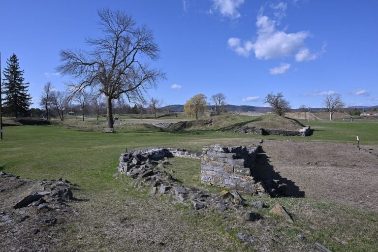
New York State acquired the land in 1785 and transferred it to Columbia University and Union College in 1803. The colleges sold it to William Ferris Pell in 1820. Pell established a summer retreat nearby, and by 1840 his Pavilion had become a hotel for people visiting the ruins. The fort developed into a regional destination during the nineteenth century; in 1848, artist Russell Smith painted its ruined state.
The Pell family restored the fort and opened it to the public in 1909. Stephen Hyatt Pell led the restoration and founded the Fort Ticonderoga Association in 1931; the Association manages the site. Between 1900 and 1950, the lands acquired around the fort included Mount Defiance, Mount Independence, and much of Mount Hope. Fort Ticonderoga became a National Historic Landmark in 1960, a designation that also covers Mount Defiance and Mount Independence, and entered the National Register of Historic Places in 1966. Since 1998, it has been on a National Historic Landmark watchlist because of the condition of some walls and the Pavilion. Work to restore the Pavilion was underway in 2009. Today, the Association operates the site as a museum of early American military history and a research center.
Remains
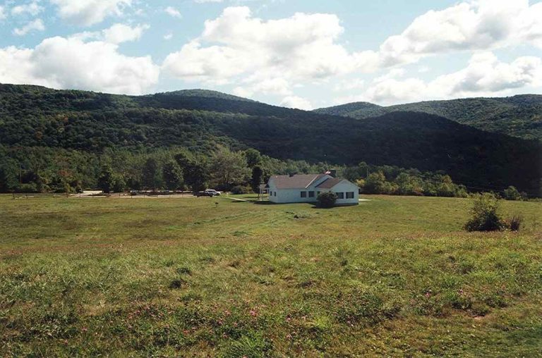
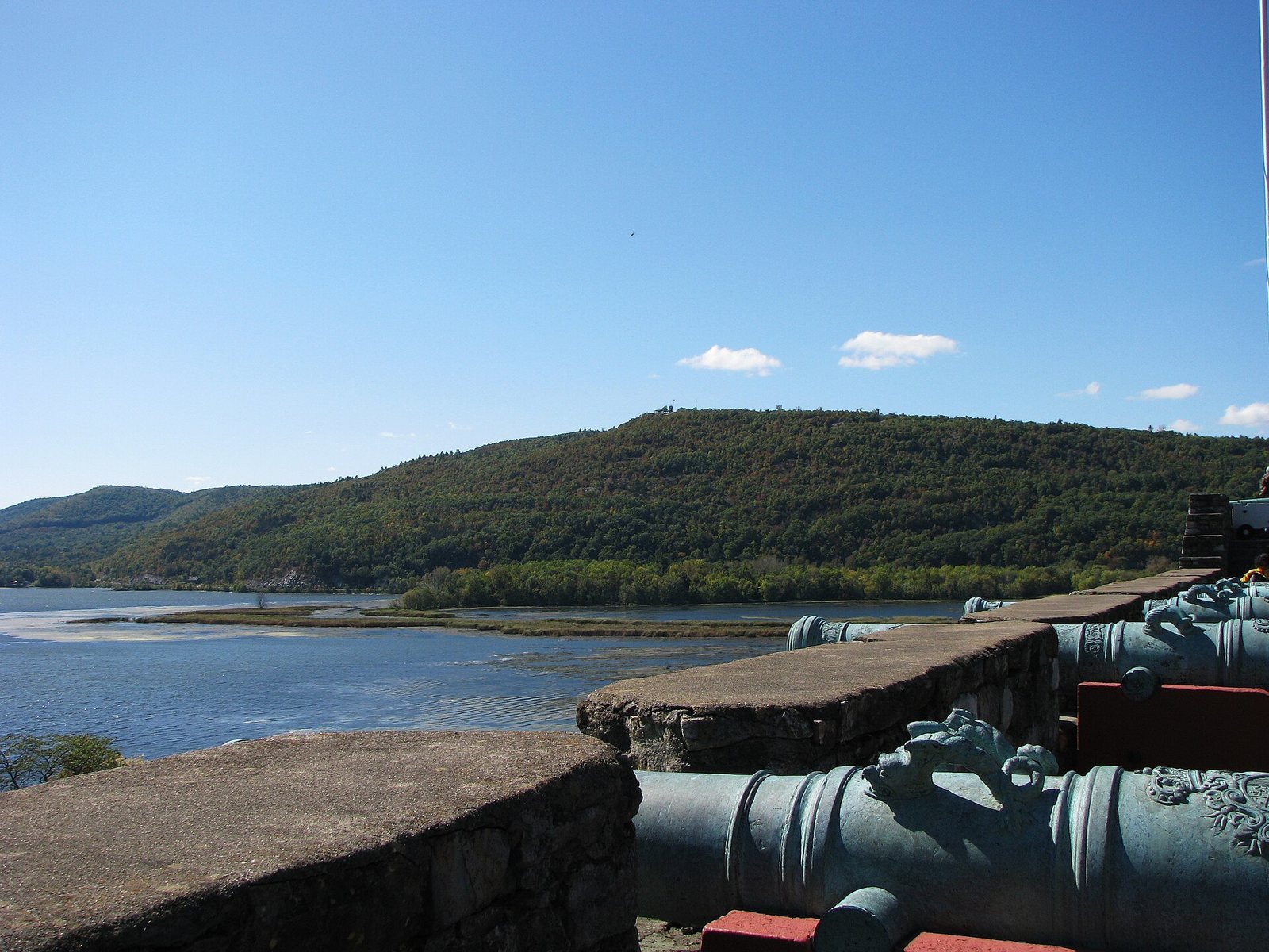
The fort stands at a narrow point near the southern end of Lake Champlain, beside the mouth of the La Chute River, which flows from Lake George to Lake Champlain. The portage between the lakes is about 3.5 miles (5.6 kilometers), and the site covers 21,950 acres (8,880 hectares). The French fort is about 500 feet (150 meters) across. Mount Defiance, at 853 feet (260 meters), and the nearby Mount Hope and Mount Independence overlook the area; the surrounding heights could expose the fort to artillery fire from above.
The French fort and its defenses
Main walls and outer works
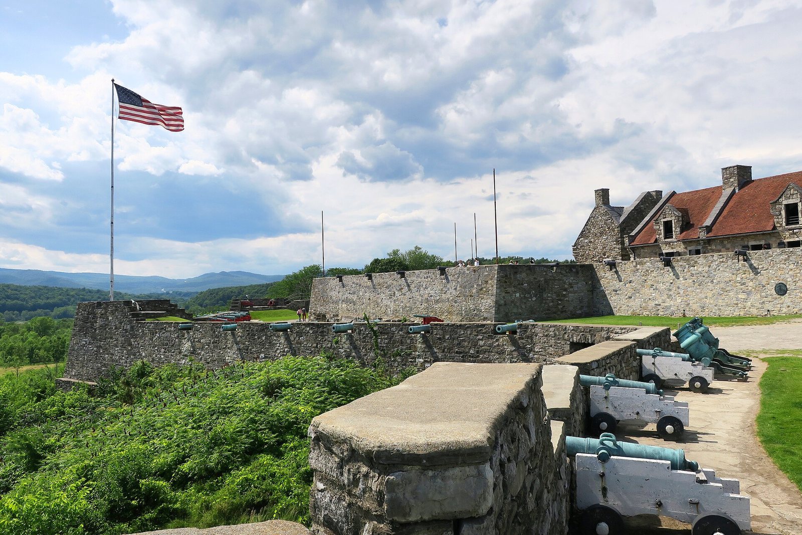
The fort’s star-shaped plan drew on Vauban’s system of angled defenses. Its four bastions, projecting sections of the wall, were named Reine and Germaine to the northeast and northwest, and Joannes and Languedoc to the south. The northern pair faced away from the lake; the southern pair looked toward the lake and landing area. Two half-moon-shaped outer works strengthened the landward sides, one to the north and one to the west.
The walls were about 7 feet (2.1 meters) high and 14 feet (4.3 meters) thick. Builders first made them from squared timber beams, packing earth between them, then added a partial facing of stone from a quarry about a mile (1.6 kilometers) away. The stonework was never finished. A sloping earthwork outside the walls and a dry moat, approximately 5 feet (1.5 meters) deep and 15 feet (4.6 meters) wide, completed the defenses.
Detached positions and lakeshore
Work began with the main walls and the Lotbinière redoubt, a detached fortified position west of the fort intended to cover the La Chute River. Four bastions and a sawmill beside the river followed in 1756. Because the fort stood too far west to cover the lake narrows adequately, the French added another redoubt to the east. The northeastern Germain and Pontleroy redoubts were added after the 1758 battle.
A timber palisade, a defensive fence of upright stakes, protected the strip between the fort’s southern wall and the lake shore. This area held the principal landing place, extra storage, and other facilities needed to supply the fort.
Buildings and water supply
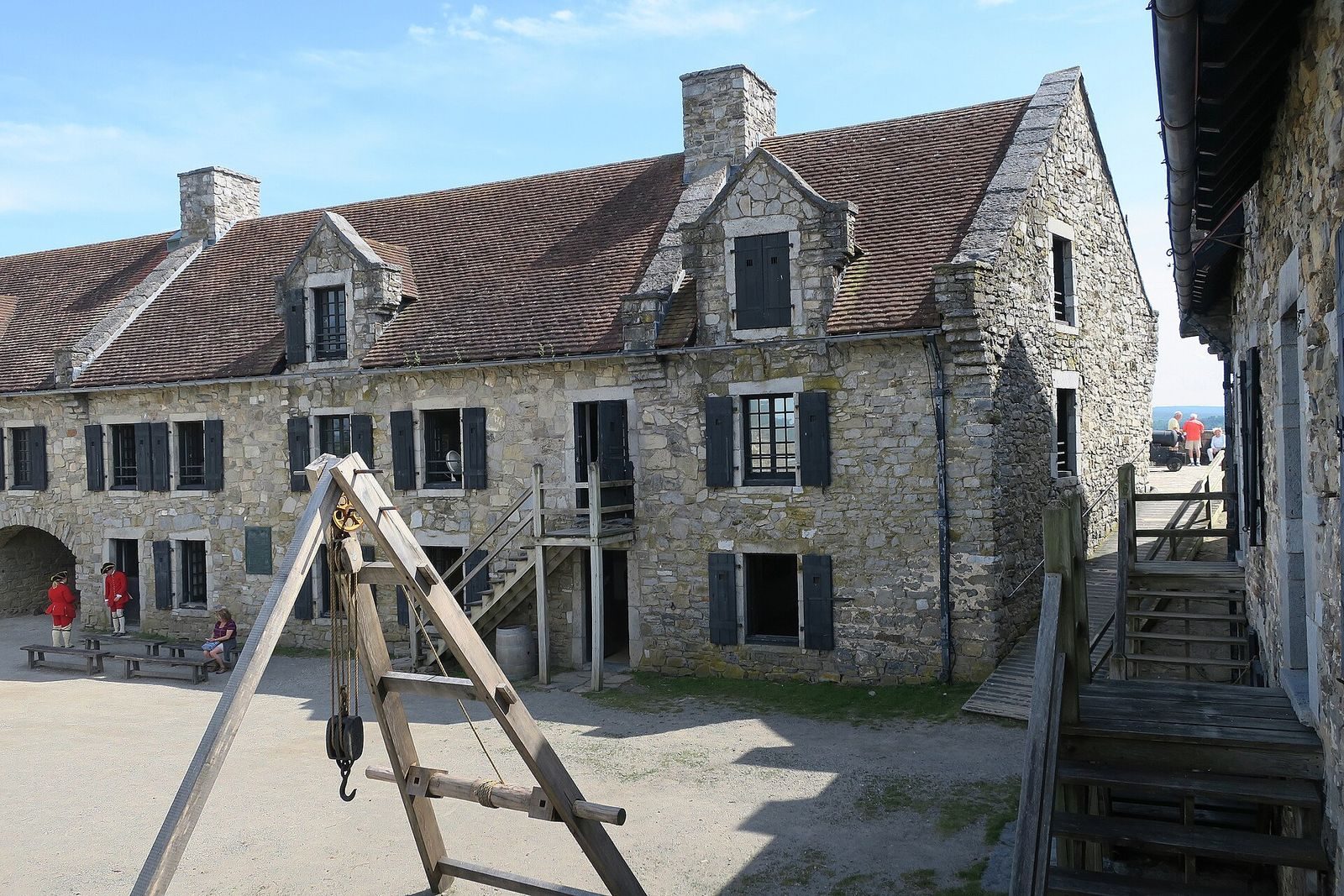
Stone buildings inside the fort included three barracks and four storehouses. A bakery in one bastion could produce 60 loaves of bread a day. Beneath the Joannes bastion, builders cut a gunpowder store into the bedrock. During an inspection in 1758, Montcalm and two military engineers criticized the buildings as too tall and exposed to artillery. They also judged the masonry poor and found that the powder store leaked. Limited storage meant provisions had to be kept in exposed places beyond the walls. The cistern was small, and its water had a poor reputation. The barracks could house only about 400 soldiers.
Revolutionary-era defensive works
Mount Independence and the bridge
Defenses on Mount Independence included trenches near the water, a horseshoe-shaped artillery battery partway up the slope, a fortified stronghold at the summit, and gun-armed redoubts around the summit. Water surrounded most of the mountain. A floating bridge linked it to Ticonderoga and had land batteries protecting both ends. Twenty caissons, watertight enclosures used as structural supports, were built on the ice and sunk into place for the bridge. Their remains were found and documented in the 1960s, and parts of the bridge are displayed at Vermont’s Mount Independence Museum.
Mount Hope and Mount Defiance
Defenses on Mount Hope were strengthened with a star-shaped fort. Mount Defiance remained without fortifications in 1776. The British began constructing a blockhouse, a small defensive building, at its summit in 1777.
Later buildings and landscape
The Pavilion and King’s Garden
The nineteenth-century Pavilion associated with Pell’s estate stands north of the fort. The nearby estate garden, known as the King’s Garden, was reconstructed in 1921 at Sarah Pell’s direction, with landscape architect Marian Cruger Coffin, and restored in 1995.
Armament and reconstructed building
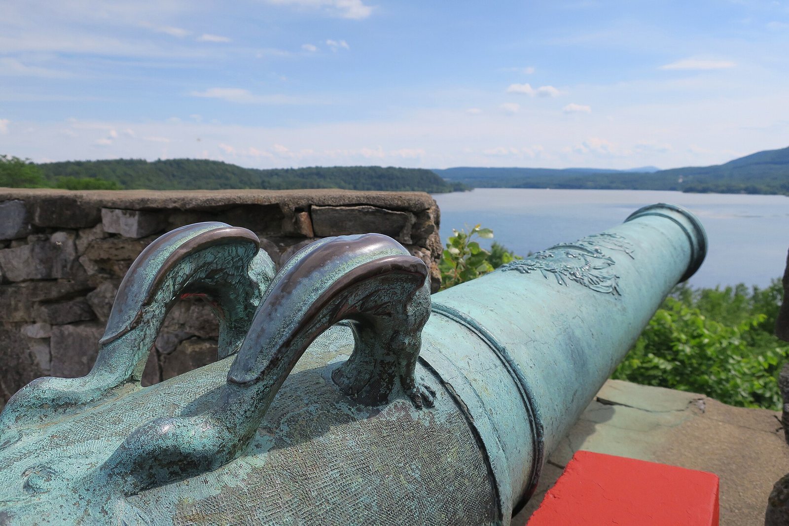
The fort was rearmed with 14 British-supplied 24-pounder cannons. Cast in England for use in the American Revolution, they were never shipped before the war ended. A building destroyed by the French in 1759 was reconstructed in 2008, using Lotbinière’s 1755 plans in part. The reconstructed building serves as an education and conference center.
The fort in a landscape painting
Russell Smith’s 1848 painting Ruins of Fort Ticonderoga portrays the fort in its ruined condition. Smith belonged to the Hudson River School, a nineteenth-century American movement devoted to landscape painting.