Avignon City Walls: The Medieval Defensive Circuit of Avignon, France
Site at a Glance
- Country
- France
- Primary era
- Medieval
- Eras represented
- Medieval, Early Modern, Modern
- Civilizations
- French, Papal States
- Site type
- Military
- Remains
- Wall
On this page19 sections
History
The Avignon city walls form a defensive circuit around the historic centre of Avignon, France. The present enclosure was built chiefly in the fourteenth and fifteenth centuries, as the town expanded under papal rule, and protected both its urban districts and surrounding land.
From Greek settlement to medieval defenses
Avignon began around 539 BC as a trading settlement established by Phocaeans, Greek colonists from Phocaea, near modern Marseille. In the fourth century BC, Massalia, the Greek city at the site of Marseille, made alliance treaties with Avignon and other Rhône Valley towns. Avignon later came within Massalia’s sphere of influence and became the fortified centre of the Cavares, an ancient people of the lower Rhône.
A Roman defensive wall is considered unlikely because archaeological evidence for one has not been found, although a first-century enclosure has been proposed. In late antiquity, a more modest defensive line was built with stone taken from Roman monuments. Centred on the Rocher des Doms, it enclosed less ground than the earlier Roman town. Gregory of Tours mentioned a wall when describing Clovis I’s siege around AD 500.
The earliest medieval circuit is usually dated to the twelfth century, though proposed dates range from 1060 to 1176. In the early thirteenth century, a second line and a moat were added outside it. During the Albigensian Crusade, a campaign against the Cathar movement in southern France, Avignon supported Raymond VII, Count of Toulouse. Louis VIII, king of France, besieged the city for three months in 1226. Famine brought about its surrender; Louis then ordered most of the defenses destroyed, the moats filled, and rebuilding prohibited for five years.
Avignon rebuilt its defenses from 1234 to 1237 beyond the remains of the earlier circuit, although the project was not finished until 1248. In 1251, Alphonse of Poitiers and Charles of Anjou took control and installed a local magistrate, ending the city’s independence.
The papal city and fourteenth-century circuit
The papacy moved from Rome to Avignon in 1309. As the town grew beyond its older defenses, new suburbs developed outside them. In 1348, Pope Clement VI bought Avignon from Joanna I of Naples, Queen of Naples and Countess of Provence, for 80,000 gold florins.
Clement VI assigned Juan Fernandez de Heredia responsibility for new defenses in 1349. His successor, Pope Innocent VI, continued the undertaking from 1355, and construction began in 1357. The walls were intended to shield the enlarged papal city from the Free Companies, mercenary bands that might plunder when out of work, during the Hundred Years’ War between England and France. Their protection was meant to extend to the papal palace, cardinals’ residences, religious houses, suburbs, and cultivated land. While the stone defenses were under construction, temporary wooden barriers protected the outer suburbs.
Taxes on salt, wine, and merchandise, a payment of one florin per person, and loans from the papacy helped pay for the work. Papal officials sought contributions across Europe. Philippe de Cabassolle, bishop of Cavaillon, obtained substantial backing from princes of the Holy Roman Empire with recommendations from Emperor Charles IV of Luxembourg. In 1358, Innocent VI also paid 1,000 gold florins to the mercenary captain Arnaud de Cervole to secure the withdrawal of his band.
The main building campaign lasted from 1357 to 1373. By 1372, the defenses were advanced enough to protect Avignon from mercenaries travelling toward Italy. The enclosure also embraced suburbs and extensive agricultural areas. Its walls served everyday economic purposes as well: an annual fair took place beside them on 30 November, grapes were sold along the Rhône-facing stretch, and flocks travelling from Crau toward Ventoux passed by the Oulle defenses.
Late medieval and early modern changes
In 1381, battlements beside the Dominican monastery were rebuilt. During the Western Schism, a division in papal authority from 1378 to 1417, troops loyal to the antipope Benedict XIII defended the papal palace complex against attacks by townspeople. Fighting damaged the defenses near the bridge. The tower controlling the bridge entrance collapsed in 1410 and was rebuilt in 1414.
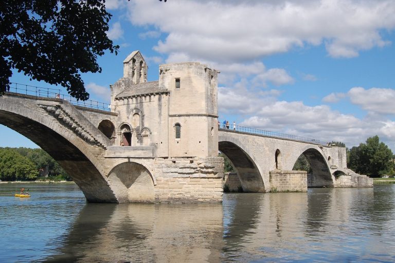
Flooding in 1471 brought down sections near the Dominican convent. Repairs and redesign followed between 1479 and 1488 under the initiative of papal legate Giuliano della Rovere, later Pope Julius II. The work reduced the number of gates from twelve to seven. In the late fifteenth century, papal master builder Antoine Carteron added an outer defensive work before Porte Saint-Lazare and raised the gatehouse at the entrance to the Saint-Bénézet bridge.
During the sixteenth century, towers were repaired and openings for cannon added. In 1561, Pope Pius IV sent his cousin Fabrizio Serbelloni to organize the city’s defense against the Huguenots, French Protestants, during the French Wars of Religion. Three gates were sealed and the other four strengthened with outer defenses. The blocked entrances reopened from 1661, but the drawbridges were removed a few years later. In 1679, defenses outside Porte Saint-Michel were converted into a triumphal arch dedicated to Pope Innocent XI.
From papal territory to French city
Maintenance continued during the eighteenth century, including the rebuilding of three gates, but work stopped during the French Revolution. Avignon and the Comtat Venaissin, a papal territory in Provence, became part of France on 24 September 1791. French military control of the walls lasted from 1796 until 1816 to 1818, partly because the seven entrances made it easier to collect the octroi, a tax on goods brought into town. Abolished during the Revolution, the tax returned in 1800. A new opening, Porte Saint-Dominique, was cut in 1839 to improve access to the southwest.
Demolition proposals followed. A campaign in 1833 argued that the walls obstructed urban improvements and sanitation. In 1846, engineer and railway entrepreneur Paulin Talabot proposed carrying a railway over the northern defenses. Mayor Eugène Poncet’s council supported the plan, while naturalist Esprit Requien and historic-monument inspector Prosper Mérimée opposed it. After Poncet left office, his successor Hyacinthe Chauffard cancelled the project.
The Rhône’s floods made the enclosure an important barrier against rising water. After the severe flood of 1840, the town planned to use gates to hold temporary dams and to fit sluices to canals and drains. In May 1856, rapid melting in the Alps raised the river to 7.83 metres. A sewer sluice failed near Porte Saint-Lazare, and about 30 metres of wall collapsed between Porte Saint-Dominique and Porte Saint-Roch. The breach sent a wave roughly 1.5 metres high through the streets and flooded three quarters of the town.
The disaster led to flood-protection legislation in 1858 and a wider plan to improve the Rhône; riverbanks were embanked from 1860. Engineers strengthened the walls during the 1860s, and Eugène Viollet-le-Duc directed restoration of gates, masonry, and battlements, especially on the southern side. The flood measures proved effective in 2003, when areas beyond the western walls were submerged while flooding in parts of the east remained shallow.
Mayor Joseph-Gaston Pourquery de Boisserin had Porte Limbert demolished in 1896 and Porte de l’Oulle in 1900. A new protection listing in 1901 stopped his broader demolition campaign. The walls had been classified as historic monuments in 1861, with further listings for the walls and their surroundings in 1906, 1914, 1915, 1933, and 1937. Avignon’s historic centre, including the papal palace, episcopal complex, and Saint-Bénézet bridge, is part of a UNESCO World Heritage site.
Remains
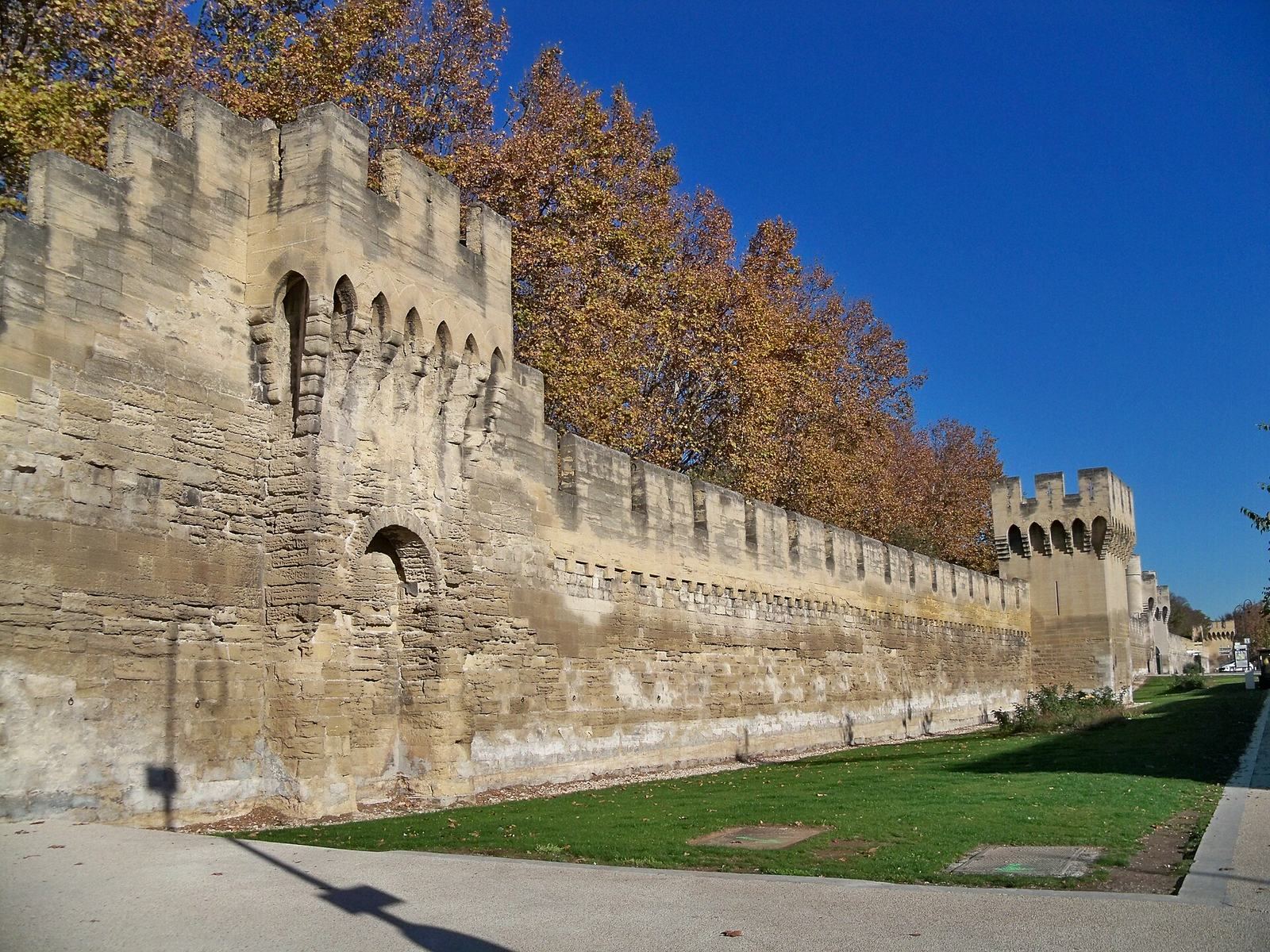
The surviving circuit follows an elliptical course around roughly 150 hectares and measures about 4,330 metres in length. Its line is interrupted by the steep Rocher des Doms, which provides natural protection along part of the northern edge. The walls rise about eight metres and are built from Burdigalian molasse, a locally abundant sedimentary limestone. The upper masonry is now the most visible part of the enclosure.
Earlier defensive lines
Late-antique enclosure
The late-antique defensive line centred on the Rocher des Doms and enclosed a smaller area than the Roman town. Its builders reused stone from Roman monuments. A separate Roman enclosure has been proposed along streets west, south, and east of the historic centre, with the rock forming its northern boundary; this suggested course remains hypothetical.
Thirteenth-century double defenses
The thirteenth-century circuit consisted of two parallel walls about 30 metres apart, with a moat at each line. It enclosed approximately 45 hectares along a route about three kilometres long. Semicircular towers stood on the outer wall, and twelve pairs of arched entrances provided passage through both lines. Water from the Sorgue reached the moats through the Canal de Vaucluse; after 1229, the Canal de l’Hôpital, also known as La Durançole, brought in additional water from the Durance.
Parts of this former alignment remain legible in the street plan, including rues des Trois-Colombes, Campane, Paul-Saïn, Philonarde, des Lices, Henri-Fabre, Joseph-Vernet, and Grande-Fusterie. A fragment of the outer wall survives where rue Joseph-Vernet meets rue Saint-Charles. Beside rue des Teinturiers, the outer face and lower portions of semicircular towers can be seen beneath the covered moat. The towers average 6.2 metres across and stand roughly 34 metres apart. Building fronts along parts of rues des Lices, Henri-Fabre, and Joseph-Vernet follow the buried wall line, while several street names preserve memories of former gates.
The surviving fortifications
Wall and towers
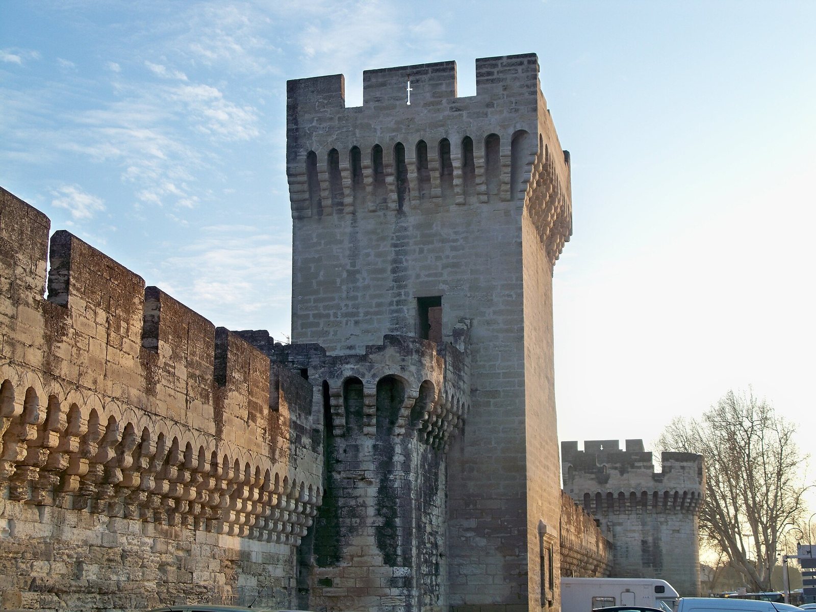
The original moat of the present circuit was about four metres deep and supplied by the Sorgue and Durance. It ran beside most of the enclosure, except where the Rocher des Doms protected about 270 metres of the north and along the Rhône-side stretch between Porte Saint-Jacques and the rock. The moat was later filled. Battlements, the notched defenses at the top, crown the wall, and a wall-walk, a passage along its summit, runs between them. Stonecutters’ marks are particularly visible in the upper masonry, while flooding has worn lower stones.
The defensive system changed in scale over time. The fourteenth-century arrangement had 36 four-sided towers and 56 small sentry turrets; a later configuration had 35 main towers and 50 smaller ones. Towers generally project beyond the connecting wall, and the wall-walk passes behind them or breaks beside their sides. Most open toward the city. Their tiled roofs may originally have carried wooden defensive platforms, later replaced in stone. Because the city-facing sides were open, the towers could not be defended if an enemy entered the town. Three towers facing the Rhône are semicircular; another is polygonal.
Stonecutters’ marks
About 450 different marks appear on the masonry, each roughly seven centimetres square and cut five to six millimetres deep. They include letters and simplified images of tools such as compasses, squares, picks, shovels, ladders, and hammers. Groups of 50 to 100 stonecutters worked on the construction, and the marks served as individual signatures for payment.
Flood-control features
The inner sides of the gates include vertical slots that could hold two rows of planks, forming temporary barriers against floodwater. The space between the rows could be packed with a waterproof mixture. During reinforcement work in the 1860s, builders added an interior retaining wall clad in dense, moisture-resistant marble from Tavel in Gard. These measures formed part of the broader effort to strengthen the enclosure against the Rhône.
Gates and pedestrian passages
Gate construction
The original gate defenses combined drawbridges, portcullises, and two heavy wooden doors. A barbican, an outer defensive work protecting an entrance, stood before Porte Saint-Lazare. Its esplanade was described as large enough for 500 troops. A further entrance under a pointed arch was opened beside the gate in the late nineteenth century under architect Henri Révoil.
Gates along the Rhône and east side
Porte Saint-Lazare stands on the eastern side near the former Bernard-de-Rascas hospital and faces rue de la Carreterie. A tradition links its rebuilding around 1364, together with the adjoining wall toward the Rocher des Doms, to damage caused by flooding in 1358. On the northeast, Porte de la Ligne faces the Rhône and Île de la Barthelasse. It was relocated in 1757 and rebuilt to a design by Jean-Pierre Franque opposite the salt granary. Porte du Rhône, near the Saint-Bénézet bridge, was reconstructed in classical style in 1761, after its earlier gatehouse was demolished. Porte de l’Oulle was rebuilt on a slightly altered line in the 1780s and demolished in 1900; traces of its arch remain on the wall’s inner face.
Southern and western entrances
Porte Saint-Roch, on the southwest side, was rebuilt in 1865 to Viollet-le-Duc’s plans. Porte de la République, south of the centre opposite Avignon-Centre railway station, was opened in 1855 and given a neo-Gothic form by Viollet-le-Duc in 1863. A southern entrance west of Porte Limbert was restored in 1868 and 1869, then repaired again after the 1944 bombardments. Porte Limbert is now a breach at the site of the gate demolished in 1896. Porte Saint-Dominique, on the western side, was opened in 1839. Other modern breaches include Porte Saint-Joseph, cut at the base of a tower, and an opening in the southeast named for the street it serves.
Posterns and canal passage
Small pedestrian entrances, called posterns, pierce the circuit at several points. Poterne Saint-Lazare lies between Porte Saint-Lazare and Porte Saint-Joseph; Poterne de la Banasterie connects rue de la Banasterie with quai de la Ligne; and Poterne Georges-Pompidou opens from rue de Limasset onto boulevard du Rhône. Poterne de l’Oratoire links the Allées de l’Oulle with the centre, while Poterne Raspail lies between Porte Saint-Roch and Porte Saint-Dominique. Poterne Saint-Michel connects the Saint-Ruf suburbs with the administrative district. Since 1974, another pedestrian opening has passed beneath the Rocher des Doms.
At rue des Teinturiers, a branch of the Sorgue flows beneath the walls and continues along the street. A pedestrian passage crosses above the canal, with openings through both sides of the wall at the security gates. Two smaller gated entrances serve a private residence and Avignon University, housed in the former Sainte-Marthe hospital; these are the only entrances fitted with gates that can be closed.
Images of the enclosure
A fifteenth-century miniature by the Master of Boucicaut depicts Avignon enclosed by its walls. Another miniature, by Jean Fouquet, shows Louis VIII’s assault during the Albigensian Crusade. The Boucicaut image is held by the Bibliothèque nationale de France.