Ategua Archaeological Site: A Multiperiod Settlement in Spain


Site at a Glance
- Rating
- 4.5
- Popularity
- Very Low
- Country
- Spain
- Primary era
- Classical
- External website
- Open
- Eras represented
- Iron Age, Classical, Medieval
- Civilizations
- Crown of Castile, Iberian, Roman, Tartessian
- Site type
- City
On this page17 sections
History
The Ategua Archaeological Site in Spain is a large settlement near Santa Cruz in Córdoba, beside the Guadajoz River, with confirmed occupation from the Late Bronze Age through the Middle Ages. Its cultural sequence includes Tartessian, Iberian, Roman, Andalusi, and Castilian phases, and the settlement became especially important during the Roman Republic and the Second Roman Civil War. Materials from the second millennium BC suggest earlier activity, although an earlier occupation has not been conclusively established.
Early settlement and Iron Age development
The earliest confirmed remains include a necropolis dating to the ninth century BC. Houses from the eighth and seventh centuries BC show the development of a settled community, which expanded substantially during the Iron Age. The site formed part of the world of Tartessos, an ancient culture and polity of southwestern Iberia associated with settlements, metalworking, and distinctive archaeological materials in present-day Andalusia.
Later Iberian occupation shaped the fortified settlement whose remains survive across the hill. The defensive enclosure covered the summit and parts of the slopes, establishing the setting for the urban development that followed under Roman rule.
Roman occupation and the civil war
Ategua acquired particular importance during the Roman Republic, the period before Rome became an imperial system. On 19 February 45 BC, Julius Caesar entered the settlement after Pompeian forces surrendered to his army. Caesar was the Roman military and political leader of the Caesarian side in the civil war against supporters of Pompey and his sons, Gnaeus and Sextus Pompey. The conflict in Hispania, including Ategua’s role, is described in De bello Hispaniensi, an account of the war between Caesar and the Pompeian commanders.
During the Roman period, the settlement developed much of the urban form represented by the surviving remains. Houses, a public building, a temple, baths, water installations, and hillside burials belonged to this phase. Several houses were abandoned during the second century AD, a change associated by the excavator Martín Bueno y Cancela with the abandonment of the residential area.
Late Antiquity
A representative of Ategua’s Christian community attended the Council of Elvira in the early fourth century alongside Bishop Hosius. Late Antiquity was the period of transition from the classical ancient world to the Middle Ages. A large necropolis from this period was identified in 2007 on an adjoining estate, while the nature and extent of urban occupation at Ategua during the same period remain uncertain.
Andalusi and Castilian phases
During the Islamic period, the settlement was known as Ataba. In the tenth century, the historian Ibn Hayyan described it as a small settlement belonging to the administrative district of Córdoba, known in Arabic as Qurtuba. In the twelfth century, Ibn Sahib al-Sala related that Ibn Hamish fled to Ataba after sacking Córdoba and found the settlement deserted.
During the final phase of Islamic rule in the region, a fortress was constructed on the summit. It continued in use during the centuries that followed the Christian conquest and was abandoned in the fifteenth century. The later medieval occupation included a commercial enclosure outside the fortress, adding another phase to the settlement’s long urban history.
Excavation, conservation, and protection
The first excavation took place in the early nineteenth century, when Colonel Eugéne-Georges Stoffel investigated Ategua under orders from Napoleon III in connection with Caesar’s war against the sons of Pompey. In 1933, Rafael Castejón, Samuel de los Santos, and Félix Hernández excavated the summit, and the recovered materials were deposited in the Archaeological Museum of Córdoba.
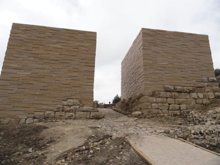
In 1965, Blanco Ferreiro restored sections of the southern Iberian-Roman wall, repaired the northwest gate, and established stratigraphic sequences, which record successive archaeological layers and building phases. Several years later, a stela with Tartessian decoration was found and became known as the Ategua Stela.
Between 1980 and 1983, Martín Bueno y Cancela directed extensive excavations that revealed the medieval wall, a plaza, structures beside the wall, a second-century Roman house, a temple, and Roman baths. The expropriation in 1985 of the estate containing most of the archaeological remains allowed José Clemente Martín de la Cruz to continue the work in 1998. Olive planting in 1999 damaged part of an archaeological complex whose remains are interpreted either as an incineration necropolis or as a Tartessian wall. The access road was expropriated in 2001, followed by a surface survey in 2002.
In 2007, the medieval wall and nearby structures were consolidated and restored. Geophysical surveys inside the walled enclosure later indicated approximately 76 streets and paths, many aligned north-south and east-west, forming around 58 blocks that may belong to the ancient city. The results point to a substantial Roman settlement beneath the visible remains. Ategua was designated a national monument in 1982 and an Asset of Cultural Interest in the archaeological-zone category in 2005, under Spain’s cultural-heritage system.
Remains
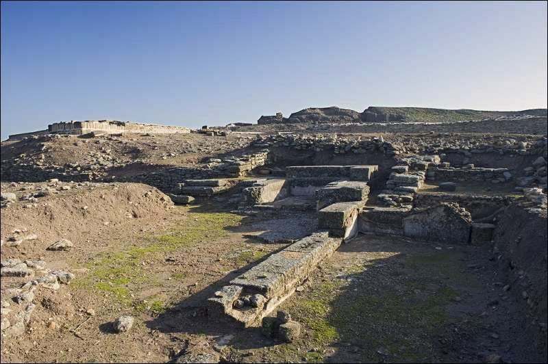
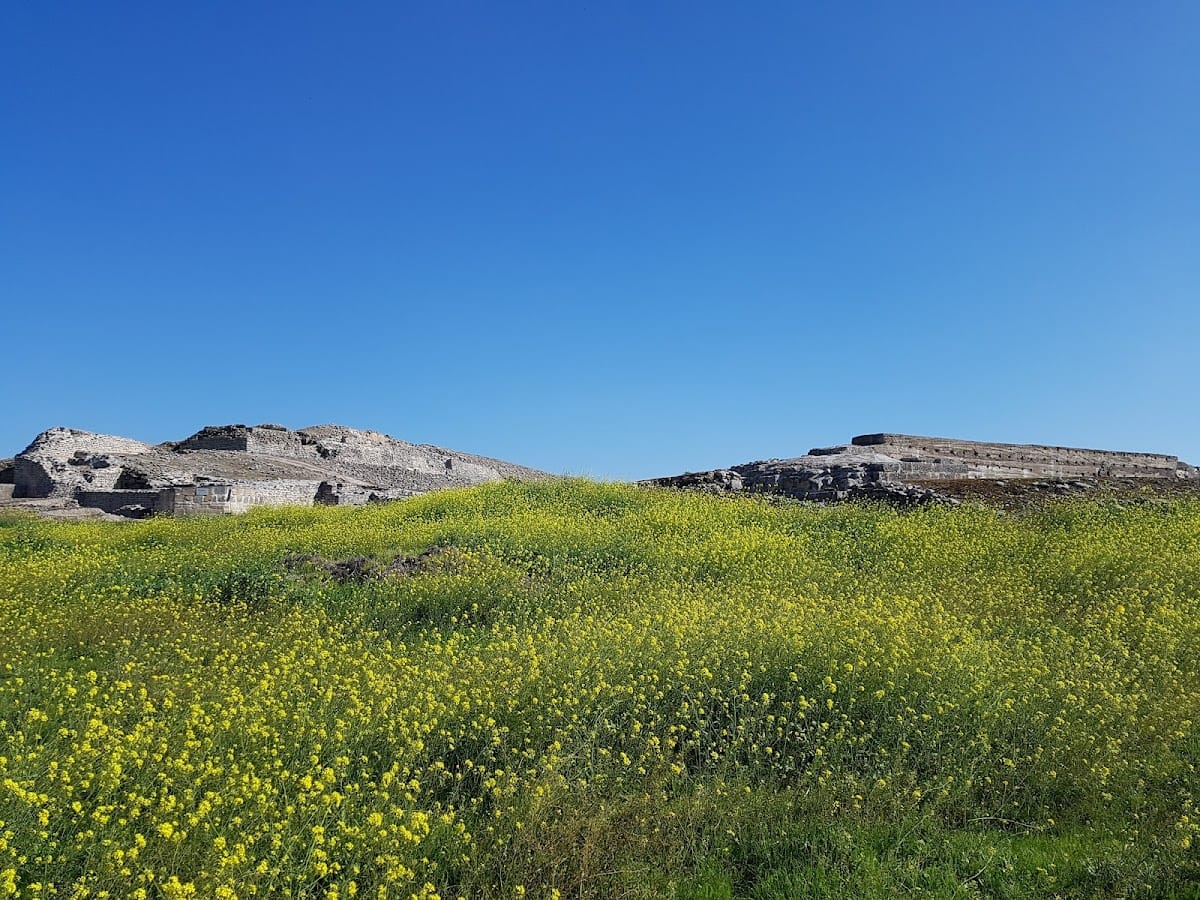
Ategua occupies a broad, plateau-like hill edged by biocalcarenite, a limestone formed largely from sand-sized carbonate grains and biological material. The Guadajoz River lies less than one kilometre away through fertile plains, orchards, and irrigated lowlands. The northern and eastern sides of the hill are steepest, while the more accessible southern and western sides are close to the river and include natural biocalcarenite outcrops. The surviving remains form a superimposed sequence of fortifications, streets, houses, water installations, public buildings, and later medieval structures.
Defensive enclosures
Iberian-Roman wall
The oldest visible defensive system belongs to the Iberian-Roman settlement. It enclosed the summit and part of the slopes, and its line can be followed across much of the hill through surviving wall sections and corresponding changes in the ground. On the western side it follows approximately the 250-metre elevation contour, then rises northward toward its highest point on the east, at about 290 metres above sea level.
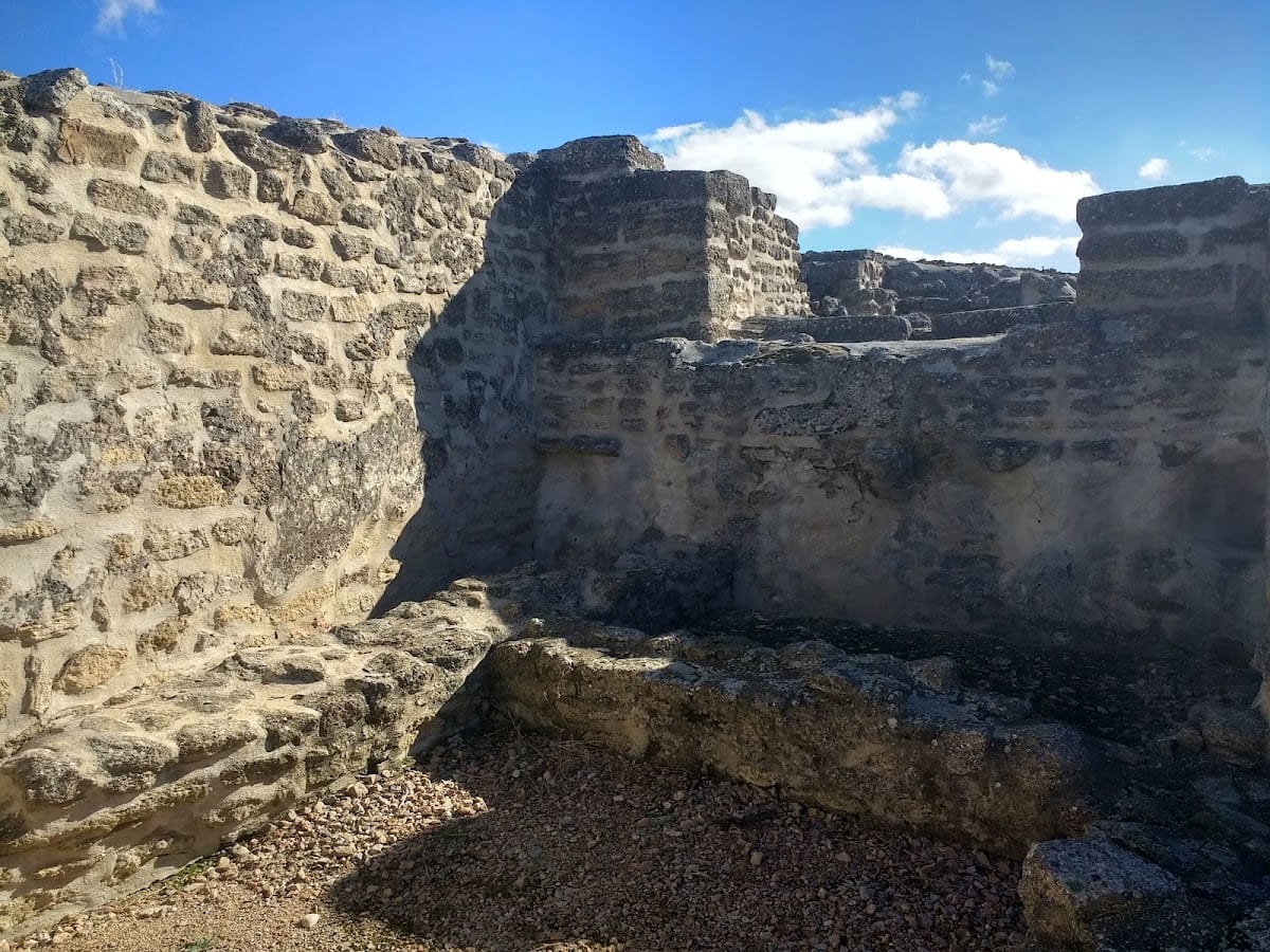
Locally quarried biocalcarenite formed the wall. Slabs and roughly worked stones were laid in horizontal courses, with larger dressed blocks used at corners and in the foundations. The lower exterior face projects outward as a battered slope, while the inner face is vertical. Cuttings in the rock on parts of the slope show that the biocalcarenite outcrops were also quarried, although the date of that activity is unknown. On the southwest, a lower defensive line lies buried on a terrace and is identified as the fortification of the Tartessian settlement.
Late Islamic fortress
The late Islamic fortress occupies the upper terrace and appears to have reused the earlier enclosure, although it covered a smaller area. Sections of the Iberian-Roman wall were incorporated on the east. The northern, western, and southern sides were newly constructed using a contrasting method, with relatively regular rubble masonry bonded with mortar in the foundations and lower courses and rammed earth forming the upper sections.
Excavation exposed the north, south, and west sides of the enclosure, which had ten regularly spaced towers. The northern entrance was protected by a projecting bastion, a defensive structure extending from the wall, on its eastern side and by an advanced buttress on its western side. During the Christian period, an octagonal tower was added, forcing entry through a bent route. The southern entrance gave direct access and was flanked by two square towers. Buildings, possibly residences, occupied the interior.
Northwest bastion
A projecting bastion at the northwest corner contained several stone-paved rooms and an open area with a water well. Two towers, one to the north and one to the south, defended it. Its position enabled surveillance of routes that included the road network linking Córdoba and Granada.
Medieval commercial enclosure
Outside the Islamic wall, between two towers at the southwest corner, a medieval commercial enclosure was organized around a rectangular plaza. Irregular stone slabs paved the square, and regularly arranged rooms, probably shops, opened onto it. A central axis structured the plaza, whose centre was slightly sunken to drain rainwater. Several perforated slabs may have held the posts of an awning.
Roman buildings and water systems
Roman houses
Several Roman houses were excavated southwest of the upper platform. Their rooms had floors of opus signinum, a waterproof cement-like mortar, compacted earth, or stone slabs. Open courtyards in at least two houses contained an oval cistern and a square well. Two houses opened onto a decumanus, an east-west street in a Roman settlement. Their construction date is uncertain but may belong to the late Republican period. They were built over earlier structures whose dates and functions remain unknown.
Public building and other Roman structures
South of the acropolis, the elevated central area of the ancient settlement, are the remains of a Roman Republican public building. They include Attic bases, a classical form of column base, and parts of the smooth shafts of four columns. Other portions lie beneath the Islamic wall and later medieval structures, including buildings that predate the wall, and these later works disturbed earlier archaeological layers.
The Roman occupation also included a temple, baths, and burials on the hillside. Together with the houses and public building, these features indicate the range of domestic, civic, religious, bathing, and funerary spaces represented at Ategua.
Water installations
On the western slope, the spring called Fuente de Teba is associated with a water-supply installation. Several Roman pools remain visible there. They were built in opus caementicium, Roman concrete, and lined with opus signinum to create waterproof surfaces.
Further hydraulic structures occupy the upper terrace. They include oval or circular cisterns lined with opus signinum. These installations may have been reused during the medieval or modern periods, although further excavation has not confirmed that interpretation.
Archaeological evidence
The Ategua Stela, decorated in the Tartessian tradition, provides material evidence for the settlement’s early cultural sequence. The ninth-century BC necropolis, Roman hillside burials, and the extensive Late Antique necropolis on the adjoining estate represent successive funerary phases. Within the walled enclosure, geophysical results indicating streets, paths, and approximately 58 blocks add a broad plan of the ancient city beneath the excavated structures.