Archaeological Site of Karthaia: Ancient City-State and Harbor
Site at a Glance
- Rating
- 4.8
- Popularity
- Low
- Country
- Greece
- Primary era
- Classical
- Eras represented
- Classical
- Civilizations
- Ancient Greek, Roman
- Site type
- City
On this page20 sections
History
The Archaeological Site of Karthaia in Greece preserves one of the four ancient Greek city-states of Kea, an island in the Cyclades. Occupied from the Geometric period in the eighth century BC until Late Antiquity, Karthaia developed as a fortified city and important harbor on the island’s southeastern coast. Its monumental buildings, substantial defenses, and silver coinage indicate particular prosperity from the end of the sixth century BC to the end of Greek antiquity.
Formation and prosperity
Karthaia was a polis, an autonomous Greek city-state together with its surrounding territory. Its domain extended across southeastern Kea, where settlements, farm structures, towers, roads, and evidence of metalworking have been identified. The city’s ancient name appears in the works of Strabo and Pausanias, while Pindar described its setting as a narrow ring of land.
The city remained inhabited for approximately 1,300 years. Its most prosperous phase began near the end of the sixth century BC, when monumental architecture and large fortifications were developed. Silver coinage from the city also reflects its economic activity and population during this period. Karthaia’s harbor supported its place within the Cycladic world, while roads connected the acropolis and town with the wider territory of Kea.
Late Antiquity and abandonment
Karthaia declined and was deserted during Late Antiquity, the later Roman and early Christian centuries from approximately the third to the seventh century AD. The temples of Apollo and Athena were destroyed in the sixth or seventh century AD. After their destruction, graves were dug among the earlier monuments, including within the Apollo temple, on the Athena terrace, inside the ruined Building D, and on the slope beside Vathypotamos. These burials represent the last inhabitants of Karthaia, and some reused ancient architectural members.
The city’s roads remained important after antiquity. Many traditional paths on Kea later followed their routes, preserving parts of the ancient network in the island’s landscape. Ancient remains also continued to be visible for centuries, attracting travelers from the seventeenth century onward and especially during the eighteenth and nineteenth centuries.
Rediscovery and archaeological investigation
Before 1811, travelers and maps often identified the ruins incorrectly as Ioulis, the capital of Kea. In December 1811, the Danish archaeologist Peter Oluf Brøndsted recognized the site as Karthaia after finding inscriptions in place. Two honorific inscriptions began with the words “The deme of Karthaia,” identifying the city’s own civic authority. Brøndsted also carried out a short excavation with thirty local workers.
Scientific investigation began soon after 1900. The Belgian archaeologist P. Graindor excavated in the fortification area, the temple area, and at Vathypotamos in 1905 and again in 1920–1921. The Archaeological Service cleared and excavated the temples of Apollo and Athena and the theatre between 1963 and 1965.
Since 1987, systematic work has included surveying, drawing, clearing, and excavation by the Ephorate of Antiquities in cooperation with the University of Athens. The French Archaeological School and the National Hellenic Research Foundation have also participated in the investigation. Projects conducted in 2002–2008 and 2011–2015, organized by the Greek Ministry of Culture and Sports, revealed or restored the temples, Building D, the Propylon, the theatre, and associated areas. Excavated finds are exhibited at the Archaeological Museum of Kea in Ioulis.
Remains
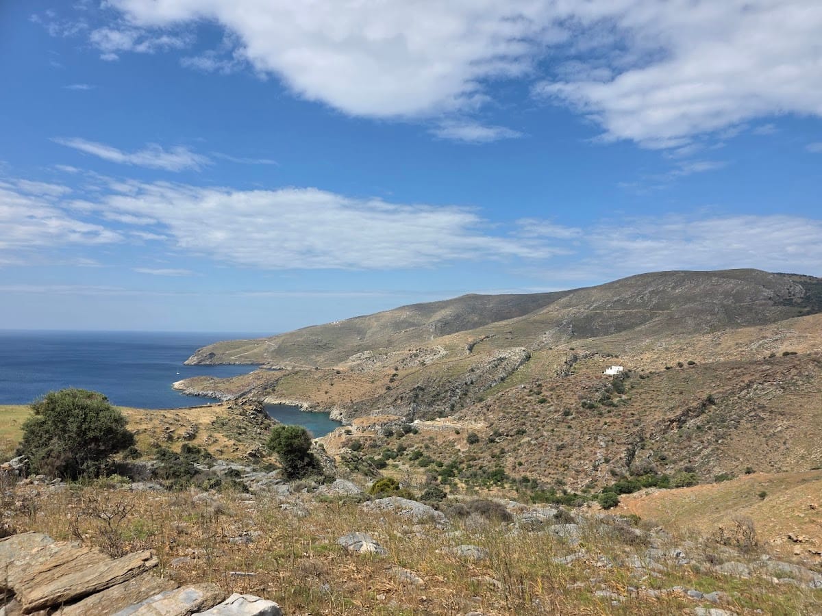
Karthaia occupied the Aspri Vigla hills, between the Kalamitsis valley to the east, the Vathypotamos valley to the west, and the sea to the south. The surviving remains extend across the acropolis, town center, harbor, valleys, and surrounding territory. The acropolis had lower and upper terraces. Temples and public buildings stood on the lower level, while additional public architecture occupied the upper level.
Fortifications and civic terraces
Acropolis walls and gates
The acropolis was enclosed by massive fortifications more than two kilometers long. The walls used polygonal or rectangular stone blocks, with smaller stones and other materials packed within them. They were built as double-faced walls or retaining walls and reinforced by rectangular and circular towers. Following the rocky ground, the enceinte formed a plan with repeated recesses. Construction and development took place in phases spanning the late sixth to the fourth centuries BC.
Six gates interrupted the fortification line. Roads began at these entrances and connected the acropolis with other parts of the island. The defensive circuit therefore formed both a boundary and a framework for movement through Karthaia’s territory.
Propylon and connecting paths
The Propylon, a monumental entrance building, stood at the start of the route leading toward the acropolis and upper terrace. Constructed in the middle of the fifth century BC, it formed part of the formal approach to the elevated public area. A sloping stone-paved path reached it from the west and dates from the early or first half of the fifth century BC.
On the eastern side, a Late Archaic stairway partly cut into the bedrock led to a processional path between the lower and upper levels. Together, the paved approach, stairway, and Propylon organized access across the two terraces.
Sanctuaries and public buildings
Temple of Apollo Pythios
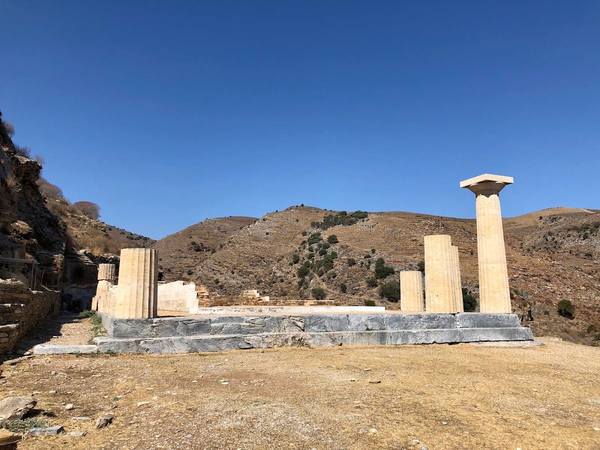
The Temple of Apollo Pythios stood on an artificial terrace at the eastern edge of Karthaia, near the sea on the lower level. Measuring approximately 31 by 16 meters, it dates from the end of the sixth or the beginning of the fifth century BC. Its front had six columns in antis, with the columns set between projecting side walls. A cult statue of Apollo stood in a niche cut into the rock west of the building.
Architectural elements, sculptures, and inscriptions were found in the temple area. Numerous dedications, including statues, were displayed on the terrace in front of the building. Ancient texts describe this sanctuary as Karthaia’s most important place of worship. Christian burials were later placed at its southwestern end and among the remains of the temple.
Temple of Athena
The Temple of Athena stood near the southeastern gate on the upper terrace. It was a smaller Doric peripteral temple, meaning that it used the Doric order and was surrounded by a colonnade. The building measured approximately 11 by 23 meters and had six columns across its front and eleven along its sides. It dates from the end of the sixth or the beginning of the fifth century BC.
The temple’s architectural sculpture showed scenes of the Amazonomachy, the mythological battle between Greeks and Amazons. Fragments of this decoration are kept in the Archaeological Museum of Ioulis. Architectural members and inscriptions on the spaces between the columns were also found inside the temple.
Building D
Building D was a public structure on the upper terrace, dating to approximately 300 BC. Its function remains uncertain. A monumental six-step stairway led to a Doric porch, or pronaos, with six semi-fluted columns arranged in antis.
The nearly square central chamber, or cella, had a floor of white sea pebbles. At its center was a square outlined with purple volcanic stone and a cubic limestone base. Graves were later dug within the destroyed building.
Theatre, harbor, and water systems
Theatre and Roman bath complex
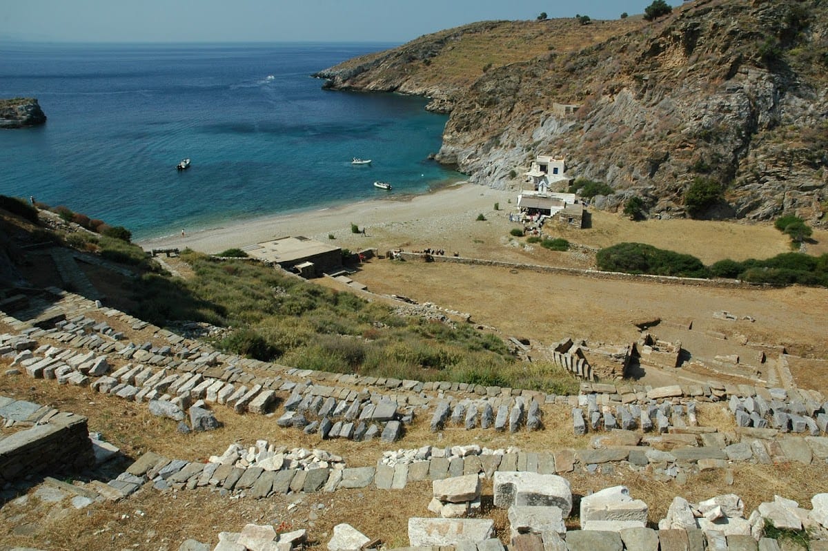
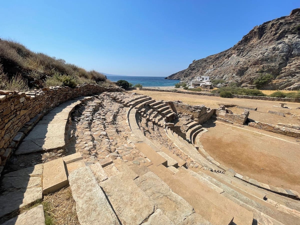
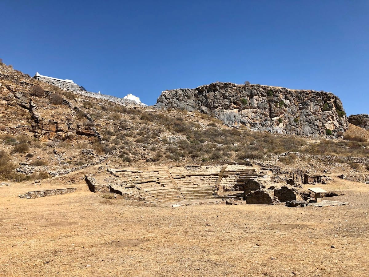
The stone-built theatre stood at the foot of the slope beside the Vathypotamos stream. It had a circular form and accommodated approximately 1,000 people. Its date remains uncertain. Excavation and preservation work has continued in the theatre area, where a Roman bath complex has also been uncovered.
Ancient harbor
Karthaia’s harbor included a submerged stone-built jetty approximately 160 meters long and 35 meters wide. Made from stone, slabs, and pebbles, it extended between the two bays toward the opposite rocky islet. The structure remains discernible beneath the water.
Water supply
Aqueducts, cisterns, and water-supply pipes have been identified in several parts of the city. Installations occurred along the route between the Apollo and Athena sanctuaries, as well as south of the theatre and east of the Apollo temple. These systems operated from the Hellenistic period, the era following Alexander the Great’s conquests from approximately 323 to 31 BC, through the Late Roman period.
Religious, domestic, and funerary remains
Temple at Aspri Vigla and Early Christian basilica
At the summit of Aspri Vigla, where the Church of the Theotokos of the Myrtles now stands, an ancient temple was dedicated to an unknown deity. The Theotokos is a Christian title for Mary, the mother of Jesus.
An Early Christian basilica stands on the banks or bed of Vathypotamos. Its construction reused material from an earlier temple in the area associated with Demeter.
Houses and cemetery
Private houses occupied the slopes of the hill. Their remains include walls, thresholds, heaps of stones, pottery, tools, and other smaller objects. Outside the city walls, the ancient cemetery lay in the Kalamitsis valley. A polyandrion, or collective funerary monument, contained numerous Roman-period graves. A surviving vaulted square building may have been a family tomb or another funerary monument.
Wider territory
The territory of Karthaia contained houses, farm structures, towers, metallurgical installations, and roads. The city’s paved road network extended beyond the urban center, linking settlements and agricultural areas across southeastern Kea. Parts of this ancient network correspond to paths that continued to be used on the island.