Archaeological Site of Pella: Capital of Ancient Macedonia
Site at a Glance
- Rating
- 4.4
- Popularity
- Medium
- Country
- Greece
- Primary era
- Classical
- External website
- Open
- Eras represented
- Classical, Medieval
- Civilizations
- Byzantine, Kingdom of Macedon, Roman
- Site type
- City
On this page12 sections
History
The Archaeological Site of Pella in Greece preserves the remains of the Macedonian kingdom’s royal capital, whose regular urban plan was established in the first half of the fourth century BC. Built on the former island or promontory of Phacos, Pella developed from a mixed Greek and non-Greek settlement into a political, administrative, commercial, and cultural centre of Macedonia.
Origins and the Macedonian capital
Pella’s earliest history remains uncertain. It probably came under the Temenid kings, the royal dynasty that ruled Macedonia before the Antigonids, around 510–505 BC, although it may have retained some autonomy until the middle of the fifth century BC. The city first entered the historical record in connection with Xerxes’ invasion of Greece. Xerxes was the Achaemenid king who led that campaign. Pella was later mentioned by Thucydides during his account of Macedonian expansion and the war with Sitalces, king of the Odrysian Thracians.
By the beginning of the fourth century BC, Pella had replaced Aigai as the capital of the Macedonian kingdom. Tradition attributes the change to Archelaus I, although Amyntas III has also been considered a possible, and perhaps more likely, founder of the city’s capital status. Pella’s fertile hinterland, access to newly incorporated territories, and connection with the sea helped the kings administer the kingdom, encourage trade, and direct Macedonian expansion. Xenophon described it at the beginning of the fourth century BC as the largest city in Macedonia.
Archelaus strengthened the city’s administrative and military organization and attracted leading Greek artists and poets. The painter Zeuxis and the writers Euripides, Agathon, Choerilus, and Timotheus of Miletus were associated with his court. Euripides spent his final years at Pella, where he wrote and staged Archelaus. The city is also linked with the first performance of his Bacchae.
Royal and civic life
The arrival of Macedonian colonists when Pella became the capital altered the city’s population and the names used within its community. Pella itself revolted in 383 BC. Philip II, the son of Amyntas III and father of Alexander the Great, grew up in the new palace and later completed the integration of Macedonia’s eastern territories.
The city was organized and enlarged under Philip II and Cassander. It retained its position as a royal capital during the Hellenistic period under the Antigonid dynasty, reaching its political and economic peak probably under Antigonus II Gonatas. It later served as the capital of Philip V and Perseus during the Macedonian Wars. Pella’s greatest prosperity began in the second half of the fourth century BC and continued until Macedonia’s defeat by Rome in 168 BC.
Pella was the habitual residence of the Macedonian king and contained the royal palace and institutions of government. The sanctuary of Heracles served as a meeting place for the Macedonian Council and probably also for the civic council. The Macedonian army assembled there during the spring festival of Xandika, which included a ritual purification. Despite its royal function, Pella retained civic institutions. Two politarchs, senior civic magistrates, served as its principal officials. A priesthood of Asclepius is probable, while a decree found in the Asclepieion attests a financial magistracy of at least two treasurers.
During the Antigonid period, Pella had a mint whose coins bore the name of the Bottiaians. This referred to a meris, an administrative district of the Macedonian kingdom, rather than to an ethnic group. The city also held the kingdom’s principal treasury, or the treasury of its district, and probably possessed regional financial institutions and an assembly.
Religion and cultural associations
Pella contained numerous sanctuaries, although Dion remained Macedonia’s religious capital. Worship at Pella included Demeter, Aphrodite, Cybele, Heracles, Asclepius, Darron, Athena, Dionysus, and Pan. The sanctuary of Demeter Thesmophoros hosted the autumn Thesmophoria, a women’s festival connected with Demeter’s agricultural cult, during which animals were sacrificed. A sanctuary dedicated to Aphrodite and Cybele was active from the last quarter of the fourth century BC until its abandonment in the first century AD, probably after the earthquake that destroyed much of the city. The sanctuary of Darron, a local healing deity, stood near the monumental road leading to the port.
Two discoveries from the eastern cemetery illuminate religious and social practices at Pella. A gold funerary leaf refers to Posidippos as a pious initiate and addresses Persephone, the goddess associated with the underworld and the fate of the dead. The mystery cult behind the inscription remains uncertain. It may have involved Persephone, Dionysus, or other deities, but it was not identified with the mysteries of Eleusis or Samothrace.
A lead curse tablet found in 1986 in a tomb records an anonymous woman’s attempt to prevent the marriage of Dionysophon and Thetima. It is dated approximately to 380–350 BC, although that dating rests on its position in the cemetery. The inscription uses a Greek dialect with distinctive Macedonian features. Its language has contributed to the argument that ancient Macedonian was a northwestern Greek or Doric dialect.
Roman rule and later occupation
Rome captured and sacked Pella in 168 BC at the end of the Third Macedonian War, the conflict that brought the Macedonian kingdom under Roman control. Pella then became the capital of the third administrative district of Roman Macedonia and may have been the seat of the Roman governor. In 148 BC, however, the provincial capital was transferred to Thessalonica, accelerating Pella’s decline.
The city continued to be productive and active until the early first century BC, when a major earthquake probably destroyed it. A separate Roman colony, Colonia Iulia Augusta Pella, was established around 30 BC, or sometime between 45 and 30 BC, for Italian settlers and veterans whose land had been confiscated by Augustus. The colony was administered by four pairs of duoviri quinquennales, but it did not receive ius Italicum, the special legal status that gave certain Roman colonies privileges associated with Italian soil.
The Roman colony occupied a different location from the Hellenistic city, a distinction that helps explain differing literary descriptions of Pella’s decline. The Via Egnatia, the major Roman road crossing the Balkans from the Adriatic toward Byzantium, passed through the colony, which remained an important route between the Adriatic and Thessalonica. Literary evidence places Pella’s existence in late antiquity, although its importance had greatly diminished. Slavs probably destroyed the site in the late sixth or early seventh century. A fortified settlement later occupied part of the ancient city during the Byzantine period, followed by limited residential use and a small church.
Rediscovery and excavation
River deposits from the Loudias, Aliakmon, and Axios, together with the drainage of the Giannitsa marshes, transformed the landscape around Pella. The ancient city, once connected with the Thermaic Gulf by navigable waterways, eventually lay about 23 kilometres from the gulf. Eighteenth- and nineteenth-century travellers debated the location of ancient Pella before identifying it through Livy’s description. Twentieth-century excavations confirmed the identification.
G. Oikonomos carried out a small excavation in 1914–1915. Systematic exploration began in 1953, and excavations under Ph. Petsas started in 1957. The first major campaign ended in 1963, work resumed in 1976, and excavation has continued, especially in the agora. Excavations between 1957 and 1964 revealed mosaic-floored houses and part of the palace. Later campaigns exposed further palace remains, the agora, houses, fortifications, sanctuaries, and cemeteries.
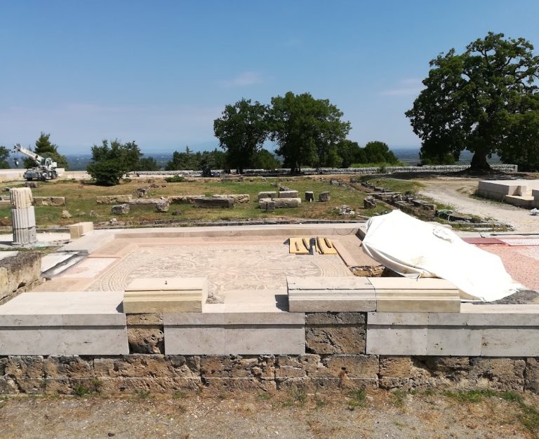
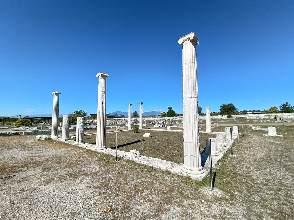
Basic restoration during 1957–1964 repaired walls and an Ionic colonnade in the House of Dionysus. A column in the House of the Abduction of Helen was restored in 1976. Conservation of the southern stoa of the agora began in 1998 and was progressively extended to other excavation sectors. A museum was first opened on the site in 1973 and reorganized in 1988. The present museum, designed to integrate with the archaeological site, opened in 2009 and presents material from Pella and other locations in the regional district.
Remains
Urban plan and public centre
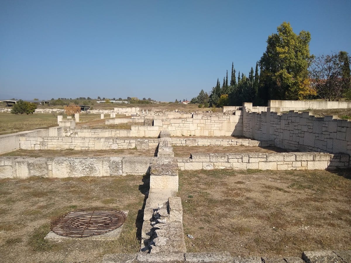
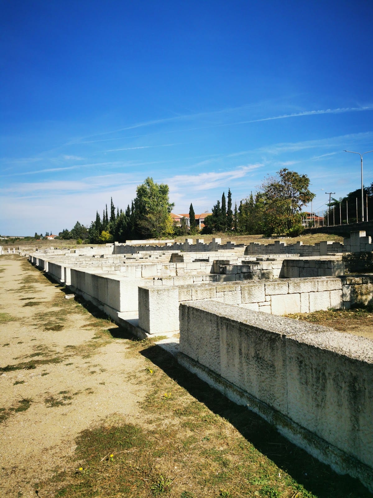
Pella occupies elevated ground on the former Phacos promontory, above marshes and a lake that opened toward the sea during the Hellenistic period. In antiquity, navigable waterways connected the city with the Thermaic Gulf. The settlement followed a regular Hippodamian plan, a grid of straight streets crossing at right angles. The streets formed eight rows of rectangular blocks, generally about 45 metres wide and 111–152 metres long, with 125 metres the most common length.
Most streets measured 9–10 metres across. The principal east-west street, about 15 metres wide, led toward the agora, while two somewhat wider north-south streets connected the city with the port. Sewers and water-collection or supply conduits ran along the streets and served private houses. The orthogonal plan belongs to the first half of the fourth century BC, and its unusually large blocks give the city a distinctive urban structure.
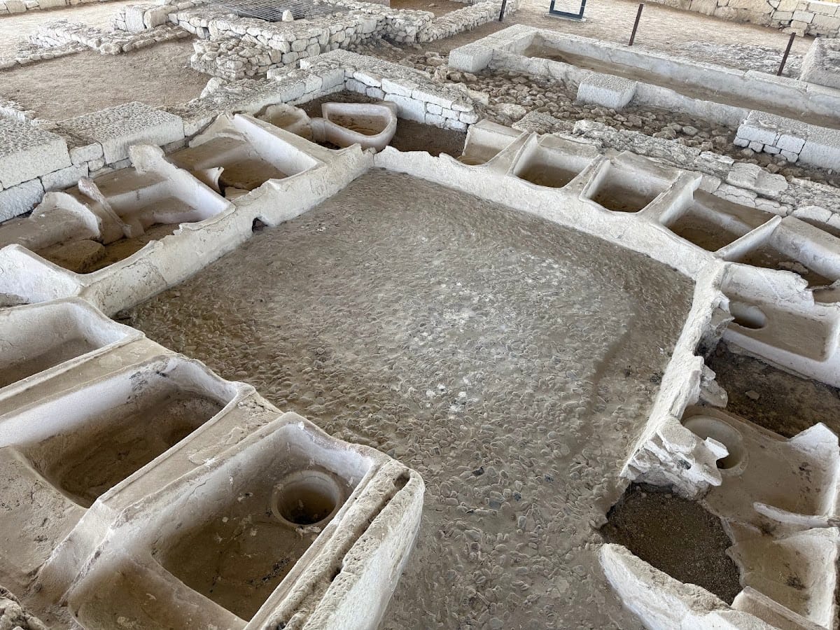
The agora occupied the centre of Pella across the area of ten urban blocks. Its central space measured approximately 200 metres from east to west and 181 metres from north to south. Including the surrounding stoas, roofed colonnades or porticoes, the complex measured about 262 by 238 metres. Workshops and shops in the agora produced or sold pottery, terracotta figures, metal objects, and foodstuffs for distribution to the surrounding areas.
Fortifications and palace
The city wall consisted of mud-brick ramparts set on stone foundations. The bricks measured approximately 50 centimetres square. Excavated stretches lie north of the palace and in the southern part of the city near the lake. Three hills occupied the northern section of the fortified settlement, with the palace on the central hill overlooking the city and its surrounding area. The palace’s complete plan remains incompletely known, but its area may have been about 60,000 square metres.
The palace comprised several large architectural groups, perhaps seven, arranged in two rows or on ascending terraces. Each group contained rooms around a large square courtyard, generally bordered by porticoes. A palaestra, a facility for athletic training, and baths have been identified. The southern facade facing the city carried a monumental portico at least 153 metres long, built on a foundation about 2 metres high. A triple propylaeum, or monumental entrance structure, about 15 metres wide interrupted the portico between the four principal complexes and formed an entrance visible from the city.
Some parts of the palace may predate Philip II. The main porticoed buildings probably belong to his reign, around 355–336 BC, while the baths are associated with Cassander’s reign, around 305–297 BC. The complex combined the royal residence with governmental and administrative functions.
Houses and mosaics
Each urban block contained at least two houses. The largest residences, concentrated around the agora, measured approximately 2,500–3,000 square metres, while smaller houses covered about 200–500 square metres. Most were arranged around courtyards surrounded by Ionic or Doric colonnades, known as peristyles. Residential rooms opened onto these courtyards, and some houses had an upper storey. Wealthier residences included large banqueting rooms, usually opening onto the north side of the courtyard.
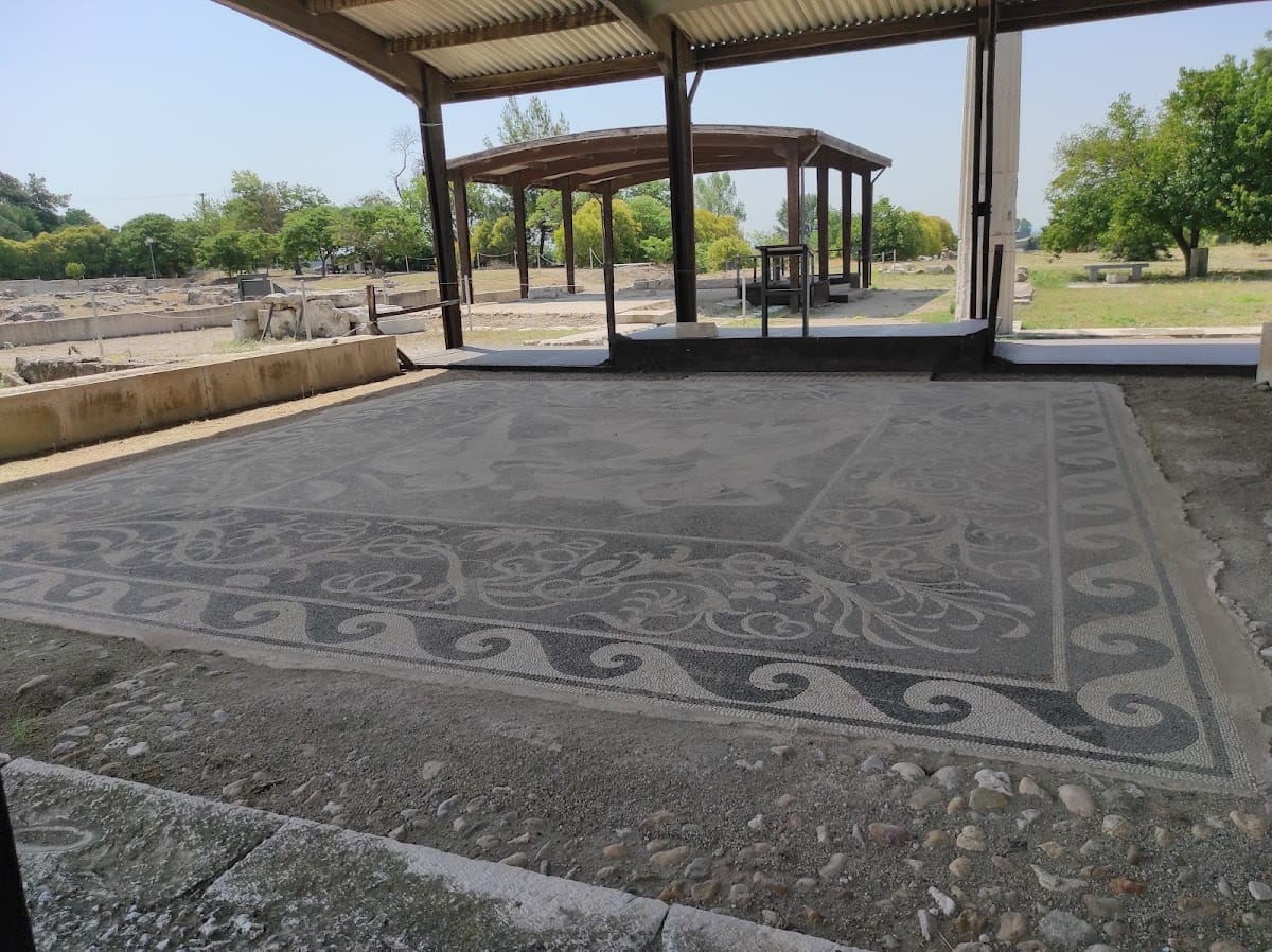
Rich houses had elaborate pebble mosaics showing mythological scenes, some reproduced from contemporary paintings. Inscriptions identified figures in several compositions, while lead or terracotta strips emphasized outlines and motifs. By the end of the third century BC, small glass pieces, or tesserae, had begun to replace pebbles in some mosaics. The House of Dionysus had two courtyards, one with a Doric colonnade and one with an Ionic colonnade. Its banqueting room contained a mosaic of Dionysus with a panther, while other floors showed a lion hunt, two centaurs, and a griffin attacking a deer. Geometric mosaics decorated the entrance rooms.
The House of the Abduction of Helen contained a mosaic approximately 8.48–8.5 metres long and 2.8–2.84 metres wide. It shows Theseus abducting Helen, the daughter of Leda, as he moves toward a chariot driven by Phorbas. Helen turns toward a companion identified by an inscription as Deianeira. Other mosaics depict an Amazonomachy and a deer hunt, the latter signed by the painter Gnosis. These floors probably date shortly after the reign of Alexander the Great. One house also preserves frescoes in the First Pompeian Style, a Roman wall-painting style that imitates architectural revetment and masonry. The paintings reach about 5 metres high and use architectural forms and perspective effects.
Sanctuaries and cemetery
At the northwestern edge of the city, the Thesmophorion formed a small enclosed sanctuary, or peribolos, about 10 metres in diameter. A central altar stood within the precinct. Clay figurines were produced in series in a local workshop, and large quantities of animal bones, especially piglets and sheep, were associated with sacrificial activity.
The sanctuary of Aphrodite-Cybele occupied the length of a city block north of the agora. It included an open area, two small temples at the northern and southern ends, storerooms, workshops, and an underground cistern. Inscriptions, statuettes, and clay figurines identify the cult, while some figurines were found in shops in the agora. The sanctuary of Darron stood in the southwestern part of the city near the monumental road to the port. A second-century BC inscription identifies its deity. Figurines and statuettes also represent Athena with a gorgoneion and a helmet decorated with three bull horns, as well as Dionysus and Pan.
The eastern necropolis, the oldest cemetery identified at Pella, contains burials dating from the late fifth century to the third quarter of the fourth century BC. Its use changed as the city expanded during the second half of the fourth century BC. The gold funerary leaf found there is shaped like a laurel leaf and measures approximately 8.3 centimetres long and 2.35 centimetres wide. Its three-line inscription names the initiate Posidippos and addresses Persephone. The rolled lead curse tablet from another tomb was buried with no other object and preserves a magical appeal concerning marriage.
Roman and Christian remains
The Roman colony lay separately from the Hellenistic city, near the baths associated with Alexander the Great and along the Via Egnatia. Its excavated remains were protected by a comparatively modest third-century enclosure. Archaeological material indicates that the colony continued in use during the fourth and fifth centuries AD.
North of the baths stood a large Early Christian basilica. The three-aisled, timber-roofed church measured approximately 42.5 by 20.2 metres and included a narthex, an entrance hall, an exonarthex, an outer vestibule, and an atrium, an open forecourt. Its eastern end contained a semicircular apse about 7.5 metres in diameter, with a marble-covered synthronon, a tiered seating arrangement for clergy.
The sanctuary, central nave, and central part of the narthex had opus sectile floors, made from cut pieces of stone or marble fitted into patterns. Coarser geometric mosaics covered the side aisles, the remaining parts of the narthex, and the exonarthex. The church was built around the middle of the fifth century, reconstructed with alterations in the sixth century after an earlier destruction, and suddenly destroyed at the beginning of the seventh century, probably by an earthquake.
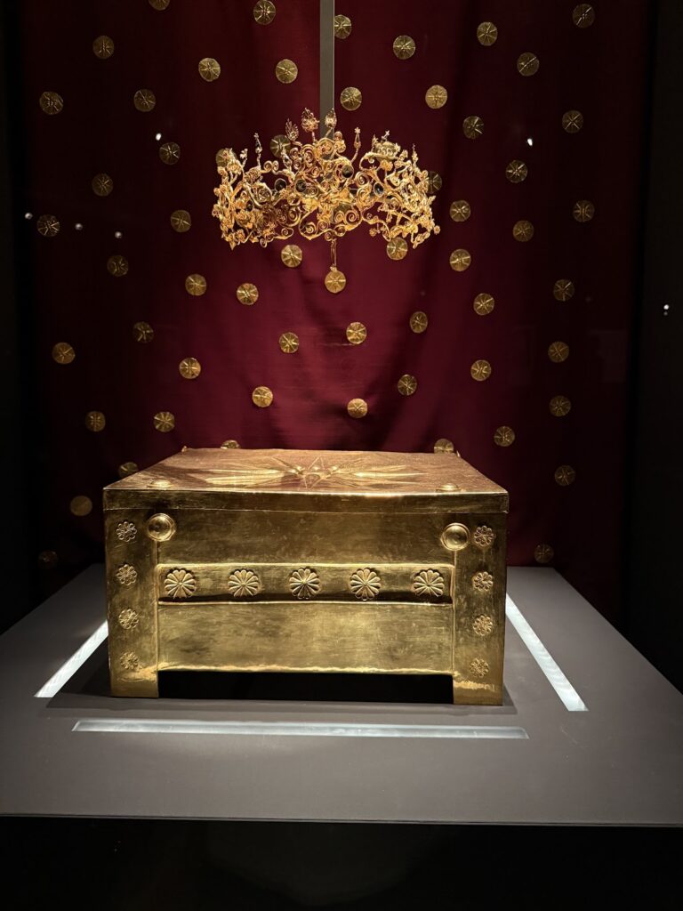
During the sixth-century rebuilding, the side aisles were raised with galleries reached by stairs from the narthex. Monumental porticoes connected the church with a city street on one side and a baptistery on the other. A smaller church was later built a short distance west of the basilica during the Byzantine occupation. The archaeological museum within the site displays mosaics from luxurious houses, First Pompeian Style frescoes, terracotta figurines, the Pella curse tablet, and thematic material on daily life, public institutions, sanctuaries, cemeteries, and the palace.