Angkor: Religious and Political Center of the Khmer Empire
Site at a Glance
- Rating
- 4.7
- Popularity
- Low
- Country
- Cambodia
- Primary era
- Medieval
- Eras represented
- Medieval
- Civilizations
- Unclassified
- Site type
- City
On this page25 sections
History
Angkor is the former religious and political center of the Khmer Empire, located near Siem Reap in Cambodia, and developed as a Khmer urban and temple landscape from approximately the ninth to the fifteenth centuries. The name derives from the Khmer nokor and ultimately from the Sanskrit nagara, meaning “city.” In Khmer inscriptions, the principal urban center was known as Yasodharapura.
Formation of the Angkorian state
The Angkorian period traditionally begins in 802, when Jayavarman II declared himself chakravartin, a universal monarch, at Mahendraparvata, generally identified with Phnom Kulen. The ceremony asserted the independence of Kambujadesa and formed part of Jayavarman II’s military and diplomatic unification of the Chenla polities. He moved among several centers, including Indrapura and Vyadhapura, before establishing Hariharalaya, now called Roluos, near Tonlé Sap.
Hariharalaya remained the royal center under successive rulers until Yasovarman I transferred the capital to Angkor around 889. The early chronology is partly uncertain because contemporary inscriptions for Jayavarman II and his son Jayavarman III are lacking. The foundation stele of Sdok Kok Thom, dated to about 1052, is a principal source for the early dynastic history.
Royal capitals and expansion
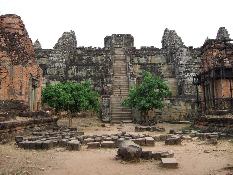
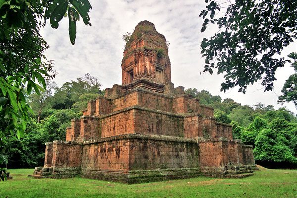
Yasovarman I established Yasodharapura around Phnom Bakheng, created a state temple there, and built the Eastern Baray, a large artificial reservoir. Angkor developed through repeated movements and refoundations of the royal center. Jayavarman IV moved the capital to Lingapura at Koh Ker around 928, after which Rajendravarman restored Yasodharapura as the principal capital and built East Mebon and Pre Rup. Jayavarman V later commissioned Ta Keo.
Suryavarman I emerged from a decade of civil war around 1010, consolidated royal authority, expanded the empire, began the Western Baray, and built a large royal palace enclosed by laterite walls. The palace enclosure measured approximately 600 by 250 meters. Udayadityavarman II completed the Western Baray and continued the monumental building program through West Mebon and Baphuon.
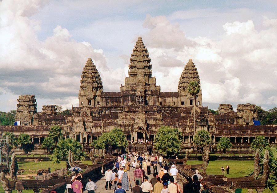
Suryavarman II came to power around 1113 and commissioned Angkor Wat between approximately 1113 and 1150. The temple was dedicated to Vishnu and may also have served as the king’s mausoleum. After Suryavarman II’s death, dynastic conflict and warfare with the Cham disrupted the kingdom. The traditional account describes a Cham invasion and sack of Yasodharapura in 1177, although the date and the precise relationship between Khmer and Cham factions remain debated.
Jayavarman VII and the Buddhist capital
Jayavarman VII was traditionally said to have defeated the Cham and became king in 1181. He built Angkor Thom over or near the former capital, established the Bayon at its center, and initiated a large program of temples, roads, bridges, public buildings, reservoirs, and rest houses.
Jayavarman VII adopted Mahayana Buddhism, a Buddhist tradition emphasizing the path toward universal compassion and enlightenment, as the state religion. He built Ta Prohm for his mother, represented as Prajnaparamita, the personification of transcendent wisdom, and Preah Khan for his father, Dharanindravarman II. He also constructed or sponsored Ta Som, Banteay Kdei, Neak Pean, and other monuments.
The last known stone temple constructed at Angkor was Mangalartha, inaugurated in 1295 under Jayavarman VIII. After Jayavarman VII’s reign, the construction of large stone temples declined and activity increasingly focused on altering existing monuments. Jayavarman VIII restored Shaivism, the religious tradition centered on Shiva, as the state religion and sponsored the removal or destruction of Buddhist images. During the fourteenth century, Theravada Buddhism became Cambodia’s dominant religious tradition.
Late Angkor and changing interpretations of decline
The Chinese diplomat Zhou Daguan visited Angkor from 1296 to 1297 during the reign of Indravarman III. His account described the court, religion, agriculture, commerce, social customs, and royal processions, providing important evidence for late-thirteenth-century society.
Angkor declined politically and demographically during the fourteenth and fifteenth centuries. Ayutthayan warfare and the sack of 1431 contributed to the movement of population and political power southward, although Angkor continued to be restored and used as a royal center into the sixteenth century. Proposed explanations for the decline include warfare, changes in royal and religious institutions, reduced maintenance of the hydraulic network, ecological overexploitation, weakened political centralization, severe droughts, flooding, and climatic changes between the late fourteenth and early fifteenth centuries.
Angkor was not completely abandoned after the fifteenth century. Angkor Wat remained a Buddhist pilgrimage center, while construction, restoration, canal maintenance, and other activity continued in parts of the site into the sixteenth and seventeenth centuries. European reports circulated from the late sixteenth century. António da Madalena visited around 1585 to 1586, and Japanese visitors left an inscription at Angkor Wat in 1632. Kenryio Shimano produced the earliest known plan of the temple after visiting between 1632 and 1636.
Exploration, conservation, and archaeological research
Angkor was known locally and was not recovered from an entirely deserted condition. European interest expanded during the nineteenth century through accounts by Charles-Émile Bouillevaux, Henri Mouhot, and later French, British, and American explorers. Archaeological surveys and epigraphic studies established the monuments as Khmer rather than Roman or unrelated to modern Cambodia.
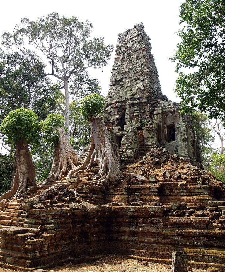
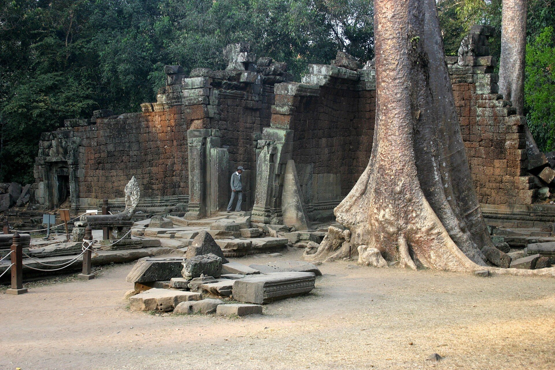
After Siem Reap was returned from Siam to Cambodia in 1907, conservation responsibility was assigned to the École française d’Extrême-Orient. Jean Commaille began clearing Angkor Wat and parts of Angkor Thom, including the Bayon. Under Henri Marchal, Georges Trouvé, Maurice Glaize, and later conservators, excavation, vegetation clearance, mapping, drainage, and restoration expanded during the twentieth century. Anastylosis, a conservation method that reassembles original architectural elements, was widely used, sometimes with concrete. Selected vegetation was retained at monuments such as Ta Prohm to preserve their physical character.
International conservation resumed substantially after the withdrawal of Vietnamese forces in 1989. UNESCO and international teams joined Cambodian institutions, the International Coordinating Committee for the Safeguarding and Development of the Historic Site of Angkor was established in 1993, and the APSARA authority was created by royal decree in 1995. UNESCO inscribed Angkor as a World Heritage Site in 1992 under cultural criteria i, ii, iii, and iv. The site remained on the List of World Heritage in Danger from 1992 to 2004, after which it was removed as conservation and management improved.
From the 1990s onward, radar, aerial survey, satellite imagery, and LiDAR revealed extensive roads, canals, reservoirs, non-religious structures, and dispersed urban areas that are difficult to identify from ground level. These studies indicate that Angkor consisted of several densely settled urban nuclei connected by infrastructure rather than a single compact city surrounded only by rural settlement. Looting and illicit trafficking affected the site from the fifteenth century onward and intensified during political instability. In 1969, the statue associated with the Terrace of the Leper King was moved to the National Museum of Cambodia and replaced with a concrete copy to reduce the risk of vandalism.
Remains
Angkor occupies the alluvial plain between Tonlé Sap and the Kulen Hills, north of modern Siem Reap. The principal concentration of monuments extends roughly 15 kilometers from east to west and 6.5 to 8 kilometers from north to south. The wider archaeological landscape covers at least 400 square kilometers, while infrastructure surveys indicate an urbanized area of more than 1,000 square kilometers.
The Angkor Archaeological Park includes the central monuments, the Roluos area, Banteay Srei, and distant sites such as Kbal Spean. The broader landscape contains approximately 72 major temples or other major buildings and several hundred additional temple sites, many surviving as traces or brick ruins. Angkor was a low-density, dispersed urban and hydraulic landscape interspersed with rice fields. Roads, canals, reservoirs, embankments, moats, and settlements supported transportation, water storage and distribution, flood management, agriculture, and possibly ritual activity.
Materials and temple form
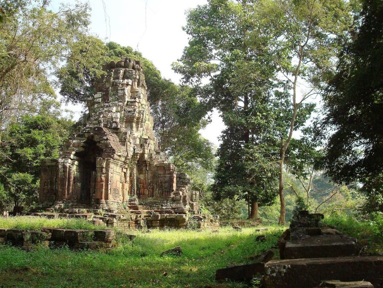
Earlier monuments such as Ak Yum, Preah Ko, and Bakong preserve the transition from brick architecture to the later widespread use of sandstone and laterite. Brick surfaces could be finely worked, covered with stucco, and painted in vivid colors. Traces of red, white, and gold remain on some Angkor Wat reliefs, while paint traces have also been found at Preah Khan and Neak Pean.
Sandstone was quarried near Phnom Kulen and transported to Angkor, probably by water. It formed major structural and decorative elements, including entrances, false doors, doorjambs, lintels, sculptures, and extensive bas-reliefs. Laterite was used chiefly for foundations, enclosures, retaining structures, and other surfaces not intended for elaborate carving. Khmer builders commonly used corbelled vaults rather than true arches. Wood remained important for roofs, cells, pavilions, and non-religious buildings, while ceramic and terracotta tiles were also used.
The characteristic temple-mountain combines a raised pyramid or platform with a central sanctuary, often surrounded by four subsidiary towers. Concentric galleries, enclosure walls, and moats represented Mount Meru, the surrounding mountains, and the cosmic ocean in Hindu cosmology. The central sanctuary generally contained a linga, a cylindrical sacred symbol associated with Shiva, or another divine image.
Roluos and early temple-mountains
Preah Ko
Preah Ko was built by Indravarman I in 879. Its six east-facing brick towers stand in two rows and were associated with Shiva and sacred bulls. The monument preserves the early use of finely worked brick within the developing architectural tradition of the Angkorian period.
Bakong
Bakong, built in 881, is an early temple-mountain with nested enclosures and moats. Its outer complex measures approximately 900 by 700 meters. The monument combines a raised central structure with the surrounding spaces that defined the religious and ceremonial setting of an Angkorian temple.
Lolei
Lolei was built by Yasovarman I in 893 on an island in the Lolei Baray. Four surviving brick towers form part of a group that may originally have contained six. Its position within the reservoir demonstrates the relationship between royal temples and the hydraulic landscape.
Phnom Bakheng
Phnom Bakheng was built by Yasovarman I in the late ninth century as the state temple of Yasodharapura. It stands on a hill, faces east, and uses terraces and six stairways to represent a temple-mountain.
Major temples and royal monuments
Banteay Srei
Banteay Srei lies approximately 25 kilometers northeast of the central Angkor area. Dedicated to Shiva in 967, it was built by the court official Yajnavaraha rather than by a king. Its small scale, fine sandstone carving, and exceptionally elaborate reliefs distinguish it within the Angkorian landscape.
Baphuon
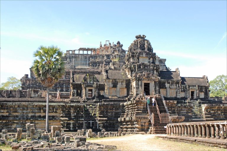
Baphuon is a three-tiered temple-mountain built under Udayadityavarman II and dedicated to Shiva. Its base measures approximately 120 by 100 meters, and its height is about 34 meters. Built on unstable sandy ground, it was later converted to Buddhism and suffered major structural collapse. A lengthy reconstruction was completed in 2011.
Angkor Wat
Angkor Wat stands on a terrace approximately 332 by 258 meters within a rectangular enclosure. Its outer wall measures about 1,024 meters from east to west and 802 meters from north to south, with a height of approximately 4.5 meters. A clear strip approximately 30 meters wide separates the wall from a surrounding moat about 190 meters wide.
The temple is oriented west rather than east and is dedicated to Vishnu. Its central sanctuary measures approximately 4.6 by 4.7 meters. Five upper towers represent Mount Meru, while the surrounding walls and moat represent the cosmic mountains and ocean. The inner gallery contains an approximately 600-meter-long and 2-meter-high continuous series of bas-reliefs depicting episodes from the Mahabharata and Ramayana, the judgment of souls by Yama, paradises and hells, Suryavarman II’s court and military procession, and the Churning of the Ocean of Milk.
Angkor Thom and Jayavarman VII’s monuments
Angkor Thom
Angkor Thom is a square walled capital built in the late twelfth century under Jayavarman VII. Its laterite walls are approximately 8 meters high and about 3 kilometers on each side. They enclose roughly 145.8 hectares and are surrounded by a moat approximately 100 meters wide.
Bayon
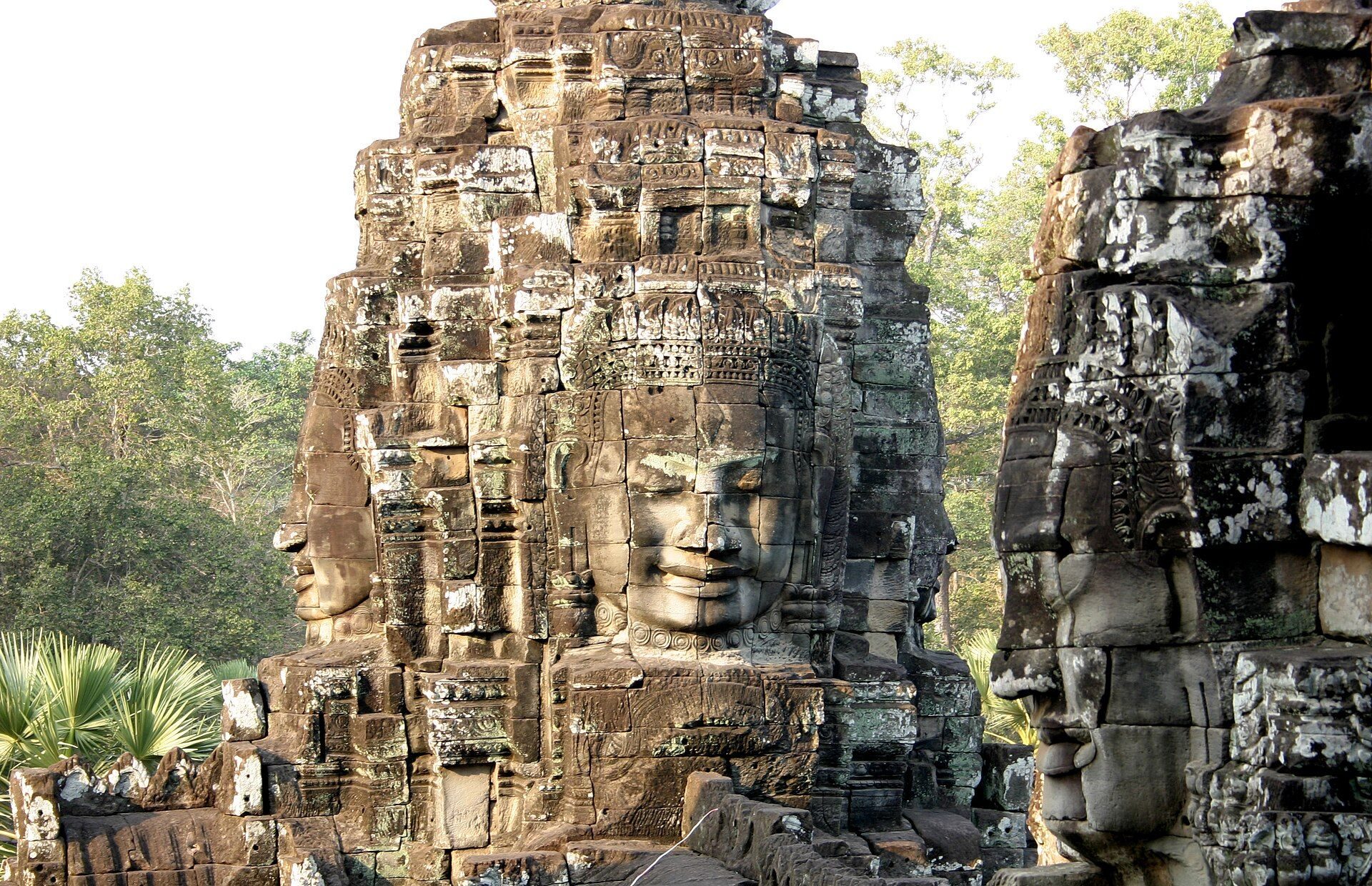
The Bayon occupies the center of Angkor Thom and served as the capital’s principal state temple. Built under Jayavarman VII as a Mahayana Buddhist monument, it has densely arranged towers with large faces associated with Lokeśvara, a bodhisattva linked with compassion. The number of towers has been counted as 49 or possibly as many as 59, with 37 of the traditionally counted towers still standing.
Ta Prohm
Ta Prohm was built in 1186 as Rajavihara, a Buddhist monastery and educational institution dedicated to Jayavarman VII’s mother in the form of Prajnaparamita. Inscriptions associate the institution with approximately 12,500 residents, including 18 high priests and 615 dancers, as well as about 80,000 people in surrounding villages who supported it. Vegetation has been retained in selected areas as part of the monument’s conservation and presentation.
Preah Khan
Preah Khan was consecrated in 1191 by Jayavarman VII in honor of his father. The complex measures approximately 700 by 800 meters and includes an enclosure and a now-dry baray. It may have served as a temple, royal settlement, and Buddhist educational institution, as well as a temporary royal center before Angkor Thom was completed.
Neak Pean
Neak Pean is a Buddhist temple on an island in a baray associated with Preah Khan. Its name refers to intertwined serpents represented in sculpture, and its arrangement was connected with Buddhist healing concepts.
Terraces of Angkor Thom
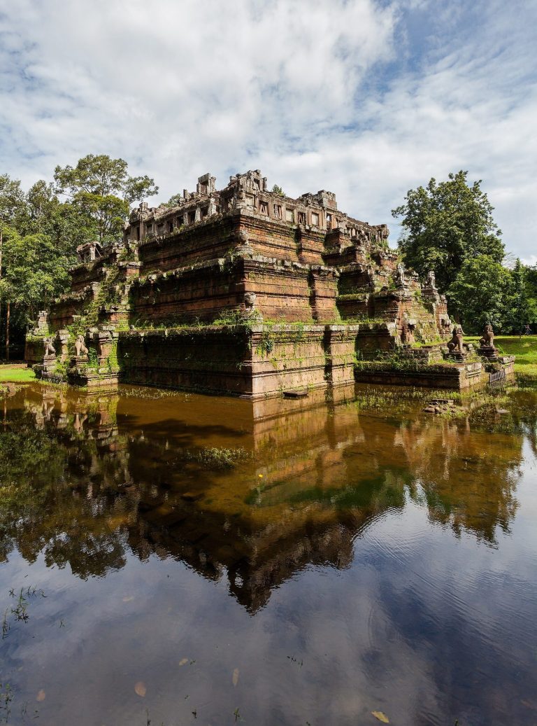
The Terrace of the Elephants formed part of Angkor Thom and was built under Jayavarman VII. Approximately 350 meters long, it adjoined the Phimeanakas palace and served as a royal viewing platform, as indicated by its surviving foundations and eastern elephant carvings.
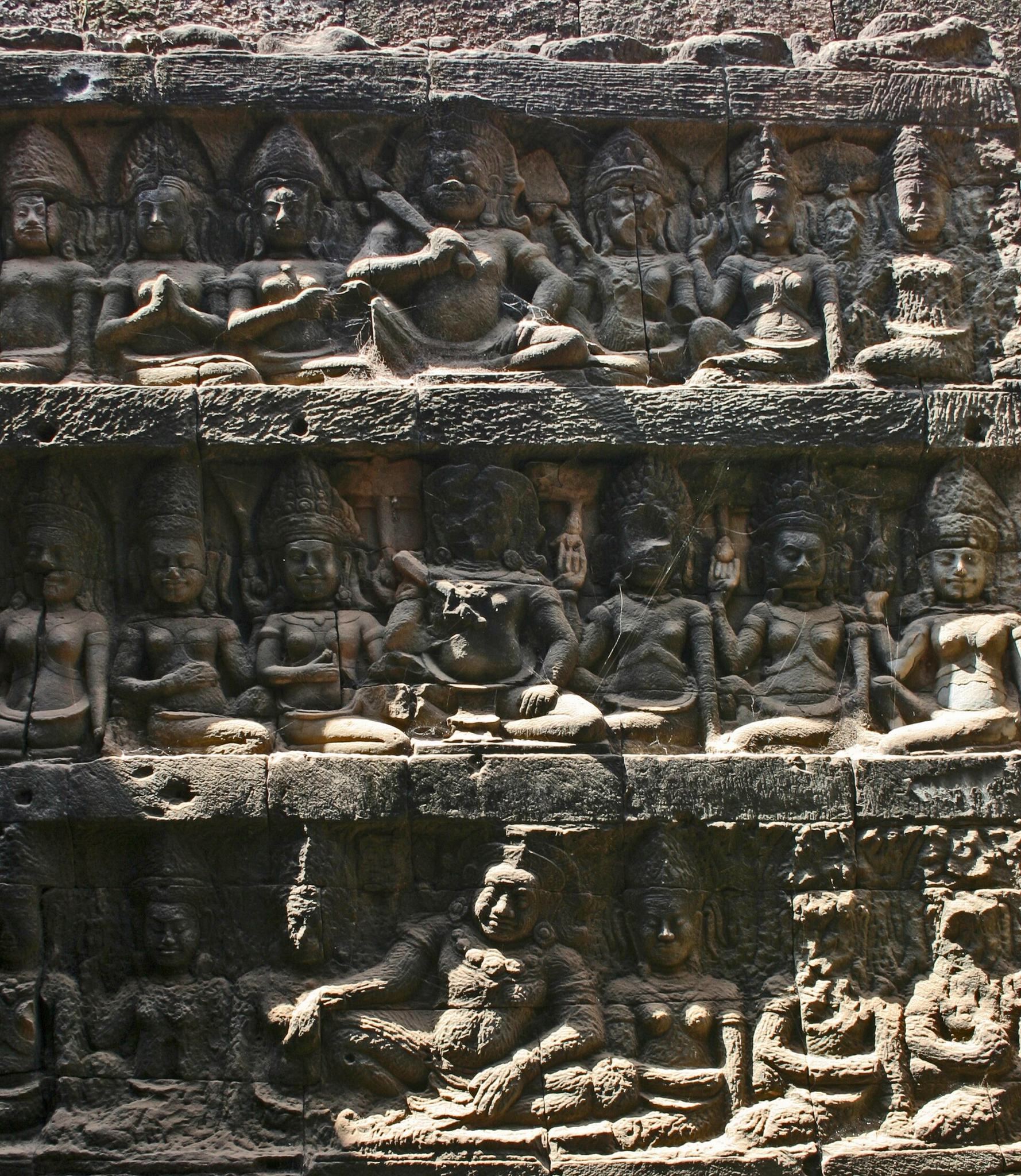
The Terrace of the Leper King stands at the northwest corner of Angkor Thom’s royal square. Its reliefs include dancers, demonic figures, and naga, serpent beings in South and Southeast Asian religious traditions. The modern name derives from a fifteenth-century statue identified as Yama, the Hindu god of death, whose weathered surface became associated with a Cambodian leprosy legend.
Hydraulic and urban landscape
The reservoirs, canals, moats, embankments, roads, and settlements formed an interconnected landscape around the monumental temples. The Eastern and Western Barays, along with smaller reservoirs such as the Lolei Baray, supported water storage and distribution. Remote sensing and LiDAR have identified buried or obscured roads, canals, reservoirs, residential areas, agricultural systems, and other non-religious remains, helping define Angkor as an extensive urban and hydraulic network rather than only a collection of temples.
Surviving architectural decoration includes stucco, painted brick, sandstone reliefs, apsaras, naga, divine figures, lintels, false doors, and narrative sculpture. Modern conservation has included vegetation clearance, foundation repair, drainage, archaeological excavation, anastylosis, and the reassembly of dismantled stones on concrete foundations. Large visitor numbers, groundwater extraction, tropical deterioration, biological growth, and pressure on the sandy subsoil continue to complicate the preservation of the archaeological landscape.