Ancient Ostra: A Roman Municipium in Italy
Site at a Glance
- Popularity
- Medium
- Country
- Italy
- Primary era
- Classical
- Eras represented
- Classical
- Civilizations
- Roman
- Site type
- City
On this page22 sections
History
Ancient Ostra was a Roman town at Le Muracce near Ostra Vetere, Italy, where the earliest known human activity dates to the third and second centuries BC. It became a municipium, a self-governing Roman town with formal civic status, in the first century BC and prospered most in the second century AD. In the Augustan period, it belonged to Region VI, an administrative district of Italy that included Umbria and the Ager Gallicus, the Roman name for territory associated with Gallic settlement along the Adriatic.
From settlement to municipal town
Ostra stood in territory formerly occupied by the Senones, a Celtic people who settled in parts of northern and central Italy. Its position on a route linking Rome with the Roman colony of Sena Gallica, at modern Senigallia, connected it with nearby Aesis in the Esino valley. A road from the middle Esino valley probably joined the main route nearby. Ostra’s location and surroundings may have encouraged settlement before the Roman state reorganized the region.
By 232 BC, Ostra was a praefectura, a community or district governed through a Roman prefect. It acquired municipal status during the first century BC. Inscriptions identify it as a municipium and associate it with the Pollia, a Roman voting tribe used for civic registration. The Liber Coloniarum, a Roman land register, instead includes the territory of Ostra among colonies. Inscriptions also name municipal officials, including a duovir, one of two chief magistrates, and an augur, a religious official who interpreted signs. They record occupational associations and the worship of Bona Dea, a goddess linked with women’s rites, fertility and well-being. Pliny the Elder mentions Ostra alongside Suasa, about eight kilometres to the west.
Urban development
An urban centre began to take shape around a large forum, the town’s central public square, during the middle Republic. From the Augustan period to the end of the first century AD, Ostra underwent extensive building and reorganization. The forum was paved and enclosed, public buildings were constructed or altered, and the main urban roads were laid out. A further building phase, extending from the second half of the first century into the early second century AD, included the completion of the public baths.
Between the late first and early second centuries AD, a new complex occupied part of the eastern forum. Its arrangement may have followed the model of Rome’s Temple of Peace, a large imperial public complex, and the buildings may have served religious, cultural and political purposes. The project reduced the open square and shifted its northeastern boundary back by more than 20 metres. The forum also became entirely pedestrian during this period, changing from a space probably crossed by a principal road into an enclosed precinct for civic, religious and commercial activity. In the second half of the second century, builders altered a small shrine and enlarged the eastern complex.
Decline and later settlement
Tradition attributes Ostra’s destruction in 410 to the Visigoths under their king Alaric, during invasions of central Italy. The town’s decline, however, appears to have unfolded over time rather than following a single attack. Insecurity during the sixth-century Gothic War, a conflict between the Byzantine Empire and the Ostrogoths in Italy, and the expansion of the Lombard duchy of Spoleto in central Italy contributed to the weakening of exposed valley settlements.
Ostra ceased to function as a city in the late sixth or early seventh century. It had been an episcopal seat in the sixth century: in 502, its bishop Martinianus attended a synod in Rome convened by Pope Symmachus. Later changes to the town included the removal of building materials and the reuse of the central area. Burials in the forum and around the principal temple reflect a shift in the use of the former civic centre. The temple may have been adapted as a Christian church, although the evidence does not establish that conversion with certainty.
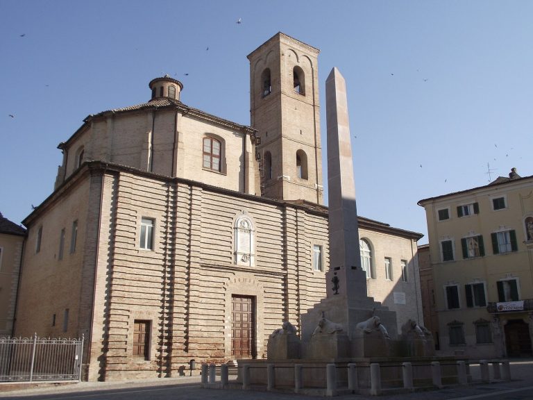
According to tradition, inhabitants moved into the surrounding hills and founded settlements that included Montalboddo, also called Monte Bodio, and Montenovo. Belvedere Ostrense is also linked with this history of settlement. In the nineteenth century, disputes over claims of descent from Roman Ostra accompanied the adoption of the names Ostra for Montalboddo and Ostra Vetere for Montenovo.
Excavation and interpretation
The discovery of a large statue in 1841 helped prompt Giuseppe Baldoni’s excavations in 1903 and 1904. Baldoni excavated the baths, theatre, forum, roads and temple. Further work by the Superintendency for Archaeological Heritage of the Marche between 1985 and 1990 did not substantially alter the known plan of the Roman town.
An agreement among the municipality of Ostra Vetere, the University of Bologna’s archaeology department and the Superintendency was signed in 2005. Systematic summer excavations resumed in 2006, with a team from Blaise Pascal University in Clermont-Ferrand joining in 2010. A 2020 volume brought together findings from the 2006–2019 campaigns.
Remains
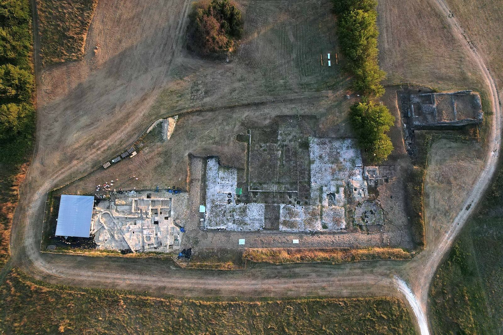
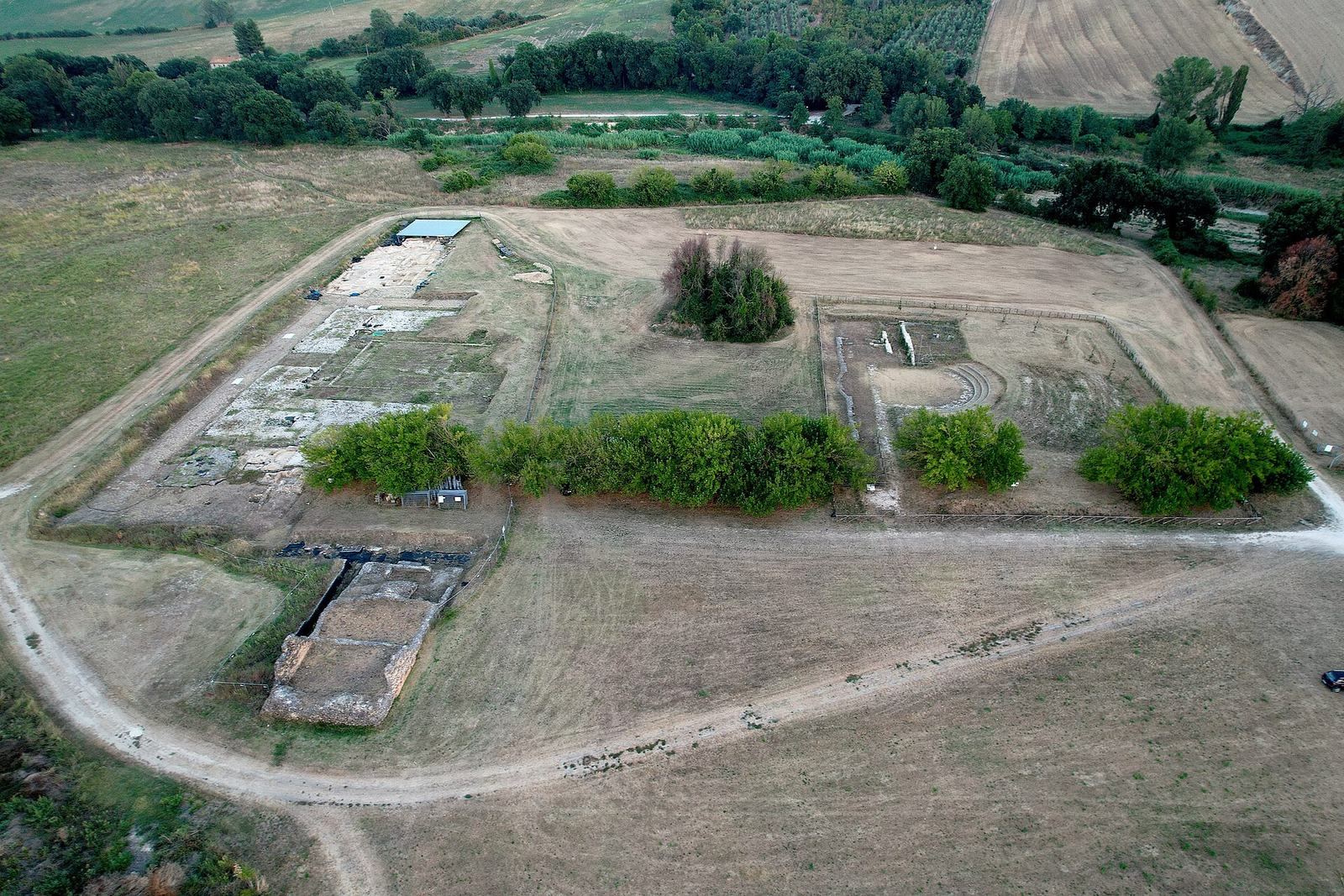
The archaeological area covers about 200,000 square metres on an alluvial terrace, raised ground formed by river deposits, on the left bank of the Misa, known in antiquity as the Sena. It lies at about 82 metres above sea level, roughly three kilometres from present-day Ostra Vetere. The visible remains include the forum, a temple, public baths, a theatre and sections of paved roads. The principal routes included a broad northwest–southeast road between the baths and theatre, a second road crossing it at right angles, and another stretch running parallel to the first. A section is identified as the Via Bolsena.
Forum and civic precinct
Forum, paving and entrances
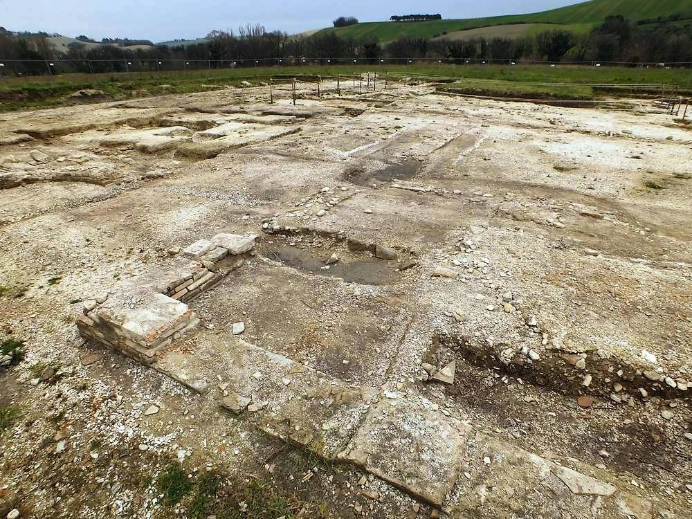
The forum occupied an area about 75 metres long and 65 metres wide. In its early form, deposits of gravel, 30 to 60 centimetres thick, covered the square. A brick drainage channel ran northwest–southeast and divided it into two areas. In a later phase, additional gravel raised the northern area about 20 to 30 centimetres above the rest of the square.
A perimeter wall enclosed the forum, with a monumental gate where the principal urban road reached the square. The paved entrance area continued the approach road but used different paving stones, and a curb separated it from the forum to prevent carts from entering. The threshold and jambs of the entrance portal survive. These features belong to the forum’s later, enclosed arrangement.
Structure 14, a proposed voting installation
In the northern part of the forum, rows of square pits formed Structure 14, in an area later occupied by Structure 8. On the northeast side, six pairs of pits, each measuring about 48 to 50 centimetres across and 1.40 to 1.50 metres deep, stood in two parallel rows about 1.90 metres apart. The distance between pairs ranged from 2.40 metres to slightly more than four metres. At least three shallower pits on the opposite side formed another parallel line. Pits at either end define long spaces about 20 metres in length.
The arrangement has been interpreted as a municipal voting installation. The pits may have held wooden posts about one Roman foot square, with ropes between them forming lanes for voters. Immediately to the north, a rectangular space opened onto a rear road through a colonnade. It may have been a diribitorium, a place where votes were counted. Comparisons with voting installations in other central Italian towns inform this interpretation. Structure 14 was dismantled in the second half of the first century AD, probably to clear space for Structure 8.
Structures 18 and 19
Structure 18, an Augustan-period shrine, stood where the principal urban road reached the forum. Its interior had a front room interpreted as an entrance porch and a rear chamber, or cella, where a cult statue probably stood.
Structure 19, slightly southeast of the shrine, had a curved, recessed form and was associated with water. It incorporated a brick-lined well that may have predated the building. In an early phase, small basins and rooms with terracotta floors were arranged symmetrically around a semicircular basin 4.26 metres in diameter, open toward the square.
Circular building
A circular building behind Structures 18 and 19 was probably constructed somewhat later. About 11.20 metres across, it had an outer ring of brick columns covered in stucco surrounding an inner room about 4.5 metres in diameter. The inner room may have been a cella, or principal chamber.
Structure 8, the eastern complex
Built between the late first and early second centuries AD, Structure 8 occupied the eastern forum. Its square courtyard measured 28.40 metres on each side. Porticoes ran along three sides, while a continuous wall facing the forum had two entrances. On the opposite side, a rectangular cult hall projected slightly into the courtyard behind a columned front.
In a later phase of uncertain date, builders enlarged the hall by moving its rear wall to the edge of the street pavement. The complex may also have included a garden, water features, artworks and a library, comparable to elements associated with its proposed model, Rome’s Temple of Peace.
Structures 20 and 27
Structure 20 was built between Structures 18 and 8 in the second half of the second century AD. The large rectangular building had a front porch and a larger rectangular hall, but its function is uncertain. During this period, the cult hall of Structure 8 was also extended toward the road along the forum’s northern side.
Structure 27 is a rectangular building with two interior spaces, an entrance portico and a large hall. Its function remains under study.
Temple and neighbouring building
Podium temple
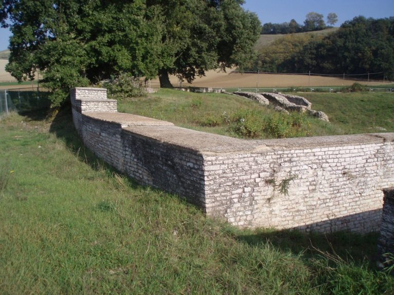
The temple stood on the western side of the forum, about 50 metres north of the theatre. Its rectangular plan measured 25 by 12 metres and contained three rooms. The perimeter walls survive to about two metres high; the remains rise about 2.5 metres above the present ground and nearly four metres above the original forum level.
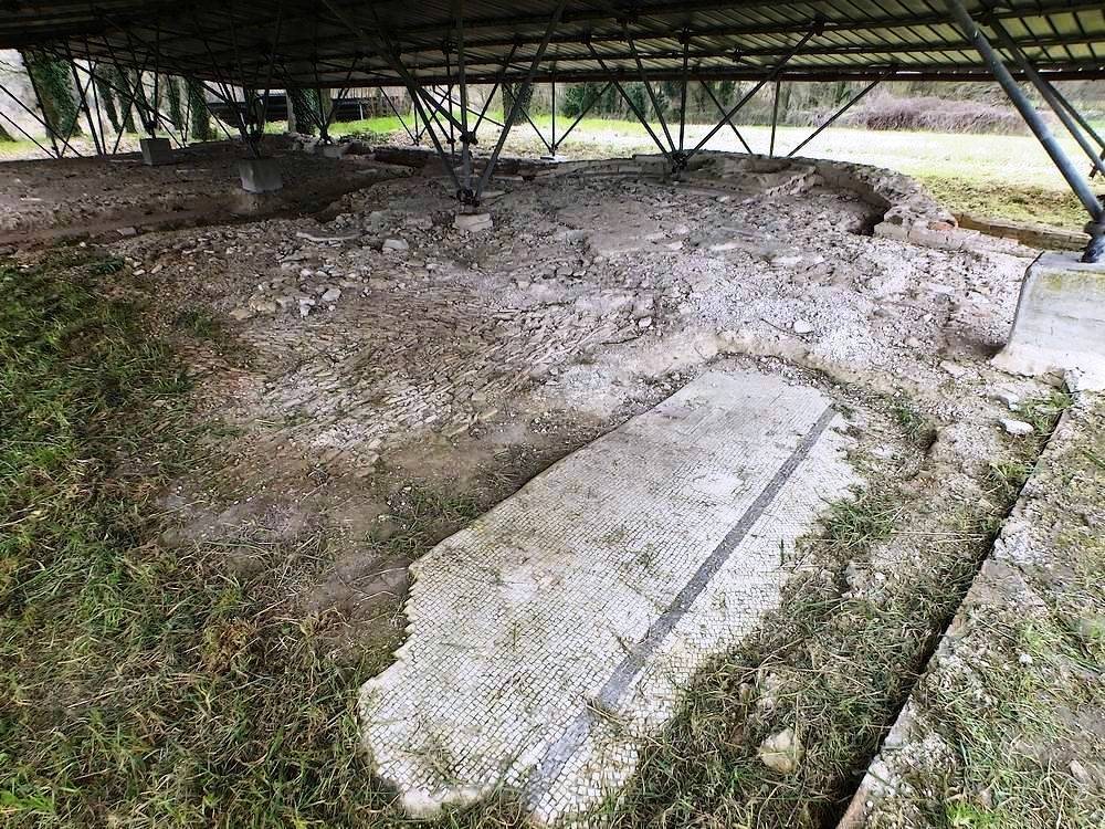
The façade was probably tetrastyle, meaning it had four columns, and faced a substantial raised platform, or podium. Two stairways at the sides reached the platform, while a central stairway led to the sanctuary rooms. A corridor paved with mosaics ran around three sides of the temple, whose front opened directly onto the forum.
The walls were made of carefully laid brick. A lime-based core was faced on both sides with evenly coursed bricks cut into blocks with triangular bases. From the fifth century, the two lowest podium steps were blocked, apparently to accommodate the rising level of the pavement outside. Together with nearby burials, this alteration is consistent with the proposed conversion of the temple into a Christian church, but does not prove it.
Structure 4
Beside the temple, Structure 4 measured 17.90 by 11.15 metres. A rectangular front room and three adjoining rooms at the rear opened onto a central hall. The middle rear room ended in a curved recess, and the three rooms did not connect directly with one another. The hall retains a strip of white mosaic along its walls; its central pavement of marble slabs was later removed. Marble facing remains low on the walls, while collapsed material yielded coloured stucco from the upper wall surfaces.
The building used the same construction technique as the temple. Its original purpose is uncertain. It may have been another shrine or the headquarters of a civic association.
Baths and theatre
Public baths
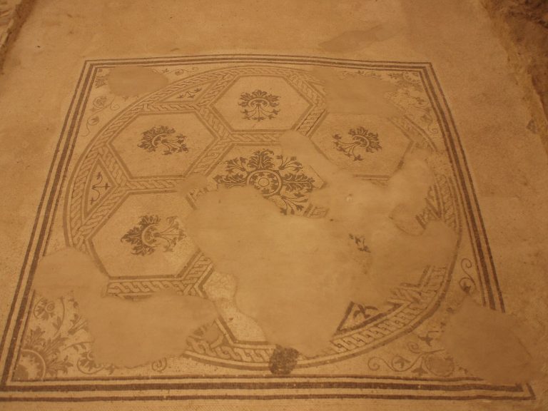
The public baths occupied the southeastern part of the town. Excavations exposed 25 rooms, including a heated room and a cold room, with mosaic floors and walls faced in marble. Two furnaces served the complex, and a large basin probably held its water supply. The baths were built between the late first and early second centuries AD. Floors beneath the mosaics date from the late Republican to Augustan periods and may belong either to an earlier bath building or to a residential quarter that preceded the baths.
Theatre
The theatre lay between the forum and the baths and measured 44.60 metres in diameter. Excavations exposed the stage, whose rear wall alternated rectangular and semicircular niches, and part of the orchestra, the performance area, paved with large terracotta slabs. Some remains stood about two metres above the ancient ground level when excavated.
Burials, church and finds
Church and burials
A Roman house lies beneath an early Christian church, part of whose walls remains visible. The house is still under study. More than 50 graves have been identified around the temple, dating at least from the late fifth or early sixth century. Burials in the forum include examples whose grave goods indicate dates reaching at least the middle of the seventh century.
Statue of Parian marble
A marble statue more than two metres tall was found in 1841. Carved from marble quarried on the Greek island of Paros, it shows a nude figure in a heroic pose. It may represent a local public figure whose features resemble those of the emperor Trajan. A commission examining the statue in Bologna in 1865 identified the figure as Trajan depicted as Mars, the Roman god of war, but that identification remains uncertain.
The statue was sold to Geneva in 1893 and is now held by the Musée d’art et d’histoire there. A copy made in 2018 is displayed at the Antiquarium Città Romana di Ostra, a museum opened in 2012 to connect the archaeological site with displays of material recovered from the area and explanatory panels about the excavations.