Alba Fucens: A Roman Colony and Municipium in Italy


Site at a Glance
- Rating
- 4.6
- Popularity
- Medium
- Country
- Italy
- Primary era
- Classical
- External website
- Open
- Eras represented
- Classical, Medieval, Early Modern
- Civilizations
- Kingdom of Naples, Roman, Spanish
- Site type
- City
On this page29 sections
History
Alba Fucens is an ancient Roman city in Italy, founded as a Latin colony in 303 BC, or possibly 304 BC, after Rome defeated the Aequi. Built on an elevated and strongly fortified hill beside the frontier of the Marsi, the settlement controlled an important Apennine corridor and routes toward the Adriatic. Its Roman development began with a planned military colony and continued through republican, imperial, late antique, and medieval phases.
Foundation and strategic role
The site probably began as an Aequi settlement in territory immediately beside the lands of the Marsi, two ancient Italic peoples of central Italy. Rome established a colony of about 6,000 settlers after the defeat of the Aequi. The colonists soon constructed a defensive wall, but the Aequi attacked the new stronghold in the following year and were unsuccessful.
Alba Fucens stood beside the Via Valeria, the Roman road linking Rome with the interior and the Adriatic side of the peninsula. It was also positioned at a crossroads, where another route led from southern Etruria through the Liri valley toward Campania. This location, combined with the city’s walls and elevated position, made Alba a valuable base during the military conflicts of central Italy.
Republican loyalty and citizenship
During the Second Punic War, the conflict between Rome and Carthage, Alba initially remained loyal to Rome. In 211 BC, when Hannibal was advancing toward Rome, the city sent 2,000 men to assist the Roman war effort. It later refused to provide additional contingents and was punished along with other colonies.
Rome repeatedly used the inland city to hold important prisoners of state. Among them were Syphax, king of Numidia, Perseus, king of Macedonia, Alexander, the son of Perseus, and Bituitus, king of the Arverni. Alba’s defensible position and distance from the coast suited this function.
In 89 BC, Alba became a municipium, an incorporated community whose inhabitants held Roman citizenship. This change began the city’s principal period of prosperity. Inscriptions, public buildings, private residences, and archaeological finds all reflect the expansion associated with its Roman civic status.
Civil wars and changing allegiance
Alba remained loyal to Rome during the Social War, when Rome’s Italian allies rebelled to demand citizenship and political rights. Later, during the conflict between Marius and Sulla, it supported Marius. After Sulla’s victory, part of Alba’s territory was distributed to veterans of his lieutenant Metellus Pius.
During the civil war between Julius Caesar and Pompey, Alba held a garrison of six cohorts commanded by Lucius Domitius Ahenobarbus. The garrison later surrendered to Caesar’s forces. In 44 BC, the legion Martia, recruited among the Marsi, mutinied against Mark Antony and joined Octavian, Caesar’s adopted heir and later the emperor Augustus. The legion occupied Alba because the city enabled contact with Octavian and could block Antony’s route toward the Adriatic. Octavian subsequently gathered further forces there, including the Fourth Legion as well as veteran and newly recruited troops.
Imperial expansion and late antiquity
During the reign of the emperor Claudius, major works partly drained the nearby Fucine Lake through the Claudian tunnels. The reclaimed land increased the area available to Alba, although the basin later became covered by water again.
The city began to decline from the third century AD, and this process accelerated during the following century. In late antiquity, inhabitants moved toward higher and more defensible locations. The sixth-century historian Procopius records that Byzantine troops occupied Alba and spent the winter there in 537 during the Gothic War. This is the last known historical reference to the ancient city.
Medieval Albe and archaeological exploration
Medieval settlement developed on the higher northern hill around Albe and the later Castello Orsini rather than in the ancient urban center. Albe became the political and administrative center of the medieval county of Albe, which existed from the twelfth century until feudal rights were abolished in 1806.
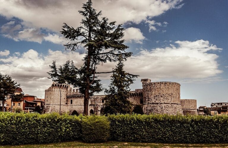
The Orsini acquired the fief of Albe in the fourteenth or early fifteenth century and built a castle over the ancient fortifications. The castle later passed to the Colonna, who retained it until the nineteenth century. The 1915 earthquake severely damaged the castle, and bombing during the Second World War caused further destruction. The medieval village was abandoned and later rebuilt lower on the hill.
Systematic archaeological exploration began in 1949 under Fernand De Visscher of the Belgian Academy in Rome. Work continued under Joseph Mertens and Belgian research institutions, exposing the city center and allowing detailed study of most public and private buildings. Regional archaeological authorities continued investigations from 2006, while the University of Brussels undertook further work from 2007. These later investigations included the discovery of a painted calendar and fasti, calendrical or chronological records that could preserve information about civic or religious timekeeping.
Remains
Setting and urban enclosure
Alba Fucens occupied an elongated hill rising roughly 300 meters above the former Fucine basin, at about 949 to 990 meters above sea level and below Monte Velino. Its main axis ran from north to south, while the principal urban buildings lay in a valley approximately 100 meters wide between hilltops and projecting spurs.
City walls and gates
The fortified area enclosed the hills of Albe, Pettorino, and San Pietro, together with the valley between them. The wall extended for about 2.9 kilometers around an area measuring approximately 1,150 by 675 meters. Its earliest major construction is generally placed in the mid-third century BC. Modifications followed in the second century BC and at the beginning of the first century BC. The wall, built with massive rubble and carefully fitted polygonal blocks, was approximately 2.8 to 3.4 meters thick.
Four principal gates served the enclosure. The Porta Massima faced the Via Valeria, the Porta di Massa led toward Aveia in the territory of the Vestini, and the Porta Fellonica faced the territory of the Aequiculani in the Cicolano area. A tower and two bastions protected three of the gates. One bastion carries phallic symbols, probably intended to ward off malign forces.
Northern defenses
Along the northern side, three defensive lines extended for roughly 140 to 150 meters. They were built at different times. The earliest may have been constructed by the first Roman colonists, although an earlier pre-Roman origin has also been proposed. Some sections used concrete faced with finer polygonal masonry.
Streets and civic center
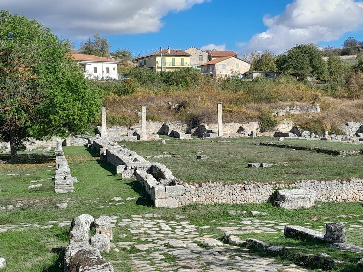
The city followed an orthogonal grid. The main longitudinal route was the decumanus maximus, identified with the Via Valeria along the valley floor, while the transverse cardo maximus formed the other principal axis. The Via dei Pilastri provided another important route. Its pedestrian crossing resembles crossings known from Pompeii, and porticoes and shops with standardized ground plans lined the street.
The monumental center developed chiefly during the late Republican period between the main decumanus and the Via dei Pilastri. Its sequence of public buildings included the comitium, forum, basilica, market, baths, and Sanctuary of Hercules.
Forum and public buildings
Forum and comitium
The forum occupied the central valley and measured approximately 142 meters in length and 44 meters in width. Statues and columns probably decorated the open civic space. At its northern side stood the comitium, a second-century BC building associated with civic meeting and administration. It was square externally, measuring about 20 by 20 meters, but circular inside and fitted with steps.
Basilica and market
A portico and rectangular basilica occupied the southern end of the forum. Measuring approximately 53.2 by 23.4 meters, the basilica had a principal entrance and two side entrances on its northern side, facing the forum. It served commercial transactions and the administration of justice.
The neighboring macellum, a purpose-built market, belonged broadly to the same period as the basilica, probably the late second or early first century BC. Baths adjoining the market were built during the late Republican period and enlarged under the emperors. Their floors carried mosaics depicting marine scenes and related subjects.
Northern terrace
A large terrace on the northern side was enclosed by a portico and ended in an exedra, a semicircular recess or open-ended architectural space. Built between two sections of the city wall, between the Porta Massima and Porta Fellonica, it was reached through a cryptoporticus, a covered passage that was partly underground. Dating to the first century AD, the terrace probably served partly as a training or gathering ground and contained a monumental column at its center.
Religious buildings and San Pietro
Sanctuaries of Hercules and Isis
The Sanctuary of Hercules occupied a very large paved esplanade, approximately 80 meters long, bordered by porticoes. A small cella, the enclosed inner chamber of a temple, stood at one end. The statue known as Herakles Epitrapezios was found within the sanctuary complex. The temple of Isis and the Sanctuary of Hercules stood in the urban center.
Temple of Apollo
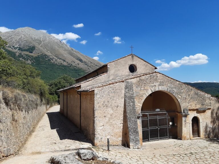
Other religious buildings occupied the western hill. Among them was a temple of Apollo on the hill of San Pietro, built in an Italic or Tuscan architectural type and broadly dated to the second or first centuries BC. It was later converted into the church of San Pietro in Albe and extensively remodeled during the medieval period.
An inscription found during restoration records the reconstruction of the temple roof in AD 236 and identifies Apollo as the deity worshipped there. This identification challenged an earlier interpretation based on Vitruvius. Votive bronze and terracotta figurines were found in small pits near the church apse.
Church of San Pietro
The church incorporates ancient columns and other remains of the temple. Two rows of eight ancient columns separate the nave from the side aisles, while additional columns form a double portico. Some columns are partly concealed by medieval walls or buried beneath the raised choir and altar pavement. The church also contains Cosmatesque decoration, a medieval technique using small pieces of colored stone and glass in geometric patterns, including a screen of spiral columns and a marble pulpit with porphyry and serpentine panels.
The 1915 earthquake seriously damaged the church. It was reconstructed during the 1950s, and an almost complete anastylosis, the rebuilding of a ruin with its original architectural elements, was carried out under Raffaello Delogu between 1955 and 1957. Medieval walls concealing some of the ancient columns were removed during the work.
Entertainment buildings
Amphitheatre
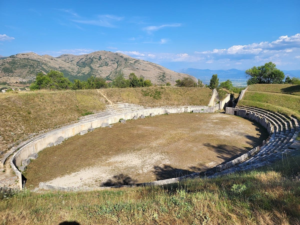
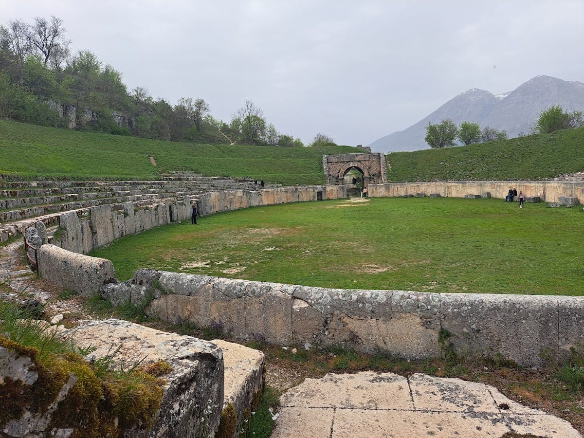
The amphitheatre lies on the eastern slope of Colle di San Pietro, below the temple area. It is an oval, largely sunken structure measuring approximately 95 to 96 meters by 79 to 80 meters externally. Its arena measures about 69 by 40 meters. The northern entrance faced the city, while the southern entrance was incorporated into the city wall and also functioned as a city gate.
The building was constructed in the early first century AD during the reign of Tiberius. Its financing came through a testamentary bequest by Nevius Sutorius Macro, a native of Alba who served as prefect of the Praetorian Guard. An inscription above the northern entrance records the bequest. A nearby villa was demolished or left unfinished to make way for the amphitheatre. Its floors carried mosaics and its walls had frescoes, which were later removed.
Theatre
The Roman theatre stood on the western slope of Colle di Pettorino. Its cavea, the seating area, was approximately 77 meters wide, and its orchestra had a diameter of about 10 meters. Later quarrying removed much of the building stone, leaving chiefly the outline of the structure.
Houses and water supply
Private residences
Excavations in peripheral districts have exposed numerous patrician houses and luxurious residences, including a building known as a domus. Their decoration included mosaics, frescoes, statues, and other works of art, revealing the material richness of some private properties in the Roman city.
Aqueduct
The Roman aqueduct was built in the late Republican period or as early as the first century BC. Approximately 10 kilometers long, it carried water underground from the Sant’Eugenia spring beyond the pass of Fonte Capo la Maina near Santa Jona. Remains survive along its original route, particularly at Arci, where the bridge of an inverted siphon remains visible.
The final approximately three kilometers used a pressurized pipeline to cross a valley. An inverted siphon descends into a valley and rises again on the opposite side, allowing an aqueduct to maintain its overall gradient. At Arci, the structure included an embankment about 12 meters wide and more than 130 meters long. At the deepest point, arches carried the pipes across part of the valley, reducing pressure and leakage.
Medieval and later remains
Church of San Nicola
The church of San Nicola was built in the seventeenth century. The 1915 earthquake destroyed it, and it was rebuilt in the new settlement of Albe using materials from the original church and from the archaeological site beneath it.
Castle of Albe
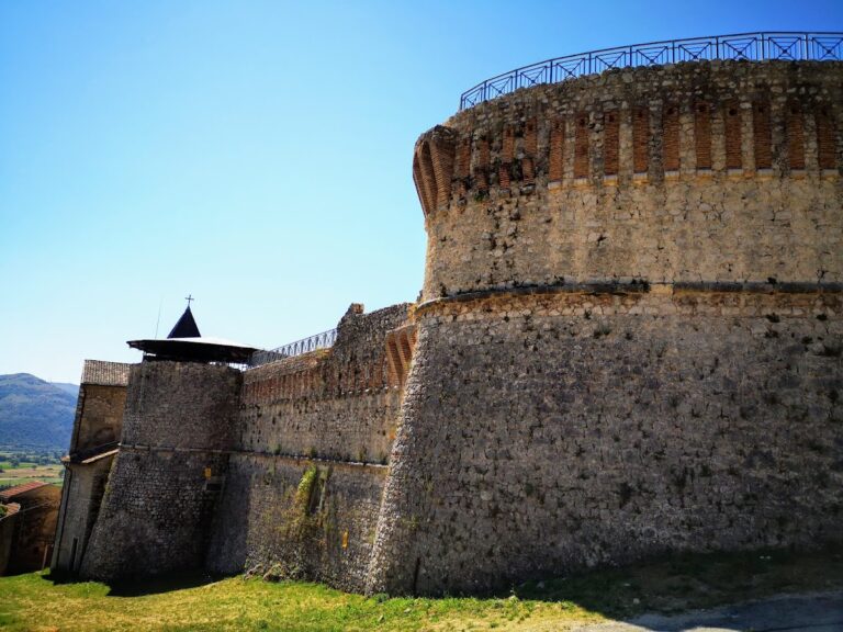
The castle of Albe had a rectangular plan and originally possessed four towers. Only one tower survived the 1915 earthquake. Its remaining masonry preserves evidence of a sixteenth-century alteration, including characteristic crenellations.
Excavated objects and collections
Excavations produced inscriptions, architectural sculpture, pavement fragments, marble portrait busts, bronze statuettes, the Venus of Alba, and the seated Herakles Epitrapezios. The Herakles statue was discovered in 1960, although its stool or rock has been lost. These finds, together with other principal objects from Alba, are preserved at the National Museum of the Abruzzi in Chieti.
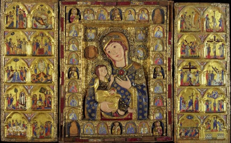
Medieval reliefs and frescoes from San Pietro, along with objects from the church treasury, are displayed at the Museum of Sacred Art of the Marsica in the Piccolomini Castle at Celano. The material includes twelfth-century reliefs, frescoes from the thirteenth to fifteenth centuries, a triptych or portable altar dating to about 1350, a Byzantine goldsmith’s reliquary containing fragments of the True Cross, and a fifteenth-century processional cross from Sulmona.