Alahan Monastery: An Early Byzantine Religious Complex in Türkiye
Site at a Glance
- Popularity
- Medium
- Country
- Turkey
- Primary era
- Classical
- Eras represented
- Classical
- Civilizations
- Byzantine
- Site type
- Religious
- Remains
- Monastery
On this page16 sections
History
Alahan Monastery is an early Byzantine religious complex in Geçimli, Türkiye. Construction took place in two phases, one in the mid-fifth century and another in the last quarter of that century. Although commonly called a monastery, its original purpose is disputed, and some interpretations identify it as a pilgrimage shrine.
Imperial construction and early importance
Emperor Leo I, Byzantine ruler from AD 457 to 474, oversaw the first phase. The later work took place under Zeno, who became emperor in AD 474 and assumed responsibility for the project. He probably financed it. His repeated returns to Isauria, a region of southern Asia Minor, as a retreat may reflect an interest in completing the complex.
Alahan is noted for its place in the development of early Byzantine architecture and for the skilled stonework associated with Isauria. Its construction preceded by about half a century major architectural achievements in Constantinople linked with Anicia Juliana, an imperial aristocrat and church patron, and Justinian I.
Community and uncertain identification
The complex served monks and pilgrims into the seventh century. Coins discovered during excavation indicate that people continued to use the site at least into the eighth century, leaving the date and circumstances of its abandonment uncertain.
Alahan’s ancient name is unknown. It has been tentatively identified with Apadna, an Isaurian monastery that the sixth-century historian Procopius said Justinian I restored. The proposed identification lacks adequate evidence, and archaeologist Michael Gough noted no signs of restoration at Alahan.
Changing names and modern study
The site was called Koca Kalesi in the late nineteenth century, while Alahan Manastırı became its common name from the mid-twentieth century. The settlement below the churches was known as Alaca Han, Turkish for “multicolored inn.” Ottoman travel writer Evliya Çelebi visited in 1671–72, expressed amazement, and described the complex as a structure recently completed by its architect. French antiquarian and archaeologist Count Léon de Laborde, the first European visitor, came in 1826 and wrote enthusiastically but inaccurately about the site. Later, English cleric A.C. Headlam published a detailed account and proposed the identification with Apadna.
Gough’s excavations, conducted from the 1950s into the early 1970s, shaped much of what is known about Alahan. From 2002 to 2006, the British Göksu Archaeological Project, led by Hugh Elton, carried out further research at the site and in its surroundings.
Alahan entered UNESCO’s World Heritage Tentative List in the cultural category on 25 February 2000. The buildings also underwent a two-year renovation.
Remains
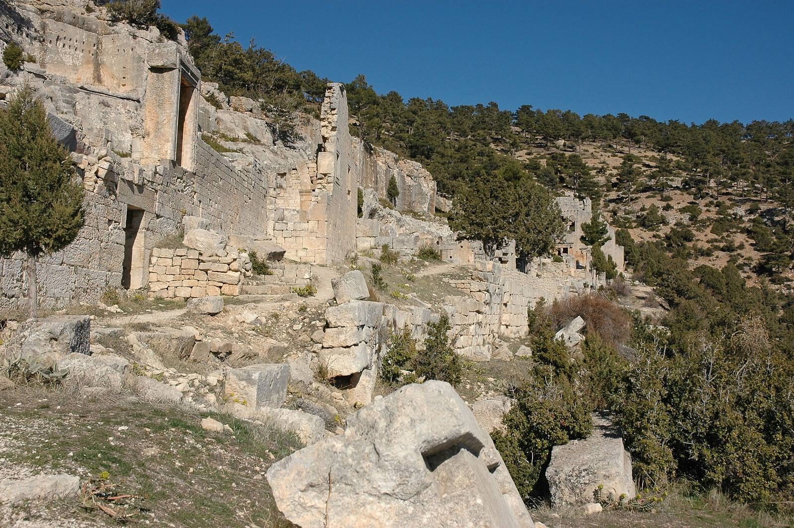
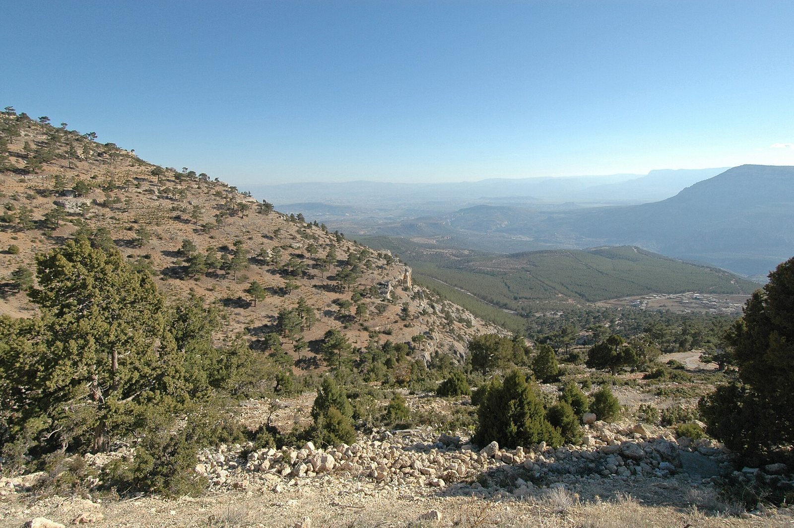
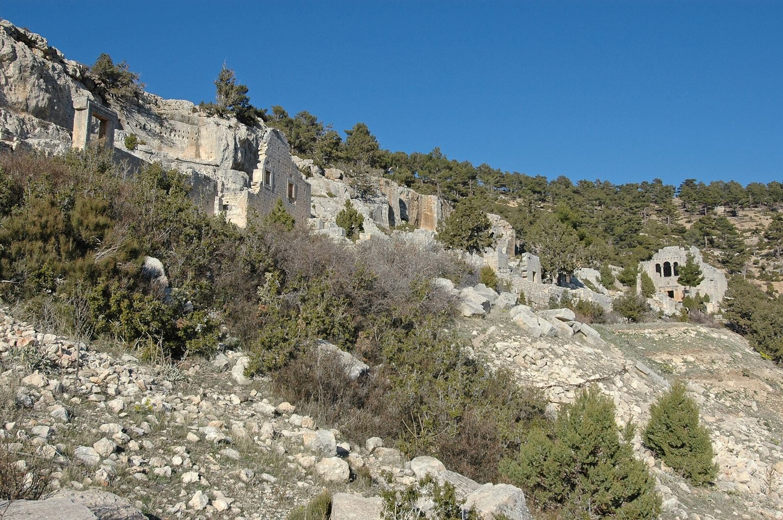
The ruined complex stands on the southern slope of a rocky ridge in the Isaurian mountains of ancient Cilicia, a region of southeastern Asia Minor. It lies about 1,200 m above sea level and approximately 11 km north of Mut. Three churches form the main religious buildings, with the largest at the western end and the best-preserved at the eastern end. A covered, column-lined walkway runs between them, connecting other communal structures and living quarters. The churches use basilica layouts, with a central space and side aisles, while the complex also includes rooms and tombs cut into rock.
Churches
Cave church
A naturally formed cave, about 10 m high, lies at the western end of the complex. It once held large rooms on three levels, each just over 2 m high. A church within the cave measures about 7.5 by 7.7 m and is thought to have been the first church built at Alahan.
West Church
The West Church, also called the Church of the Evangelists by Gough, is the largest of the three churches, measuring 36 by 16 m. Its basilica plan has a central nave, or main church space, and two side aisles. The building replaced an earlier structure dating to the fourth century. Constructing it required cutting back much of the cliff, and its plan follows the terrain rather than the exact east–west alignment usual for churches of its period.
The West Church is the least well-preserved of the three. Part of its entrance vestibule survives, including a richly carved doorway assembled from three large stone blocks. Reliefs show two angels holding a medallion of Christ above a four-winged, four-headed figure called a tetramorph, a composite Christian image associated with the four Evangelists. Carvings on the inner faces of the supports depict the archangels Gabriel and Michael. Gough’s excavations also brought to light sculpted masonry and elaborate mosaics.
East Church
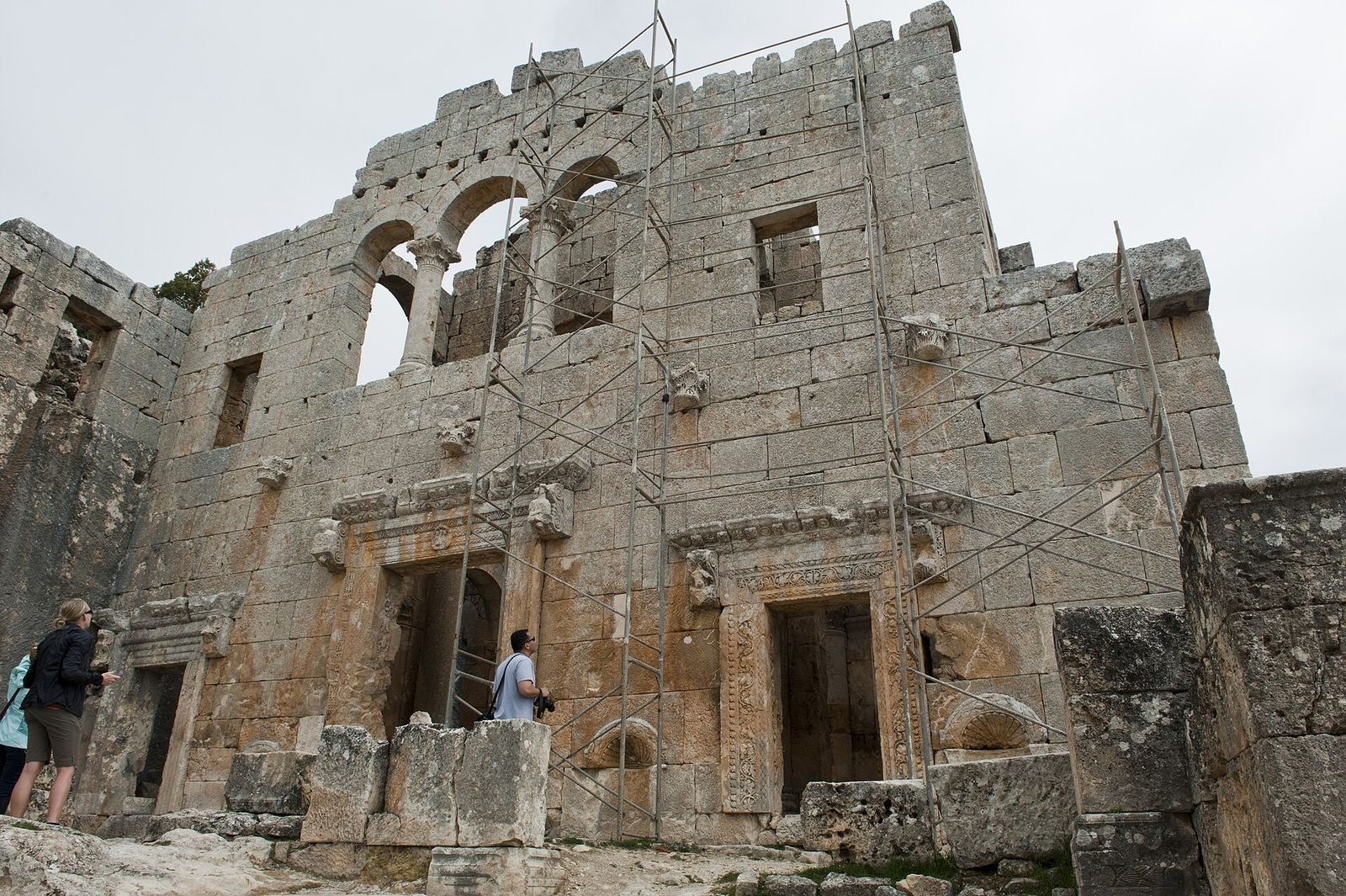
At the eastern end, the East Church is the best-preserved church and measures 23 by 15 m. It has a basilica plan, with a tower above the eastern part of the nave. Columns with Corinthian capitals, column tops decorated with stylized foliage, divide the central and side aisles into sections. A dome covered the square section before the apse, a recess at the end of the church. Corner supports helped carry the dome, with small columns resting on projecting stone supports.
The curved apse contains a three-tiered bench traditionally used by clergy, and a two-part window set within an arcade lights the space. Vine and fish motifs decorate the frames of the three entrances. Compared with the other churches, the East Church has modest decoration, mainly around its entrance. Gough considered a stone roof unlikely because few roof fragments were found, and suggested that light timber tiles may have covered it.
Walkway and communal buildings
Colonnaded walkway
A covered colonnaded walkway, about 130 m long, links the West and East Churches and gives access to the baptistery and living quarters. A high retaining wall along its southern side restricted access from the hillside below.
Baptistery and oratory
The baptistery, a place for Christian baptism, is oriented east to west and has two aisles and two apses, or recessed ends. Its southern entrance opens through the walkway’s north wall. A cross-shaped baptismal pool confirms the building’s function, and paintings survive inside. A small oratory, or chapel for prayer, stands east of the baptistery, before the East Church.
Living quarters
As the community grew, four separate groups of rooms were built between the West Church and the baptistery. They could be reached through the cave complex and from the colonnaded walkway.
Burial, water and agriculture
Forecourt and tombs
A forecourt lies outside the East Church, north of the walkway, and a cemetery lies just west of the forecourt. The cliff beside the cemetery contains tombs associated with Tarasis the Elder and Tarasis the Younger, whose historical identities are uncertain. Rock-cut tombs and stone coffins are also visible in front of the church.
Water system and lower terrace
A spring system channels water around and beneath the buildings, helping keep them dry while supplying the community. A bathhouse stands east of the East Church, and a lower terrace in the valley was used for agriculture.