Syedra: An Ancient Port City and Regional Centre in Türkiye


Site at a Glance
- Rating
- 4.5
- Popularity
- Very Low
- Country
- Turkey
- Primary era
- Classical
- External website
- Open
- Eras represented
- Bronze Age, Classical, Medieval
- Civilizations
- Ancient Greek, Byzantine, Roman
- Site type
- City
On this page21 sections
History
Syedra is an ancient port city in Türkiye, located between Alanya and Gazipasa on the southern coast, whose history extends from the seventh century BCE to the thirteenth century CE. Its cultural phases include the Hellenistic, Roman, Early Christian, Byzantine, and Seljuk periods. The settlement developed between a port at sea level and an upper town about 400 metres higher on a hill, at a shifting historical boundary associated with Cilicia and Pamphylia.
Early settlement and Roman rule
Syedra’s first known written mention dates to the middle of the first century BCE, although the settlement itself reaches back to the seventh century BCE. Ancient geographical authorities placed the city variously in Cilicia, Pamphylia, or Isauria, three regions of southern Anatolia whose boundaries changed over time. Modern scholars generally place Syedra in Cilicia, while the evidence does not permit complete agreement about its ancient provincial affiliation.
In 48 BCE, the Roman general Pompey held his final war council at Syedra before sailing to Egypt, where he was later killed. The city also resisted Mediterranean piracy. A first-century BCE inscription preserves an oracle, probably connected with the sanctuary of Apollo at Claros, which advised the Syedrians either to confront the pirates in battle or drive them away and bind them in chains. The text reflects the pressures faced by the coastal community and its involvement in regional conflict.
Syedra maintained its own civic identity during the Roman period and minted coins from the reign of Tiberius, who ruled from 14 to 37 CE, through at least the reign of Gallienus, emperor from 253 to 268 CE. In 193–194 CE, during the civil war between the emperor Septimius Severus and the Roman commander Pescennius Niger, Syedra supported Severus. After defeating Niger, Severus granted the city privileges and titles. An inscription dated to 194 CE records his congratulations to the inhabitants for resisting attackers described as bandits and impious enemies.
Christian and medieval phases
Syedra remained an active Christian community in late antiquity. In 374 CE, Epiphanius of Salamis, a Christian bishop and theologian, wrote Ancoratus as a letter to the Church of Syedra. He described the city through the image of a safe harbor that required spiritual anchoring, linking the city’s coastal setting with a Christian religious idea.
The settlement continued through the Byzantine period and into the era of the Seljuks, a medieval Turkic ruling dynasty whose territories included parts of Anatolia. Its occupation ended in the thirteenth century CE, when Syedra was abandoned. The surviving churches, civic buildings, defensive works, and water installations reflect the city’s changing functions as a port settlement, urban community, religious centre, and administrative centre.
Archaeology and historical interpretation
Syedra was registered as a first-degree archaeological site by the Antalya Regional Council for the Conservation of Cultural and Natural Heritage on 19 March 1991. Modern excavations began in 1994 under Ismail Karamut, then director of the Alanya Archaeological Museum, and continued until 1999. Work resumed in 2020 under excavation director Hasan Ertug Ergurer and was still continuing.
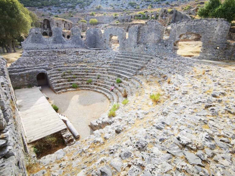
Underwater archaeological work in 2011 recovered port remains dated to the Bronze Age, approximately 5,000 years ago. These finds indicate activity at the site before the historical city developed. In October 2024, archaeologists identified a theatre, the Colonnaded Street, and other major structures. The theatre was estimated to have held between 4,000 and 5,000 spectators. Inscriptions concerning athletic contests, together with references to the Gymnasiarchia competition, place Syedra among the region’s important ancient centres for organized sports.
Remains
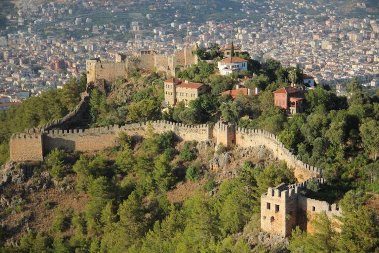
Syedra extends across a broad hillside above the Mediterranean coast. Its principal physical divisions are the lower port and the elevated upper town. A monumental gate provided entry to the city, while defensive walls enclosed the upper area and its acropolis, the fortified elevated part of an ancient city. The acropolis survives only in part and is largely ruined. The excavated urban landscape includes streets, shops, public buildings, religious structures, cisterns, residential ruins, an agora, a necropolis outside the city, and theatre seating.
Streets and fortified upper town
Colonnaded Street
The Colonnaded Street runs westward from the eastern city wall for about 250 metres and is approximately 10 metres wide. Limestone paving formed its surface. Shops stood along its northern, eastern, and western sides, while a wall about 10 metres high occupied the middle of the street and a row of columns filled another central section. Some columns remain intact, set 2.75 metres apart on Ionic-style bases. The northern part had a wooden roof supported by columns, whereas the southern part formed an open road paved with stone.
Acropolis buildings
A three-room building in the acropolis is thought to have been constructed after the third century CE. Its walls contained rubble, fragments of funerary containers, mortar, roof tiles, and pieces of inscriptions. The building may have been the original location of inscriptions later found elsewhere in the city. Another acropolis structure, known as the Tower, has the so-called Prophecy Inscription in its southern wall. The inscription preserves the oracle associated with the Claros oracle centre and is important for interpreting Syedra’s regional circumstances.
Civic, athletic, and performance buildings
Colonnaded Street theatre
A small theatre-like structure on the city slope is thought to have been a council house, or bouleuterion, the meeting place of a city council. Its function remains uncertain because it is still partly buried, and it may have served both as a council house and as a theatre. A separate theatre discovered in October 2024 was estimated to accommodate 4,000–5,000 spectators. Theatre seating and other administrative buildings are also among the surviving features of the city.
Bathhouse
The large bathhouse stands south of the Colonnaded Street and is one of the principal surviving structures at Syedra. It was a two-storey building with an apsidal, or rounded-ended, form. Its rooms were arranged along non-parallel axes and received water from the city’s cisterns. Sections of mosaic floor decoration have been uncovered within the building.
Gymnasium
A building immediately south of the bathhouse is thought to have been the city gymnasium, a Greek and Roman institution for athletic training and related civic education. Traces of plaster and wall niches remain visible, and the building was supplied by the city’s cisterns. Inscriptions and coins referring to the Gymnasiarchia athletic contest support the identification of a gymnasium at Syedra.
Religious buildings
Western basilica
A rectangular building near the main entrance in the western part of the city is thought to be a fourth-century CE Christian basilica. A basilica was a large hall-type building that could serve civic purposes and was later adapted for Christian worship. Niches were set into both its northern and southern walls.
Street church
A church with basilica-like features stood beside the Colonnaded Street and is dated to the fifth century CE. The church and other buildings along the street collapsed, and their ruins filled part of the road. Its position and collapse form part of the physical evidence for the later condition of this urban thoroughfare.
South church
A small church excavated south of the acropolis had a narthex, or entrance vestibule, on its western side. Its walls carried frescoes, and its floor was made of brick. The building resembles a church investigated at Iotape, another ancient city on the Cilician coast, suggesting a date in the tenth or eleventh century.
Temple
A small structure on a hill within the city walls was approached by steps and is thought to have been a temple. Excavated in 1998, it is badly damaged, with only a small amount of its floor paving remaining in place.
Baptismal Cave
Near the western gate, the rectangular Baptismal Cave served a Christian religious purpose, probably baptism. Nearly all its walls were decorated with frescoes and iconographic elements. A niche and the remains of a circular basin occupied the eastern wall, and the basin is thought to have been used for baptisms.
Water systems and port evidence
Cisterns and Spring Cistern Cave
Several pool-shaped cisterns lie south of the Colonnaded Street and beside the bathhouse. They collected water from rainfall and natural springs and supplied the city’s public buildings. The cisterns remain in use today, while archaeological work recovered substantial quantities of pottery from the cistern between the street and the bathhouse. In the western part of the city, the Spring Cistern Cave contains fissures through which water passed and traces of wall plaster, showing continued use during a later period.
Bronze Age port
The port remains recovered underwater in 2011 date to the Bronze Age, approximately 5,000 years ago. They lie at the lower coastal part of the settlement, distinct from the upper town on the hillside, and provide physical evidence for maritime activity before the later ancient city.
A mosaic recovered at Syedra is displayed in the Alanya Museum. Together with the excavated principal street of the upper town, the Baptismal Cave, the acropolis, churches, civic buildings, shops, athletic facilities, and water installations, it contributes to the surviving picture of a settlement whose functions extended from seaborne activity to urban administration, worship, and public contests.
Nearby sites