Roman City of Aquincum: A Roman Military and Civic Centre in Hungary
Site at a Glance
- Rating
- 4.5
- Popularity
- Low
- Country
- Hungary
- Primary era
- Classical
- External website
- Open
- Eras represented
- Iron Age, Classical
- Civilizations
- Celtic, Roman
- Site type
- City
On this page25 sections
History
Roman City of Aquincum in Hungary occupied the area of modern Óbuda in Budapest, where the Roman Empire’s military and civic settlements developed along the western bank of the Danube. Built by the Romans from the mid-first century AD, Aquincum became a frontier centre, the capital of Pannonia Inferior, and later a major urban complex containing a legionary fortress, a military settlement, and an independent civilian town.
Before and during the Roman conquest
The area had prehistoric settlement before Roman rule. During the first half of the first century BC, the Celtic Eravisci maintained a fortified settlement and regional centre on Gellért Hill. Roman control developed gradually during the first century AD. The Eraviscian settlement was probably abandoned under Roman pressure in the 40s, after which its inhabitants moved to settlements on the plain.
The Danube formed part of the Roman limes, a frontier system made up of the river boundary, forts, roads, watchtowers, harbours, and communication routes rather than a single continuous wall. Aquincum’s position offered a ford, converging roads, sheltered terrain, springs, clay deposits, and other resources useful for construction and settlement.
Roman military occupation began with temporary and auxiliary posts during the middle of the first century. A cavalry camp for about 500 men stood at Víziváros from approximately AD 45 to 50, and another auxiliary camp was established near Óbuda in AD 73. A large legionary fortress was founded beside these installations late in the century, probably in AD 89.
The fortress and provincial capital
Legio II Adiutrix was transferred to Aquincum from Britain, probably in AD 89. The legionary fortress had a nominal strength of about 6,000 men and became the centre of a settlement complex. Around it grew the canabae, the civilian community attached to a legionary fortress, while a separate civilian town developed farther north. All three areas were known as Aquincum, although their legal and administrative positions differed.
Legio II Adiutrix was temporarily withdrawn during Trajan’s conquest of Dacia, a Roman campaign that brought the territory north of the lower Danube under imperial control. Legio X Gemina replaced it for a time. After service in Dacia and the Parthian War, Legio II Adiutrix returned in AD 118 and remained Aquincum’s principal garrison into Late Antiquity.
Hadrian served at Aquincum as a military tribune during the 90s and later returned as governor of the newly created province of Pannonia Inferior. When Trajan divided Pannonia, probably around AD 105 or 106, Aquincum became the provincial capital and the governor’s seat. This administrative role brought the city into closer contact with imperial government, military command, and regional commerce.
During the 120s, Hadrian granted the northern civilian town the status of Municipium Aelium Aquincum. A municipium was a Roman civic community whose inhabitants possessed municipal rights. In AD 194, Septimius Severus raised the town to colonial status as Colonia Aelia Septimia Aquincum. A colonia generally conveyed broader legal and political privileges to its citizens. The later status may also have extended to the canabae, although the precise administrative consequences remain uncertain.
Aquincum’s frontier position brought repeated military activity, imperial visits, and investment in roads, water supply, buildings, and other infrastructure. Emperors associated with visits to the city include Domitian, Trajan, Hadrian, Marcus Aurelius, Commodus, Septimius Severus, Caracalla, Elagabalus, Alexander Severus, Maximinus Thrax, Decius, Gallienus, Aurelian, Probus, Diocletian, Constantine, Constans, and Constantius II. In AD 214, Caracalla visited Aquincum when a reorganization of the Pannonian provinces was proclaimed there.
Urban growth and religious life
The second and early third centuries were Aquincum’s principal period of growth. The two urban centres and their surrounding settlements together may have contained approximately 40,000 to 60,000 people. The population included Eraviscian and other local inhabitants, Roman veterans and their families, soldiers, officials, merchants, artisans, and immigrants from European, Asian, and African provinces.
Aquincum served as a commercial and administrative centre. Roads converged there, and goods moved between Pannonia, the non-Roman Great Hungarian Plain, and areas of northern Dacia. Local production included pottery, terra sigillata tableware, bricks, glass, metalwork, leather, bone products, jewellery, building materials, painted and stucco decoration, and mosaics. Banking and long-distance trade were also practiced.
Religious life combined Roman, local, and eastern traditions. The Roman state gods, the imperial cult, Silvanus, Fortuna, Apollo, Aesculapius, Hygieia, Jupiter, Juno, and Minerva were worshipped alongside Celtic and eastern cults. The imperial cult involved public veneration of the emperor and imperial household as holders of sacred political authority. Jupiter was sometimes identified with the Eraviscian god Teutanus. At least six sanctuaries of Mithraism, a Roman mystery cult especially associated with soldiers and other male members, have been found. Christianity became increasingly important in Late Antiquity.
Late Roman transformation
Aquincum was affected by the military and economic instability of the third century. The city apparently avoided destruction during the attacks around AD 260, but the fortress had to be rebuilt and strengthened. Rising levels of the Danube forced the planned abandonment of the governor’s palace late in the third century.
Diocletian’s reforms around AD 294 placed Aquincum within the new province of Valeria. The city lost the provincial governorship, probably to Sopianae, although its exact administrative position within Valeria remains disputed. A provincial military commander, the dux Valeriae ripensis, continued to reside at Aquincum. A dux was a senior military commander, and this official directed troops along Valeria’s river frontier. A state shield factory was also established in the city.
During the late third and early fourth centuries, the civilian town was largely abandoned. Population became concentrated in the military settlement and in a new fortress beside the river. The former canabae increasingly lost their residential function and were used for cemeteries and churches. The military amphitheatre was converted into a fortification in the early fifth century.
Roman administration withdrew from the Danube during the first half of the fifth century. A smaller Roman-influenced urban community survived for some time under successive Lombard and Avar rule and under the leadership of a Christian bishop. The civilian town was essentially abandoned by around AD 300, although major roads continued to receive occasional later use.
Reuse, rediscovery, and archaeological work
From Late Antiquity onward, Roman buildings were quarried for stone and other construction materials. Avar and medieval inhabitants reused Roman foundations and building elements, while some Christian buildings and parts of the Late Roman settlement continued in use. Roman roads and urban boundaries also influenced later patterns of settlement.
Medieval Hungarian tradition associated the military amphitheatre with the residence of the sacral ruler Kursan and called it Kursan’s Castle. The Gesta Hungarorum instead described the ruins as the city of King Attila. Medieval Buda developed between the former amphitheatre and the Late Roman fortress. After the Mongol invasion in the thirteenth century, the principal settlement moved to the safer castle hill, and the former Roman area became known as Óbuda, or Old Buda.
Aquincum was gradually forgotten, and its ruins were misidentified during the Renaissance, including as the legendary city of Sicambria. In 1778, István Schönvisner examined Roman underfloor-heating remains discovered in Óbuda and identified the ruins with ancient Aquincum. His excavation of the fortress baths was published that year. Contra Aquincum was identified in 1796 and Transaquincum in 1815, although these conventional modern names cannot be assigned securely to the surviving structures.
More systematic excavation began during the nineteenth century. Bálint Kuzsinszky directed excavations from 1882 and became the first director of the Aquincum Museum after its foundation in 1894. Excavations during construction of the Óbuda gasworks in 1910 to 1913 exposed industrial quarters of the civilian town.
After the First World War, Lajos Nagy expanded research beyond the civilian town. Work included a Christian funerary chapel in 1927 to 1930, the civilian-town fire brigade headquarters and the Aquincum organ in 1931, Contra Aquincum in 1932 to 1936, and the military amphitheatre from 1925 to 1941. The governor’s palace was excavated in 1950 to 1956, and the Hercules Villa was investigated in 1964 to 1967.
Conservation of the civilian town began in 1963, and sixteen buildings had been restored by 1973. Excavation and conservation in the legionary fortress and canabae intensified during major construction projects in the 1970s and 1980s. Aquincum was protected by a Budapest administrative decision in 1878, an early monument-protection measure prompted by the destruction of Roman remains during the expansion of modern Budapest.
The Aquincum Museum, founded in 1894 and now a branch of the Budapest History Museum, combines museum buildings with an archaeological park. It excavates, protects, researches, and presents Budapest’s Roman heritage. By 2008, more than 10,000 scientifically documented excavations had contributed to its collections, which then held more than one million objects. The surviving civilian-town ruins are chiefly the result of twentieth-century excavation, restoration, and conservation, and represent approximately one-third of the ancient settlement.
Remains
Aquincum’s remains spread across two principal urban centres separated by about three kilometres. The larger military settlement, or canabae, surrounded the legionary fortress, while the smaller civilian town occupied an irregular area farther north. The governor’s palace stood on a Danube island northeast of the legionary fortress. Streets, water systems, cemeteries, forts, workshops, houses, public buildings, and religious structures together reveal a settlement shaped by both military administration and civic life.
The legionary fortress and military settlement
The legionary fortress
The earliest legionary camp used timber and earth, and its buildings were rebuilt several times in slightly different positions. During Hadrian’s reign, a stone fortress was constructed somewhat farther from the river. Its rounded-corner rectangular enclosure measured approximately 476 by 570 metres. Walls about 1.4 metres thick were reinforced by regularly spaced square towers, while larger towers protected the gates. A ditch lay outside the western wall, and three parallel ditches protected the other sides.
Four principal gates served the standard Roman military plan. At the centre, the principia contained headquarters, a sanctuary, treasury, archives, and administrative offices. The surrounding blocks held the commander’s residence, hospital, baths, barracks, officers’ quarters, granaries, workshops, and food-production areas. Running water and sewers served the fortress from an early period, while repeated expansions during the second and third centuries included a more elaborate entrance to the headquarters building, rebuilt baths, and a massive eastern gate facing the frontier.
The eastern main gate had three openings. Mounted traffic used the central passage, while pedestrians used the two side passages, and two-storey towers flanked the entrance. The southern principal gate had two entrances, each about 3.5 metres wide, one of which was blocked during the early fourth century.
The Thermae Maiores
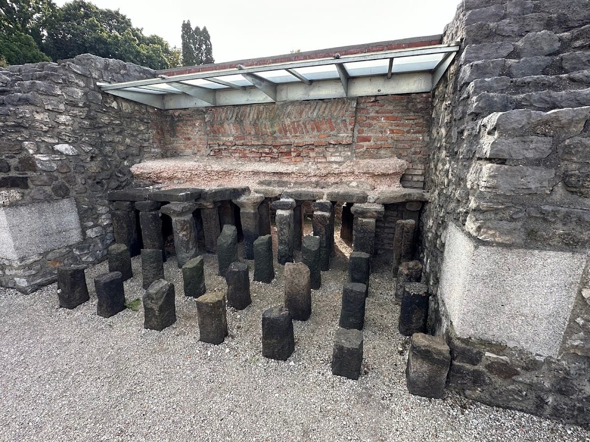
The fortress’s large bath complex, the Thermae Maiores, contained cold, warm, and hot pools, a gymnasium, a sauna, and rooms heated by a hypocaust, a Roman system that circulated hot air beneath raised floors and sometimes through hollow walls. Much of the complex was rebuilt in Late Antiquity, when it probably became the residence of the provincial military commander after the governor’s palace was abandoned.
The Late Roman riverside fortress
A new fortress was built beside the river east of the legionary fortress during the early fourth century, probably under Constantine. It covered approximately 720 by 300 metres and had walls more than three metres thick. Its western, northern, and eastern sides were straight, while the southern side consisted of concave sections separated by towers.
An internal wall later divided the southern part from the rest of the fortress. A reduced contingent of Legio II Adiutrix remained there, and major repairs were still underway around AD 400. The southern sector contained a substantial storage system, probably designed to hold grain during prolonged sieges. In Late Antiquity, a church and other non-military buildings occupied the eastern half of the former legionary fortress. An underground water conduit was constructed in its western half to supplement the earlier aqueduct, and it remained in use into the Middle Ages.
The canabae and military amphitheatre
The canabae extended around all four sides of the set-back legionary fortress and covered approximately 140 hectares. Its inhabitants included soldiers’ families, merchants, artisans, officials, and specialist workers such as interpreters employed by the governor. The settlement developed from simple huts into timber-framed buildings and then into stone architecture. Water supply, sewers, heating systems, streets, and other infrastructure expanded between the first and third centuries.
Workshops occupied much of the western and southwestern area, including pottery and brick-making establishments that used local clay. The military settlement’s forum and a large market area were also located in the southwest. A wealthier residential district lay north of the canabae near the governor’s palace, where villas contained mosaics, wall paintings, and sculpture. The Hercules Villa belonged to this area, which also included temples.
A harbour extended along the Danube on the eastern side of the military settlement, with associated warehouses and probably a hotel. Several bath complexes served the area. At its southern edge, the military amphitheatre measured approximately 132 by 108 metres and held an estimated 10,000 to 13,000 spectators. Its oval arena had a northeast to southwest long axis, principal entrances at the ends, and animal cages at the ends of the shorter axis.
The amphitheatre used a natural depression that had served as a training ground during the first century. An inscription states that it was rebuilt in stone around AD 145 under Antoninus Pius by the pioneer unit of Legio II Adiutrix. Most seating rested directly on compacted earth. The surviving stonework consisted chiefly of the arena wall and twenty-four U-shaped sections of the outer wall. In the early fifth century, the building was converted into a fortification.
The civilian town
Walls, streets, and forum
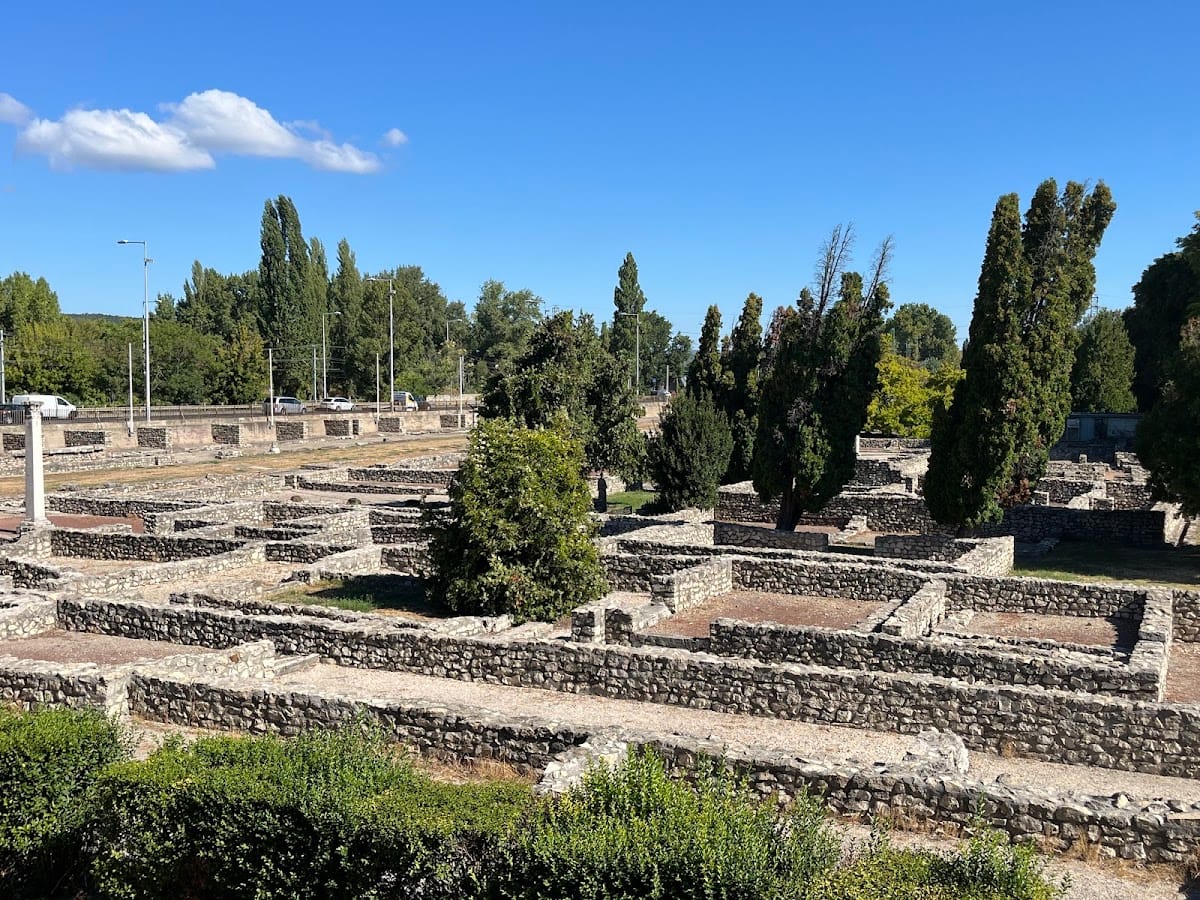
The civilian town occupied an irregular or trapezoidal area of about 30 hectares. A wall enclosed it, with gates at the principal approaches. The northern, southern, and eastern gates have been excavated. Two main streets crossed at right angles, one running north to south and the other east to west. Narrower streets divided the residential blocks, measured approximately three to eleven metres wide, and incorporated sewers.
The forum stood where the main streets met. Its quarter included an imperial altar, a basilica used for legal proceedings, administration, and commerce, shops, and a large public bath. The forum expanded as the town developed. A macellum, or Roman market hall associated especially with food sales, was built near the forum in the mid-third century. Its central courtyard contained a circular building known as a tholos, a round structure probably related to North African architectural models.
Houses, workshops, and public entertainment
Large courtyard houses stood near the southwestern side of the forum, while smaller houses lay farther north. Wealthier residences away from the busiest streets had domestic shrines and private baths. Many buildings had running water, sewers, hypocaust heating, wall paintings, stucco, mosaics, and glazed windows. Shops opened onto the streets, and a nearly continuous row of commercial premises followed the north to south main road.
Industrial installations included glassworking areas, foundries, oil and wine presses, metalworking facilities, tanneries, and workshops producing bone-based adhesive. A second amphitheatre north of the civilian town measured approximately 86 by 76 metres. An earth-filled space lay between its inner and outer walls, and two arched entrances served the audience. Seating was divided into wedge-shaped sectors for approximately 4,000 to 7,000 people.
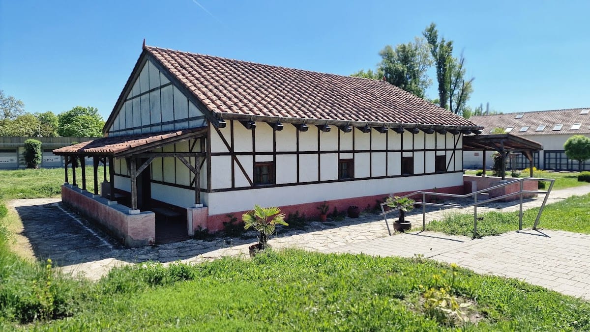
The civilian amphitheatre hosted theatrical performances, athletic contests, animal combats, gladiatorial combats, political gatherings, festivals, and imperial ceremonies. A nearby establishment trained gladiators. The House of the Painter is presented as a Roman-style house furnished to illustrate domestic life in the civilian town.
Water supply and aqueduct
A major aqueduct crossed the civilian town from north to south. It had originally supplied the legionary fortress, and passages through its structure maintained communication between the eastern and western parts of the town. The aqueduct carried spring water from the area now associated with Rómaifürdő, about five kilometres to the north.
The channel followed a gradient of about one to two degrees. It first passed through collecting basins and a large water tower, then continued in an open channel supported by vaulted arches. Distribution and storage tanks allowed water to be drawn at several points. Underground channels supplied fresh water within the settlements and carried wastewater away. A restored section of the aqueduct is visible near the museum and farther north in a park.
The governor’s palace and decorated residences
The governor’s palace
The governor’s palace stood on a Danube island northeast of the legionary fortress. Construction began in the early second century, when Pannonia Inferior was established, and the complex eventually measured approximately 120 by 150 metres around a central courtyard. Its principal facade faced east toward the Danube and the non-Roman territory beyond it. Projecting circular towers marked its corners.
The eastern wing contained richly decorated reception rooms. The northern wing held the governor’s private apartments and baths, while the southern wing contained workshops, storerooms, ovens, and a small temple. Sixteen altars dedicated by successive governors between AD 120 and 283 survive from the temple. Another courtyard temple was associated with the imperial cult and Fortuna. A western boundary wall enclosed the palace, and bridges probably connected it with Aquincum and the opposite bank. A landing place lay below the eastern facade.
Nearly one hundred rooms served residential, political, ceremonial, and administrative purposes. The palace received embassies, public addresses, official meetings, and government work. Mosaics, wall paintings, sculpture, and underfloor heating enriched its rooms, service areas, and toilets. Wall paintings were renewed repeatedly, with later decoration sometimes applied over earlier schemes. A broken imperial statue from the palace is displayed in the Aquincum Museum.
The reception wing included five large halls whose early second-century floors were mainly decorated with black-and-white geometric mosaics made from limestone and basalt. Later mosaics in the northern bath wing included a partly preserved marine scene with a dolphin and a goldfish in an octagonal recess. Two circular pools had mosaics of deep-red and yellow water lilies associated with the hot room. One of these mosaics was removed to Vienna during the nineteenth century.
The Hercules Villa
The Hercules Villa stood on the mainland opposite the governor’s palace among other decorated residences, baths, temples, and officials’ houses. Its central structure dates from the early second century. It was enlarged in the early third century with underfloor heating and additional mosaics.
One mosaic depicts Hercules fighting the centaur Nessus. It was probably made in Alexandria and is described as Pannonia’s only mosaic imported from outside the province. The carefully fitted stone tesserae number approximately eight or nine per square centimetre and retain bright colours. A mosaic in the tablinum, a reception room in a Roman house, showed a festive procession of Dionysus. A surviving section depicts Cupid offering grapes to a female tiger.
The bath-house changing room contained an almost completely preserved mosaic of two boxers. One figure stands victorious and flexes his muscles, while the defeated opponent lies bleeding on the floor. Frescoed walls and floral decoration covered door and window frames, recesses, and sills. Reconstructions of characteristic decorative motifs are displayed in the tablinum.
Objects, burials, and religious remains
The Aquincum organ and archaeological finds
The Aquincum organ is a third-century hydraulic organ discovered in a schola, a meeting building used by a Roman association. The building was associated with one of the town’s collegia, organized professional, religious, or social associations. Surviving components and a playable reconstruction present the instrument.
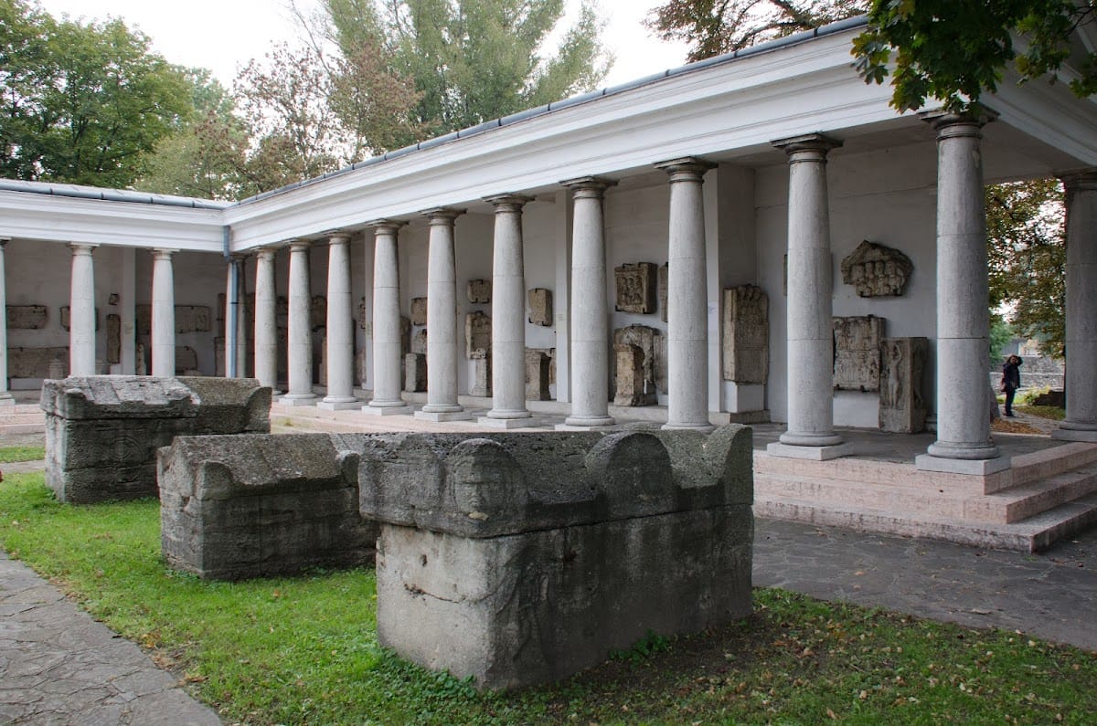
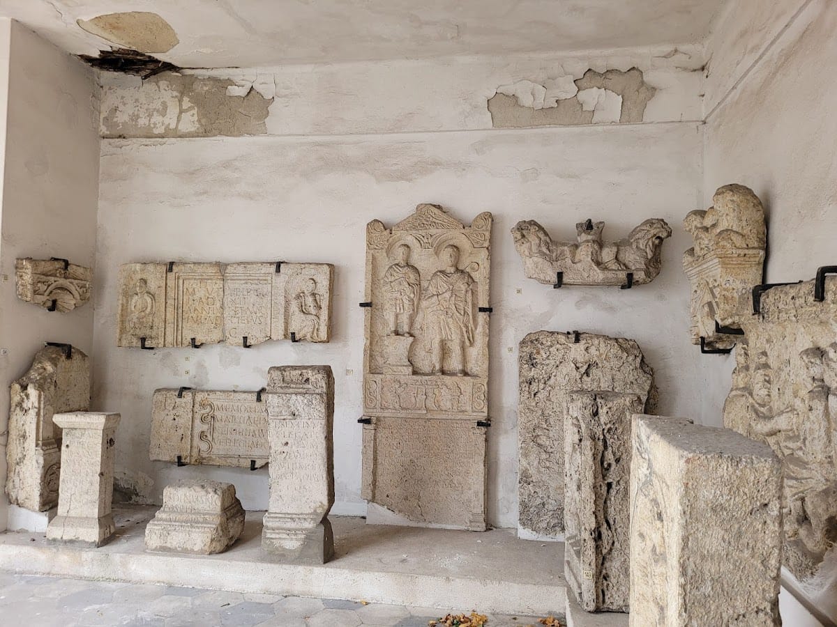
Aquincum has produced inscriptions, reliefs, tombstones, sarcophagi, votive objects, coins, military objects, sculptures, mosaics, wall paintings, pottery, and architectural fragments. Finds from the canabae include a clay mould for a Victoria figurine, an altar to Jupiter and Juno that mentions the colonial name, and a silver protective amulet carrying obscure magical words.
Cemeteries and Christian buildings
Cemeteries extended around both urban centres, except along the eastern side of the canabae, where the Danube intervened. Several thousand graves and several hundred funerary inscriptions have been documented. Burial forms included cremation pits, urn graves, simple inhumations, stone-slab and brick graves, cist graves, sarcophagi, painted burial chambers, above-ground tomb monuments, and Late Roman funerary chapels. Rare mummified burials are also attested.
Tombs could be grouped within walled burial gardens or precincts. Funerary monuments incorporated inscriptions, reliefs, capitals, and other architectural elements. Characteristic imagery included funerary-banquet reliefs and scenes of the deceased travelling to the afterlife in a wagon. A building with an apse in the civilian town’s eastern cemetery was probably a funerary church. Other Christian basilicas were built in Late Antiquity, including one southeast of the abandoned civilian town and two or three near the Late Roman fortress.
Frontier structures and the wider landscape
Gellért Hill ceased to be a settlement after the Roman-period abandonment of the Eraviscian oppidum, a fortified Celtic settlement, but remained a religious location where sacrifices continued until the third century. A northern park area contained springs, wells, temples, and shrines dedicated especially to nature and healing deities, as well as a larger building probably used as a hospital or inn.
A Roman milestone found near the eastern gate of the legionary fortress bears the zero-distance mark. This indicates that the gate was the caput viae, or starting point, for regional road measurements. The ancient road alignments and division of land continued to influence parts of modern Budapest.
In antiquity, the Danube was a branching, meandering, and partly marshy river system. Roman settlements occupied slightly raised river terraces protected from flooding. A bridge probably crossed the river near the legionary fortress, alongside shorter-lived wooden bridges and ferry routes.
Contra Aquincum
Contra Aquincum was a small riverside fort on the eastern bank near the later centre of Pest. It was probably built around AD 294 to control a major crossing. The rectangular fort measured approximately 86 by 84 metres and had horseshoe-shaped towers. Part of its northern wall and two towers survive in their original location.
Transaquincum and the frontier network
Transaquincum stood farther north on the eastern bank opposite the legionary fortress and governor’s palace. A bridge approximately 76 to 78 metres long connected it with the western bank. Its piles were found in the riverbed during the nineteenth century. The crossing may have been temporary or supported by pontoons. The fort had a rectangular plan with porticoes along three sides, and its remains are no longer visible.
The frontier around Aquincum included auxiliary forts, watchtowers, fortified harbour installations, small posts, and burgi, compact fortified positions. Commodus sponsored construction at strategically important crossing points, while Valentinian I initiated extensive repairs and new building along the frontier during Late Antiquity. The names Contra Aquincum and Transaquincum are conventional modern designations, and their connection with the surviving structures is not secure.