Toplou Monastery: A Fortified Greek Orthodox Monastery in Crete


Site at a Glance
- Rating
- 4.4
- Popularity
- Medium
- Country
- Greece
- Primary era
- Medieval
- External website
- Open
- Eras represented
- Medieval, Early Modern
- Civilizations
- Venetian
- Site type
- Religious
- Remains
- Fortified Monastery
On this page15 sections
History
Toplou Monastery is a Greek Orthodox monastery in Greece, near Siteia in eastern Crete, dedicated to the Virgin Mary and Saint John the Theologian. Its oldest identifiable church fabric and frescoes date from the fourteenth century, although the foundation itself remains uncertain. The monastery belongs to the Church of Crete, the island’s self-governing Orthodox church, and to the Diocese of Ierapytna and Siteia.
Medieval origins and Venetian rule
The monastery stands on Cape Sidero, also known as the Samonion promontory, about 6 kilometres north of Palekastro and 10 kilometres east of Siteia. Its original name was Panagia Akrotiriani, meaning “Our Lady of the Cape.” Fifteenth- and sixteenth-century documents and seals preserve this name. The name Toplou first appears in a Turkish document of 1673. It is generally linked with the Turkish word top, meaning “cannon,” probably referring to a cannon mounted at the monastery. Another explanation connects the name with a shortened word meaning “wealthy,” reflecting the monastery’s extensive landed property.
Toplou flourished during the fourteenth and fifteenth centuries. Its collection of Byzantine icons reflects the development of Constantinopolitan painting in Crete, while the education provided to its monks contributed to the cultural life of Renaissance Crete. During Venetian rule, however, the monastery faced repeated danger from pirates and corsairs. Corsairs sacked it in 1498, and Maltese knights attacked it in 1530. A cannon served both as a defensive weapon and as a warning signal for nearby villages.
A major earthquake brought the monastery down in 1612. Venetian authorities then supported its rebuilding and fortification because of its strategic position. Andrea Cornaro, a Venetian-Cretan scholar and member of the Cornaro family, had left the monastery 100 ducats in his will of 1611. In 1613, the Venetian Senate allocated a further 200 ducats to Abbot Gabriele Pantogalo. Pantogalo, a monk, abbot, and scholar, supervised the reconstruction. The fortified form that developed during the final years of Venetian rule reflected both the Ottoman threat and the continuing danger from corsairs.
The monastery prospered until eastern Crete came under Ottoman control in 1646. Afterward it was destroyed or abandoned for a long period. In 1704, Toplou became a stauropegic monastery, meaning that it was placed directly under the authority and protection of an Orthodox patriarch rather than the ordinary jurisdiction of a local bishop. It was then reoccupied. Under Ottoman rule, the monastery was regarded by Ottoman authorities as a refuge for persecuted local people and a centre of revolutionary activity. Its substantial property also made it a frequent target for Ottoman irregulars.
Ottoman rule and modern history
During the night of 26–27 June 1821, twelve monks were massacred in front of the outer entrance, known as the Porta of the Loggia. In 1828, about 250 Turkish-Cretan armed men and approximately 1,000 civilians took refuge inside the monastery as Greek insurgents advanced in the Siteia region. A siege forced the defenders to capitulate, and the monastery remained deserted for several years after the monks’ massacre. From 1870 onward, an elementary mutual-teaching school operated there.
Toplou again became a place of resistance during the German occupation of Crete from 1941 to 1944. It sheltered resistance fighters and operated a wireless transmitter that communicated with Allied forces in Cairo. After the transmitter was discovered, German forces executed the then abbot and a monk, among others. The abbot’s bones were transferred in 1955 to the war memorial outside the monastery.
Repeated rebuilding, restoration, and renovation have maintained the monastery as an active religious and economic institution. Archaeological-service supervision accompanied the restoration of its ancillary buildings. Toplou is described as the only surviving monastery among the many large and small monasteries formerly found in the Siteia area. Its estates continue to include vineyards and olive groves, and the monastery produces and exports wine, tsikoudia, and olive oil. Related facilities include an olive mill, an olive-oil bottling plant, a winery, and bottling installations for wine and tsikoudia. Olive oil made from the Koroneiki variety has received international European Union awards and a high assessment from a chemical laboratory of the Greek Ministry of Development.
In the late twentieth and early twenty-first centuries, the monastery’s landholding on the Cavo Sidero peninsula became involved in a proposed large tourist development. The 25.9-square-kilometre peninsula was intended to contain six tourist villages, 7,000 beds, golf courses, a conference centre, a marina, and sports facilities. The area is also designated Natura 2000 for its biodiversity and archaeological importance and includes the Vai natural palm forest. In April 2009, Greece’s Supreme Administrative Court accepted a request from approximately 300 Siteia residents to annul the environmental approval, finding that the project’s licensing was incompatible with land-use planning for only mild tourist development.
Remains
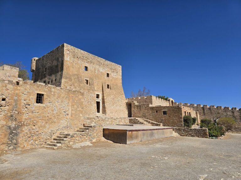
Toplou is a fortified, square monastery arranged around an inner courtyard. Its enclosure walls rise to approximately 10 metres, while the complex covers about 800 square metres and reaches three floors. The courtyard is paved with sea pebbles and is surrounded by roughly forty ancillary spaces, including kitchens, ovens, monks’ cells, guesthouses, the abbot’s residence, and storerooms. The surviving buildings combine the defensive organization of a fortified enclosure with Renaissance architectural details and the continuing functions of a monastic community.
Entrance and defensive architecture
Facade and main gate
The Renaissance-style facade has a gabled form and carries a carved foundation inscription composed by Abbot Gabriele Pantogalo in elegiac couplets. Above the main gate is a defensive opening known as a boiling vessel, through which defenders could pour hot oil and lead onto attackers trying to break through the door. This feature forms part of the monastery’s fortified entrance and reflects the dangers that influenced its rebuilding in the seventeenth century.
Bell tower
The western bell tower rises above the main entrance. Built in Renaissance style and dated to 1558, it reaches 33 metres in height. Relief crowns, crosses, and inscriptions decorate its structure, giving the entrance complex a prominent architectural element that predates the earthquake reconstruction of 1612.
Church and water supply
Monastery church
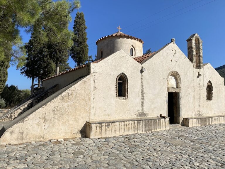
Opposite the courtyard well stands the monastery church, a two-aisled basilica with two dedications. The northern aisle is dedicated to the Nativity of the Virgin Mary, while the southern aisle, added later, is dedicated to Saint John the Theologian. The northern aisle is the oldest identifiable structure in the monastery and may have stood independently before the surrounding fortifications were constructed. Its wall paintings, or frescoes, date as early as the fourteenth century. The archaeological service found them beneath later plaster, and they are well preserved.
The church contains numerous icons, sacred painted images used in Orthodox Christian devotion. These include Great are You, Lord, and Wonderful Are Your Works, which presents 61 scenes based on the prayer of the Great Blessing of the Waters at Epiphany; Axion Estin, painted by Ioannis Kornaros in 1770; Rose Unfading, dated 1771; and an icon of Saint Anastasia the Healer. An icon of the Virgin Mary was found in a nearby cave containing a flowing spring regarded as holy water.
Well and spring system
An old well in the inner courtyard, probably constructed during the monastery’s early years, supplied water to the complex and continues to do so. The wider water system originally depended on a substantial spring near the ravine below the monastery. That spring is now associated with a windmill-driven pump that draws water from the underlying water table.
Collections and estate
Relics and ecclesiastical objects
Toplou preserves relics associated with Saints Charalambos, Domitian, Tryphon, Panteleimon, Stephen, Abercius, James, and Anastasia. The monastery also holds a bishop’s sakkos, an outer Orthodox episcopal vestment, and an epitrachelion, a priestly or episcopal stole worn around the neck, associated with Saint Chrysostom of Smyrna.
Monastery museum
The monastery museum displays Byzantine icons, books, manuscripts, documents, ecclesiastical-art objects, Gospels, silver-gilt crosses, patriarchal documents, Ottoman sultanic firmans, seals, revolutionary banners, and episcopal vestments. A firman is an official order issued by an Ottoman sultan, while a patriarchal document is an official act issued by an Orthodox patriarch. The collections also include copperplate engravings and Greek folk prints produced by monks during the eighteenth and nineteenth centuries.
Approximately twenty portraits of monks, bishops, and abbots were painted by the portraitist Thomas Papadoperakis. Frescoes by the icon painter Manolis Betinakis decorate the walls of the monks’ refectory.
Vineyards, olive groves, and production buildings
The monastery’s wider estate includes vineyards and olive groves, together with industrial installations for producing wine and olive oil. These working facilities form part of the institution’s continuing economic life and include the olive mill, olive-oil bottling plant, winery, and bottling facilities for wine and tsikoudia.
Gorge and coastal setting
Toplou Monastery stands on the upper southern slope of the Moni Toplou Gorge. The ravine descends toward the Sea of Crete through a boulder-strewn coastal area known as the Abbott’s Beach. The gorge and its surrounding landscape form part of the Siteia Geopark, placing the fortified monastery within a wider geological and coastal setting.