Bjelaj Fortress: A Medieval and Ottoman Stronghold in Bosnia and Herzegovina
Site at a Glance
- Rating
- 4.9
- Popularity
- Very Low
- Country
- Bosnia and Herzegovina
- Primary era
- Medieval
- Eras represented
- Medieval, Early Modern
- Civilizations
- Hungarian, Ottoman
- Site type
- Military
- Remains
- Fort
On this page12 sections
History
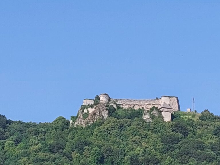
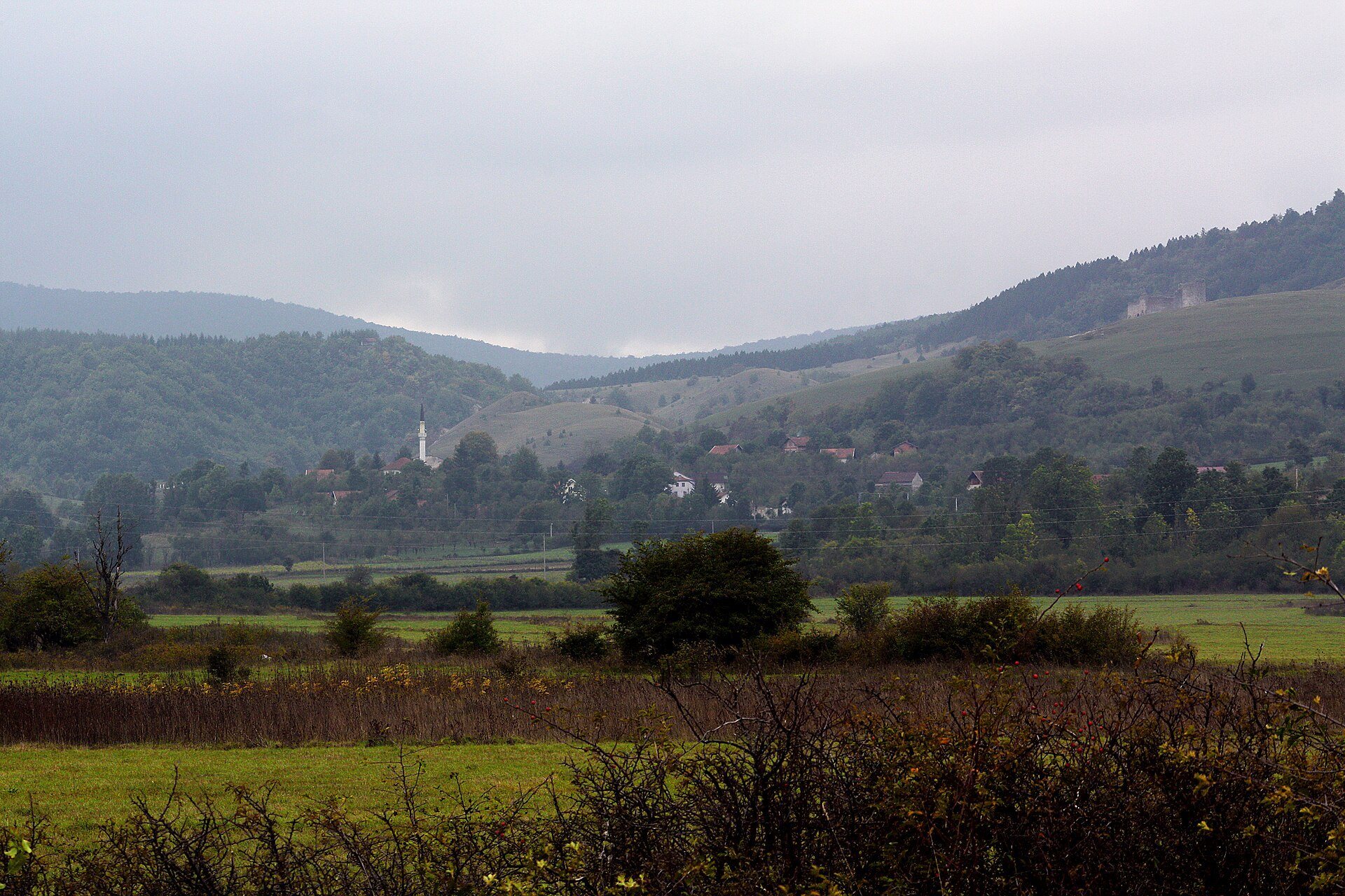
Bjelaj Fortress is a medieval town-fortress complex in Bosnia and Herzegovina, built in the fifteenth century and used at least until 1833. Known locally as Stari Grad Bjelaj, or Bjelaj Old Town, it stands near Bjelaj village in the Bosanski Petrovac area. The site occupies a plateau on the northern slope of Osječenica, at the edge of the Petrovac plain, and combines a medieval fortress with a later Ottoman military enclosure.
Prehistoric and Medieval Origins
The plateau includes an earlier archaeological site associated with the Bronze and Iron Ages. The medieval fortress was built by an unidentified builder in the fifteenth century. Its first written mention dates from 1495, when Gašpar Perušić received 30 forints for preserving his fortified town of Belaj. The record associated ownership with the treasurer of Vladislaus II, king of Hungary and Croatia from 1490 to 1516.
In 1505, Bjelaj was held together with Sokolac Fortress and Ripač by Beatrice Frankopan, a member of the Frankopan noble family and a relative of Johannes Corvinus, a Hungarian nobleman and military leader. The castellan Dujam Orlovčić administered the three towns in her name. These records place Bjelaj within the political and military network of the late medieval frontier.
Ottoman Administration and Military Use
Between 1530 and 1537, Bjelaj came under Ottoman rule and became part of the Sanjak of Bosnia, an Ottoman administrative district. It was first recorded as a Bjelaj nahija in 1540. A nahija was a smaller administrative district. The district later became known as the Bjelaj-Blagaj nahija and subsequently came under the jurisdiction of Kamengrad.
From 1562, the Bjelaj nahija was connected with the Novosel cadiluk in the Sanjak of Klis. A cadiluk was a judicial and administrative district under a Muslim judge. From 1592, Bjelaj belonged to the Bihac captaincy, a military-administrative territory organized around fortresses, and from the eighteenth century it formed part of the Petrovac captaincy.
The fortress held an Ottoman garrison of 370 mercenaries in 1577 under a dizdar, the commander responsible for a fortress and its soldiers. One of its commanders, Alijaga, served on a delimitation commission involving the Republic of Venice. In 1747, the garrison consisted of 30 men under Dizdar Hasanag. The fortress is also associated with an Ottoman siege, while an inventory from 1833 listed one cannon described as 12 and three small guns described as 6.
Later Condition and Protection
Bjelaj remained in use at least until 1833. Its historical controlling powers are listed as the Kingdom of Hungary, the Ottoman Empire, and Austria-Hungary. An inspection in February 2007 found the medieval fortress relatively well preserved and sections of the Ottoman enclosure’s western wall still standing. Bjelaj was declared a National Monument of Bosnia and Herzegovina in 2007 and lies within the contact zone of Una National Park.
The site remains exposed to deterioration caused by neglect, inadequate maintenance, and the absence of an appropriate management plan. These conditions affect the preservation of both the medieval fortress and the Ottoman enclosure.
Remains
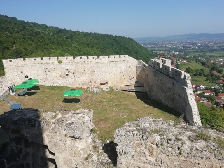
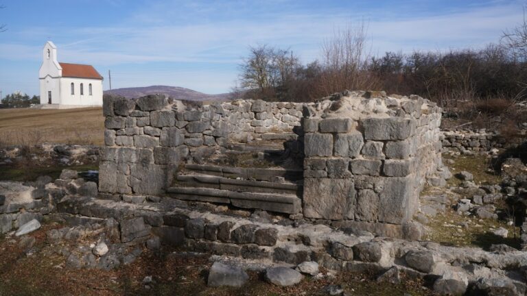
The complex extends across a plateau approximately 850 metres long on the northern slope of Osječenica, overlooking the Petrovac plain, also called Bjelajsko field. Its two principal parts are the southern medieval fortress and the northern Ottoman enclosure. The medieval town has an irregular rectangular plan, measuring more than 40 metres from north to south and about 35 metres from east to west, with its entrance on the northern side.
Medieval Fortress
Northwestern Tower
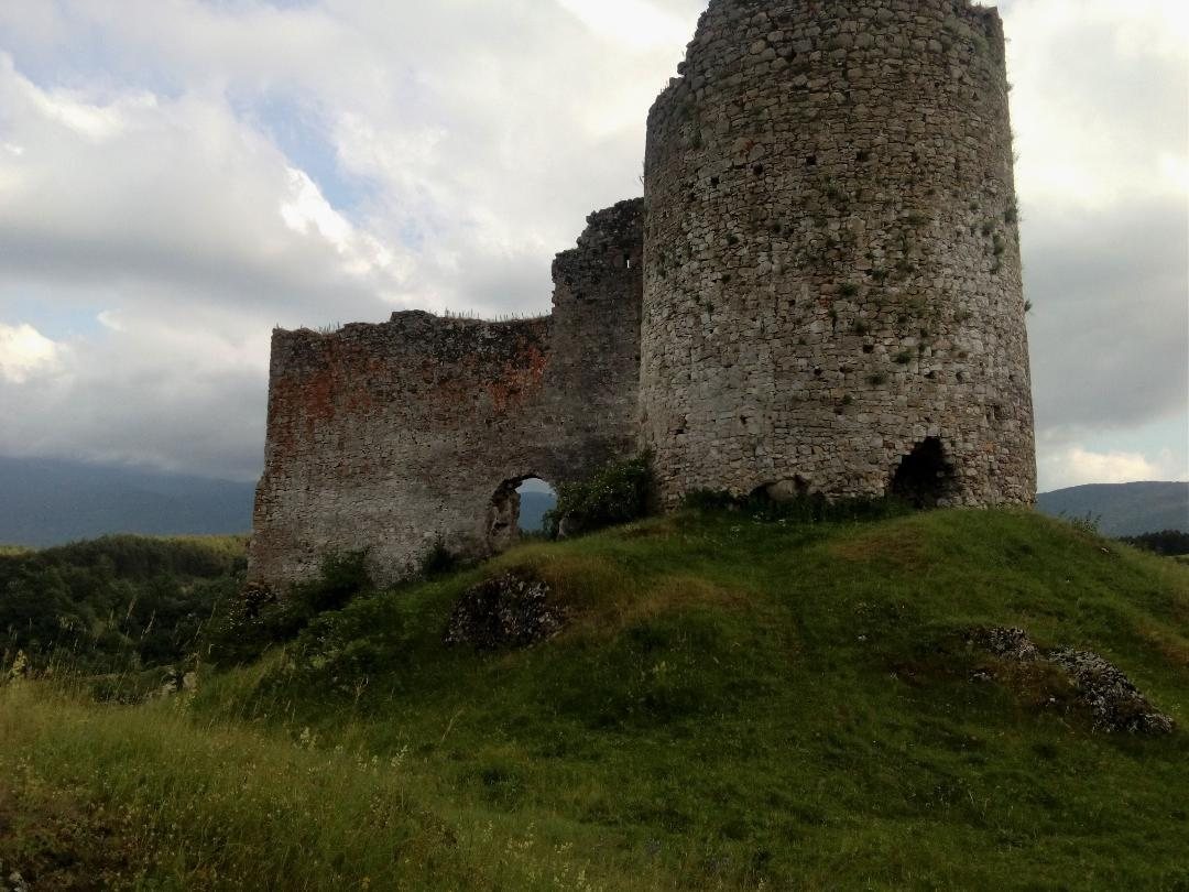
A massive round tower projects about two-thirds beyond the northwestern ramparts and rises approximately 16 metres. Its entrance is around 4 metres above the present ground level. The tower was probably divided into three levels: a ground floor or basement, a floor at entrance height, and a space above the entrance. A continuous ceiling line remains visible on the wall surface, helping to indicate the internal arrangement.
Entrance and Wall Defences
Sections of arches and doorways survive within the partly enclosed medieval town. East of the entrance is a narrow, hollow, heavily walled passage or space that rises to the level of the ramparts, about 15 to 16 metres above the ground. Its upper part survives and probably allowed soldiers to reach the wall walk, which had crenellations and occasional small loopholes, narrow openings used for observation or firing.
A longitudinal eastern wall divides the easternmost part of the medieval interior from the western area. After several metres, it turns toward the south and disappears. It may have helped protect the entrance into the town. The western defences were more heavily built because attackers could approach from behind. The monolithic ramparts end in roughly shaped stone blocks, and stone consoles beneath the level of a chestnut tree once supported a wooden superstructure. A lower row of shorter brackets remains embedded in the rampart.
Eastern Rampart and Ditch
The eastern rampart faces Bjelajsko field and contains four large semicircular loopholes. They were arranged for firing from a wooden or stone platform while standing. Several retain vertically and horizontally carved stone frame blocks and inner-side slabs. Above the openings is a horizontal line of beam holes for a ceiling, with stone consoles positioned above it. A cistern lies beside the western rampart near the tower. Older fortress structures and towers were built from travertine blocks and broken stone.
A ditch lies in front of the northern rampart and the medieval entrance. It is filled or waterlogged, but its outline remains identifiable. Holes in the medieval walls show where stone was removed from them.
Ottoman Enclosure
Walls and Entrances
The Ottoman enclosure was added north of the medieval fortress. Its plan is almost regularly quadrilateral, approximately 110 metres long and 40 metres wide. The surviving western ramparts reach up to 2 metres in height. They differ from the medieval walls in both material and construction, consisting of finely broken stone mixed with a large quantity of plaster.
The northern wall contained the entrance to the enclosure, which was covered by a pointed arch. The upper parts of the ramparts at this location survive mainly as traces. The best-preserved Ottoman wall remains lie south and north of the medieval ditch and along the western side of the plateau. A further entrance appears to have been formed in the western wall north of the ditch.
Small Mosque
A small mosque stood within the Ottoman enclosure. Its former location is marked by a hollow filled with stones, providing a physical indication of the religious structure that served the garrison and settlement inside the later fortified area.