Celtic Camp of La Bure: A Gallic and Roman Fortified Highland Settlement


Site at a Glance
- Rating
- 4.6
- Popularity
- Low
- Country
- France
- Primary era
- Iron Age
- Eras represented
- Stone Age, Iron Age, Classical, Modern
- Civilizations
- Celtic, Roman
- Site type
- Military
- Remains
- Fortified Town
On this page16 sections
History
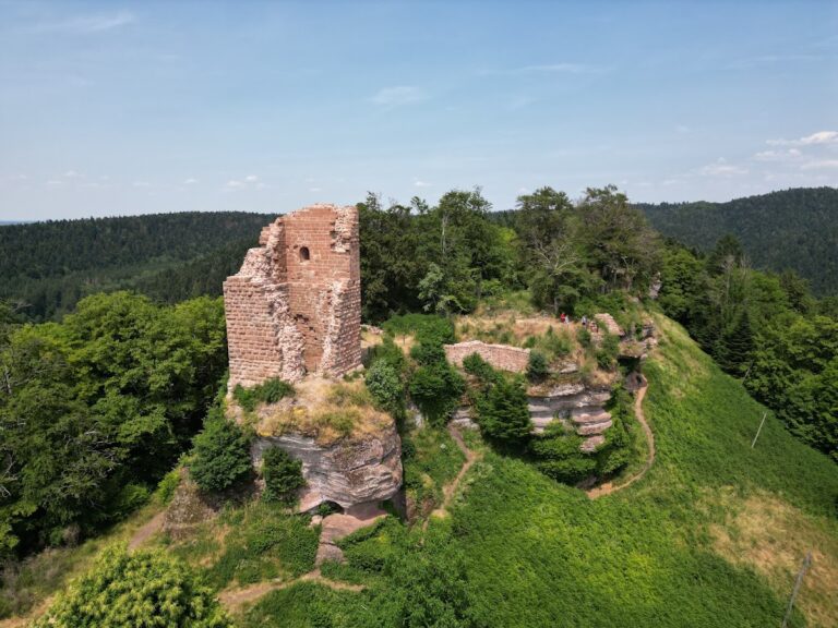
The Celtic Camp of La Bure is a fortified highland archaeological site in France, above Saint-Dié-des-Vosges, developed by Gallic and Roman communities from the Iron Age into the Roman period. The promontory was occupied from at least the Late Neolithic, about 4,000 years ago, while its most intensive use occurred during the second and first centuries BC, at the end of the La Tène period, the later Iron Age tradition associated with the peoples commonly called Gauls. Settlement continued through almost the entire Roman period, from the second to the fourth century AD.
Early settlement and Gallic occupation
La Bure formed part of a chain of fortified hilltop sites bordering the Haute-Meurthe valley. Other sites in this network included Pierre d’Appel, Chazeté, Warrinchâtel, and La Corre. During the Gallic period, the promontory was an entrenched settlement protected by steep natural cliffs and constructed defenses. Its inhabitants combined farming and pastoralism with ironworking, stone extraction, and glassworking. The position also allowed the settlement to oversee movement through the converging valleys below.
More than 1,000 Gallic and Roman coins point to substantial exchange activity. The wider material reflects a varied community and many functions, including craft production, warfare, aristocratic residence, pilgrimage, forestry, quarrying, agriculture, trade, and stonecutting. The late La Tène occupation included the manufacture of Nauheim-type brooches, a form of Iron Age clothing fastener, together with the production and use of ceramic vessels, glass bracelets, and beads.
Roman use and religious traditions
La Bure remained occupied during the Roman period, when its defensive system and productive activities continued in altered forms. Religious activity also persisted. Gallic cult practices are represented by archaeological finds, while place-name evidence has encouraged the interpretation that the Gallic deity Baco or Bago, whose name means “beech,” may have been worshipped here during the second and first centuries BC. Roman-period worship involved Mercury and Jupiter, with Jupiter associated in Gaul with the local god Taranis. Diana, a Roman goddess linked with wilderness, hunting, and the moon, also appears among the site’s religious associations.
Later names preserve changing interpretations of the place. It was known at different times as the “Camp of the Swedes,” “Camp of the Saracens,” “Castle of the Saracens,” “Camp of the Romans,” “Camp of the Gauls,” and “prehistoric enclosure.” The current name may refer either to mining shafts or to the upper part of a forge, but this explanation remains interpretive. Small quantities of green-glazed medieval pottery indicate activity after the Roman period.
Later use and archaeological investigation
In the eighteenth century, people continued to visit La Bure for rituals intended to obtain blessings or incantations for children and adults. A cross was erected there in 1752–1753 in connection with a child allegedly attacked and devoured by wolves, with the stated purpose of exorcising the location. The surrounding population also quarried sandstone at the site. A feature once considered a small temple or an Iron Age enclosed ritual area was later reinterpreted as an installation connected with the First World War, probably an early form of French mortar.
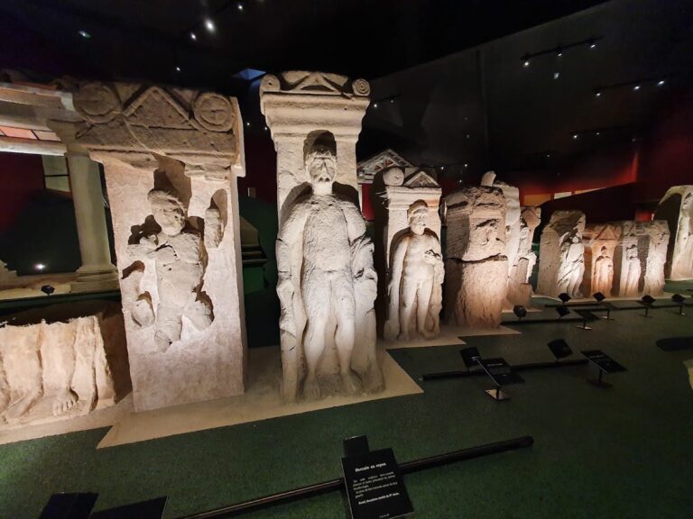
Local scholars began examining La Bure in the mid-nineteenth century, among them Édouard Ferry and the artist Gaston Save. The first scientific excavations began in 1964 under Albert Ronsin. Georges Tronquart directed further work from 1966 to 1986, with both investigators associated with the Société Philomatique Vosgienne. Excavation brought to light funerary and votive stela fragments, metal, ceramic, stone, and glass objects, together with Gallic and Roman coins. The site was classified as a Monument historique on 6 August 1982, and the surrounding slopes, including Tête du Villé and Rein de Champ Cote, received the same heritage protection on 5 April 1993. Archaeological research has identified La Bure as the second major archaeological site in the Vosges department after Grand. Excavated objects are held and partly displayed in the archaeological section of the Pierre-Noël Museum in Saint-Dié-des-Vosges, which also contains a model of the site.
Remains
Promontory and defensive layout
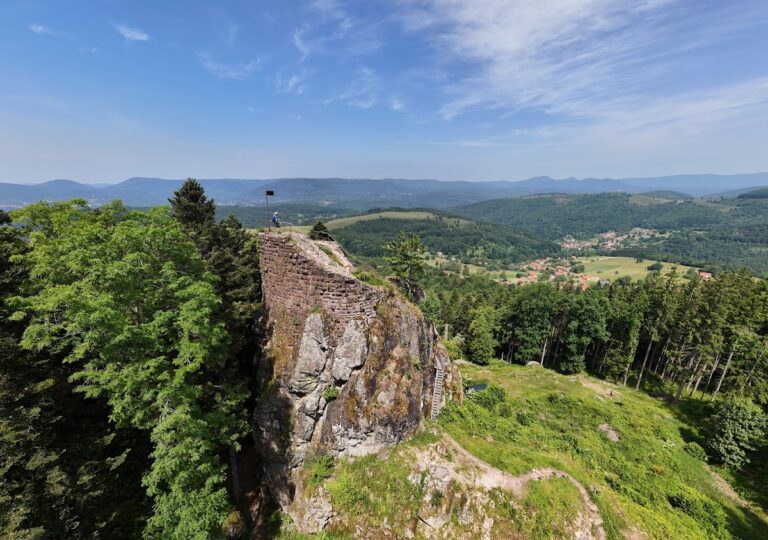
La Bure occupies a naturally defended sandstone promontory more than 200 metres above the Meurthe valley. The plateau reaches about 583 metres at its highest point, extends approximately 350 metres in length and 120 metres in width, and covers slightly more than three hectares. Steep cliffs define its edges. As a barred spur, a promontory isolated by artificial banks, ditches, or walls, it was fortified chiefly along the eastern side, where the principal Gallic, late La Tène, and Roman defenses were concentrated.
Gallic ramparts
The earliest identified Gallic rampart dates from the second half of the second century BC. Preserved for 38 metres, it is an angled wall up to 7.50 metres wide and remains about three metres high at its outer face. Two outer faces of quadrangular sandstone blocks enclosed an oak framework fastened with iron pins, while stone and earth formed the core. Thirteen iron pins were recovered. This construction belongs to the Ehrang type, a timber-reinforced Iron Age fortification whose arrangement differs from the more widespread murus gallicus.
Later rampart and Roman defenses
A later rampart, probably built during the first half of the first century BC, formed a straight structure 45 metres long. It was a murus gallicus, a timber-reinforced stone rampart characteristic of late Iron Age Gaul, with a single sandstone outer face strengthened by internal woodwork. An artificial earthen bank covered its inner side. Roman defenses included a line of 18 large sandstone blocks extending for more than 18 metres, reinforced by a ditch cut into the bedrock. The ditch measures 43 metres in length and three to five metres in width. A peripheral defensive terrace, probably Roman, survives at a little over 0.60 metres high and can be traced for more than 350 metres around the settlement.
Entrances and access structures
Entrances served the settlement from the north, south, and east. They included three posterns and a principal gate, possibly with a second gate reached by a paved route suitable for carts. The northern entrance is comparatively well preserved, and its approach retains paving for several metres.
Religious and funerary features
Cult areas and rock-cut basins
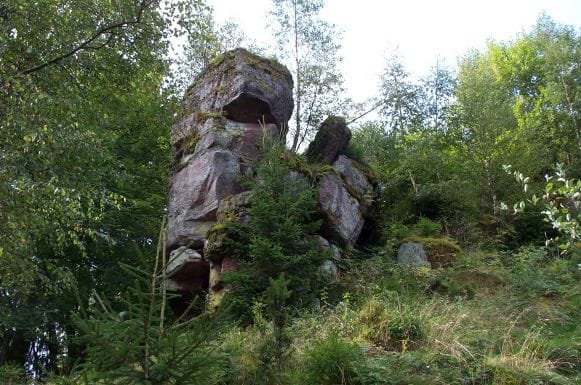
Several locations contain basins carved directly into the sandstone. They served cult purposes and probably also held water. Some are associated with the Dianas and Taranis. The highest part of the central plateau is interpreted as a possible area reserved for deities. At least three representations show Jupiter riding an anguiped, a serpent-legged being depicted beneath the mounted god. A Roman-period stela fragment found in the nineteenth century represents Mercury wearing a petasos, a broad-brimmed travel hat. Other sculptures and remains relate to Mercury, Jupiter, and the Dianas.
Cemetery and stelae
The terrace east of the Roman ditch served as a cemetery and was also used to extract sandstone. Fragments, and sometimes complete examples, of Roman funerary and votive stelae were reused in the rampart and in the ditch fill. More than 23 funerary stelae were found, including examples with inscriptions. Four casts are displayed at La Bure.
Quarrying, workshops, and archaeological finds
Sandstone extraction and ironworking
Quarrying is marked by rows of wedge marks, stepped quarry faces, and notches made for lifting equipment. These features are attributed to the Roman occupation. An L-shaped quarry supplied sandstone slabs for construction, and at least 19 iron wedges were recovered. Ironworking is represented by more than 460 kilograms of slag, along with an anvil, hammer, and tongs. Iron ore was exploited in the La Bure massif, and glassworking also formed part of the site’s craft activity.
Coins, weapons, and crafted objects
A group of 346 Gallic coins includes potins and denarii associated with the Leuci, Remi, Sequani, Aedui, and Lingones. Weapons include javelin and spearheads, as well as arrowheads with a single barb. Other finds comprise metal, ceramic, stone, and glass objects, including tools, jewelry, sculptures, coins, and stelae. The excavated material is held and partly exhibited at the Pierre-Noël Museum, while casts of four stelae remain displayed at La Bure.
Landscape setting
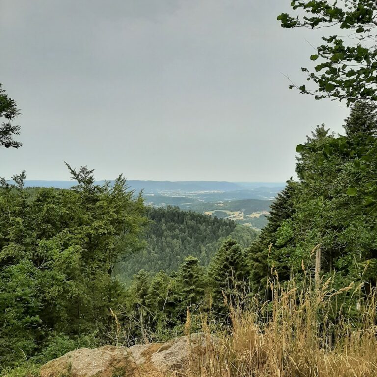
The western end of the plateau has an orientation table installed in 1992. The site overlooks the confluence of the Hure and Meurthe and the ancient road system, including routes toward the Haute-Meurthe valley, the Hure valley, the Lorraine plain, the Vosges passes, and the Rhine valley.