Château de Pierre-Percée: A Medieval Fortified Castle in France

Site at a Glance
- Rating
- 4.3
- Popularity
- Very Low
- Country
- France
- Primary era
- Medieval
- External website
- Open
- Eras represented
- Medieval
- Civilizations
- Duchy of Lorraine, Holy Roman Empire
- Site type
- Military
- Remains
- Castle
On this page12 sections
History
Château de Pierre-Percée is a medieval fortified castle in France, built on a rocky ridge in the Lorraine side of the Vosges. Formerly known as Langenstein, meaning “long stone,” it probably originated in the eleventh century and later became associated with the Counts of Salm. Its surviving ruins reflect a history of noble inheritance, episcopal warfare, repeated military repairs, and destruction during the Thirty Years’ War.
Origins and the Counts of Langenstein
The earliest apparent reference to a castle at the site comes from a chronicle written around 1140. It mentions Albertum de Longuicastro, a nobleman said to have lived in the mid-eleventh century. Albert, also called Adalbert, was a younger member of the Counts of Alsace. Emperor Henry III, a medieval ruler of the Holy Roman Empire, appointed him Duke of Lorraine, and Adalbert probably built the castle before adopting the name associated with it.
Adalbert was killed at the Battle of Thuin on 11 November 1048 by Godfrey II the Bearded, who was seeking to recover the duchy. Henry III then granted Lorraine to Adalbert’s brother, Gerard I of Lorraine. Adalbert’s daughter Mathilde married Folmar IV, Count of Metz. Their son Godfrey held the title Count of Langenstein, married Agnes of Bar before 1100, and died around 1110.
Sieges and the Salm inheritance
Around 1135, Stephen of Bar, Bishop of Metz, besieged the castle and blocked its main approaches with three fortifications at Dame Galle, Ortomont, and La Roche des Corbeaux. The defenders resisted for about a year before surrendering.
Agnes, the widow of the Count of Langenstein, later married Hermann II, Count of Salm. Through this marriage, the castle and the surrounding territory became linked with the hereditary possessions of the Counts of Salm, a noble family whose lands included parts of Lorraine and the Vosges. The territory included Badonviller, which became the county capital, as well as Blâmont.
Around 1134, Hermann II joined the Duke of Lorraine in a war against his brother-in-law, the Count of Bar, and Stephen of Bar, Bishop of Metz. Hermann was killed in battle outside Château de Frouard. Around the same time, Pierre-Percée was besieged and captured by the Bishop of Metz. Hermann’s eldest son, Hermann III, apparently disappeared during these events, and his younger son, Henry I, inherited the county.
Medieval administration and episcopal control
A chapel at the castle is mentioned in a text written between 1228 and 1244. Henry III donated it to the nearby Abbey of Saint-Sauveur. Later, financial difficulties led Count Henry IV to sell Château de Pierre-Percée and Château de Salm, in the Bruche valley, to Jacques, Bishop of Metz, before 1258. Henry subsequently recovered both castles as fiefs.
Pierre-Percée was not the principal residence of the Counts of Salm. They generally lived in towns and at the ducal court, while officials such as cellarers, captains, and provosts administered distant castles. The castle could also be pledged to creditors as security for loans, giving it a financial role as well as a military one.
Repairs and destruction
Regular repairs were carried out between 1564 and 1634 on the upper-floor frameworks, roofs, and masonry. Some of this work followed the collapse of roofs and floors through decay. In 1587, the garrison was reinforced and the defenses were extensively repaired in anticipation of mercenaries serving Protestant princes, including the King of Navarre and the Duke of Bouillon.
The 1587 works included repairs and improvements to the bailey, roofs, cistern, drawbridge, watchtower, and two guardhouses. A gun loophole was added near the drawbridge, and the arquebuses were overhauled by a gunsmith from Badonviller. A bailey was an enclosed area within or beside a medieval castle, commonly used for service buildings, storage, and working spaces.
The castle and the hamlet below it were destroyed during the Thirty Years’ War, a European conflict fought from 1618 to 1648 amid religious, dynastic, and territorial struggles. The destruction was particularly associated with the siege of 1636, led by Bernard of Saxe-Weimar against Imperial forces. The castle had been deserted by this period and was not rebuilt afterward.
Stone from the ruined fortress was reused in the small village and its church below the site. The ruins are now owned and maintained by the Office National des Forêts. Château de Pierre-Percée has been protected as a French historic monument since 21 September 1981.
Remains
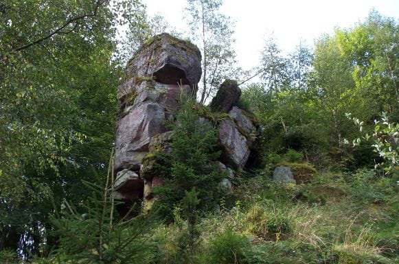
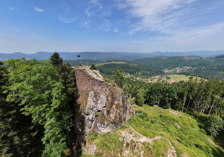
The ruins occupy the summit of a foothill on the Lorraine side of the Vosges, at an elevation of 495 metres. The castle stood along an east-northeast to west-southwest rocky ridge more than 120 metres long and about 12 metres high. The ridge consists of locally very friable conglomeratic sandstone, and the surviving remains are concentrated at its western-southwestern end.
Rocky ridge and water supply
Castle ridge
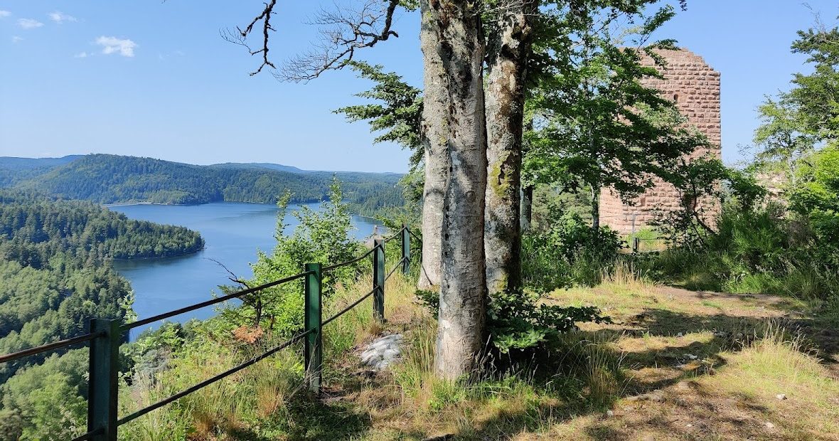
The castle’s elongated position gave rise to its earlier names, Langenstein and Langstein, which continued in use into the twelfth century. Later names included the Latin Petrae Perforatae and the Old French Piereperciée, both referring to the pierced rock associated with the castle’s deep well. A small village with a church lies below the site, and part of the village was built with stone taken from the ruins. Lake Pierre-Percée was created at the foot of the mountain during the twentieth century.
Rock-cut well
A well was cut into the rock before 1138, traditionally at Agnes’s initiative. It reached a depth of about 33 metres and lies beneath the southwestern part of the ridge. Only its upper section remains visible, with a diameter of 2.20 metres. Its construction helps explain the later names Pierre-Percée and Petrae Perforatae.
Fortified structures
Square keep
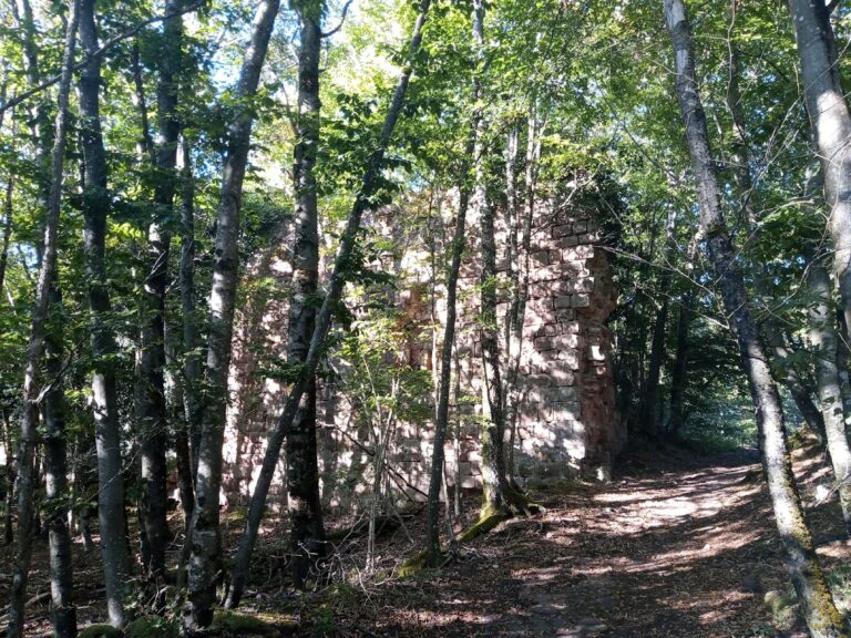
The principal surviving structure is a square keep, the castle’s main fortified tower and often its strongest part. It measures 8 by 8 metres and still rises to approximately 13 metres. Carefully finished masonry forms the tower, which includes a small rounded-arch window in the Romanesque style, a medieval architectural tradition marked by massive walls, small openings, and rounded arches. The keep is probably a twelfth-century structure.
The tower also survives in well-formed rusticated, or bossed, stone blocks whose central faces project outward to create a textured surface. It is described as one of the few Staufian-period castle complexes west of the main Vosges crest. The term Staufian refers to the period associated with the Hohenstaufen dynasty and its political and architectural influence in medieval Central Europe.
Defensive complex
The former defensive complex included a cistern, drawbridge, watchtower, two guardhouses, and a gun loophole near the drawbridge. These features formed part of the castle’s later defensive arrangements, especially those repaired in the sixteenth century. The surviving ruins themselves consist mainly of modest wall fragments concentrated at the western-southwestern end of the ridge.