Forte Tenna: An Austro-Hungarian Mountain Fortification in Italy


Site at a Glance
- Rating
- 4
- Popularity
- Low
- Country
- Italy
- Primary era
- Modern
- Eras represented
- Modern
- Civilizations
- Austria-Hungary, Habsburg
- Site type
- Military
- Remains
- Fort
On this page14 sections
History
Forte Tenna is an Austro-Hungarian mountain fortification in Italy, built during the 1880s in the Vogl period of defensive construction. Its exact construction date is uncertain. The fort stood within the Tenna Barrage, part of Subrayon III of the Austro-Hungarian defensive system along the Italian frontier and of the wider Fortress of Trento.
The Tenna Barrage
Forte Tenna operated with the twin fortification of Colle delle Benne on the Colle di San Biagio. Together, they were intended to close the Upper Valsugana and Valsorda, protect the Calceranica and Caldonazzo area, prevent an attack on the rear of Trento, and observe the road toward Monterovere and the fortifications at Lavarone and Vezzena. Because of its exposed position, Forte Tenna received a heavier armament than was usual for comparable works.
The fort also had a communications role. Telephone lines connected it with the Trento command, Colle delle Benne, the Monte Rovere position, and the barracks of the Austro-Hungarian Silesian Field-Jäger Battalion No. 16 at Levico. Optical signals could be exchanged with Colle delle Benne and the position on Monte Celva.
First World War and later reuse
Forte Tenna did not take part in fighting during the First World War. Shortly after the war began, it was disarmed, and its guns were transferred to the area around the San Valentino chapel. The building then served mainly as an observation post and accommodation under the Trento Directorate of Fortifications. A concrete observation cupola was added to the roof for this purpose.
After the war, the fort passed to the Italian state and was removed from the military-property register in 1931. In the 1930s, Angelo Castellani of Idro acquired it through a public tender for 10,000 lire. It later passed to Aldo Baruchelli of Tenna, who donated it to the municipality.
Private owners removed the fort’s armored components for sale as scrap. This stripping was associated with the steel embargo imposed on Italy by the League of Nations during the Mussolini-era war against Ethiopia. During the Second World War, the fort was used as a wood store. After 1945, it also served as a stable and wood depot, while local volunteer fire brigades used the structure for climbing and abseiling training.
Damage and conservation
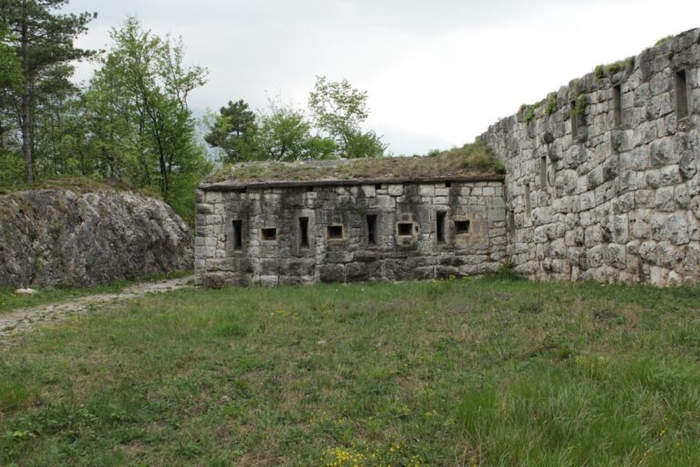
The Traditor and parts of the right shoulder of the casemate block were demolished at an unknown date, possibly for building material. The ditch and its enclosing wall also survived in incomplete form. Extensive recovery and conservation work commissioned by the Autonomous Province of Trento began in April 2009 under the architectural direction of Cinzia Broll of Pergine Valsugana. The work was conservative rather than reconstructive, stabilizing the surviving structure and making it usable without rebuilding demolished or missing sections.
Remains
Setting and overall layout
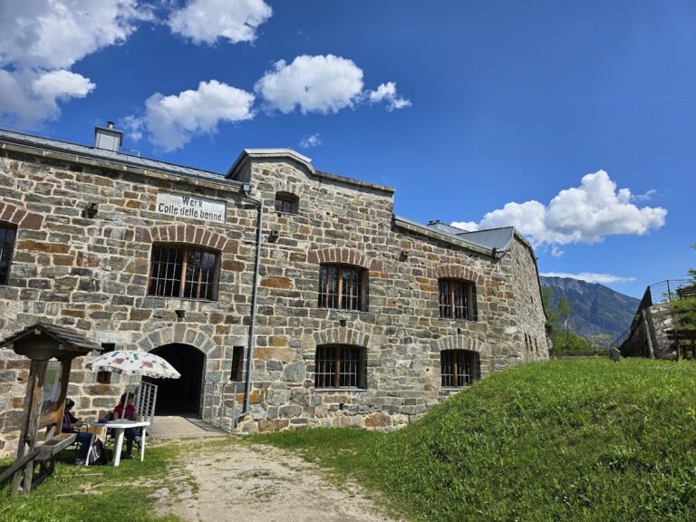
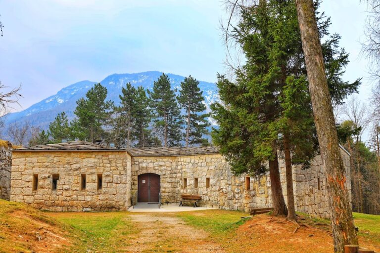
Forte Tenna stands at 608 metres above sea level on the ridge between Lake Caldonazzo and Lake Levico, overlooking the Valsugana and both lakes. It was built as an exposed fortification, with freestanding walls and no planned camouflage. The complex has an irregular quadrilateral plan, with sides measuring approximately 92.85, 40.15, 45.50, and 82.94 metres.
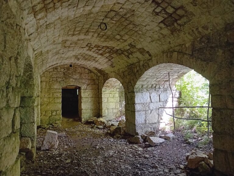
The fort formed one connected complex consisting of a casemate block, a battery block, and a Traditor, a flanking artillery position designed to fire along a ditch or against an approaching enemy at the side. It had four storeys, including three levels above ground and a basement. Service rooms and accommodation occupied the lower levels, while the upper levels contained gun casemates and magazines. The highest level was the battery deck. The casemates and passages had barrel vaults about seven metres high and were divided by an inserted intermediate floor.
Dolomite and limestone masonry formed the structure. Earth covered the front and roof, and the roof was initially waterproofed with clay rather than a reinforced-concrete layer. It was later strengthened with concrete. Four elliptical columns, each approximately seven metres high, remain on the front facade.
Defensive perimeter and underground connections
The dry ditch
A dry ditch surrounded the fort for approximately 280 metres. It was about six metres wide and four metres deep. Its unequal-sided outline resembled a redan, or projecting angular defensive work, although it was not technically a ravelin. The front formed an obtuse angle, and a removable bridge provided a crossing. On the gorge side, the outer wall of the ditch, called the counterscarp, was sloped rather than built in masonry.
Ditch-defense structures
Two structures stood at the shoulder points of the front angle, each equipped with two machine guns for defense in both directions. Covered passages connected them with the casemate and battery blocks. Another passage ran beneath the ditch floor from the projecting shoulder of the front to an advanced observation post outside the fort.
Water supply
A cistern beside the right flank held 84.5 cubic metres of drinking water. A pipe connected it with the casemate block, and its capacity was calculated to supply the wartime garrison with 5.5 litres per person per day during the maximum siege period.
Artillery and communications
Guns and armored positions
The planned armament comprised two 15-centimetre armored mortars, eight 12-centimetre guns, and four 11-millimetre machine guns for ditch defense. The mortars were later replaced by two 10-centimetre armored howitzers mounted in rotating turrets with a 360-degree field of fire.
The eight guns occupied three casemates on the second level. Their embrasures, the openings through which the guns fired, were kept as small as possible and faced with granite on surfaces inclined at about 30 degrees to reduce the angle of impact. Two guns covered the area east of Levico, four covered the road toward Lavarone, Monte Rovere, and Vattaro, and two covered the southwest toward Valsorda. Each group had a stated field of fire of 60 degrees, while the guns in the minimal-opening embrasures could be adjusted laterally by 30 degrees in either direction.
The fort originally possessed rotating armored gun turrets and other armored elements. These were removed, and three armored observation cupolas are specifically recorded among the metal components stripped from the structure.
Power and signaling
A 5-kilovolt line from Pergine connected the fort to the public electricity network. Electric searchlights illuminated distant areas, while acetylene lamps served the nearby ditch. The telephone and optical signaling systems linked Forte Tenna with the surrounding command, fortification, and barracks network.
Construction supply and conservation fabric
Building materials reached the fort from the western shore of Lake Levico by a cableway completed by Bleichert of Leipzig-Gohlis in December 1885. The line measured 598 metres, rose through a height difference of 155 metres, and was carried by ten intermediate towers as well as its terminal supports.
Conservation work cleared vegetation around the fort and removed accumulated fill from the ditch. Inside, about a century of compacted earth was taken out, drainage pipes were placed beneath the floor to limit rising damp, and the flooring was rebuilt with concrete, iron, and wood. The exterior was insulated against moisture caused by weather.
Nearby sites