Fort Saint-Père: An Eighteenth-Century Bastioned Fort in France
Site at a Glance
- Rating
- 4.3
- Popularity
- Low
- Country
- France
- Primary era
- Early Modern
- Eras represented
- Early Modern, Modern
- Civilizations
- French
- Site type
- Military
- Remains
- Fort
On this page14 sections
History
Fort Saint-Père is an eighteenth-century French fortification in Saint-Père-Marc-en-Poulet, France, built between 1777 and 1785 according to principles associated with Vauban’s bastioned defenses. It stands on a height overlooking the Châteauneuf isthmus, about 9 kilometers south of Saint-Malo, and was intended to protect the city and its port from English raids.
Foundation and construction
The isthmus formed Saint-Malo’s only practicable year-round land approach. An enemy landing at Cancale could have cut this route, making the height above Châteauneuf an important defensive position. Construction began in 1777 during the reign of Louis XVI, the Bourbon king of France from 1774 to 1792. The first stone was laid on 14 July by the Marquise Baude de la Vieuville, wife of the Marquis of Châteauneuf, in the presence of Monsieur de Carpilhet and Monsieur de Lorandal, colonel of the Armagnac Regiment.
The military engineers Louis Aguillon and Pierre-Jean de Caux designed the fort. The first battalions of the Agénois and Armagnac regiments supplied labor, and the works continued until their completion in 1785. Fifty workers died during construction. The project cost 1,484,913 livres, the currency used in France before the Revolution and during the late eighteenth century.
Defensive role and changing name
The fort was originally called Fort de Châteauneuf because it stood closer to the town of Châteauneuf than to the village of Saint-Père. Its planned garrison numbered 600 men. The powder magazine was regarded as one of the largest in Europe, although the fort’s armament apparently never exceeded 18 cannons. Despite its strategic purpose, Fort Saint-Père never experienced combat.
Military use after 1870
An arsenal was added in 1880, and a railway connection followed in 1885. During the First World War, the fort became a prisoner-of-war camp, a facility for holding captured military personnel.
During the German Occupation in the Second World War, the fort stored shells for German 194 mm and 75 mm guns, together with torpedoes belonging to the Kriegsmarine, the German navy during the Nazi period. As American forces advanced toward Saint-Malo, German troops partially demolished the fort with explosives. The American army occupied it briefly, and the site was cleared between 1944 and 1950. The French army later used it as an explosives depot, while materials from beach-clearance operations were also stored there.
Abandonment and civilian reuse
The French army abandoned the fort in the late 1970s. It was declassified in 1985 and transferred to the public estate. The commune of Saint-Père purchased it in 1989 and began a long restoration campaign. A work-integration project was established at the fort in 1995, and goats have been used to maintain parts of the extensively grass-covered site.
A test concert by Noir Désir in August 1993 helped persuade the commune to host La Route du Rock. The festival moved from Saint-Malo to Fort Saint-Père in 1994, and its continuing presence accelerated the restoration and adaptation of the former military site. Since 2017, the fort has also hosted the No Logo BZH reggae and world-music festival. The La Route du Fort running event has taken place there since 2013.
Remains
Overall layout and defenses
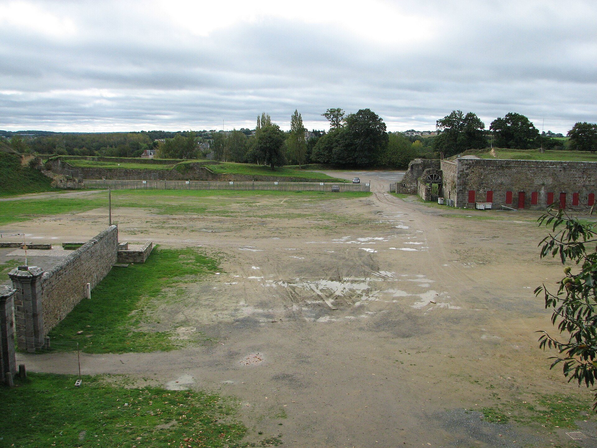
Fort Saint-Père covers about 30 hectares, an area comparable to that of Saint-Malo within its walls. The fort forms a closed quadrilateral enclosed by a thick rampart, with projecting corner bastions called the King’s, Artois, Queen’s, and Monsieur’s bastions. A bastion is a projecting part of a fortification designed to provide flanking fire along adjoining walls. The defensive structure is largely buried and protected by a wide ditch.
Entrance and bastions
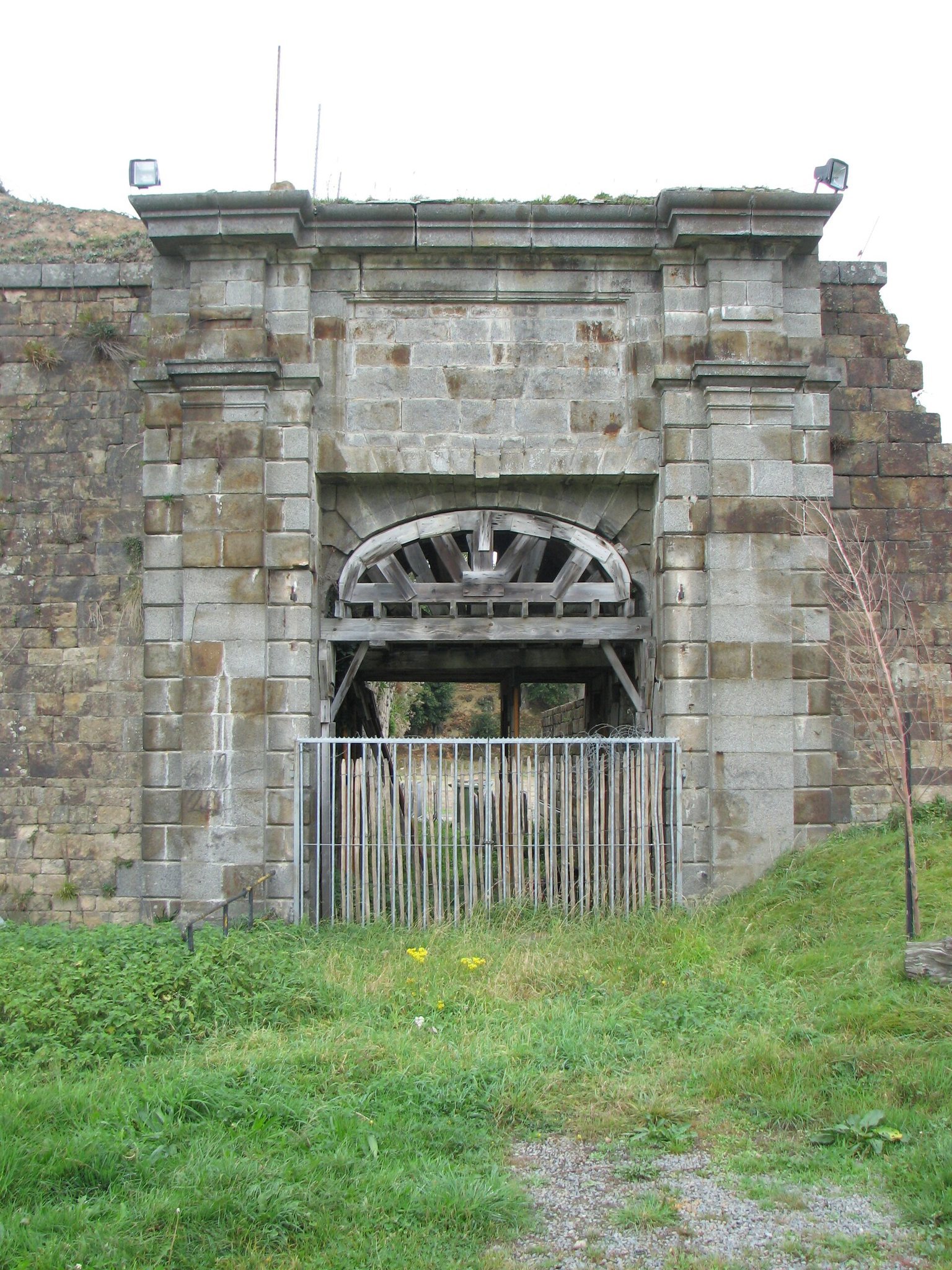
The entrance was closed by a drawbridge and flanked by two guardhouses. The four corner bastions project from the quadrilateral enclosure, while the wide ditch surrounds the buried defensive works. The King’s Bastion later served as administrative and management offices, and the Queen’s Bastion became a press area during La Route du Rock.
Troop accommodation and storage
Casemates
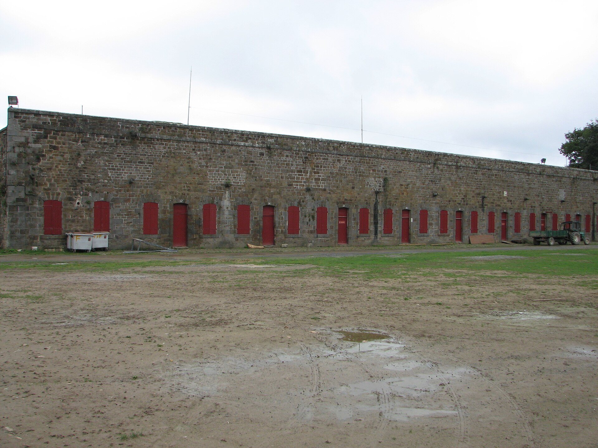
The fort contained 26 casemates arranged in two groups for its 600 soldiers, along with six casemates for officers. A casemate is a vaulted or strongly protected chamber used for troops, storage, or artillery-related purposes. Each measured 20 meters by 6 meters and stood 4.7 meters high. Its façade had one door and two openings, while the interior included a fireplace and two air vents.
Food stores
Six additional casemates were used as food stores. Their doors were topped by an oculus, a small circular opening. The powder magazine measured 46 meters by 13 meters, and its buttresses were later adapted as artists’ dressing rooms for the music festival.
Water supply and building materials
The courtyard contained a well, while a second well was dug in the southern glacis. A glacis is a gently sloping defensive surface outside the main fortifications. A fountain stood in the northeastern ditches, adding several distinct water sources to the fort’s defensive layout.
Materials came from several regions. Dressed stone was obtained from the quarries of Saint-Pierre-de-Plesguen and the Chausey Islands. Window glass came from workshops in Rouen, roofing slate from the quarries of Châteaulin, and iron fittings from Spain and Sweden.
Arsenal and adapted spaces
The arsenal added in 1880 survives as part of the fort’s later military fabric. During La Route du Rock, it served as a canteen. Other spaces were adapted for the festival, including the powder-magazine buttresses as dressing rooms, the King’s Bastion for administration, and the Queen’s Bastion for press operations.
Conservation and physical change
Festival tents stood in the ditches until 2005, when part of a rampart collapsed. Extensive demining and pollution-removal works in 1998 temporarily moved the festival into open fields several hundred meters outside the fort. Demining involved removing mines and other explosive hazards. Drainage and wider site-improvement works began in 2011, after the festival’s twentieth edition, contributing to the continuing restoration and use of the surviving fortification.