Gabii: An Ancient Latin City and Urban Centre in Italy


Site at a Glance
- Rating
- 4.3
- Popularity
- Very Low
- Country
- Italy
- Primary era
- Classical
- External website
- Open
- Eras represented
- Iron Age, Classical, Medieval
- Civilizations
- Roman
- Site type
- City
On this page15 sections
History
Gabii was an ancient city of Latium in Italy, approximately 18 to 20 kilometres east of Rome on the route to Praeneste. Built by the Latin communities of central Italy, it developed from an Iron Age settlement into an urban centre between the ninth and seventh centuries BC. Its position beside the road later known as the Via Praenestina, and earlier as the Via Gabina, gave it an important place in the landscape east of Rome.
Origins and urbanization
Pottery from the Middle Bronze Age has been found around Gabii, while small quantities of Final Bronze Age material belong to Latial I, an archaeological phase dated here to 1000 to 900 BC. More definite settlement began during Latial IIA, from about 900 to 830 BC. This phase was pre-urban, while the following Latial IIB phase was proto-urban, reflecting the development of larger and more organized communities.
Urbanization probably began no earlier than the opening of the second half of the eighth century BC and was probably complete by the end of the seventh century BC. Between about 830 and 730 BC, settlements in the area acquired a shared geopolitical identity. At its greatest extent, Gabii covered approximately 1.9 square kilometres.
The communities of prehistoric and protohistoric Gabii are represented by the Castiglione and Osteria dell’Osa cemeteries. Osteria dell’Osa was used from the ninth to the sixth century BC and contained approximately 600 to 700 burials. Its graves provide evidence for changing social organization and the emergence of hierarchy among pre-Roman communities in Latium.
Legends and the early Roman connection
Ancient traditions gave Gabii more than one origin. Some attributed its foundation to the Latins of Alba Longa, while others connected it with the Siculi, an ancient people associated primarily with Sicily and with traditions about pre-Roman populations in central Italy. A minor foundation story named two Siculian brothers, Galatus and Bins, although the proposed origin of the city’s name is not considered reliable.
Another tradition stated that Romulus and Remus, the legendary founders of Rome, were educated at Gabii. They were said to have learned literature and the use of Greek weapons there, reinforcing the city’s place in stories about Rome’s earliest history.
Gabii belonged to the Latin League, an association of Latin communities that maintained religious, political, and military connections. During the reign of Lucius Tarquinius Superbus, traditionally the seventh and last king of Rome, Gabii rejected Rome’s claim to take Alba Longa’s position within the league and went to war with Rome.
According to the tradition, Sextus Tarquinius, the king’s son, pretended to have rebelled against his father and took refuge in Gabii. After gaining command of the city’s army, he enabled Rome to bring Gabii under submission through deception rather than a decisive battle. The peace agreement associated with this episode was called the Foedus Gabinum, or treaty of Gabii. It was said to have been written in Latin letters using Greek characters on an ox hide stretched over a wooden shield and displayed in the temple of Sancus in Rome.
After the Roman monarchy was overthrown, Sextus Tarquinius fled to Gabii. The city’s leaders killed him there in revenge for his deception. Gabii later became an ally of Rome after 493 BC. In 221 BC, Hannibal, the Carthaginian commander, led troops past Gabii while marching toward Rome in an unsuccessful attempt to surprise the city.
Roman transformation
During the late Republican period, Gabii became depopulated in part because of extensive quarrying beneath the archaic city. The local volcanic stone, known as lapis Gabinus, was valued as a durable and fire-resistant building material and was also used in Rome. The Roman dictator Sulla subsequently settled veterans in Gabii’s territory. Cicero later described the community as a small and insignificant municipality.
Augustan poets used Gabii as an example of a city that had declined from an earlier importance. Inscriptions nevertheless indicate a revival and municipal reorganization from the time of Augustus or Tiberius. Hadrian appears to have supported this renewal, constructing a senate-house and an aqueduct. Gabii was also known for its public baths.
The city’s importance declined after the third century AD, when it largely disappeared from written history. Its buildings continued to be used, and bishops of Gabii appear in ecclesiastical documents until the end of the ninth century. From the eleventh century, the site was abandoned and converted to agricultural use.
Rediscovery and archaeological investigation
In the eighteenth century, Pierluigi Galletti incorrectly identified Gabii with a site on the river terraces of the Tiber and Farfa. The correct location was excavated by Gavin Hamilton, a sculptor and amateur archaeologist, beginning in 1791 after he received permission from Prince Marcantonio Borghese. The excavation exposed the forum and nearby buildings and recovered more than 200 statues, of which 49 could be restored.
Many of Hamilton’s finds entered the Borghese collection and were displayed in the Casino di Gabi museum at the Villa Borghese in Rome. The museum was dismantled in 1807. Material was sold to Napoleon, and many sculptures were transferred to the Louvre in Paris.
The Gabii Project, a multi-institutional archaeological program led by Nicola Terrenato of the University of Michigan, began large-scale geophysical surveying in 2007. Excavations from 2010 onward revealed the city’s road system and successive road surfaces. Fieldwork since the 1990s had also examined the eastern city wall, a sanctuary near a city gate, and an archaic building tentatively identified as a regia, a royal or ruler-associated building.
A half-ton, lead-encased inhumation burial was reported in 2010 and tentatively dated to the Roman Imperial period, probably the second or third century AD. Early elite burials, including infant burials, illuminate the development of social hierarchy between the eighth and sixth centuries BC. An important but fragmentary Republican Latin inscription was published in 2011.
In October 2025, researchers from the University of Missouri uncovered a large stone-lined basin cut directly into bedrock. It was probably a monumental fountain at a public crossroads and was dated to around 250 BC. This places it among the unusually early examples of Roman monumental architecture outside temples and city walls.
Remains
Gabii occupied the southeastern edge of an approximately circular extinct volcanic crater lake. The former lake was known in different periods as Lacus Gabinus, Lacus Buranus, Lacus Sanctae Praxedis, and later Lago di Castiglione. It has since been drained and is now agricultural land. The settlement stood on a defensible isthmus between two water basins, with the Fosso dell’Osa and Fosso di San Giuliano flanking it on the west and east. The streams crossed the main road by bridges and flowed north toward the Anio and then the Tiber.
Settlement, walls, and street grid
The main archaic settlement lay between the eastern and southern sections of the city wall, a ditch on the west, and the crater edge on the north. The ancient acropolis, or arx, occupied the area later marked by the medieval Tower of Castiglione. Long stretches of the wall survive in square blocks of Aniene tuff. Aerial reconnaissance identified six Iron Age hamlets on the isthmus and further settlements along the eastern ridge.
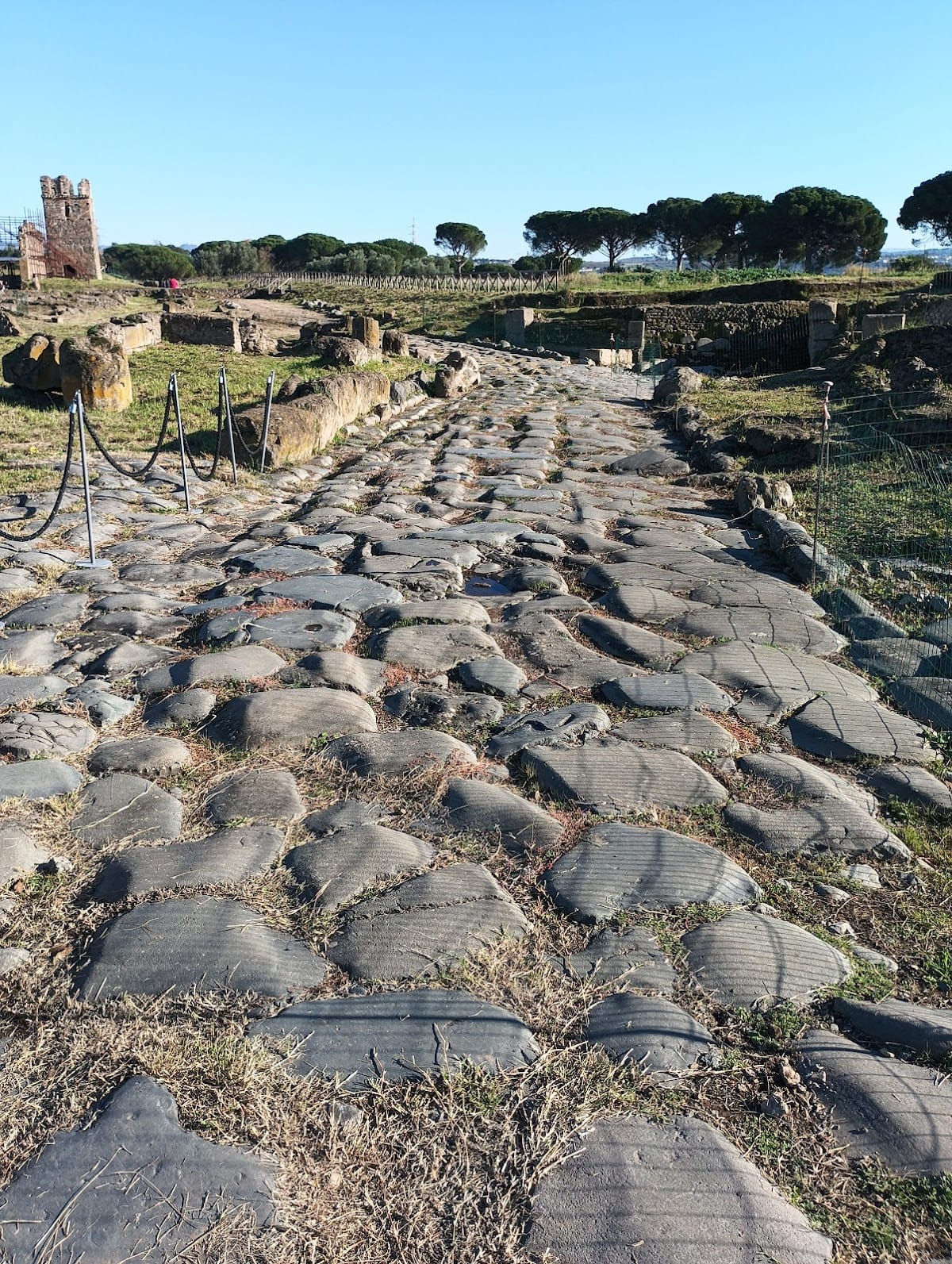
Geophysical survey revealed a regular, nearly right-angled street grid centred on the main road. Streets running across the slope were adjusted to the incline of the crater cone, producing a planned layout that reflects centralized coordination. The earliest excavated roads date to the late fifth century BC and were cut into bedrock. Later surfaces, from the mid-Republican period through Late Antiquity, used successive layers of compacted gravel and clay, while some sections were reinforced with lava slabs.
Sanctuaries and sacred spaces
Sanctuary of Juno Gabina
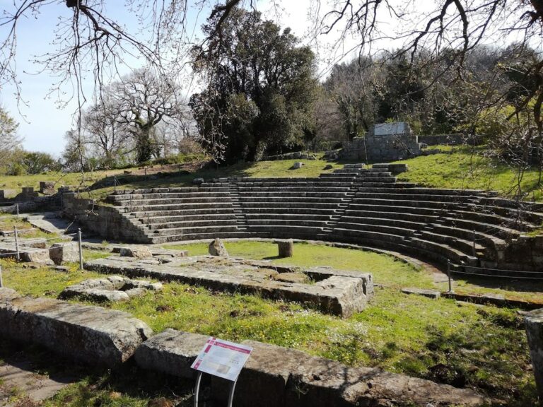
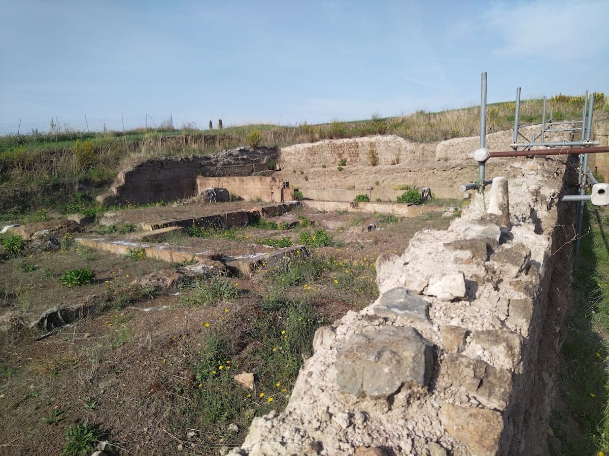
The sanctuary of Juno Gabina occupied a hillside west of the main settlement. Its complex included a temple, theatre, and other buildings. The temple is generally attributed to Juno, a Roman goddess associated especially with women, marriage, and the protection of the state, and dates to 150 to 100 BC. Its single cella, the principal enclosed room of a classical temple, was built from lapis Gabinus and stood on a podium at the centre of a precinct.
The façade had six Ionic or Corinthian columns, with six columns along each side except at the rear. Doric colonnades surrounded three sides of the precinct and stood in front of rooms that may have served several purposes, including use as temple shops. A painted inscription reading “IVN” on an antefix, an ornamental element fixed to the edge of a tiled roof, identifies the temple with Juno.
Approximately 55 tree pits behind the temple, on the cliff side above the road, represent a sacred grove. The religious complex began as a seventh-century BC grove in which one tree received special worship. A small shrine was added in the fourth century BC, and anatomical terracotta votives, clay models of body parts offered in hope of divine assistance, were found around it. Other discoveries include votive pedestals dedicated to Fortuna, a goddess associated with fortune and fate, a pavement inscription to Jupiter Jurarius, an epithet of Jupiter connected with oaths, and two additional shrines.
The temple of Juno continued in use during the Roman Empire after the town itself had been abandoned. The sanctuary was excavated by the Spanish School at Rome during the 1960s and 1970s.
Eastern sanctuary
The eastern sanctuary, within the city walls, was active from the seventh to the second century BC. It was probably dedicated to a female deity associated with childbirth, and several small bronze votive objects were found there. Its use ended from the second century BC, when settlement became more concentrated around the Via Praenestina.
Shrine of Domitia Longina
A building near the sanctuary of Juno was identified through a dedication naming its two financial sponsors as a shrine dedicated to Domitia Longina, the wife of Emperor Domitian. A medieval church stood immediately outside the ancient settlement.
Forum and civic sculpture
The forum lay east of the temple and is now buried. Hamilton described it as a rectangular piazza with a portico along three sides, while the remaining short side opened directly onto the Via Praenestina. Excavations in the forum area recovered 38 statues and busts, including representations of Venus, Diana, Nemesis, Agrippa, Tiberius, Germanicus, Caligula, Claudius, Nero, Trajan and Plotina, Hadrian and Sabina, Marcus Aurelius, Septimius Severus, Geta, and Gordian III.
The inscriptions on these sculptures mainly concern local and municipal matters. Many of the statues entered the Borghese collection and were later transferred to the Louvre.
Roadside baths and public infrastructure
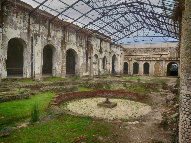
A public thermal complex discovered beside the road in 2013 covered approximately 250 square metres. It dates from the Augustan age to the first decades of the first century AD and remained in use at least until the fourth century AD. Its rooms included an entrance, a frigidarium or cold room, a tepidarium or warm room, and a calidarium or heated room.
The baths contained varied mosaic decoration. A mosaic in one heated room shows male figures riding fantastic marine creatures and uses yellow marble, white tesserae, and black tesserae. Another mosaic in the calidarium depicts four horse-drawn chariots around a central male figure identified by a black-and-white inscription as “Victor, guardian of the baths.”
Cemeteries and inscriptions
A necropolis lay beside the lake below the later Castiglione site, while the larger Osteria dell’Osa cemetery stood north of the Osteria dell’Osa inn. Osteria dell’Osa contained both inhumations and a smaller number of cremations. Early groups included male warrior burials, cremations in hut urns, and richer cremation graves with miniature bronze tools, weapons, and pottery.
Women’s burials included jewelry and spindle whorls. The cemetery’s northern and southern groups differed in urn covers, fibulae, razors, spearheads, and pottery decoration. Two archaic inscriptions from Osteria dell’Osa are among the oldest found in the area. One is a Greek inscription from the eighth century BC whose reading and meaning remain uncertain. The other is a Latin inscription from the seventh century BC, probably meaning “I greet you, Tita.” These finds are displayed in the Protohistory section of the National Roman Museum at the Baths of Diocletian.
Quarries and medieval remains
The quarries that produced lapis Gabinus lay immediately below the archaic city. Their stone was used at Gabii and in some buildings at Rome, while the scale of quarrying contributed to the late Republican depopulation of the city.
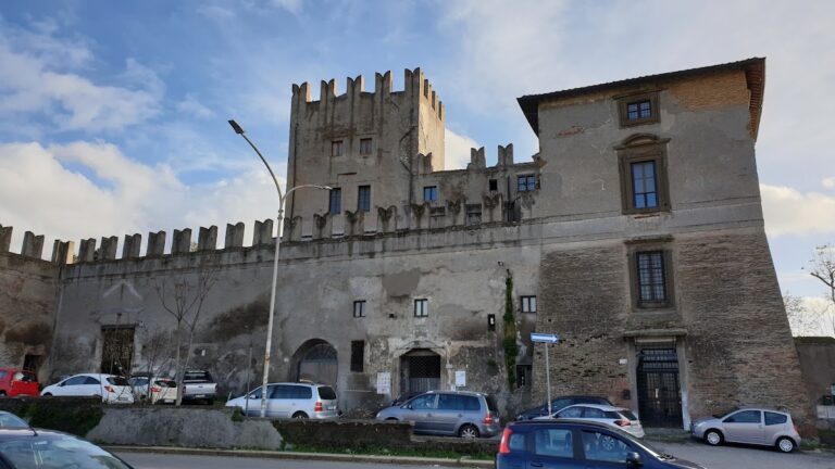
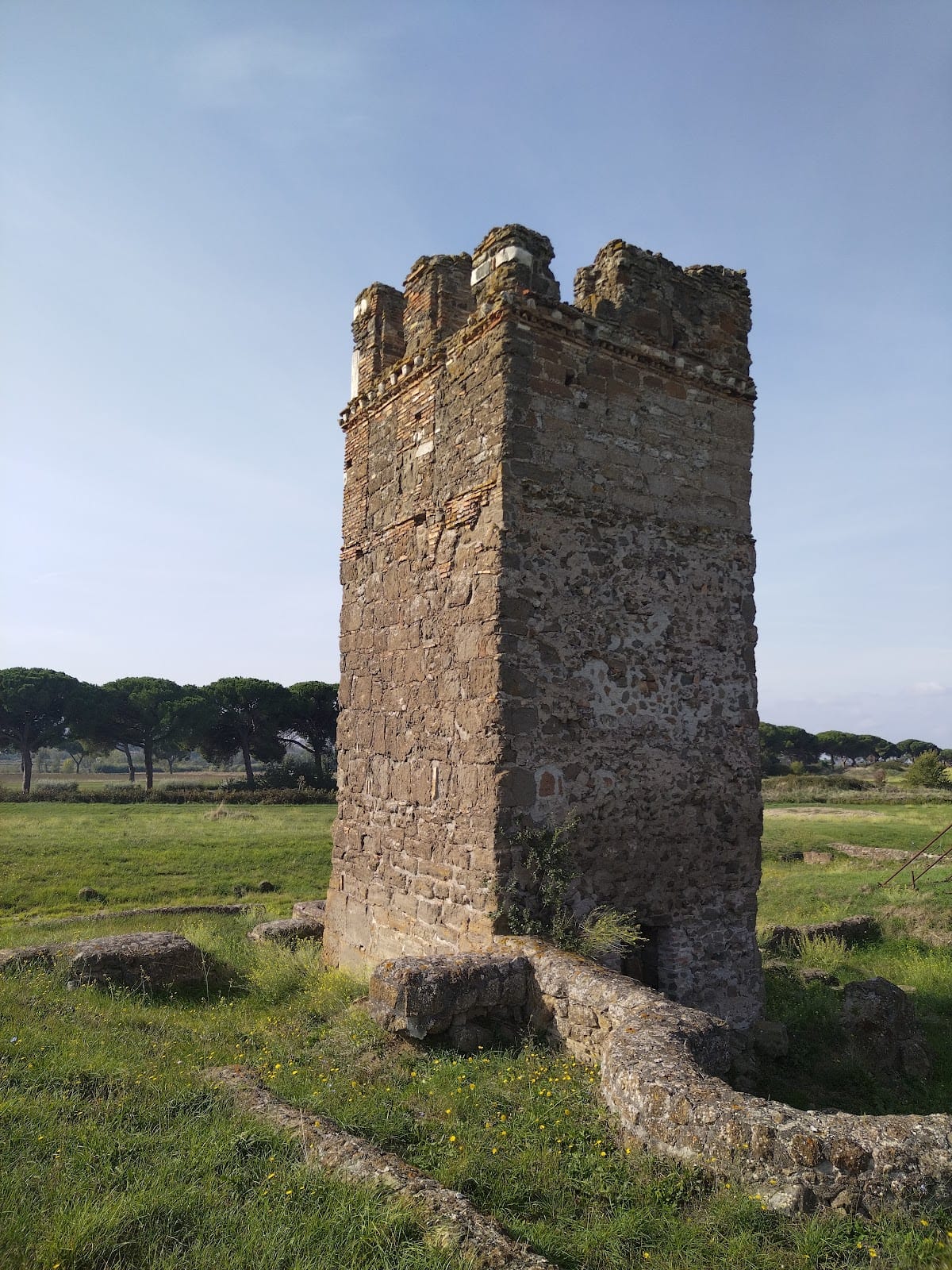
The medieval Tower of Castiglione marks the former citadel and stands on the ancient acropolis. The tower also gave the later lake its name, Lago di Castiglione, meaning “lake of the fortification.” The surviving archaeological landscape includes portions of the ancient settlement, the Via Praenestina, the forum area, city walls, the acropolis, sanctuary complexes, baths, cemeteries, and the medieval tower.