Parco Archeologico di Turris Libisonis: Roman Colonial City and Port in Sardinia


Site at a Glance
- Rating
- 4.5
- Popularity
- Low
- Country
- Italy
- Primary era
- Classical
- External website
- Open
- Eras represented
- Classical
- Civilizations
- Roman
- Site type
- City
On this page22 sections
History
Parco Archeologico di Turris Libisonis preserves the remains of a Roman colony at Porto Torres in Italy, founded at the mouth of the Mannu River during the first century BC, probably between 46 and 41 BC. Established by either Julius Caesar, the Roman military leader and dictator of the late Republic, or his adopted heir Octavian, later the emperor Augustus, the settlement was created during a period of Roman expansion in Sardinia. Its position on the Gulf of Asinara suited both river transport and maritime trade, while the surrounding area had already been used by prehistoric, Nuragic, Phoenician, and Carthaginian communities.
Foundation of the Roman colony
Turris Libisonis was a Roman colony, meaning a settlement organized for Roman citizens and connected to Rome through its civic and administrative institutions. Its residents held Roman citizenship, and the colony bore the title Iulia, linking it to the Julian political house. The foundation may have settled Roman veterans by granting them agricultural land, although the identity of the founder remains uncertain.
The name Turris Libisonis may have referred to a Nuragic tower near the river mouth. The element Libisonis has also been associated with Libya or with older Sardinian and Mediterranean place-names, but its exact origin is unresolved. Pliny the Elder provides the earliest surviving written reference to the city. Later references by Ptolemy and late antique writers, together with Roman milestones and itineraries, confirm its place within the island’s communications network.
Port, commerce, and imperial prosperity
Turris Libisonis developed as a major maritime crossroads between Rome and the northwestern Mediterranean. Its port maintained direct commercial links with Rome and Ostia, as well as with Gaul, the Iberian Peninsula, North Africa, and the Tyrrhenian coast. The city gathered and exported cereals, pastoral products, silver, lead, tuna, and garum, a fermented fish product. Fishing, mining, craft production, storage, and the transfer of goods between different forms of transport also supported its economy.
The settlement possessed both a river port and a maritime port, which probably operated together until at least the third century AD. By the later first century AD, it also had an aqueduct, baths, a forum complex with a Capitolium, curia, temples, basilica, and tribunal, along with an entertainment building known from inscriptions. Public works, warehouses, private houses, and the expansion of urban blocks reflected the city’s growing prosperity.
After Caralis, Turris Libisonis became one of Sardinia’s leading cities in population and prestige. Its greatest urban and economic development came during the Severan period, the era of the imperial dynasty that ruled mainly in the late second and early third centuries AD. At the beginning of the third century AD, the provincial governor spent part of each year there, and the city was described as exceptionally prosperous and magnificent. Expansion toward the river, improvements to the roads, private construction, and the construction or major development of the central and Pallottino baths belonged to this phase.
Late Roman transformation and decline
From the late third century AD, reduced resources contributed to the abandonment and deterioration of buildings and some major roads, particularly in the eastern and far western districts. Disused structures and former streets were gradually occupied by cemeteries. Christianization increased the need for burial space, and hypogeal cemeteries expanded across Monte Angellu toward the rock of San Gavino a Mare. According to local Christian tradition, the Turritan martyrs Gavino, Proto, and Gianuario were buried in this area after their martyrdom.
Pagan and Christian burial practices continued alongside one another until approximately the seventh century. The city’s decline accelerated during the crisis of the Western Roman Empire. Vandal invasion in the fifth century, Byzantine reconquest in the sixth, the Lombard threat, and the disruption of Mediterranean routes by Arab control all reduced its importance. The later emergence of the Sardinian giudicati, the island’s medieval territorial states, formed part of the wider political changes that accompanied its gradual depopulation.
Turris Libisonis remained the principal urban center of northern Sardinia through late antiquity. From the fifth century onward, some inhabitants moved inland toward the area of Sassari, which later became the region’s main urban center. Turris continued as an episcopal see from at least AD 484 throughout the Middle Ages, but its urban role was eventually superseded by Sassari by the thirteenth century.
Archaeological recovery
The archaeological park and the Antiquarium Turritanum preserve excavated remains and finds from the ancient city. Excavations by Massimo Pallottino in 1941 and 1942 exposed the bath complex later named after him. Work beneath the Comita atrium of the Basilica of San Gavino in 1988 revealed early medieval material, while a 1995 excavation in the western necropolis uncovered eleven burials, a coin, and ceramic material.
Demolition work in 2000 exposed an unknown underground funerary complex at 53 Via Libio. After an initial partial investigation, it was reexamined during an official excavation campaign in 2016. Harbor modernization also brought Roman remains to light between 2006 and 2009. Discoveries near the demolished lighthouse pier in 2006 and near modern Via Mazzini in 2008 led to further investigation, while a 2009 campaign examined the Pallottino Baths.
A new campaign begun in January 2022 followed the accidental discovery of Roman remains in 2020. It uncovered previously unknown structures and finds, including buildings that continued in use during the fourth and fifth centuries AD. Finely worked plaster and ceramics from those centuries provide evidence for continued activity during the late Roman period.
Remains
The ancient city occupied level ground west of the Mannu River and the northern slopes of the present Faro hill. The coast formed its northern boundary, while the eastern and southern limits remain uncertain beneath the modern town. On the western side, the urban boundary followed the line of the present Via Fontana Vecchia near the river and hillside. An Imperial-period circuit wall survives in the western sector, although the full perimeter of the settlement is not securely established.
Streets, bridge, and water supply
Urban roads
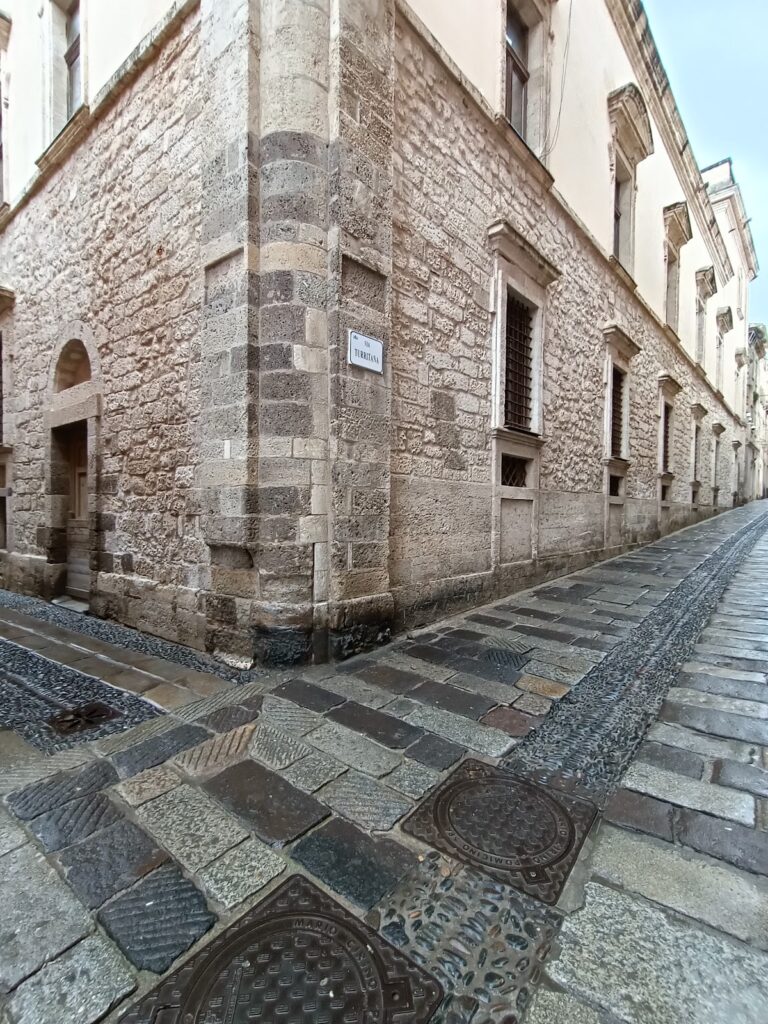
The park contains paved streets arranged around routes running northeast, northwest, and southwest from a Y-shaped layout. These Roman roads used smoothed, quadrangular trachyte blocks set between worked trachyte kerbstones. Their carriageways ranged from about 12 Roman feet to approximately 17 Roman feet wide. Major streets had covered drainage channels beneath their centers, with slightly concave surfaces that collected and discharged water.
Roads connected Turris Libisonis with other Sardinian settlements. The principal route toward Caralis was known as the Karalibus Turrem, and part of its course later influenced the modern SS 131. A surviving section lies near Su Crucifissu Mannu. Another branch near Bonorva led toward Olbia.
Roman bridge
The Roman bridge over the Mannu River was built in the early Imperial period with opus quadratum, a technique using regularly cut stone blocks laid in courses. About 135 metres long, it has seven arches and is described as the largest Roman bridge in Sardinia. The bridge connected the city with agricultural fields and mining areas in the Nurra and remains substantially preserved. Its higher arches may have allowed vessels to pass beneath it between the river and the sea.
Aqueduct and port installations
Water reached the city through an aqueduct drawing from springs in the San Martino area near modern Sassari. The route ran roughly parallel to the principal road toward Caralis, using underground channels as well as raised masonry carried on arches. It extended for about 30 kilometres and is now largely lost and in poor condition, although a section approximately 105 metres long survives within the archaeological area.
The ancient port system combined river and maritime installations. Remains attributed to the Roman port survive in the modern harbor area. An inscription dated AD 211 to 212 records construction of a protective structure, probably a mole or breakwater, against the Aquilo, a strong northerly or northeastern wind.
Houses and public baths
Residential districts
Excavated urban blocks include houses and tabernae, shops or commercial rooms, as well as larger aristocratic residences. The Domus of Orpheus takes its name from a polychrome mosaic showing the poet playing a lyre among animals. Painted wall plaster and further mosaic pavements also belonged to the house.
The House of the Mosaics had an unusual fan-shaped plan, with decoration dominated by marine subjects. A private bath installation formed part of the residence. The Domus of the Satyr produced a marble mask that is displayed in the Antiquarium Turritanum.
Central baths
The central baths were public and occupied an entire block of about 2,000 square metres near the Domus of Orpheus and the House of the Mosaics. Traditionally called the Palace of King Barbaro, the complex is not thereby established as a royal palace. Its rooms served hot, warm, and cold bathing, massage, sauna use, and exercise. Surviving exterior walls and rooms retain mosaic decoration, while refined mosaics, statues, and reliefs were recovered from the complex.
Maetzke Baths
The public Maetzke Baths date from the Augustan period. Only one room survives. The complex takes its name from the archaeologist who discovered it.
Pallottino Baths and Peristyle
The Pallottino Baths date from the late third century AD and preserve parts of three investigated rooms. They were associated with the Pallottino Peristyle, a colonnaded portico that gave access to shops linked with the forum. Four columns of the portico survive, and the complex originally faced the sea.
Religious and civic buildings
Religious activity included a public cult of Isis, an Egyptian goddess whose worship at Turris Libisonis was connected with maritime activity and the protection of sailors. The Altar of Bubastis and another altar, now in the Sanna Museum in Sassari, attest this association. Other Egyptian or eastern cults included Bubastis, Jupiter Ammon, and Mithras, the central deity of a Roman mystery cult that spread widely among soldiers and merchants.
A marble inscription dated AD 244 records a Temple of Fortuna and a basilica. This civic basilica served public meetings and was distinct from the later Basilica of San Gavino. The park also includes parts of the forum area and other public structures that formed the administrative and ceremonial center of the colony.
Industrial areas and cemeteries
Riverbank production and storage
The eastern bank of the Mannu contained Roman ceramic kilns and facilities for storing goods. These installations belonged to the productive and commercial landscape around the settlement, alongside the port and routes that carried agricultural, mineral, and fish products.
Western and southern necropolises
The western bank became a funerary area from the second century AD. Its burials included amphora graves, graves covered with roof tiles, and stone-lined coffins. The southern necropolis, now beneath the modern town, included about 50 arcosolia, arched recesses cut into rock or walls for burials. They were arranged in four rooms cut into a limestone hill, together with sarcophagi and simple pits.
Tanca Borgona hypogeum
The Tanca Borgona hypogeum, an underground or partly underground chamber, dates from the third or fourth century AD. Its single rock-cut room contains 32 burials. Two columns were carved from the surrounding tuff, and parts of the fresco decoration survive. A cylindrical columbarium, a structure for containing cremation remains, was built in opus cementicium, Roman concrete containing aggregate, during the second century AD. Marble slabs covering the burials were decorated with frescoes and mosaics.
Coastal funerary complexes
The Scogliolungo funerary complex and the Balai tombs formed part of the eastern coastal burial zone. The Balai tombs are early Christian and lie near San Gavino a Mare on the cliff above the coast. They are associated with the cult of the Turritan martyrs. The funerary monuments at San Gavino a Mare later supported the Basilica of San Gavino.
Late Roman structures
Excavations begun in 2022 revealed a third-century AD domus, an urban private house, with a mosaic floor and a large adjoining room. Another irregularly planned room also had a mosaic floor and seats along all four walls. It has been interpreted as a probable apodyterium, or changing room, serving a nearby bath complex. Finely worked plaster and ceramics dated to the fourth and fifth centuries AD came from the newly exposed structures, whose continued use extended into late Roman times.