Carsulae: A Roman Road City and Trading Center in Italy


Site at a Glance
- Rating
- 4.5
- Popularity
- Medium
- Country
- Italy
- Primary era
- Classical
- External website
- Open
- Eras represented
- Classical, Medieval
- Civilizations
- Roman
- Site type
- City
On this page26 sections
History
Carsulae is a Roman city in Italy, near present-day San Gemini and Terni, that developed along the western branch of the Via Flaminia. Its growth began beside one of central Italy’s major Roman roads and reached its most organized form under Augustus, when the settlement became a municipium, a town incorporated into the Roman state while retaining local civic administration. Carsulae served as a regional market, trading post, and supply center for Umbria, linking the road network with the agricultural uplands at the foot of the Martani Mountains.
Origins beside the Via Flaminia
The date of Carsulae’s first settlement remains uncertain. A foundation around 220–219 BC has been proposed in connection with the construction of the Via Flaminia, but remains from the third or second century BC have not been found within the city itself. Earlier Umbrian occupation is known in the wider area, including polygonal walls of the fifth and fourth centuries BC near Cesi.
The Via Flaminia was laid out in 221–220 BC by Gaius Flaminius Nepos, a Roman censor whose name the road retained. It linked Rome with the Adriatic coast and divided near Narnia into eastern and western branches. The western route passed through Carsulae from south to north, attracting goods, travelers, and people from the surrounding uplands. The road gave the settlement its main economic purpose and shaped its later urban plan.
Augustan development and civic life
Carsulae became a properly structured city during the reign of Augustus. Most of its public buildings probably followed the restoration of the Via Flaminia in 27 BC. As a municipium, the city possessed a degree of local self-government. It was initially administered by two duoviri, magistrates serving in a college of two men, and later by four quattuorviri.
The city prospered through its position on the road, its agricultural hinterland, and its function as a market and transshipment point. A theater, temples, and mineral baths provided public amenities for inhabitants and travelers. The Greek geographer Strabo included Carsulae among the important places along the road. In AD 69, Tacitus recorded that commanders of Vespasian rested there for several days because the city offered broad views and a dependable food supply. Pliny the Elder probably referred to the same fertile plain when describing Umbrian viticulture.
Expansion under the emperors
Construction continued through the Julio-Claudian and Flavian periods and into the third century AD, as inscriptions indicate. The theater and much of the central public complex probably date from the first century AD, while the amphitheater is generally attributed to the Flavian period. Carsulae was an unfortified road settlement, and its position and period of development may have made defensive walls seem unnecessary.
Decline and abandonment
Decline probably began in the later third century AD, when the main north-south traffic shifted to the eastern branch of the Via Flaminia through Terni and Spoletium. Inscriptions cease after the reign of Diocletian. A major earthquake probably damaged much of the city in the middle of the fourth century, after which the unfortified settlement may have suffered repeated plundering.
Carsulae was gradually abandoned during the fifth or sixth century, as its population probably moved to San Gemini. Earthquake damage, the loss of road traffic, economic decline, insecurity during the weakening of Roman authority, and later conflict along the western branch of the Via Flaminia may all have contributed. During the sixth to eighth centuries, the so-called Longobard Corridor may have diverted further north-south traffic toward the Via Amerina.
Medieval reuse and rediscovery
After abandonment, deposits from the surrounding hills covered parts of the city. Its buildings became a source of stone for San Gemini, Acquasparta, Cesi, Terni, Massa Martana, and smaller settlements, while portions of the site returned to agricultural use. Roman materials from Carsulae were reused in later buildings, including the former church of Sant’Andrea at Cesi.
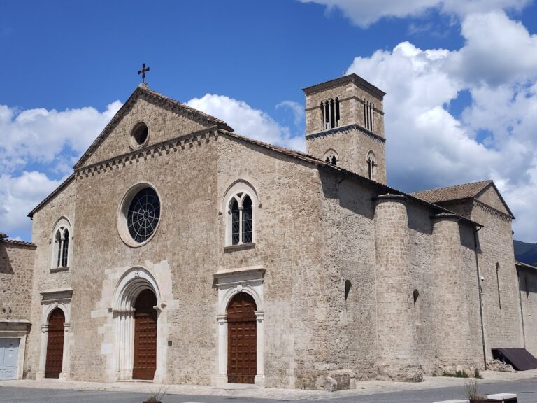
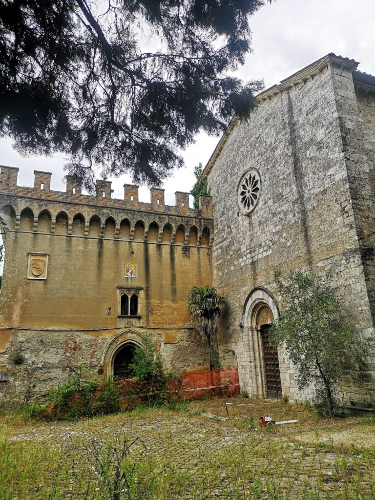
A Benedictine community probably founded a monastery at Carsulae in the eleventh century. The small church of Saints Cosmas and Damian was probably built on the abandoned Roman site during the medieval period. About one hundred nuns were apparently transferred elsewhere by Pope Honorius III in 1220, and Pope Gregory IX gave the monastic complex to the Cistercian Order in 1230.
Federico Cesi began the first known explorations in the sixteenth century, removing Roman objects and inscriptions for display in Palazzo Cesi at Acquasparta. Pope Pius VI organized a larger excavation in 1783, and many finds were transferred to the Museo Pio Clementino in the Vatican. Further work followed under the archbishop of Spoleto in 1851, with some finds sold to finance the excavation.
Modern excavation
Systematic excavation began under Umberto Ciotti in 1951 after 22 hectares were expropriated in 1950. Work continued through 1972 and concentrated on the forum, theater, amphitheater, and paved urban section of the Via Flaminia. The campaign comprised eighteen excavation sites and was followed by conservation and restoration of the exposed remains.
Excavation of the baths resumed in the 2000s after an interruption of about thirty years, under Jane Whitehead of Valdosta State University in collaboration with the Associazione per la Valorizzazione del Patrimonio Storico San Gemini. From 2012, investigations extended into the northern sector and forum area. They revealed additional rooms, completed the excavation of the probable Capitolium, and exposed a large domus in the southwest sector.
Remains
The excavated remains occupy a plain about 450–500 metres above sea level at the foot of the Martani Mountains. Carsulae also extended onto a travertine plateau projecting from the slope of Monte Torre Maggiore, which rises to 1,121 metres. Only part of the ancient city has been excavated. Medieval quarrying reduced many buildings to low walls and foundations, while deposits from the surrounding hills left numerous structures as slight rises beneath the grass before excavation.
The road and urban center
Via Flaminia
The Via Flaminia crossed Carsulae from south to north as the cardo maximus, the principal north-south street of a Roman town. Its surviving urban stretch retains paving made from stone blocks, along with sidewalks and drainage channels. The paving reflects several rebuilding phases, including later repairs. Near the southern baths, irregular dry-laid walls may have supported an early crossing over a change in level or a small watercourse. A road descending toward the amphitheater was damaged when part of the underlying depression collapsed. Its sunken white paving was retained, while reddish limestone was used for the ancient repair that remains visible.
Forum and entrances
The trapezoidal forum lies west of the Via Flaminia. It was originally surfaced with pink marble slabs, some of which survive, and was enlarged and regularized during the Augustan period on a platform supported by vaulted construction. Two monumental four-sided arches, or quadrifronts, marked the eastern entrances. Twelve steps connected the southern passage with the Via Flaminia, while the northern passage stood almost level with the forum. One arch at the southern entrance has been partly reconstructed.
Public buildings and religious spaces
Twin temples and civic rooms
Two closely similar temples stand at the southeast end of the forum. Each had a cella, the principal enclosed chamber, and a porch on a podium, probably with four columns across the front. Remains beneath and behind the podia may belong to a Republican-period portico. Their similarity has led to a tentative identification with Castor and Pollux, although the divinities remain uncertain. Rooms behind the eastern podium probably served as tabernae, or shops.
Four rooms of different sizes face the twin temples across the forum. Each has an apse, and all were faced with marble, with marble and opus sectile decoration in their floors. Opus sectile used cut pieces of stone or marble fitted into geometric patterns. In the largest room, a plastered brick wall later closed the apse. A seated statue larger than life-size, a portrait head of Emperor Claudius, and other statue fragments connect part of the complex with the imperial cult, the public religious practices honoring the emperor and his household. The largest room is now considered probably to have been the curia, or municipal council house.
Capitolium
A small temple on the western side of the forum retains fragments of its entablature and ornamental decoration. It is probably Carsulae’s Capitolium, a Roman temple dedicated to the Capitoline Triad of Jupiter, Juno, and Minerva.
Basilica and lodging facility
The basilica east of the Via Flaminia was a large public hall used for legal, administrative, commercial, and civic purposes. Its rectangular interior was divided into a central nave and two side aisles by rows of columns or pilasters, whose bases partly survive. An apse on the eastern side probably held a magistrate’s chair for arbitration and the administration of justice. The building survives chiefly at foundation level, although its western and eastern sides reach the level of the floor. Foundations south of the basilica may belong to a hospitium, a lodging facility for travelers.
Theaters and associated buildings
Theater
The theater was built against the slope of Monte Torre Maggiore, which accommodated its semicircular seating area, or cavea. The cavea measures about 62 metres across. A high stage façade once closed the performance area, and large blocks from its upper entablature survive. Its principal walls use opus reticulatum, a technique formed from small, regularly arranged diamond-shaped masonry units, supporting a date in the first century AD.
Amphitheater
The amphitheater stands slightly askew from the theater’s axis in a natural depression formed by the collapse of an underground karst cavity, or doline. The depression allowed the lower seating to be cut into its sides, while retaining walls secured the structure to the north and south. The elliptical building measures about 87 by 62 metres and was constructed mainly from layers of limestone blocks and brick.
A channel between the theater and amphitheater was supplied by a cistern south of the amphitheater. It may have allowed the arena to be flooded for naumachiae, staged naval spectacles. A building north of the theater has a columned entrance and interior. It is probably the schola, or meeting building, of the local Collegium Iuvenum, a youth association whose existence at Carsulae is known from inscriptions now preserved in San Gemini.
Church and southern facilities
Church of Saints Cosmas and Damian
The church of Saints Cosmas and Damian stands at the southern end of the urban center beside the forum. It was built over a Roman building, perhaps the nearby macellum, or market building, although that identification remains uncertain. Possible ancient arcades survive in one wall, later filled with brick. The original church had a rectangular nave and an apse with a narrow single-light window. A portico, interior arcades or colonnades, and extensive spolia, reused architectural materials from Roman buildings, were added later.
The portal tympanum carries a relief of two saints receiving healing water from a cross. Fragments of frescoes survive on the rear wall and in the apse. The church was restored in 1691.
Cisterns and baths
Cisterns supplied Carsulae with water over several centuries. Another cistern south of the city was adapted as an antiquarium. At the southern end of the urban area, the baths drew on natural mineral springs. Excavated rooms include a large apsidal chamber with a mosaic pavement, praefurnia, or furnace rooms, and suspensurae, the raised supports that allowed heated air to circulate beneath a floor. An excavation in 1783 revealed a mosaic with marine scenes, while later work uncovered additional rooms and led to a preliminary reconstruction of the bath complex.
Northern gate and necropolis
Arch of Trajan
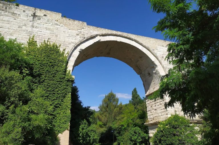
Two gates marked the limits of the urban area despite the city’s unfortified layout. The northern gate crossed the Via Flaminia and probably had three passages. Only the central arch survives, while the side passages were narrower and lower. Known as the Arch of Trajan or Arch of San Damiano, it was built from squared limestone blocks apparently intended to receive marble facing. Clamp holes and unfinished surfaces indicate the planned treatment.
Funerary monuments
A necropolis lay north of the gate. Its best-preserved round tomb has a cylindrical drum 17 metres in diameter on a square base. Parts of the upper structure and its crenellations have been reconstructed. The missing earth filling and tumulus reveal six radial walls extending from a central core to the outer drum. An inscription fitted to the drum names the gens Furia and commemorates a father and son, both called Caius Furius Tiro, who had served as quattuorviri. Lucius Nonius Asprenas and two women of the gens Furia made the dedication. The inscription dates to the second half of the first century AD and is preserved at Palazzo Cesi in Acquasparta.
Another monument, known as the tower tomb, has a circular upper section on a square base and more elongated proportions than the round tomb. It probably dates from the late Republic or early Empire. Its metope-triglyph frieze depicts weapons, animals, and ornamental figures. The excavated necropolis contains three funerary monuments in all. A second was substantially reconstructed by Ciotti as a cylindrical structure with a Doric frieze above a rectangular base, while a third retains its square base without reconstruction.
Nearby, a travertine sarcophagus with a lid contained a lead sarcophagus holding the remains of a young girl. A pair of earrings and a finely made gold necklace accompanied the burial.
Southwestern residence
Large domus
A large Roman domus facing the forum was excavated in the southwest sector. Covering more than 3,000 square metres, it contains peristyles, nymphaea, private baths, and refined black-and-white geometric mosaics. The mosaics uncovered so far occupy about half of the total area and remain exceptionally well preserved.