Archaeological Site of Aptera: An Ancient Greek City-State in Crete
Site at a Glance
- Rating
- 4.6
- Popularity
- Medium
- Country
- Greece
- Primary era
- Classical
- External website
- Open
- Eras represented
- Classical, Medieval, Early Modern, Modern
- Civilizations
- Ancient Greek, Byzantine, German, Roman, Venetian
- Site type
- City
On this page33 sections
History
The Archaeological Site of Aptera in Greece preserves the remains of an ancient Greek city-state founded during the Geometric period, probably in the 8th century BC. Aptera occupied Paliokastro hill above Souda Bay, where its elevated position overlooked the Apokoronas plain and the White Mountains. Two ports, Minoa at modern Marathi and Kissamos near modern Kalives, supported its commercial and political development.
Origins and the Geometric Period
The earliest known written form of Aptera’s name, A-pa-ta-wa, appears on a Linear B tablet from Knossos dating to the 14th or 13th century BC. The city itself was founded later. Burials in the nearby cemetery place its foundation in the Geometric period, an early phase of Greek history associated with the 9th and 8th centuries BC and named for its characteristic geometric artistic styles.
The Minoan settlement at Stylos, approximately 1.5 kilometres away, was a separate site rather than an earlier phase of the city. Aptera’s position on the hill gave it control over important land and maritime connections. Its territory included surrounding villages and agricultural land, although its exact boundaries remain uncertain.
Growth and Hellenistic Power
Aptera reached its greatest prosperity in the Hellenistic period, the era that followed the conquests of Alexander the Great and lasted until Roman annexation in the eastern Mediterranean. Its economy may initially have been connected with regional metalworking. The city became known for its archers, who served as mercenaries beyond Crete, while its ports supported broader commercial relationships.
Imported silver from Egypt and Cyrenaica allowed Aptera to issue its own coinage. Seventy-six coin types are known, many depicting Artemis and carrying the names Aptaraion, Apteraion, or Pteras. During its prosperous period, the city is estimated to have had approximately 20,000 inhabitants. Free residents included merchants, landowners, and shipowners, alongside a much larger enslaved population.
Aptera’s military and diplomatic connections brought it into the conflicts of the Greek world. Pausanias records that Apteran archers fought alongside Sparta in the Second Messenian War in 668 BC. In the 5th century BC, Aptera did not join the Persian Wars, the conflicts in which Greek states resisted the expansion of the Persian Empire, but imported pottery indicates commercial relations with Athens.
In 267–266 BC, Aptera supported Sparta against Macedonia during the Chremonidean War. In the Cretan conflicts of the 3rd century BC, it generally allied with Knossos. During the Lyttian War in 220 BC, however, forces associated with Gortyn, Polyrrhenia, and Philip V of Macedon besieged the city. Aptera then joined the camp of Gortyn.
In 183 BC, Aptera entered an alliance of thirty cities with Eumenes II of Pergamum. It later honoured Attalus II of Pergamum with a bronze statue. The city also appointed proxenoi, citizens who represented another city’s interests in their own community, in Cretan cities, the Peloponnese, the Aegean, Asia Minor, and along the Adriatic coast.
Religion and Civic Life
Artemis was Aptera’s principal deity. Religious activity connected with her reaches back to the 8th century BC. Inscriptions refer to athletic contests held in her honour during the 3rd and 2nd centuries BC, a sanctuary associated with the renewal of an alliance with Teos in 170 BC, and a votive dedication to Artemis under the title Eileithyia, the goddess associated with childbirth.
Other deities worshipped at Aptera included Dionysus, Demeter, Persephone, and Isis. The city’s religious life continued through the Roman period, when older cults remained active and new or expanded forms of worship appeared. A small temple of Demeter and Persephone was excavated in 1958, while evidence for the cult of Isis was found in the necropolis. The cult of Dionysus also continued.
Roman Rule and Late Antiquity
During the Roman conquest of Crete in 67–63 BC, Aptera surrendered without fighting. Roman taxation was relatively low, but the city was already declining and may have become administratively dependent on neighbouring Kydonia. It nevertheless experienced renewed prosperity during the 1st and 2nd centuries AD, when public infrastructure expanded through the construction of baths and large water-storage systems.
Aptera began to decline from the 3rd century AD as Kissamos and Kydonia grew more prosperous. A major earthquake around 365 AD destroyed or severely damaged parts of the city, including the baths and a Roman house. Some buildings were then roughly altered and reused. Occupation continued into the Byzantine period, and a Christian church dated to the 7th or 8th century AD was built with graves beneath its floor.
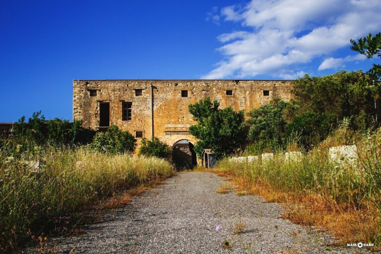
A further earthquake in the 7th century and a Saracen raid in 823 contributed to the city’s abandonment. Around 1182, a monastery dedicated to Saint John the Theologian was constructed in the centre of the ancient city. Owned by the Monastery of Saint John the Theologian on Patmos, it remained active until 1964.
Later Reuse and Rediscovery
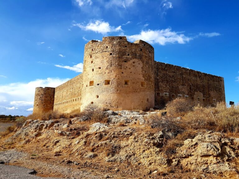
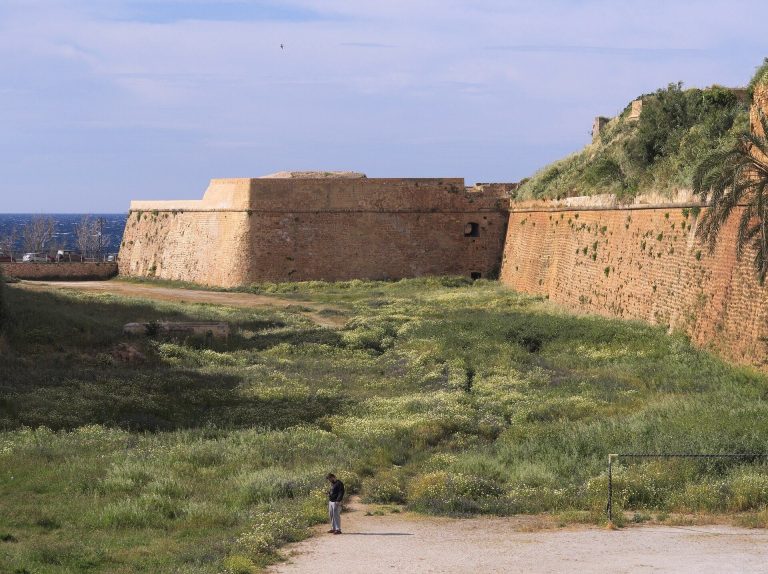
The Venetians later built a fortress at the northeastern edge of the ancient city. Pirates destroyed it in 1583, and the Ottomans restored it in 1866–1867 during the Cretan revolt. Stone from Aptera was also reused in the 19th century for the Ottoman fortress of Izzeddin at Kalami, constructed in 1872.
German forces occupied the site after the Battle of Crete during the Second World War. Their defensive positions, including machine-gun emplacements built with stones taken from the ruins, remain visible.
Early travellers sometimes identified the ruins incorrectly as Minoa or other places. Robert Pashley recognised them as Aptera in 1834, supported by coins bearing the city’s name and a city decree found near the monastery. Carle Wescher’s excavations in 1862 and 1864 uncovered the Wall of Inscriptions, whose decree honoured Attalus II and confirmed Pashley’s identification. Further inscriptions were found in 1928.
German excavations took place in 1942 during the occupation. Stylianos Alexiou led further work in 1958, followed by campaigns in 1986–1987 and 1992–1995. Excavation continues across the site. The theatre was excavated in 2008–2009, and a conservation programme stabilised and restored the monument while preserving the surrounding terrain and vegetation. The Greek Ministry of Culture and the Ephorate of Antiquities of Chania administer the archaeological site. The former monastery accommodates archaeological teams, and one room contains an exhibition on Aptera’s history, architecture, and excavations.
Remains
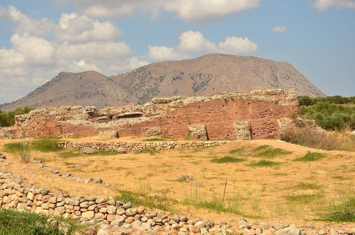
Aptera occupied the plateau of Paliokastro hill at approximately 231 metres above sea level. A fortified circuit 3,480 metres long enclosed the plateau, whose interior contained urban, religious, domestic, funerary, and public areas. The remains combine Hellenistic and Roman construction with later Byzantine, Venetian, Ottoman, and modern military features.
Fortifications and Gates
City Walls
The fortifications were built before the middle of the 4th century BC. Their course follows the natural terrain rather than a single uniform plan, using defensive ridges and the rocky southern and southeastern slopes. At least six towers formed part of the system. The north and northeast walls use large stones of uneven size, while the east side combines rectangular ashlars with irregular blocks in a mixed polygonal style. The west and southwest sides display more carefully finished pseudo-isodomic masonry, in which shaped blocks are laid in horizontal courses that may differ in height.
Sally ports, cross-walls, and multi-storey towers were incorporated into the circuit for defence and the use of war machines. Excavation on the western side revealed evidence of a Hellenistic siege, including catapult shot, sling bullets, moulds, spearheads, and arrowheads. These remains relate to the siege of 220 BC during the Cretan War, when Polyrrhenia and its allies, including Philip V of Macedon and the Achaeans, attacked Aptera.
Western Gates
Three gates opened through the western fortifications, two toward the southwest and one toward the northwest. The principal gate was flanked by a rectangular tower on the west and a curtain wall on the east. The lower stones of its door jambs survive, and a paved access road approximately 3.5 metres wide approaches from the north. Cart ruts remain visible near the entrance.
The western tower of the principal gate was founded on bedrock. Its surviving lower section belongs probably to a two-storey B-type tower with a gabled roof, arrow slits, and openings for war machines. Another northeastern entrance, known as the Iron Gate, retains substantial monolithic door jambs. A paved road from this gate led toward Kissamos, settlements in the valley, and cities farther east. A further gate connected the city with the valley.
Theatres and Public Roads
Main Theatre
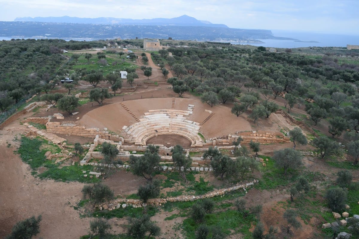
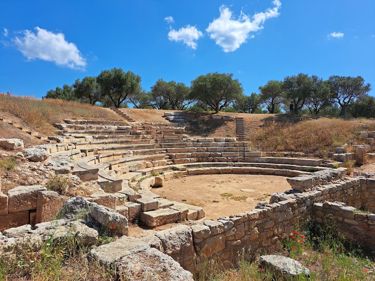
The main theatre occupies a natural hollow near the southeastern gate and faces south toward the White Mountains. It was built from local fossiliferous limestone. Its cavea, the seating area, measures 54.68 metres in diameter and is divided by five staircases into four wedge-shaped sections. At least 26 rows of seats survive in the structure, while the orchestra, the circular performance area, has a radius of 5.45 metres.
Construction began in the first half of the 3rd century BC, during the Early Hellenistic period. The first phase included the southern stage wall, most of the parodoi walls at the sides of the performance space, the retaining wall around the cavea, and the substructure supporting the seats. In the second half of the 1st century AD, Roman remodelling gave the cavea its final form, replaced the stage, and lowered the orchestra floor. A later Roman phase altered the stage building, repaired the structure, and remodelled the lower seating area.
The theatre was severely damaged when a modern lime kiln was built at the centre of the cavea. During the 20th century, seats and architectural elements were burned to produce quicklime. The tiered rubble-masonry substratum is consequently visible across much of the seating area. Conservation and restoration have stabilised the monument and incorporated the ancient road beside it into the modern presentation scheme.
Rectilinear Theatre
A second, rectilinear theatre was built shortly after the main theatre, in the first half of the 3rd century BC. It is set against the rear of the horseshoe-shaped theatre and faces north. Its position may have allowed it to function partly as a retaining structure supporting the earlier building.
The rectilinear theatre measures 50 metres in length. Four staircases divide the seating into four approximately equal sections. Four rows of seats and the foundations for two further rows survive, while the original arrangement probably held 11 to 13 rows for approximately 600 to 720 spectators. Cuts in the central seats indicate reserved places for important individuals.
Its form resembles Minoan theatral areas used for religious ceremonies and athletic events. At Aptera, the building may have accommodated religious ceremonies, athletic contests, or political gatherings. Its exact function remains uncertain, but it was distinct from the main theatre and from a stadium.
Ancient Paved Street
An ancient paved street runs east of the theatres. Dating to the Hellenistic period, it is 55 metres long and served the theatre, public buildings, and sanctuaries in the surrounding area. It reached the main theatre through the eastern parodos or by a broad staircase, part of which survives. Its northern end meets the eastern side of the rectilinear theatre.
Temples and Civic Buildings
Two-Room Temple
A small two-room temple dating to the 5th century BC stands beside a paved road running south toward the theatre. The building is preserved to a low height and measures 6.32 by 3.96 metres externally. Each interior room is 2.26 metres wide and 3 metres deep. Uniform dressed ashlars were joined lengthwise by iron clamps shaped like double axes and vertically by iron dowels.
The entrances stood on the east side within an enclosure containing a small plain altar. The temple appears to have been built over an earlier place of worship used from at least the Geometric period. Its division into two rooms indicates a religious function, and Artemis and Apollo were probably worshipped there jointly during the Classical period.
Sanctuary Area and Public Building
The road beside the temple ran between the building and a substantial east-west retaining wall. A public building, probably a stoa, stood beside the road and may have formed part of the sanctuary of Artemis. Travellers described a Wall of Inscriptions in this area. It carried resolutions of the city council and the people of Aptera, including the decree that helped identify the ruins.
Building with Three Niches
At the eastern edge of the fenced area, a building preserves the west wall of a structure with three niches standing to considerable height. It may have served a public function and has been proposed as the Roman bouleuterion, a meeting building for the city council, although that identification remains unconfirmed. Test trenches show that the structure was founded over an earlier building.
Roman Baths and Water Systems
Bath I
The Roman baths comprise two complexes connected with the city’s cistern system. Bath I lies north of the three-aisled cistern and has a clearer plan. Its eastern zone contained three rooms with hypocaust heating, an underfloor system in which hot air circulated beneath a raised floor. Rooms A, B, and E formed part of this heated area.
The western zone contained two rooms with bathtubs, an arched room, a corridor, and three incompletely excavated northern rooms. Three corridors probably held auxiliary spaces and furnaces. A small arched room south of them probably belonged to the heated section. Cavities for wall-heating pipes and a chimney duct survive in its rubble masonry.
Room A is fully excavated and measures 4.50 by 5 metres internally, excluding its niches. Its hypocaust floor stood on small brick pillars. An almost square room north of the corridor had a pebble floor partly faced with marble, a tiled pitched roof, and a double doorway to Room A. Its function is uncertain, although it may have served as an antechamber.
A fragmentary inscribed lintel, probably from the main entrance of the bath linked to the three-aisled cistern, states that Varius Lucius Lampadis of Athens built the baths. The inscription dates to the first half of the 1st century or the early 2nd century AD.
Bath II
Bath II probably served as another public bath. Its eight vaulted rooms included a hypocaust, an arched room with two bathtubs, a furnace, and chimney ducts. Water reached the complex from the L-shaped cistern. The earthquake around 365 AD caused extensive destruction, especially in Bath I, after which some rooms were roughly altered and reused. Bath II retains better-preserved walls, while Bath I provides a clearer ground plan.
Cisterns
Aptera’s two principal cisterns were public installations built into the rock and covered by vaults. Their upper sections were constructed, and exterior buttresses resisted the pressure of stored water. The reservoirs were made with opus caementicium, Roman concrete, and coated with waterproof hydraulic mortar. Surface conduits connected them with smaller cisterns, and roof openings probably collected rainwater.
The three-aisled cistern lies south of the bath it supplied. It measures 17 by 25 metres internally and held approximately 2,900 cubic metres of water. A row of sturdy piers probably belongs to an earlier Hellenistic phase. Its original brick vaults collapsed in antiquity, while the surviving stone vaults are later and contemporary with the medieval monastery.
The L-shaped cistern has a long arm 55.80 metres long and a short arm 34.20 metres long. It is 9 metres wide overall and held approximately 3,050 cubic metres. Cleaning and consolidation revealed a sedimentation shaft and a narrow closed outlet pipe that may have formed part of a cleaning system. The springers of its original brick vault remain visible.
A small rectangular Hellenistic cistern lies between the L-shaped reservoir and the bath to the north. The two principal cisterns were planned with the bath complexes to provide the large quantities of water required for their operation.
Roman Domestic Architecture
Roman House
The Roman house west of the theatre was built in the 1st century AD, probably after the earthquake of 66 AD. It remained in domestic use through successive modifications until the earthquake of 365 AD. The excavated area covers 765 square metres. Later activity reused parts of the complex between the 5th and 7th centuries AD.
The house was arranged around a courtyard with a Greek-derived peristyle, a colonnaded court. Its entrance opened from a paved public street to the south through a vestibule containing a lararium, or household shrine. A double doorway connected the vestibule with the interior. Bedrooms lay west of the courtyard, while a room west of the cistern and opening onto the peristyle may have served for dining or reception.
The courtyard contained a large cistern rather than the more usual Roman impluvium, a shallow basin that collected rainwater through a roof opening. The cistern opening was incorporated into the west wall, beside a stone fountain base. An intact clay water jar dating to the late 3rd or early 4th century AD was found on the cistern floor. A stone olive-press bed, or trapetum, had probably been moved into the house, while a stone mortar indicates everyday activity during the final phase of occupation.
The peristyle had a stylobate and a colonnade arranged in five by seven columns, with Ionic bases and Doric capitals. Fallen column drums and capitals in the courtyard reflect the earthquake destruction. The tile-roofed stoa around the court carried colourful wall paintings, and the courtyard probably contained a garden. Small decorative sculptures and a marble table base were found in the garden area.
A bronze statue of Artemis and a marble statue of Apollo stood on one stone base in the destruction layer of 365 AD. Together, the figures represented Aptera’s tutelary deities.
Cemeteries and Funerary Monuments
Western Cemetery
The main cemetery lay outside the western fortifications, where wealthy families constructed mausolea near the principal gate. The oldest burials date to the Geometric period and support the 8th-century BC foundation date for the city. Early graves commonly placed the deceased in a large pithos, a storage jar also used for burial, set within a rock-cut grave and accompanied by simple pottery offerings.
From the 7th to the 1st century BC, burials included rectangular rock-cut graves covered by stone slabs, cist graves formed from thick stone blocks, and simpler tile graves arranged around the body. Roman burials commonly used rock-cut chambers entered by a stairway and closed by a stone block. Pottery, oil lamps, clay figurines, jewellery, coins, and funerary inscriptions were placed in these graves.
Funerary Monument I
Funerary Monument I was founded in the 1st century AD and contained ten burial shafts. A funerary relief beside its entrance, dated to the early 2nd century AD, depicts a young couple who were probably buried in the mausoleum. The monument was destroyed in the 7th century AD after having been looted.
Funerary Monument II
Funerary Monument II was a wealthy family mausoleum outside the western walls. Its underground section consists of an antechamber and a burial chamber with four stone burial shafts. The aboveground structure collapsed in the earthquake of 365 AD. Fragments reused in early Byzantine cist graves permit a partial reconstruction of its superstructure.
An Ionic epistyle with an integral frieze, cornice fragments, and fluted columns indicate a temple-like monument. Its north-facing facade probably had four Ionic or Corinthian columns, or two columns in antis. The epistyle survives in two pieces with a combined length of 190.5 centimetres and bears a two-line inscription stating that Soterios, son of Protogenes of Eleutherna, made it. The inscription dates to the first half of the 2nd century BC, although the monument remained in use until the early or middle 2nd century AD.
Objects from the mausoleum include metal, iron and bronze implements, glass unguentaria, small vessels for oils or perfumes, clay vessels, terracotta figurines, and fragments of gold sheet. Several figurines, including distinctive eunuch types, suggest a possible connection with the mystery cult of Cybele, an Anatolian goddess whose worship spread through the Greek and Roman worlds. In the late 5th or early 6th century AD, early Byzantine cist graves were built at the monument using material from its ruins.
Heroon
The Heroon stands near the main gate between the paved road and the western fortification wall. A heroon was a monument or sacred precinct honouring a deceased person granted heroic status. At Aptera, the monument contains inscribed statue bases from the 1st and 2nd centuries AD positioned between two groups of cist graves.
Eleven graves form the first group. Their pottery and reused Classical inscriptions date them from the Classical period to the 3rd century AD. A second group belongs to the 6th or 7th century AD, as indicated by a characteristic lamp. Five partially preserved or intact statue bases consist of three sandstone blocks each. Four carry inscriptions, while the lower part of the fifth probably also held one. The inscriptions honoured prominent Apteran citizens who received the title of hero after death, apparently for service to the city rather than for dying in battle.
Ritual pyres between the Heroon’s pillars contained offerings from the Hellenistic and Roman periods. Large cups, vessels for liquids, and burnt fruit were placed with the remains of these ceremonies.
Other Cemeteries and Christian Burials
The southeastern cemetery contains rock-cut graves whose architecture indicates Roman-period use. The western cemetery was extensively excavated, including through rescue work, and many graves were disturbed in antiquity. A Christian church dated to the 7th or 8th century AD was built with graves beneath its floor. Travellers also described mosaics near the monastery chapel, possibly belonging to an earlier Christian basilica.
Medieval and Later Structures
Monastery of Saint John the Theologian
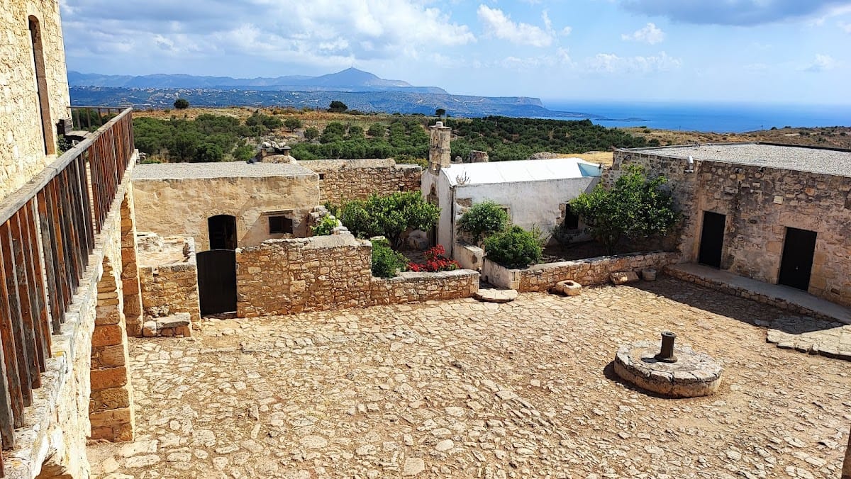
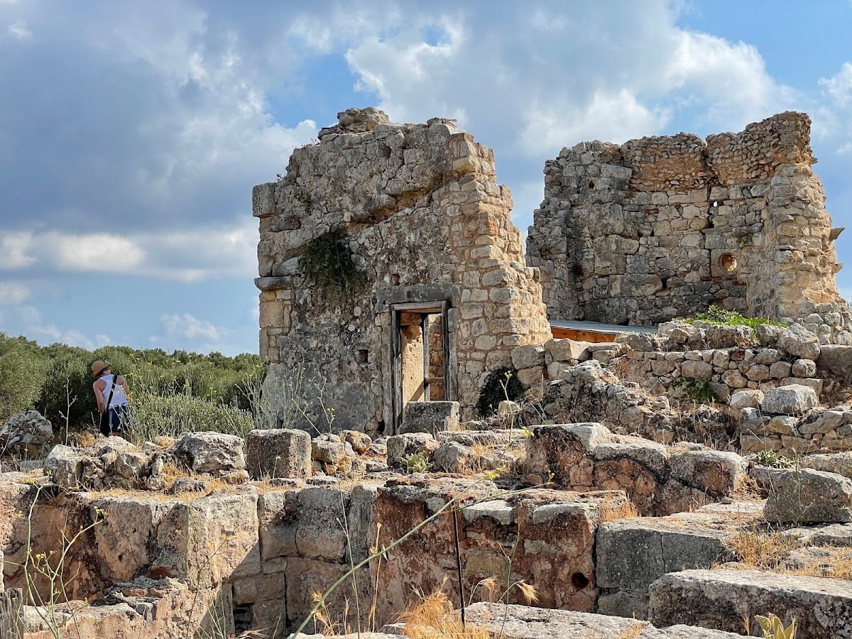
The monastery of Saint John the Theologian stands in the centre of the ancient city. Its surviving complex includes a chapel and a two-storey block of monastic cells. The abandoned monastery now accommodates archaeological teams, and one room contains an exhibition on Aptera’s history, architecture, and excavations.
Koules Fortress
The later fortress known as Koules occupies the northeastern edge of the area enclosed by the ancient walls. Its rectangular building measures approximately 35 by 25 metres. Two towers stand on the southern facade, while the northern facade forms a segment of a circle. The fortress was built partly with material taken from the ancient city’s ruins.