Sepphoris: A Multiperiod City in Galilee, Israel


Site at a Glance
- Rating
- 4.6
- Popularity
- Medium
- Country
- Israel
- Primary era
- Medieval
- External website
- Open
- Eras represented
- Classical, Medieval, Early Modern
- Civilizations
- Ancient Greek, Byzantine, Crusader, Mamluk, Ottoman, Roman, Umayyad
- Site type
- City
On this page23 sections
History
Sepphoris is an ancient city in Israel, located about 6 kilometres north-northwest of Nazareth in central Galilee. Occupation and construction can be traced archaeologically to the fourth century BCE, during the Hellenistic period, although activity at the hill began much earlier. The city later became a royal seat, a center of Jewish religious life, a commercial settlement, and a place where Jewish, pagan, and Christian communities lived together.
Early settlement and Roman rule
The hill was used during the Iron Age and also preserves evidence of Middle Paleolithic, Yarmukian, Pre-Pottery Neolithic B, and Chalcolithic activity. More substantial occupation and building began during the Hellenistic period. In 104 BCE, the Hasmoneans, a Jewish priestly ruling dynasty that established an independent Judean kingdom, conquered Galilee under either Alexander Jannaeus or Aristobulus I.
Sepphoris came under Roman control in 63 BCE and was one of five synods under Roman influence in the Near East by about 57 BCE. Herod the Great, Rome’s client king of Judea, recaptured the city in 37 BCE. He apparently established a royal palace-fortress there, together with an arsenal. After Herod died in 4 BCE, Judas, the son of the local bandit Ezekias, attacked Sepphoris, seized its treasury and weapons, and used them in a revolt against Herodian rule. The Roman governor Varus is said to have burned the city and sold its inhabitants into slavery. Archaeological investigation, however, has not established a city-wide conflagration.
Herodian rebuilding and the Jewish revolt
Herod Antipas, Herod the Great’s son and a tetrarch, meaning a regional ruler subordinate to Rome, rebuilt Sepphoris. He renamed it Autocratoris, made it the royal seat of his tetrarchy, and presented it as the “Ornament of the Galilee.” He enlarged the palace and arsenal and added a city wall. A Roman route connecting Sepphoris with Legio and, farther south, Sebastia, is believed to have been paved during this period.
Sepphoris did not join the Jewish revolt against Rome in 66–73 CE. Josephus tried twice to bring the city into the uprising, but resistance within Sepphoris and the arrival of a supporting garrison prevented this. Coins struck during the revolt used the names Neronias and Eirenopolis, meaning “city of peace.” Later coinage carried laurel wreaths, palm trees, caduceuses, and ears of barley, reflecting the city’s changing public identity and economic life.
Names and Jewish intellectual life
The city was known at different times as Sepphoris, Autocratoris, Eirenopolis, Neronias, and Diocaesarea. It was renamed Diocaesarea under Hadrian, probably around 129–130, although another dating places the change during the reign of Antoninus Pius. The name Sepphoris had returned before Antoninus Pius’s reign ended.
After the Bar Kokhba Revolt of 132–135, a major Jewish uprising against Roman rule in Judea, Jewish refugees and rabbinical families from Judea settled in Sepphoris. The city became a leading center of Jewish religious and intellectual life. Rabbi Judah ha-Nasi, a major Jewish sage traditionally associated with the compilation of the Mishnah, and the Sanhedrin, the supreme Jewish religious and legal court in late antiquity, moved there from Beth Shearim. Jewish academies were also based at Sepphoris before some moved to Tiberias by about 220.
Late Roman and Byzantine periods
During the late Roman and Byzantine periods, Sepphoris remained predominantly Jewish while also containing pagan and Christian communities. It had a Christian bishopric and developed into a commercial center because of its proximity to regional trade routes. The city retained social, commercial, and spiritual importance even as Tiberias became increasingly prominent. Its population was approximately 30,000, and it supported a relatively peaceful, multiethnic, and multireligious environment.
A Jewish revolt against Constantius Gallus in 351–352 centered on Sepphoris, then known as Diocaesarea. After the revolt was suppressed, the city was destroyed. The Galilee earthquake of 363 caused further damage, but Sepphoris was rebuilt soon afterward. Jewish religious life continued, and the Christian bishopric is represented by bishops active in 451, 518, and 536. From the fourth century onward, however, the city gradually lost its position as the principal Jewish center of Galilee to Tiberias.
Islamic, Crusader, and Mamluk rule
After the Muslim conquest, the settlement on the ancient ruins became known as Saffuriya. Rashidun forces, belonging to the early Muslim ruling period of the first four caliphs, conquered it in 634, and it was incorporated into the Umayyad state. The settlement then remained under successive Muslim dynasties, apart from periods of Crusader control.
During the early Islamic period, Saffuriya had a stone aqueduct and participated in regional commerce. Cloaks made there were worn in Medina. The village underwent substantial development during the Mamluk period. Crusader forces built a fortress and watchtower on the hill and a church dedicated to Saint Anne. The settlement changed hands several times. In 1187, the Latin kingdom’s field army marched from its well-watered camp at Sepphoris before being defeated by Saladin at Hattin. Crusader control returned briefly in 1255, when the village was associated with the archbishop of Nazareth, but the Mamluk sultan Baybars conquered it between 1263 and 1266.
Ottoman and British Mandate periods
Saffuriya came under Ottoman rule after the Ottoman victory over the Mamluks at Marj Dabiq in 1516. An Ottoman decree of 1572 placed it among the villages of the Safad district and mentioned a revolt against Ottoman authorities. In 1596, the settlement contained 366 families and 34 bachelors, all Muslim. Agricultural taxation covered wheat, barley, olives, goats, beehives, olive oil, and grape syrup.
The village remained agriculturally prosperous under Ottoman and British rule, although it no longer held its earlier cultural centrality. Its products included pomegranates, olives, wheat, and other crops. Boys’ and girls’ elementary schools were established, and a local council operated from 1923. British Mandate censuses recorded 2,582 inhabitants in 1922, 3,147 in 1931, and 4,330 in 1945. The 1945 population comprised 4,320 Muslims and 10 Christians. By 1948, Saffuriya was the largest village in Galilee by both land area and population.
War, displacement, and archaeological investigation
During the 1948 Arab-Israeli War, Saffuriya was bombarded and captured by Israeli forces in July 1948 during Operation Dekel. Local resistance destroyed several armored vehicles in an ambush, but most inhabitants fled or were expelled. The village was evacuated again in September. Fourteen residents were deported in January 1949, while approximately 550 others were resettled in neighboring Arab villages or moved to Nazareth and elsewhere. Israel subsequently classified the former residents as “present absentees” and did not permit them to recover their former homes.
The Israeli moshav of Tzippori was established southeast of the former village on 20 February 1949. Martial law continued in the area until 1966. Most remaining structures of Saffuriya were removed in a late-1960s clearance program, and the village site was planted with pine trees. Some pre-1948 houses and the eighteenth-century fortress remained. The excavated ancient-city area, including the area occupied by the former Arab village, was designated Tzipori National Park in 1992. The former village remains a focus of Palestinian commemorative Marches of Return.
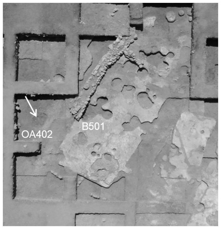
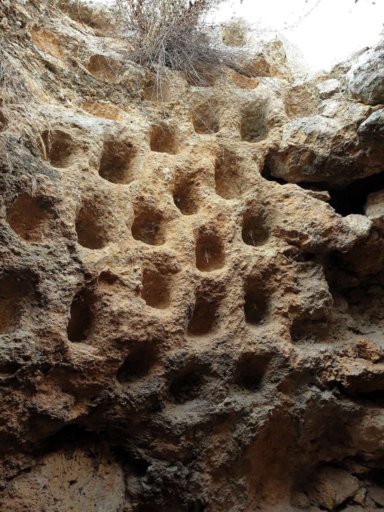
Archaeological work began in 1931, when Leroy Waterman excavated part of the school grounds over the former Crusader fortress and exposed a Roman amphitheater. Large-scale excavations resumed in the 1980s and expanded from 1990 under teams associated with the Hebrew University of Jerusalem and other institutions. Later investigations examined the fortress, Roman baths, Waterman’s Villa, the administrative building at the junction of the principal streets, and the wider site. A site survey was conducted in 2012, and two subterranean Byzantine-period wine presses were discovered in 2018.
Remains
Sepphoris occupies a hill overlooking the Beit Netofa Valley. Its surviving remains span the Hellenistic, Roman, Byzantine, early Islamic, Crusader, Mamluk, and Ottoman periods. The lower city follows a rectilinear plan organized around a paved Cardo, the principal north-south street in a Roman city, and a Decumanus, the principal east-west street. Colonnaded streets, wheel ruts, shops, multi-storey buildings, villas, Jewish houses, public buildings, baths, thermal installations, waterworks, mosaics, and later structures form the principal archaeological layout.
Urban streets and water system
Cardo, Decumanus, and houses
The lower city is arranged around the Cardo and Decumanus, whose paved surfaces and junctions organize the exposed urban remains. Excavated areas include shops, colonnades, wheel ruts, multi-storey buildings, Roman villas, Jewish houses, and administrative structures. Jewish houses stood along a principal cobbled street. Several stones set into the street carry carved images, including a menorah and a design resembling an ancient board game.
Aqueducts and reservoirs
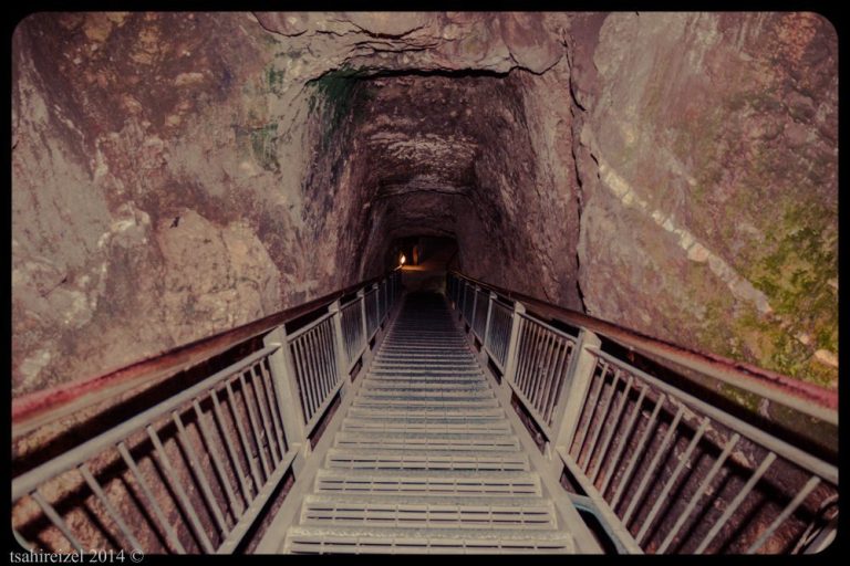
Sepphoris’s water system included aqueducts, a large rock-cut reservoir, underground cisterns, drainage channels, public baths, and stepped pools generally interpreted as Jewish ritual baths, or mikvaot. One reservoir measures approximately 260 metres in length and 10 metres in height. The water installations supported urban life and were connected with both public bathing and ritual practices.
Roman theatre and villa
Roman theatre
The Roman theatre stands on the northern slope of the hill. It measures approximately 45 metres in diameter and could accommodate about 4,500 people. Much of the structure was cut into the hillside, while other sections rested on separate stone pillars. Ancient damage is visible in the structure and may have resulted from the earthquake of 363.
Waterman’s Villa
A Roman villa built around AD 200 contains an elaborate mosaic floor in a room probably used as a triclinium, a Roman dining room where guests reclined around a central space. The mosaic consists of 15 panels and depicts Dionysus, the Greek god associated with wine and festivity, together with Pan and Hercules. One panel shows Dionysus and Hercules competing in a wine-drinking contest. Another portrays a young woman, possibly Venus, and is known as the “Mona Lisa of the Galilee.” Small tesserae, the pieces used to form a mosaic, create detailed shading and a lifelike face.
Public and religious buildings
Fifth-century public building
A fifth-century public building has a large, intricate mosaic floor and drainage channels. Some interpretations connect the room with water-related festival rituals and understand much of the mosaic as representing the measurement and celebration of Nile floods. That interpretation remains qualified.
Ancient synagogue
A synagogue at the edge of the lower city dates to the first half of the fifth century and measures approximately 20.7 by 8 metres. Its mosaic floor is divided into seven sections. Scenes include angels visiting Sarah, the binding of Isaac, and a large zodiac whose months are identified in Hebrew. Helios, the personification of the sun, appears in a chariot. Two lions flank a wreath and rest their paws on an ox’s head.
The mosaic also depicts Temple-related rituals and objects, including the tamid, the regular daily offering in the Jerusalem Temple, as well as showbread, first fruits, incense shovels, shofars, and the seven-branched menorah. One panel shows Aaron in priestly robes preparing offerings of oil, flour, a bull, and a lamb. An Aramaic inscription commemorates Yudan son of Isaac the Priest and Paragri his daughter and ends with the words “Amen, Amen.”
Christian buildings and Saint Anne’s church
Crusader forces built a church dedicated to Saint Anne on a site traditionally associated with the house of Anne and Joachim, the parents of Mary. The surviving structure is ruined, with eastern sections preserved on the slope. Excavations begun in 1909 exposed foundations attributed to a fourth-century synagogue and possibly an overlying Byzantine church. A fifth-century basilica associated with the tradition of Mary’s birth has also been excavated.
Mosaics and stone vessels
More than sixty mosaics from Sepphoris date broadly from the third to the sixth century CE. Their compositions include figurative, geometric, polychrome, mythological, and ritual designs. Alongside the Dionysus and Hercules drinking contest and the portrait called the “Mona Lisa of the Galilee,” the mosaics include representations associated with the building connected by some interpretations with Nile-flood rituals.
Stone vessels recovered from several excavation areas, especially in the lower city, include bowls, cups, goblets, kraters, trays, jar lids, and bottle stoppers. Some are incised and others are undecorated. Geochemical analysis indicates that 80 percent of the tested vessels were made from soft limestone originating in the Lower Galilee rather than the Jerusalem area, suggesting local production at least into the third century.
A complete limestone krater, a broad-mouthed vessel used for mixing or holding liquids, was found with agricultural tools in soil fills covering a farmstead near the city. The farmstead dates to the third century and was destroyed in the fourth century. Limestone vessels and numerous stepped pools indicate that some inhabitants continued Jewish purity practices until at least the beginning of the fourth century.
Fortress and later settlement
Crusader fortress
The Crusader fortress stands on the hill above the Roman theatre. Built in the twelfth century on the foundations of an earlier Byzantine structure, it is a square building approximately 15 by 15 metres and about 10 metres high. Its lower section incorporates reused ancient materials, including a decorated sarcophagus. In the eighteenth century, Daher al-Umar added the upper section and doorway. The rounded corners of this rebuilding resemble features of his fortress at Shefa-Amr.
The upper part of the fortress served as a school during the reign of Abdul Hamid II and continued in that role until 1948. A museum was later installed in the Crusader tower, displaying archaeological finds that include glass, pottery, and mosaics.
Village of Saffuriya
The former village of Saffuriya was built mainly from stone and mud along the hillside. Wells and springs served the settlement, including the spring known as al-Qastal at the village entrance, which irrigated surrounding orchards. Some pre-1948 houses survived after most of the village was removed, while the site was later planted with pine trees.