Silchester Roman Town Walls & Amphitheatre: A Roman Town and Entertainment Complex in the United Kingdom


Site at a Glance
- Rating
- 4.5
- Popularity
- Low
- Country
- United Kingdom
- Primary era
- Classical
- External website
- Open
- Eras represented
- Iron Age, Classical, Medieval
- Civilizations
- English, Roman
- Site type
- City
On this page21 sections
History
Silchester Roman Town Walls & Amphitheatre is an archaeological site in the United Kingdom that preserves the remains of Calleva Atrebatum, an Iron Age Atrebatic centre transformed into a Roman town after the conquest of Britain in AD 43. The settlement began between about 20 and 10 BC and developed into a defended capital, a major administrative and commercial centre, and a town whose Roman walls, amphitheatre, streets, and buried buildings remain important evidence for southern Britain.
The Atrebatic settlement
Silchester was originally the centre of the Atrebates, a Late Iron Age people whose territory extended across parts of southern Britain and Gaul. Their settlement, later called Calleva, covered more than 32 hectares. Archaeological evidence suggests that it may have been planned by people from north-west Gaul, with links to the area around Arras. As an oppidum, meaning a substantial settlement that could serve as a tribal centre or capital, it was both a defended community and a high-status trading and processing centre.
Locally made goods included horse and chariot equipment. These products were exchanged for metals, grain, enslaved people, and other commodities from southern Britain, and were also traded with the Roman world for luxury foods and manufactured goods. Coins bearing the name of Commius, an Atrebatic king associated with the establishment of Atrebatic power in southern Britain after movement from Gaul, indicate that he established his territory and a mint at Silchester. Coins linked with the later ruler Eppillus also preserve forms of the settlement name.
Late Iron Age occupation included roundhouses, wells, pits, metalled streets, rubbish pits, palisaded enclosures, lanes, and changing property boundaries. The occupation phases extended from approximately 25–15 BC to AD 40–50. A large boundary ditch probably dates from 40–20 BC, while a large rectangular hall may have been built between 25 BC and AD 10. The settlement was enclosed by defensive earthworks, including a low bank that remains visible today.
Roman Calleva
After the Roman conquest, the Atrebatic territory retained some autonomy until the late first century AD. The change from the Iron Age settlement to the Roman town took place through several phases, and the precise sequence remains uncertain. The resulting town, known as Calleva Atrebatum, meaning Calleva of the Atrebates, covered about 40 hectares and became the principal settlement of a Roman civitas, the administrative territory governed from a central town.
Calleva administered taxation and justice and stood at an important crossroads. Major roads connected it with Londinium, Aquae Sulis, Glevum, Sorviodunum, and other settlements. The Devil’s Highway linked the town with Londinium, while other routes led to Noviomagus Regnorum, Venta Belgarum, Ad Pontes, and Isca Dumnoniorum. Its population was predominantly British, alongside foreign merchants and immigrants, and specialist activities included metalworking, woodworking, textile production, leatherworking, and other crafts.
The Roman town was laid out with a regular street grid over the earlier settlement. It flourished into the later Roman period, with one estimate placing its population at nearly 10,000 in the third or fourth century, while other estimates range from about 1,200 to 7,500. Calleva apparently never became a municipium, but its administrative and commercial functions gave it an important place in Roman southern Britain.
Defences and later Roman occupation
The town was defended from about AD 200. The defences probably responded partly to increasing Saxon raids and helped protect the settlement from uprisings, pillaging, and external attackers, while also controlling movement through the gates. An earlier rampart with stone-built gates and two external ditches was followed by a larger stone wall, constructed around AD 270 or during the later third century.
Important buildings remained in use around AD 400–430, and Silchester appears to have remained prosperous when Roman control of Britain ended in the early fifth century. Occupation declined sharply after about AD 450. The town was probably abandoned between approximately AD 550 and 650, although the duration of organised post-Roman urban life remains uncertain.
Medieval settlement and archaeological investigation
An Ogham stone found in 1893 provides evidence for early medieval activity. Ogham was an early medieval writing system that developed in southern Ireland around AD 400 and was used mainly for inscriptions on stone. The Domesday Book recorded a village called Silcestre in 1086, and a medieval settlement later developed between the amphitheatre and the south gate.
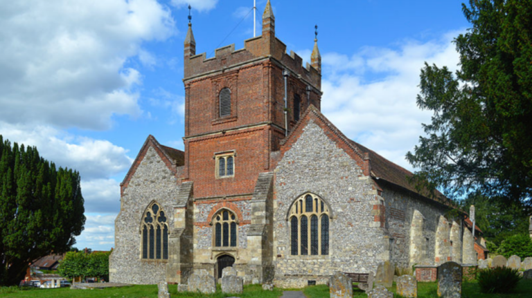
During the twelfth century, an aisled hall was built inside the amphitheatre arena and a palisade was erected on the surrounding banks. This fortification may tentatively be identified with the Castellum de Silva taken by King Stephen in 1147 during the Anarchy, the civil conflict between Stephen and Empress Matilda over the English throne. The twelfth-century church of St Mary near the east gate is the only surviving physical evidence of medieval Silchester apart from the earthworks. The medieval village appears to have been deserted around 1400, possibly following the Black Death of 1348–49. The present village developed west of the Roman town, where the earliest houses date from the seventeenth and eighteenth centuries.
The Reverend James Joyce began excavating Silchester and discovered the bronze Silchester Eagle in 1866. Large-scale work ordered by the Duke of Wellington began in the late nineteenth century, particularly through Joyce and the Society of Antiquaries between 1890 and 1909. These excavations exposed much of the Roman street plan and the plans of stone buildings, although early work gave less attention to timber structures, archaeological layers, pottery, and the precise locations of small finds.
Molly Cotton investigated the defences in 1938–39. From the 1970s, Michael Fulford and the University of Reading examined the town walls, amphitheatre, and forum basilica. The University of Reading excavated Insula IX, an archaeological town block, every summer from 1997 to 2014, tracing its development from the Iron Age into the Roman period. Work began in Insula III in 2013, and the public baths were re-examined from 2018.
Silchester is one of the best-preserved and most extensively investigated Roman towns in Britain, and one of the few sites whose exact location was reused continuously from the Iron Age into the Roman period. The ruins were not substantially built over, preserving the earthworks, walls, and buried remains. Finds such as pottery, metalwork, animal remains, and plant remains provide evidence for the inhabitants’ status, diet, occupations, lifestyles, and connections beyond the town. Hampshire County Council principally owns the site, and English Heritage manages it. Many finds are displayed in a dedicated gallery at Reading Museum.
Remains
Town enclosure and amphitheatre
Roman walls and gates
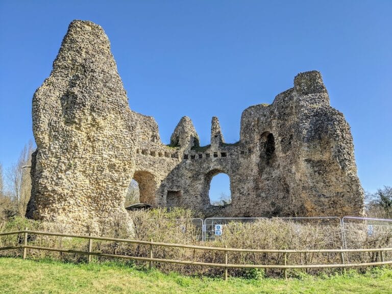
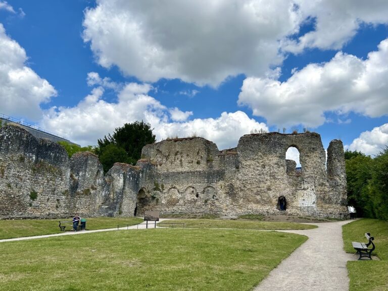
The Roman town formed an approximately 500-metre-wide, near-octagonal enclosed area, although parts of the western settlement lay outside the later walls. The circuit extends for more than 2.5 kilometres and survives in substantial ruined stretches with associated earthworks. Its first principal defensive phase consisted of a rampart, stone-built gates, and two external ditches. A larger stone wall was added around AD 270 or during the later third century. Eight gates formed part of the enclosure, although they may not all have operated at the same time. The North Gate preserves stone and tile remains that show the two-stage defensive system.
Amphitheatre
The amphitheatre stood outside the eastern side of the walled town and was added around AD 70–80. Its earliest arena was approximately circular and about 43 metres across, with a seating bank about 15 metres wide and 5.5 metres high. The arena wall was formerly about 3 metres high, and two stone-framed entrances served the building. Two niches in the arena have uncertain functions. They may have held altars to Nemesis, a Greco-Roman goddess associated with retribution and fate, or provided refuge for participants in the games.
The building passed through at least three construction phases. A mid-second-century rebuilding created an oval arena about 44 by 38 metres, while an enlargement in the early third century used more extensive stone construction and produced an arena about 49 by 40 metres. The amphitheatre could accommodate approximately 4,500–9,000 spectators, with an estimate of about 7,000 at its peak. Bear-baiting, gladiatorial combat, and other entertainments took place there. After the Roman withdrawal, Britons and Anglo-Saxons continued to use the structure, and a twelfth-century aisled hall was later built within the arena.
Forum, basilica, and civic buildings
Forum
The forum occupied the centre of the Roman town and developed through several building phases. An early forum probably preceded the regular street grid. A later complex dating around AD 85 included a courtyard about 43 by 40 metres, surrounded by porticoes, with shops and offices behind them. Two apsidal rooms on the southern side were probably offices, and the western entrance carried a large dedicatory inscription.
The forum complex used local limestone and marble for wall decoration. Excavations produced fragments of wall paintings, two stone tables including one made of marble, about twelve inscriptions, and parts of four statues. These included a larger-than-life-sized stone figure of Tutela, a possible imperial statue represented by a sandalled foot, and pieces of a larger-than-life-sized bronze statue. The nearly complete bronze Silchester Eagle, found in 1866, may originally have belonged to a statue of Jupiter in the forum. It is now held by the Museum of Reading.
Basilica
A major building phase around AD 150 produced the second-century basilica, which together with the forum covered approximately 0.8 hectares. The basilica was about 82 metres long and 17.5 metres wide. Corinthian columns, formerly about 8.6 metres high, stood within the building, while apses formed its short ends and further offices occupied the western end.
From the middle of the third century, smithing took place inside the basilica. This industrial activity indicates that the building had ceased to function as a public civic structure and had been adapted for another use.
Residential and service buildings
Mansio
A large building near the south gate occupied parts of two town blocks. Its three wings surrounded a courtyard about 45 by 35 metres. Heated rooms were concentrated in the west wing, and the complex also contained a second courtyard, a bathhouse, and later latrines. Its identification as a mansio, an official stopping place offering accommodation and services to travellers on imperial business, remains uncertain, although its size supports that interpretation.
Public baths and water supply
The public baths lay in the south-eastern quarter and were among the earliest stone buildings, perhaps constructed around AD 50. Their original alignment did not follow the later street grid, and the entrance area was rebuilt to fit the new roads. The first arrangement included a portico, a palaestra, or exercise court associated with a bathing complex, and bathing rooms. The portico was later removed, and the bathing rooms were divided into two halves, possibly separating male and female bathers.
A spring rises inside the walls near the original baths and flows south-east to join Silchester Brook. It supplied the water system associated with the bathing complex. Wells were also widespread because the town stood on elevated ground without an aqueduct. They averaged about 6 metres deep, with some left unlined and others lined with wood and later flint. Wooden buckets were used to draw water. A wooden pipe in Insulae XV and XVI shows that at least some water entered the town from outside, while a wooden pump from Insula XIV belonged to a type traditionally associated with the Greek engineer Ctesibius.
Houses and workshops
Residential buildings included timber and stone houses of varied forms. The oldest stone houses date from the late first century. Some were single-room structures with possible timber additions and hearths that may indicate workshop activity. Larger houses commonly had corridors, several rooms, or multiple wings arranged around courtyards. Insula XIV contained a four-winged house built around an internal courtyard, while large courtyards attached to some houses may indicate agricultural functions.
About thirty houses contained mosaics, usually geometric in design and mostly dating from the third or fourth century. Heated rooms were common, and wall paintings and window glass were also found. Craft production included working bone and antler, copper alloy, leather, iron, wood, pottery, glass, and tin. A possible first-century tannery in Insula VI was associated with numerous cattle jaws, while three shoe lasts from an iron hoard indicate shoemaking. Two iron hoards contained tools, an ironworking furnace survives as evidence of metal production, and woodworking tools included a plane.
Two first-century pottery kilns stood beyond the north gate, and six moulds from the forum indicate tinworking there. Most buildings used timber or stone, while tile production in the surrounding area included kilns at Little London. Two tiles bear the name of Nero, the Roman emperor who ruled from AD 54 to 68.
Religious buildings and burial evidence
Temples in Insula XXX
Three Romano-Celtic temples in Insula XXX, immediately inside the east gate, were built in the mid-first century and went out of use after about AD 200. Romano-Celtic temples commonly combined a central cella, or shrine room, with a surrounding walkway or portico. The northern temple had a square cella about 22.25 metres across and an outer portico 4.1 metres wide. Its exterior was plastered and painted red. The southern temple measured about 15.25 metres across, with a cella about 5.5 metres wide, and also had red-painted exterior walls.
The same precinct included a small apsidal building, a large hall measuring about 21 by 13 metres, and a later medieval church. Their remains form part of the changing use of this religious area.
Other sanctuaries
A Romano-Celtic temple in Insula XXXV stood south-east of the forum. It may have been associated with Mars, and inscriptions there record dedications by guilds. In Insula XXXVI, an approximately 6-by-6-metre temple stood within a precinct measuring about 30 by 35 metres. Two shafts in the precinct were filled during the fourth century and contained pottery, bones, and coins.
Insula VII contained a sixteen-sided, nearly circular temple. Its cella measured about 10.9 metres in diameter, its portico was 2.9 metres wide, and a surrounding wall extended across its northern, eastern, and southern sides. A possible Mithraic temple in Insula XIX measured about 9 by 6.5 metres and contained two rooms, with a niche in the short wall of the western room. Its plan provides the principal evidence for an association with Mithraism, the Roman cult of Mithras, but that interpretation remains uncertain. A possible nymphaeum, a fountain or shrine associated with water and the nymphs, stood near the amphitheatre north of the walled town.
Possible church and burials
A possible church in Insula IV, south-east of the forum, has an apse-ended plan resembling early western Roman churches. Its date and Christian interpretation remain uncertain. Late Iron Age cremation burials were excavated at Latchmere Green and Windabout Copse. Roman cemeteries are thought to have lain north and west of the outer earthwork. A tombstone discovered in 1577 commemorates Flavia Victorina and states that her husband, Titus Tammonius Victor, erected it. The Ogham stone found in 1893 provides the stated archaeological evidence for early medieval activity at the site.
Landscape and surviving evidence
Silchester occupies a gravel terrace near the River Kennet, between the Hampshire chalk downs and the flood plains of the Thames valley. The ground falls away beyond the walls, especially to the north, east, and south. A spring rises within the town, while the surrounding Roman landscape included heath, farmland, wetlands, marshes, and woodland.
The visible remains include the enclosing earthworks, long stretches of ruined wall, the amphitheatre, and the medieval church near the east gate. Much of the interior is farmland, while buried archaeological remains preserve evidence for houses, workshops, civic buildings, religious structures, streets, and successive Iron Age and Roman occupation phases. Plant remains show the consumption of spelt, wheat, barley, apples, figs, grapes, celery, coriander, dill, pulses, and other foods. Cattle, sheep or goats, and pigs were the principal meat animals, and rotary querns were used in many houses to grind flour.
Late Iron Age imports included Gallo-Belgic fine wares, amphorae, brooches, oyster shell, and containers for olive oil, fish sauce, and wine. Plant remains from Insula IX include celery, coriander, and olives consumed before the Claudian conquest. Roman imports included Central Gaulish samian ware, several kinds of amphora, Rhineland mortaria, Mosel black-slipped ware, Cologne colour-coated ware, an ivory razor handle, a vessel handle, and a figure of Harpocrates from a Campanian brazier.