Semyonovsky Fortress: A Defensive Installation on the Mius River


Site at a Glance
- Rating
- 4.1
- Popularity
- Very Low
- Country
- Russia
- Primary era
- Early Modern
- Eras represented
- Early Modern
- Civilizations
- Russian
- Site type
- Military
- Remains
- Fort
On this page6 sections
History
Origins and Construction
Semyonovsky Fortress was a defensive installation at the mouth of the Mius River near Beglitsa in Rostov Oblast, Russia. It was built in 1698 during the late seventeenth century and was initially called Mius Fortress after the river. The site was later renamed Semyonovsky Fortress.
Plans for a fortress on the Mius began in autumn 1674, when Prince Pyotr Khovansky-Zmey, a voivode, meaning a high-ranking military and administrative commander in the Moscow state, was sent from Moscow to the Don. The project did not proceed then because a suitable location could not be found. Construction was eventually completed at the river mouth more than two decades later.
Garrison and Destruction
In 1699, the fortress held a garrison of 421 people. They included spearmen, reiters, who were mounted soldiers serving in early modern European-style cavalry units, and other soldiers. Cossacks were also stationed there and inspected merchant vessels passing along the river and its approaches.
The fortress was partially destroyed in 1711. A peace agreement made that year placed it under the authority of Zaporizhzhia, a region associated with the Zaporizhian Cossacks. Archaeologists examined the former fortress in 1929, and intermittent archaeological research and excavation continued there during the twenty-first century.
Remains
Earthworks and Defensive Layout
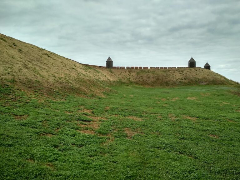
The fortress occupied an irregular quadrilateral measuring approximately 600 by 500 metres. Its defenses included four bastions, projecting works designed to allow defensive fire along the faces of the fortification, and two smaller half-bastions. One gate stood on the side facing the steppe and was protected by a half-bastion.
The earth rampart was approximately 3.5 metres high, 2 metres deep, and 6 metres wide. Its outlines remain visible on the shore of the Mius Liman, a coastal lagoon or estuary formed where a river meets the sea. Shoreline erosion has washed away part of the former fortress area.
Archaeological Finds
Excavations in the fortress area have recovered ceramic fragments and fragments of smoking pipes. These finds accompany the surviving earthworks as material evidence of activity at the former defensive installation.