Burg Hauenstein: A Hilltop Castle Ruin in Germany


Site at a Glance
- Rating
- 4.7
- Popularity
- Very Low
- Country
- Germany
- Primary era
- Medieval
- Eras represented
- Medieval
- Civilizations
- Habsburg, Holy Roman Empire
- Site type
- Military
- Remains
- Castle
On this page18 sections
History
Burg Hauenstein is a hilltop castle ruin in Germany, above Hauenstein, now a district of Laufenburg in Baden-Württemberg. Probably built before 1108, it may have been established to protect Säckingen Abbey and control a strategic border and transport corridor along the Rhine. Its position on a hard-to-bypass route beside the Alb Gorge allowed the castle to supervise both land traffic and Rhine shipping, while nearby Burg Tiefenstein controlled the only river crossing in the area.
Origins and territorial authority
The castle may have originated as early as the Carolingian period and may initially have served as the seat of the counts of the Albgau, an early medieval administrative region associated with the Alb area of southwestern Germany. Its precise age and original institutional role remain uncertain. The oldest surviving area is probably the southwest part of the complex, whose octagonal building form has been interpreted as evidence for construction in the tenth or eleventh century.
Christian Wurstisen wrote in 1580 that Hauenstein had been acquired or exchanged by St Blasien Abbey in 1108. The castle later passed from the monastery to the last Duke of Zähringen, a member of the medieval dynasty that ruled territories in southwestern Germany and western Switzerland, then to the Counts of Freiburg and ultimately to the House of Austria, the Habsburg dynasty whose possessions included important lands along the Upper Rhine.
Hauenstein was a Reichslehen, meaning a fief held directly from the Holy Roman Emperor or the empire. Until 1500, it was the seat of the Waldvogtei of the County of Hauenstein. This forest bailiwick was a regional jurisdiction whose bailiff exercised legal, fiscal, and supervisory authority for a higher lord. The castle consequently functioned both as a customs post and as a center of territorial administration. In 1476, Martin von Staufen was recorded as the Austrian bailiff of Laufenburg, Waldshut, Säckingen, Burg Hauenstein, and the four Black Forest localities belonging to the county.
Medieval settlement and later destruction
Descriptions from 1471 and 1473 portray Hauenstein as a small settlement of approximately eight to ten households, protected by a weak enclosure and two gates. Two castles stood close together on rocks above the Rhine. One belonged to the Burgundian duke, while the other was held as a fief by Guillaume de Criez. The duke’s castle contained a large square tower in severe disrepair and a small wooden residence with a heated room, a chamber, and a stable for two or three horses. An administrator was the only occupant mentioned.
The castle was repeatedly altered and enlarged. A later shield or mantle wall, a particularly strong defensive wall on the side most exposed to attack, was attached to the earlier principal residential building, or palas. The main palas may have been reduced after its southeastern wall collapsed, perhaps during the earthquake of 1356 or the fire of 1503. A later partial rebuilding may have taken place in 1644 or 1892, and possibly in 1370, but the sequence cannot be established conclusively.
In 1503, the castle and chapel were burned. Wurstisen’s 1580 description states that only a poor house and a tower remained usable by the Waldvogt as a prison. Joseph Merk’s 1833 description also connected the castle’s destruction with the German Peasants’ War, a widespread early sixteenth-century uprising involving rural communities and towns, while noting that the complex had already suffered heavily from fire.
Chapel and preservation
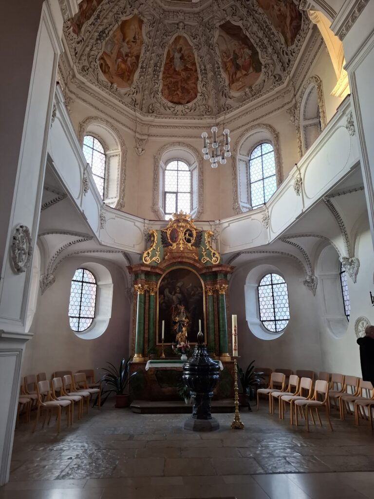
The chapel dedicated to Saint Joseph was rebuilt after the fire of 1503. Reconstruction was decided upon in 1641, and a sandstone above the entrance carries the date 1685. French forces looted the chapel in 1797, while local residents prevented its demolition in 1826. A fundamental renovation followed in 1949. The chapel remains the only completely preserved building associated with the castle.
Other parts of the complex experienced a more severe decline. Walls were quarried for stone during the eighteenth century and dismantled in the nineteenth century because of the danger from falling rock. They may also have supplied stone for a nearby railway viaduct. Repairs around 1892 helped preserve much of the northwestern and northeastern masonry, although the dating and interpretation of the surviving remains continue to require further investigation.
Remains
Ridge, ditches, and waterworks
Rocky setting and defenses
The ruin stands at approximately 330 metres above sea level on a very hard porphyry ridge above Hauenstein and the Rhine. Porphyry is a volcanic rock containing larger crystals within a finer-grained groundmass. The castle follows the ridge diagonally from northeast to southwest. Its elevated position and the bend of the river provided views both upstream and downstream.
The approach came from the southwest along a route protected by a deep V-shaped ditch. Two further ditches were partly bordered by a rampart, while additional ditches defended the southwest and northeast sides. These earthworks formed part of a layered defensive arrangement around the ridge and its access routes.
Water channel and pond
A partly surviving artificial pond northwest of the castle was supplied from Hochsal, approximately two kilometres away, through a covered water channel known as a Wuhr. This type of channel or water-control structure diverted and conveyed water, often with an associated dam or covered conduit. Remains of the channel and its overflow ditch extend toward the Rhine along the southwestern side of the settlement’s enclosure.
Main castle
Early residential buildings
The earliest main-castle buildings probably included a fortified residential tower, or donjon, an octagonal palas, and a smaller service building or stable. A donjon was a fortified residential tower, while the palas served as the principal residential and representative building of a medieval castle. It remains uncertain whether the donjon preceded the palas, whether the palas was built first, or whether both were constructed together.
The main-castle area is slightly V-shaped, measuring approximately 35 metres in length, about 16 metres across at the southern end and about 20 metres across at the northern end. Interpretations of the original palas vary. It may have measured roughly 30 by 10 metres, or about 20 metres in length, ending at a surviving projecting wall fragment that left room for additional service buildings.
Shield wall and southern tower
A shield or mantle wall approximately three metres thick was added to the older, obliquely aligned palas. It originally carried a wooden wall-walk, a defended walkway along the top of a fortification. Because the added wall is narrower than the sides of the octagonal palas, it creates an interior niche and preserves the outline of the earlier building. The corresponding southwestern palas walls are heavily damaged or missing.
The southeastern wall of the main castle extended approximately 35 metres to the former main-castle gate before turning outward at roughly a right angle into a wall about 10 metres long. That section joined a horseshoe-shaped round tower, approximately 10 to 15 metres in diameter, which projected toward the courtyard. Fragments of the tower survive among the southern remains, and it probably rose little, if at all, above the upper level of the terrain.
Defensive wall circuit
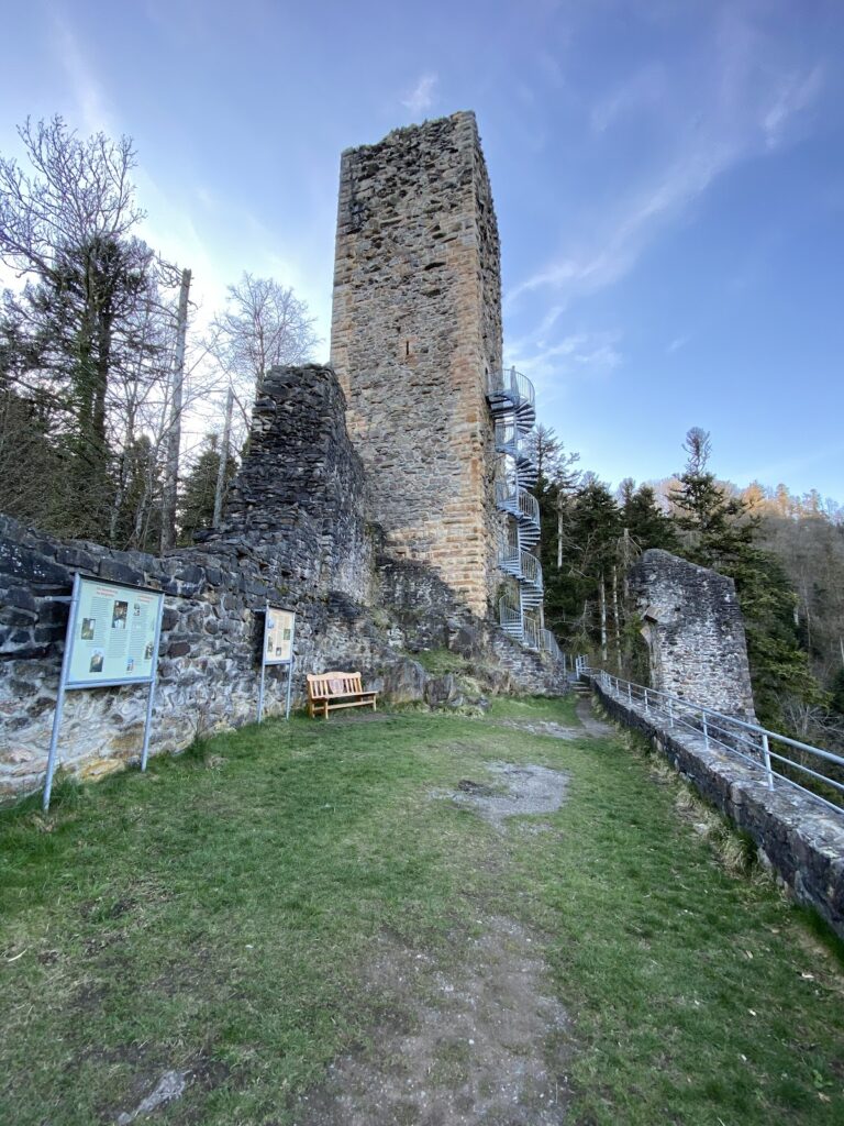
From the tower area, the southeastern wall continued northeastward along the edge of the rock for approximately 50 metres. It met the northeastern wall at a rounded corner, with the outer ends of the two rounded sections together measuring about 30 metres. Much of the southeastern wall has collapsed or been removed. The northwestern and northeastern walls are comparatively well preserved, in places more than three metres thick and up to approximately seven metres high.
The northwestern defensive line has been estimated at about 70 metres when the northern palas wall is excluded, or approximately 95 metres when the older palas wall and later fortification are counted together. The complex may once have extended onto the northern plateau, producing an overall length of approximately 140 metres. A later round tower in the northeast has walls about 1.8 metres thick. It may have been linked by another wall circuit to the present entrance and formed a separate enclosed unit.
Entrances and later castle expansion
Gates and approach
The present entrance passes through the northwestern wall by means of a vaulted gate approximately 3.6 metres high and 2.1 metres wide. Its identification as the historical entrance remains disputed. A possible northeastern entrance may have crossed the ditch by a drawbridge through a tower, and a nineteenth-century sketch shows entrances at both locations.
From the northwestern gate, a road rises in a slight right-hand curve through a sunken hollow way toward the old palas and main castle. Another gate protected this approach, while a gate also separated the small forecourt from the rest of the complex. The forecourt formed part of the castle’s controlled access system.
Northern buildings and courtyard
During a later expansion, the northwestern wall was extended to approximately 95 to 100 metres. The northeastern part probably included a tower about 13 by 10 metres beside a heavily built structure approximately 16 by 10 metres known as the knight’s house. Its rear and side walls, together with the first storey of its front, were probably constructed in masonry, while the second and possibly third storeys were timber-built.
An inner courtyard between the two castle sections measured approximately 45 by 29 metres. Rubble mounds indicate that further buildings once stood there, probably mainly timber structures. Numerous beam holes in the northwestern wall probably supported a wooden wall-walk. The old palas masonry has been substantially altered and distorted. A prominent wall behind the visitor information panel was largely built in a much later phase, probably near the end of the nineteenth century. Only its southwestern section, made from large heavy ashlar blocks, probably belongs to the medieval castle and is more likely the inner face of the old donjon than the outer face of another tower.
Chapel and lower ward
Chapel of Saint Joseph
The Chapel of Saint Joseph stands below the rock edge between the main castle and the settlement. Its surviving building belongs to the castle complex and preserves the chapel’s later form after rebuilding and renovation.
Settlement enclosure
Hauenstein served as the castle’s foreburg, or lower ward, the outer part of a fortified complex below or beyond the main castle. Much of the western town wall survives, although part of it was incorporated into the gable wall of a later house. The wall is approximately one metre thick, and its surviving upper masonry identifies it as a town fortification rather than an ordinary house wall.
The settlement was probably enclosed on all sides, with the main castle to the north, the Rhine forming a natural barrier to the south, a western wall, and a likely eastern defense across an entrance only about 20 metres wide. An eighteenth-century description refers to 18 small, poorly built houses that could be closed by two gates.
Vegetation now covers extensive parts of the complex, including the interior, where shrubs obstruct movement and views. The palas masonry requires urgent conservation because deteriorating mortar is reducing the stability of the walls.
Nearby sites