Karlsburg: A Medieval Spur Castle in Germany


Site at a Glance
- Rating
- 4.5
- Popularity
- Low
- Country
- Germany
- Primary era
- Medieval
- External website
- Open
- Eras represented
- Medieval
- Civilizations
- Carolingian, Holy Roman Empire
- Site type
- Military
- Remains
- Castle
On this page10 sections
History
Karlsburg is the ruin of an early medieval and late medieval spur castle in Germany, above the Main opposite Karlstadt. Its earliest known fortification was built in the middle of the eighth century during the Carolingian period, when the Frankish realm was being reorganized under the dynasty that followed the Merovingians. The castle formed part of the central place of Karlburg, an important political and ecclesiastical centre in the old Frankish settlement landscape.
Karlburg and the Bishopric of Würzburg
Karlburg first appears in written evidence in 741/42, in connection with the foundation of the Bishopric of Würzburg. Karlmann, a leading Carolingian royal official, transferred to the new bishopric 25 royal proprietary churches, a Marian monastery, and associated properties and rights in the settlement. In a second donation made between 751 and 753, King Pippin the Younger gave Würzburg’s first bishop, Burkard, a castle, royal court, fiscal district, and related revenues.
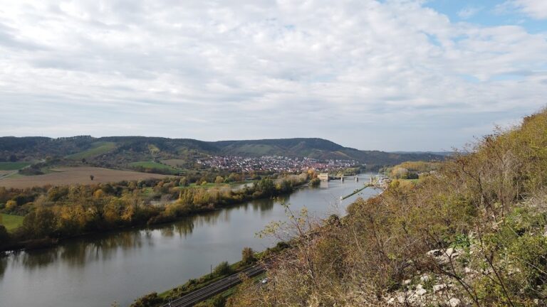
These transfers placed Karlburg within a fortified central place that combined political, administrative, economic, and religious functions. The castle and settlement occupied a strategic position on the left bank of the Main, where the valley broadens into a flat basin rising westward. Routes followed the river, while two fords about 2 kilometres apart allowed it to be crossed. Karlburg was the last staging point upstream toward Würzburg, which had become a bishopric under the missionary and church organizer Boniface. Neustadt Abbey lay about a day’s journey downstream, and Hammelburg stood to the north.
Early medieval fortifications
The exact foundation date of the castle is unknown. Its origins may lie in the Carolingian period, perhaps under Charles Martel, or in the late Merovingian period under the protection of the Hedene family, an early Frankish noble or ducal dynasty. The form and original purpose of the earliest castle are also uncertain. Local tradition associates the site with Charlemagne, the Carolingian emperor, and holds that he stayed there frequently.
The castle and its settlement remained important within Main Franconia’s early medieval landscape. An overland route connected Karlburg with Würzburg through Duttenbrunn, Unterleinach, Oberleinach, and Hettstadt. By 1286, the castle was described as a castrum, a Latin term for a fortified place. The late medieval castle may have been established as early as around 1200, possibly in connection with the foundation of Karlstadt on the opposite bank by Bishop Konrad of Querfurt, who served from 1198 to 1202.
Late medieval destruction
By the late medieval period, the castle had been reduced to the southeastern part of the broad rocky spur. Karlsburg was destroyed by fire during the German Peasants’ War, a widespread uprising of peasants and townspeople in the German lands, between 15 May and 3 June 1525. The surviving ruins preserve parts of this final medieval phase, while excavations and aerial photography have revealed earlier fortifications that are scarcely visible above ground.
Archaeological investigation
Excavations directed by Klaus Schwarz took place in 1971–72 and 1974–75, followed by a smaller probing excavation in 1994. Aerial photographs made in 1992 helped identify the line of the oldest fortification. Together, these investigations clarified the sequence from the Carolingian enclosure through the Ottonian and Salian–Staufer defenses to the smaller late medieval castle.
Remains
Karlsburg occupies a broad rocky projection at about 241 metres above sea level. The castle is a spur castle, a fortification built on a projecting ridge or rocky spur that uses the surrounding slopes as part of its defenses. Its late medieval form occupied only the southeastern section of the spur. The surviving site combines ruined walls and bedrock foundations with excavated ditches, ramparts, building traces, hearths, and postholes from several phases of construction.
Carolingian enclosure
The earliest enclosure, built around the middle of the eighth century, covered approximately 125 by 120 metres and enclosed about 1.3 hectares. A V-shaped ditch, formerly about 1.90 metres deep and 5.30 metres wide, curved across the spur. A mortar-built wall probably followed the inner edge of the ditch and may have been among the earliest fortifications of this type in southern Germany. Postholes and settlement pits show that the interior was intensively built up and used. A decorated bone plate, probably once part of a box, points to the presence of a socially elevated group within the enclosure.
Ottonian defenses
Around 900 or during the first half of the tenth century, the smaller Carolingian enclosure was abandoned and its ditch was filled. The defended area expanded to about 1.7 hectares, measuring approximately 170 by 120 metres. A curved rampart of stone and earth, 9 to 10 metres wide, enclosed the enlarged area, with an outer ditch beyond it. Two additional rampart-and-ditch systems, located about 100 and 200 metres away, probably formed part of the same defensive arrangement and created obstacles for mounted attackers. This pattern belongs to a type of fortification associated with the Hungarian invasions around 900 and during the first half of the tenth century.
Dense occupation continued inside the Ottonian defenses. Numerous postholes and hearths mark buildings and working areas. At the foot of the rampart stood a six-post building measuring 6.40 by between 5 and 5.20 metres. It had a plank floor, a stone boundary along its western side, and a masonry hearth in the northwestern corner.
Salian and Staufer fortifications
During the eleventh century, in the Salian–Staufer phase, the castle retained the size of the Ottonian enclosure. A mortar-built wall was placed on the rampart and strengthened with projecting towers, some of them partly occupying the ditch. Three excavated towers had similar construction and stood at intervals of about 32 to 35 metres. Their walls were approximately 1.60 metres thick, and each had a frontage 7.20 metres long. Two more towers are conjectured in the southwest, together with a gate at the southwestern corner.
The rampart was widened inward by 3 to 4 metres, reaching about 13 to 13.50 metres. At the same time, the ditch was deepened to 4.50 metres and widened to between 10 and 12 metres, producing a defensive zone about 25 metres across. Deep and unusually broad post pits cut into the natural bedrock belong to this phase. A two-aisled post-built house, with sides of approximately 6 metres, stood at the foot of the rampart. Pottery and metal finds indicate repeated and intensive use of the interior, including the temporary presence of mounted troops represented by horseshoes, horseshoe nails, and a stirrup.
Late medieval castle
From around 1200 or the middle of the thirteenth century until the sixteenth century, Karlsburg was confined to the southeastern spur. A deep neck ditch, 30 metres wide, cut across the spur, while much of the earlier defensive system was demolished and the ground in front of the castle was levelled. Several portions of the internal buildings survive above ground. Some Romanesque elements may belong to the Salian–Staufer phase.
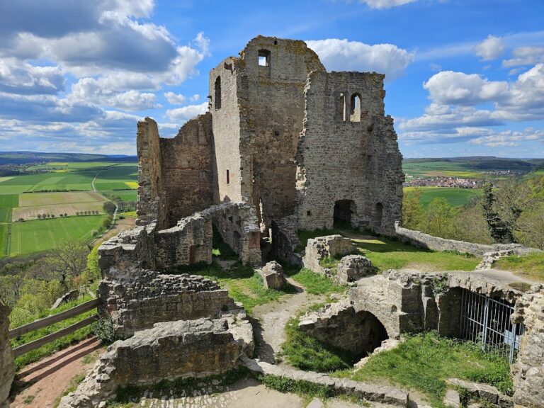
The eastern wall of the Gothic palas, the principal residential or representational building of a medieval castle, remains standing. It rises to about 90 metres above the Main and forms the most substantial surviving wall of the late medieval complex. Alongside it, massive foundations and ruined interior structures preserve the final form of the castle, while the earlier fortification lines remain chiefly as archaeological traces revealed by excavation and aerial photography.