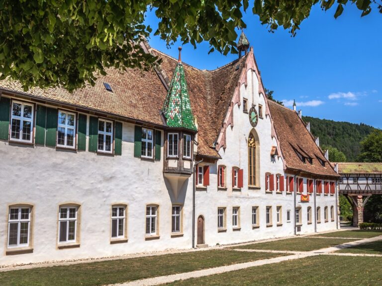
Ulm Fortress: A Federal Fortress of the German Confederation


Site at a Glance
- Rating
- 4.5
- Popularity
- Medium
- Country
- Germany
- Primary era
- Modern
- External website
- Open
- Eras represented
- Modern
- Civilizations
- German
- Site type
- Military
- Remains
- Fort
On this page23 sections
History
Ulm Fortress, formally the Federal Fortress of Ulm, was a nineteenth-century fortification in Germany built by the Kingdoms of Württemberg and Bavaria under the German Confederation. Construction took place from 1842 to 1859 in the polygonal style of the New Prussian, or New German, manner. Enclosing Ulm and Neu-Ulm, it formed part of the German states’ collective defence after Napoleon’s defeat and became the largest nineteenth-century fortification in Europe.
Planning the federal fortress
The German Confederation was an association of German states created in 1815. Its federal fortresses were jointly financed and intended to strengthen the member states’ shared defence. On 3 November 1815, Austria, Britain, Prussia, and Russia proposed Mainz, Luxembourg, and Landau for this purpose, together with another fortress on the Upper Rhine. Austria supported the expansion of Ulm, while Prussia and several southern German states favoured Rastatt.
King William I of Württemberg proposed fortifying both cities in October 1836. Bavaria and Austria accepted this compromise in 1838 and 1839. The Rhine Crisis of 1840 to 1841, a confrontation between the German states and France that prompted renewed defensive preparations, accelerated the decision. On 26 March 1841, the Federal Assembly approved fortresses at Ulm and Rastatt, including a bridgehead on the Bavarian side of Ulm. At the urging of King Ludwig I of Bavaria, Neu-Ulm was incorporated into the fortress.
The fortress occupied territory in both kingdoms and was designed by the Prussian fortress construction director, Colonel Moritz Karl Ernst von Prittwitz und Gaffron. Major Theodor Ritter von Hildebrandt directed the Bavarian works at Neu-Ulm from December 1843, after the death of the original Bavarian fortress director, Friedrich Herdegen. Up to 10,000 workers were employed at one time during construction.
Construction and military purpose
The completed fortress had a polygonal main enclosure approximately 9 kilometres long. Its closed wall surrounded Ulm and Neu-Ulm and was supported by detached forts on the surrounding heights and approaches. The Ulm forts occupied prominent high ground above the city. The terrain around Neu-Ulm lacked suitable hills, so no equivalent group of high-ground forts was built there. The first stone bridge across the Danube between the two cities stood inside the fortress, while the next such bridge was at Regensburg.
In peacetime, the fortress was intended to house 5,000 soldiers supplied by Württemberg, Bavaria, and Austria. Wartime plans allowed for up to 20,000 troops. A proposal to provide accommodation for 100,000 men was never realized. The construction cost was estimated at 16.5 million guilders.
Ulm represented a change from the traditional bastion system to a polygonal arrangement with detached outworks. This system, called the New Prussian or New German manner, had previously been used at Koblenz. The fortress combined a continuous enclosure, projecting works, detached forts, ditches, gates, casemates, and military roads with a wider defensive ring.
From the German Confederation to the Reich Fortress
After the German Confederation was dissolved, the Austrian garrison left Ulm and Neu-Ulm on 16 October 1866. A treaty between Bavaria and Württemberg in August 1868 regulated their relations concerning the fortress. Following the foundation of the German Empire in 1871, the Empire assumed control, and the complex became known as a Reich Fortress. Württemberg and Bavarian troops continued to occupy it.
Changes in artillery led to a new phase of construction from about 1900. Concrete bunkers were sunk almost entirely into the ground to reduce their exposure. The final major armament works were undertaken in 1914, although the planned forward ring of concrete positions was not completed. Unlike Rastatt, Ulm was not required to be demolished under the Treaty of Versailles after the First World War. It retained its military status until 1938.
Twentieth-century destruction and reuse
The main wall and many associated works were progressively dismantled from the early twentieth century. Wall and ditch sections were removed or levelled from about 1904 and 1905 onward. Their land was reused for roads, railway lines, schools, factories, housing, parks, and other urban facilities. Other installations were damaged during the Second World War and later demolished, while surviving forts and Reich Fortress works fell into serious disrepair.
The First World War produced the last incomplete expansion of the fortress. Work began in July 1914 on a projected ring of trenches, infantry positions, artillery rooms, ammunition rooms, pumping stations, batteries, and intermediate flanking works. Construction stopped after about six weeks when it became clear that enemy forces would not advance on Ulm. The planned line was to extend counter-clockwise from Trench 1 near Obertalfingen around Ulm and Neu-Ulm to Trench 78 north of Pfuhl. The plans included 74 trenches, 13 infantry bases, 20 artillery rooms, 10 ammunition rooms, four pumping stations, and nine intermediate flanking works, together with additional positions near Ludwigsfeld and Wiblingen.
Many of these works were built on farmers’ land without permission. Some were dismantled during the war or reused by landowners, and the United States Army demolished many of the remaining positions after the Second World War. Elements that survive in whole or in part include the Buchbrunnen pumping station, Intermediate Flanking Work 6, underground guard and shelter rooms, Support Point 70, ruins of ammunition and artillery rooms, earthworks, and building pits.
The Wilhelmsburg in the twentieth century
The Wilhelmsburg served as a military installation through several political periods. Austrian fortress artillery used it until 1866, while the Sixth Württemberg Infantry Regiment occupied it until 1871. From 1871 to 1918 it housed the Grenadier Regiment “King Karl,” and Reichswehr troops returned in 1920. The Reichswehr was Germany’s post-First World War armed force. After the Wehrmacht was reorganized in 1935, part of Infantry Regiment 56 occupied the citadel, although the Wehrmacht made relatively little use of it during the Second World War.
In August 1944, the Telefunken electron-tube factory was moved into the Wilhelmsburg from Lodz, then called Litzmannstadt, because of the Soviet Operation Bagration. This major Soviet offensive against German forces in Belarus and eastern Poland prompted the relocation. Barracks were built in the courtyard for the forced labourers employed in the factory.
Bombing burned much of the Wilhelmsburg’s roof structure. After the war, American authorities requisitioned the remaining material for urban reconstruction. The fortress then provided emergency accommodation for bombed-out residents and displaced people. A refugee camp with its own infrastructure housed as many as 3,000 people until 1956, when its last residents were transferred to Gaisenberg Barracks.
The Bundeswehr, the armed forces of the Federal Republic of Germany established in 1955, used the Wilhelmsburg from 1956 into the 1970s. Moisture entering through the missing roof eventually made its rooms unusable. The city of Ulm purchased the building from the Federal Republic in 1986 for one mark. It has since stood largely empty, with limited use by a solar company, the Förderkreis Bundesfestung Ulm, the Bundeswehr, and the Ulm Theatre.
Preservation and interpretation
The Fort Oberer Kuhberg served as one of the early concentration camps of the Nazi regime from November 1933 to July 1935. A concentration camp was a detention and forced-labour facility operated by that regime. The fort later contained a munitions facility, prisoner-of-war camps for Polish and French prisoners, air-raid shelters, emergency accommodation, business premises, and a restaurant.
Restoration of Fort Oberer Kuhberg began in 1967 through the efforts of Ulm veterinarian Otmar Schäuffelen. The work led to the foundation of the Förderkreis Bundesfestung Ulm in 1974. The association assumed responsibility for maintaining the fort and reconstructed the nearby blockhouse between 2018 and 2024. The Baden-Württemberg Monument Foundation named the fort “Monument of the Month” for January 2010.
From 1984 to 1993, the Federal Fortress of Ulm appeared on UNESCO’s tentative list as a candidate for World Heritage status. Preservation has therefore focused on a group of surviving structures rather than on the complete nineteenth-century enclosure, whose walls, ditches, and military land were altered by urban development and later destruction.
Remains
The surviving fortress is organized around the former polygonal enclosure of Ulm and Neu-Ulm, detached forts on the outer heights, and later concrete and reinforced-concrete positions. Its principal works occupied the upper, western, eastern, and lower city fronts, the Danube bank, the Neu-Ulm circumvallation, and a wider ring of forts. Some elements retain walls, ditches, casemates, gates, glacis, and underground rooms, while others survive as earthworks, foundations, or restored fragments.
Danube and western city fronts
Obere Donaubastion
The Obere Donaubastion was built from 1843 to 1855 under Major von Schele and could accommodate 2,253 men. Its principal surviving structure is a four-storey Reduit, a fortified inner building intended as a final defensive position. It also functioned as a defensive barracks, with living quarters toward the gorge and gun casemates facing outward. Powder magazines, caponiers, a bonnet casemate, a mortar battery, flanking positions, a blockhouse, and a wet ditch with a water-regulating dam formed part of the work.
The bastion’s glacis, the gently sloping ground outside a fortification, is almost completely preserved within the Ehinger Anlagen. The Reduit received a tiled roof in 1935 and was restored from 1996 to 2000. The former wall was removed between 1904 and 1914, the water ditch was filled, and supply buildings, stables, and a riding hall were constructed on the site. The Bogenescarp was demolished to ditch level but remains underground. A shaft made the lower level of the bonnet casemate accessible in 1996. The Reduit is used by the Danube Swabian Central Museum, associations, shops, and a Turkish theatre.
Courtine and Ehinger Gate
The courtine, a fortified connecting section between larger works, linked the Obere Donaubastion and the Mittelbastion. Built from 1843 to 1855 under Lieutenant Faber du Faur, it included the inner Ehinger Gate, a caponier, an escarp, and a tenaille. A caponier was a covered structure projecting into a ditch so defenders could fire along it. The wall and caponier were demolished during the 1904 defortification, while the inner gate and its outer gate piers survive.
Ehinger Ravelin and Mittelbastion
The ravelin in front of the Ehinger caponier was built from 1843 to 1855 under Major von Schele for 80 men. A ravelin is a detached polygonal work placed in front of a gate or curtain wall. Only its glacis remains. The Mittelbastion, built during the same period under Lieutenant von Sachs, contained a small octagonal gorge Reduit known as the Böblinger Tower. This tower is the surviving part of the bastion. The forward Blauflèche protected the Mittelbastion, but its masonry structures were demolished on 21 February 1903.
Blaubeurer Gate and connecting works
The work between the Mittelbastion and the Kienlesbergbastion included the Blumenschein Gate and the inner Blaubeurer Gate. The Blaubeurer Gate has a Romanesque-inspired design and stands on a foundation of 736 deeply driven wooden piles. Around 100 metres of escarp wall and the Blau water passages also survive. Part of the gate was removed during bridge construction in the 1960s. Reconstruction associated with replacing the B28 bridge with a tunnel is planned with modern materials that can be distinguished from the historic fabric.
Kienlesberg and Michelsberg
Kienlesberg Contregarde
The Contregarde at the Kienlesberg was built from 1843 to 1852 under Lieutenant von Hügel. A contregarde was a detached work intended to shield a principal fortification. Its wall and deeply cut rock casemates survive, although the casemates are no longer accessible.
Kienlesbergbastion and connecting line
The Kienlesbergbastion was built from 1843 to 1852. Its surviving elements include a double caponier, Reduit, escarp, traversed wall, mortar battery, dry ditch, and powder magazines. The long connecting work toward the Wilhelmsburg contains a 350-metre escarp wall, a dry ditch, a wall with three gun positions, a bonnet casemate, a mortar battery, a glacis, powder magazines, and a wall supervisor’s house. Its larger magazine held 1,200 hundredweight, approximately 60 tonnes, of powder.
Wilhelmsburg
The Wilhelmsburg is a citadel measuring 200 by 130 metres, built from 1842 to 1849 under Major von Erhardt. It formed the Reduit of the Wilhelmsfeste and could accommodate 6,951 men. The four-storey complex has an inner courtyard of approximately 1.3 hectares, four flanks, a gorge tower, and two front flanking towers about 30 metres high. Around 570 rooms were built from approximately 300,000 tonnes of limestone quarried in the Blau Valley.
The defensive-barracks plan placed soldiers’ rooms toward the courtyard and gun casemates toward the exterior. A dry ditch formerly surrounded the citadel, although its northern side was filled during conversion to a Bundeswehr barracks. Earth covering was replaced by a tiled roof in 1928, followed by a sheet-metal roof installed from 1986 to 1989. The building’s surviving form also reflects its wartime damage, post-war accommodation, and later military and limited civilian uses.
Wilhelmsfeste
The Wilhelmsfeste occupies the summit of the Michelsberg and formed the strongest front of the federal fortress. Constructed from 1842 to 1857 under Captain von Finsterlin, with assistance from Lieutenants Berger, von Gaisberg, and Arlt, its works could accommodate 1,607 men. The complex includes a traversed wall, escarp wall, dry ditch, shoulder redoubts with Reduits, caponiers, a flanking tower, barracks, and a powder magazine. The Wilhelmsburg forms a separate work on its southern side, and covered ways connected the Feste with the Teacher Tower and Fort Prittwitz.
Parts of the Wilhelmsfeste walls were destroyed during Bundeswehr construction, especially on the left side, but the complex remains generally well preserved. It stayed in near-continuous military use, first under the Württemberg Army, then the Reichswehr, the Wehrmacht, the United States Army, and the Bundeswehr. Since 1956 it has been known as the Wilhelmsburg Barracks. The site has housed the Second Corps, the Command for Operational Leadership of Intervention Forces, and, since July 2013, the Multinational Command Operational Leadership and Multinational Joint Headquarters Ulm.
Eastern, lower, and Neu-Ulm works
The eastern connecting line, the Gaisenberg bastions, the lower city front, and the Untere Donaubastion formed a further sequence of walls, ditches, Reduits, caponiers, gates, casemates, powder magazines, and railway connections. Many were removed as the city expanded. Surviving structures have been reused by schools, associations, cultural organizations, businesses, and municipal institutions.
The Neu-Ulm circumvallation differed from the Ulm system through its alternating brick bastions and courtines. It included half-bastions, connecting walls, caponiers, railway blockhouses, gates, powder magazines, barracks, and glacis sections. A batardeau, or masonry dam for regulating ditch water, controlled the surrounding ditch. Several works were levelled, while surviving caponiers, gates, blockhouses, glacis sections, and bastion structures have been restored or reused.
Several projected works were cancelled, mainly for financial reasons or following pressure from the Federal Assembly. These included a turret in the Ruhe Valley, Fort 10 near Offenhausen, Gun Turret 11 beside the Ulm to Augsburg railway, an outwork later associated with the Illerkanal, an additional fort near Pfuhl, and works near the Wiblinger Steige and Kapellenberg.
Detached forts and later defensive rings
The outer ring included Forts Unterer Kuhberg, Oberer Kuhberg, and Prittwitz, the Söflinger Turm, the Orlinger Tower, Fort Albeck, Fort Safranberg, Fort Friedrichsau, the Ludwigsvorfeste, and the Illerkanal outwork. Their designs used Reduits, traversed walls, escarps, dry or wet ditches, caponiers, flanking towers, mortar batteries, powder magazines, and blockhouses. Fort Friedrichsau was the only fort in the ring with a wet ditch.
Fort Oberer Kuhberg
Fort Oberer Kuhberg is fully preserved. Its later uses have left the fort with an unusually varied history of occupation, including the early Nazi concentration camp, a munitions facility, prisoner-of-war camps, air-raid shelters, emergency accommodation, business premises, and a restaurant. The Documentation Centre Oberer Kuhberg and the Förderkreis Bundesfestung Ulm now share the fort. Restoration and maintenance have preserved the structure while retaining the physical evidence of its successive uses.
Biehler forts on the Eselsberg
Later Biehler forts were built on the Eselsberg from 1881 to 1887. Their wall systems were sunk deeper into the ground to reduce visibility and were later reinforced with concrete. The Upper Eselsberg main and subsidiary works became infantry positions and were incorporated into the Reich Fortress’s forward main battle position in 1914. The interiors of the main work were demolished in 1971, while the subsidiary work has been maintained and repaired since 2009.
Reich Fortress armament works
The Reich Fortress armament works built from 1901 to 1916 used concrete and reinforced concrete outside the earlier walls and forts. Many remained unfinished. Numerous positions were levelled during the First World War or blown up by the Allies in 1945. Surviving elements include underground shelters, ammunition and artillery rooms, pumping stations, intermediate flanking works, earthworks, ruins, and building pits.
Nearby sites