Funa Fortress: A Medieval Frontier Castle in Crimea


Site at a Glance
- Rating
- 4.4
- Popularity
- Low
- Country
- Russia
- Primary era
- Medieval
- External website
- Open
- Eras represented
- Medieval
- Civilizations
- Byzantine
- Site type
- Military
- Remains
- Castle
On this page10 sections
History
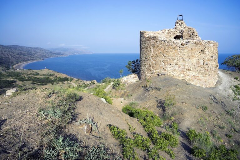
Funa Fortress is a medieval fortress in Crimea, identified in the location context with Burg Frankenstein, Germany, Russia, on a rocky hill near the western foot of South Demerdzhi, about 2 kilometres north of Luchiste. Built by the Principality of Theodoro, a medieval polity that contested Crimea’s southern coast with Genoa, it served as an eastern frontier outpost and guarded a route between the steppe and the coast.
Frontier Stronghold
The name Funa means “smoky” in Greek. The mountain and nearby pass were also formerly known by the same name. The fortress stood near a medieval trade route linking Aluston, close to present-day Alushta, with the steppe Crimea. After the Genoese Republic seized the coast between Caffa and Cembalo, Theodoro’s rulers established mountain fortifications opposite the main Genoese strongholds. Funa confronted the Genoese fortress of Aluston and helped control the important caravan route.
The site first appears in patriarchal records from 1377 to 1379, as well as from 1384 and 1390. These entries concern disputes among the metropolitans of Kherson, Gothia, and Sugdaea, senior Christian bishops responsible for separate ecclesiastical jurisdictions in Crimea. Genoese records from approximately the same period refer to the settlement as Fonna.
Fortification, Destruction, and Reconstruction
Architectural and archaeological research places the initial fortification between 1422 and the end of 1423, probably in the spring or summer of 1423. The fortress took part in the Genoese-Theodorian wars of 1422 to 1423 and 1433 to 1441, as well as local clan conflicts. A major earthquake in October or November 1423 destroyed the fortification, which was probably restored around 1425.
The restored outpost was later burned, although the cause and date remain uncertain. The fire may have followed the Genoese punitive expedition led by Carlo Lomellini in 1434, or raids on the coast during the 1450s. In 1459, the stronghold was thoroughly reconstructed and converted into a castle. Its garrison numbered approximately 30 to 40 warriors.
Funa finally lost its military function after Ottoman forces conquered Crimea in 1475. The Ottoman conquest brought both the Genoese coastal possessions and the Principality of Theodoro under Ottoman control, and the fortress was destroyed.
Archaeology, Heritage, and Legend
Funa is recognized as an archaeological and architectural monument. It has been listed as a nationally significant Ukrainian heritage monument and as a federal-level cultural heritage property of the Russian Federation. The archaeological complex received federal-level heritage-property status in October 2015.
A local tradition says that a queen of the Goths was buried near Funa with a pure-gold crown. Excavations carried out after German forces occupied Crimea did not confirm the story, but local belief continued to place the crown beneath the castle walls.
Remains
The fortified complex occupied approximately 0.52 hectares. Its maximum recorded extent was about 106 metres from north to south and 56 metres from west to east, while the rebuilt castle of 1459 measured approximately 105 metres in length and 52 metres in width. Excavation has identified walls, towers, gates, small posterns, stairways between defensive levels, a cistern, auxiliary buildings, and a principal fortified tower.
Castle Defences
Donjon
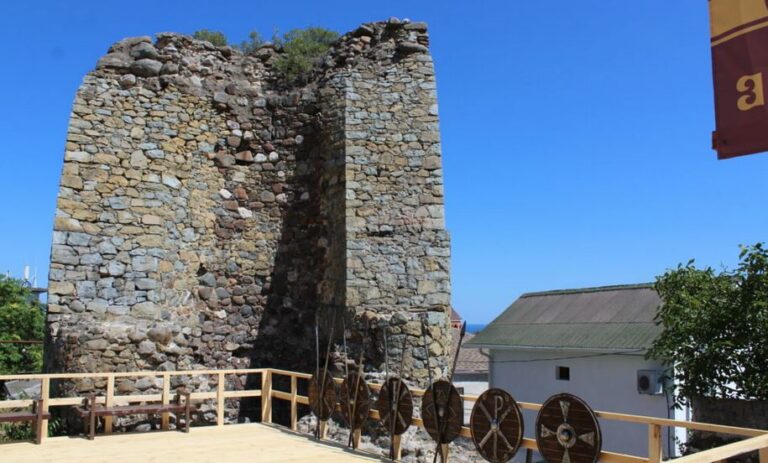
Near the gate stood a three-level donjon, the principal fortified tower of a medieval castle and a defensive command or refuge structure. It was about 15 metres high, with internal dimensions of approximately 6 by 10 metres and walls 2.3 metres thick. Its position allowed it to protect the posterns, small usually concealed gates through the fortifications, and to direct fire across the adjoining citadel area.
Gate and Defensive Levels
The surviving architectural ensemble includes a gateway arch and part of the wall above the gate church. Stairways connected the different defensive levels, while the walls, towers, gates, posterns, cistern, and supporting buildings formed the working layout of the fortified settlement. The 1459 reconstruction substantially strengthened this arrangement.
Church of Saint Theodore Stratelates
The ruins of the Church of Saint Theodore Stratelates remain within the architectural ensemble. Saint Theodore Stratelates, also known as Theodore the General, was a Christian military saint venerated in the Byzantine religious tradition. The church survived the Ottoman destruction of 1475 better than the other structures, underwent repeated repairs and rebuilding, and remained standing until the beginning of the twentieth century.
Rockfall and Earthquake Damage
Near the fortress is an area of massive rockfall known as a “stone chaos.” It consists of huge stone blocks and rubble produced by a major collapse in 1894 and by later rockfalls. The Yalta earthquake of 1927 subsequently caused substantial damage to the fortress structures.
Nearby sites