Choban-Kule: A Fifteenth-Century Genoese Castle in Ukraine


Site at a Glance
- Rating
- 4.8
- Popularity
- Low
- Country
- Ukraine
- Primary era
- Early Modern
- Eras represented
- Early Modern
- Civilizations
- Genoese
- Site type
- Military
- Remains
- Castle
On this page11 sections
History
Choban-Kule is a ruined fifteenth-century Genoese castle in Ukraine, on Agira Cape near Mors’ke. Also known during the Genoese period as Taxili or Tasili, it was begun around 1460 as the center of a lord’s territorial domain and was later expanded from a castle into a fortress. Its modern Crimean Tatar name means “Shepherd’s Tower,” while the related form Choban-Kale means “Shepherd’s Fortress.”
Foundation and Genoese rule
The fortification stood on Agira Cape, also called Bashenny Cape, about 5 km west of Mors’ke, a village historically known as Kapsikhor. The Genoese Antonio di Guasco founded the settlement of Tassili in the late 1450s and made it the center of the same-named domain, a territory governed by a local lord. He began building the castle around 1460, reportedly to protect the settlement from attacks by Turkish pirates.
The building project is associated with Antonio de Bonino, an engineer and specialist in fortifications who had come from Genoa to inspect local defenses. His involvement remains probable rather than certain. Construction is generally placed between approximately 1460 and 1473, although the fortress had not been completed by the time the Ottoman invasion reached Crimea.
Documents from the summer of 1474 show that Christoforo di Negro, the consul of Kaffa, criticized the owner, Andreolo di Guasco, for failing to follow the planned construction work. Kaffa was the principal Genoese center in Crimea, and its consul served as the chief representative of the Genoese administration there. Di Negro warned that the unfinished fortress could fall into the hands of the Turks or Goths. By 1475, only the donjon, the castle’s principal fortified tower, had been completed.
The Ottoman invasion and abandonment
The Ottoman rulers’ conquest of Crimea in 1475 ended Genoese control in the region. The defenders probably abandoned Choban-Kule without resistance during the summer invasion. Andreolo di Guasco fled first to Georgia and then to Persia. He later appears to have gone to Poland, where he corresponded with Mengli Giray at the royal court in 1481. Mengli Giray was a ruler of the Giray dynasty, which governed the Crimean Khanate.
A small settlement developed beside the castle during the second half of the fifteenth century. Antonio di Guasco established it for members of the local Sile, or Shelen, community. It included residential buildings, a church, and a cemetery, but ceased to exist during the Ottoman invasion. Its remains provide evidence of the community that accompanied the Genoese fortification.
Rediscovery and archaeological study
Peter Pallas, a German naturalist and explorer working in the Russian Empire, inspected the fortification in 1794. He described it in detail and identified it as an ancient Greek castle. In 1821, E. E. Keller and the architect E. F. Pascal visited the site, after which Keller identified the structure as Genoese. Peter Koeppen, a Russian geographer and ethnographer, instead dated it to the period after the reign of the Byzantine emperor Justinian I, who ruled from AD 527 to 565.
In 1889, the Russian military engineer and archaeologist A. L. Bertier-Delagard surveyed the castle, prepared a plan of the settlement, and measured the donjon. He reconstructed the tower as a three-storey structure apparently topped by an open fighting platform. The Soviet archaeologist N. I. Repnikov proposed that a Roman fortification had occupied the site, but investigations have not recorded material from the first to third centuries AD.
The first excavations of the settlement near the fortress took place from 1952 to 1954 under V. P. Babenchikov and A. L. Jakobson. They examined a pottery-production center east of Choban-Kule, on the left bank of the Choban-Kule-Uzen River. This was a specialized area for manufacturing ceramic vessels and related wares, and work there continued intermittently until 1989. Investigation of the fortress itself began in 1992. Choban-Kule is recognized as a cultural-heritage monument of federal significance in Russia and as a monument of national significance in Ukraine.
Remains
Fortified enclosure
Walls and corner towers
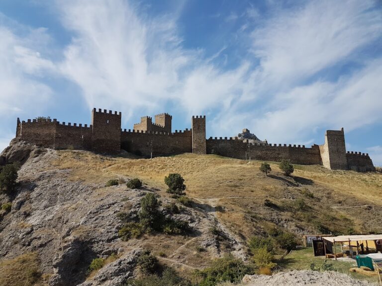
The fortified area extended for approximately 210 by 50 m and covered about 0.68 hectares. Its defensive walls ran for roughly 230 m. Within this enclosure, the castle had a broadly square plan, with corner towers and an enclosed service courtyard adjoining it on the east or southeast. The towers contained loopholes positioned to allow fire along the walls.
The walls and towers used double-faced masonry, a construction method in which two outer stone surfaces contain a rubble-filled core. The stones were irregular in size and roughly hewn, while lime mortar bonded the masonry. Excavations identified a circular eastern corner tower about 3.7 m in diameter and surviving to as much as 3 m high, together with a similar northern tower. Numerous varied weapons were found in the towers.
Donjon
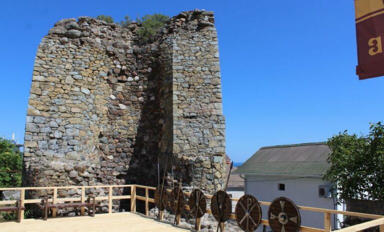
The donjon stands at the center of the castle courtyard. It is an elliptical, multi-level tower measuring approximately 12.7 by 14.1 m. The surviving basement and two levels above ground rise 8 to 9 m, representing about 45 percent of the tower’s original height. Its walls are approximately 1.8 m thick on the seaward side and reach about 4.3 m on the landward side.
The basement contained a water reservoir and a service room. The first level above ground was also used for utility purposes and preserves a fireplace, an embrasure with an internal chamber, and the tower’s splayed entrance opening. Access to the tower was placed on the second level. Wooden floors connected the storeys, and Bertier-Delagard’s 1889 measurements indicate that the uppermost level was probably capped by a dome. The surviving donjon and adjoining wall ruins form the principal remains of the castle.
Settlement and surrounding features
Settlement on the northeastern slope
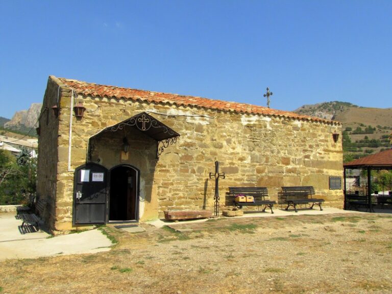
Outside the fortress, a settlement occupied the northeastern slope. It contained residential buildings, a church, and a necropolis, meaning a cemetery associated with the historic community. Parts of the former houses have been recovered. The settlement’s position beside the fortress reflects the presence of the Sile, or Shelen, community that lived there during the Genoese period.
Pottery-production center and water source
East of Choban-Kule, on the left bank of the Choban-Kule-Uzen River, lies the ninth- to tenth-century pottery-production center examined during the twentieth-century excavations. Its date places it before the Genoese castle and shows that ceramic manufacture took place in the surrounding area during an earlier period.
The associated Choban-Kule-Chokrak spring feeds the Choban-Kule-Uzen stream. The hill carrying the fortress rises approximately 85 m above sea level and runs from east to west. Its eastern and northern slopes are comparatively gentle, while the western and southern sides descend steeply toward the sea, giving the surviving walls and tower their setting on the cape.