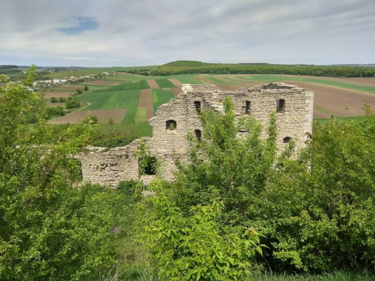
Skalat Castle: A Fortified Residence on the Polish-Lithuanian Commonwealth’s Southeastern Frontier


Site at a Glance
- Rating
- 4.5
- Popularity
- Low
- Country
- Ukraine
- Primary era
- Early Modern
- Eras represented
- Early Modern
- Civilizations
- Polish–Lithuanian Commonwealth
- Site type
- Military
- Remains
- Castle
On this page13 sections
History
Skalat Castle is a seventeenth-century fortified residence in Skalat, Ukraine, built by local nobles to help defend the southeastern frontier of the Polish-Lithuanian Commonwealth. The town, first mentioned in 1379 and known as a town by 1564, stood in a region repeatedly affected by Ottoman, Tatar, and Cossack military activity.
Skalat before the fortress
Skalat had a reputation as a rebellious town. In 1602, laborers reportedly burned the town hall in protest against oppression by the Polish authorities, while many inhabitants joined Severyn Nalyvaiko, a Cossack leader associated with an uprising against Polish rule. The insecurity of the region increased the need for a strong fortified residence for the local magnates.
The present fortress was built around 1630 and completed in 1634. Its foundation is generally attributed to Krzysztof Wichrowski, the sword-bearer of Halych and a member of the Pomian heraldic clan. Other traditions place its origin after the foundation of Skalat around 1600 or connect it with an earlier fortification, but these explanations remain uncertain. Earthworks found within the grounds suggest that a wooden fortress may have occupied the site before the visible stone complex.
Wars, destruction, and rebuilding
After Wichrowski died, the castle passed as the dowry of his daughter Weronika to Jan Firlej, the castellan of Sanok. A castellan was a senior territorial official traditionally connected with the administration and defense of a castle district. Ownership later passed through the Firlej, Scipio del Campo, Kalinowski, Poniatowski, Wodzicki, and Rozenstock families.
The fortress suffered during the Cossack wars, the major conflicts that affected towns and fortifications across the Polish-Lithuanian Commonwealth during the 1648–1651 uprising. Forces led by Maksym Kryvonis, a Cossack commander active in those years, entered Skalat in 1648, 1649, and 1651, and the castle was attacked or damaged. In 1672, an Ottoman-Tatar army led by Pasha Ibrahim Shishman destroyed the fortress and much of the town.
Jan Firlej is credited with rebuilding the ruined castle in the late seventeenth century and using it as his residence. Maria Wodzicka is associated with an eighteenth-century rebuilding that gave the fortress a quadrilateral form with four corner towers. An inscription dated 24 July 1795 credits Maria Wodzicka Scypionowa with reforming the castle, surrounding the town with walls, adding buildings, and improving the estate during a famine.
Nineteenth-century alterations and wartime ruin
In the second half of the nineteenth century, the castle and adjoining property were sold to the Rozenstock family. From 1869, Suesskind Rozenstock and his sons held the property. Count Rozenstock paid for the restoration of the towers under the architect Teodor Talowski. The work used historicism, a nineteenth-century approach that revived and recombined forms from earlier architectural periods.
The First World War almost completely destroyed the castle. The residential palace disappeared, while the towers, sections of the enclosing walls, and the entrance gate survived. Reconstruction followed during the interwar period. After the war, the site was used for municipal economic purposes and included a dance floor. The surviving towers were restored during the 1950s and later used for household purposes.
Conservation and interpretation
Conservation of the ruins began in the 1960s. From 1988, the Ukrzakhidproektrestavratsia Institute carried out architectural and archaeological examinations. In 1990, architects I. Andrushko, Lubart Lishchynskyi, and Yu. Kurets, working under M. Haida, prepared a restoration concept to stabilize the castle, repair the tower roofs and coverings of the defensive walls, clear the loopholes, and restore heating systems in the defensive towers.
By the 2000s, reconstructed wall sections had reached approximately human height, and the four corner towers had been restored to roof level. Skalat Castle became a branch of the National Reserve Castles of Ternopil Region in 2003 and was administered by the reserve from 2004. A severe storm that year damaged the tower roofs. By the late 2000s, tiled roofs on three towers had been restored and their foundations and walls strengthened, while work on the fourth tower continued. The castle remains under conservation and is protected in Ukraine as a monument of national architectural significance. Proposals to convert one tower into a museum and another into a hotel remain plans rather than completed alterations.
Remains
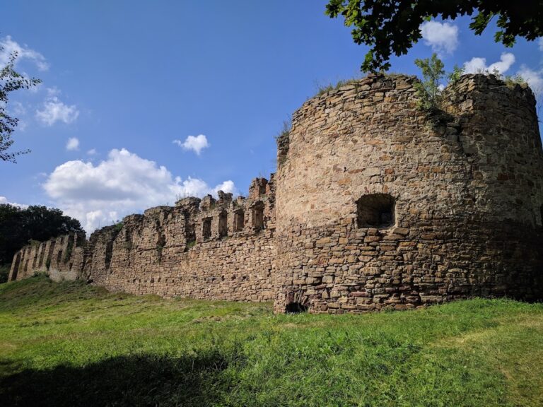
Skalat Castle occupies elevated ground in the southwestern part of the town, within a river floodplain. The fortress follows an irregular quadrilateral plan, with sides measuring approximately 92 metres on the north, 72 metres on the south, 72 metres on the west, and nearly 63 metres on the east. Sandstone and locally quarried broken stone from the Tovtry ridge, a chain of limestone hills in western Ukraine, form the principal masonry. The surviving architectural character combines late Renaissance and Baroque forms with nineteenth-century historicist alterations.
Walls, towers, and water defenses
Enclosing walls and corner towers
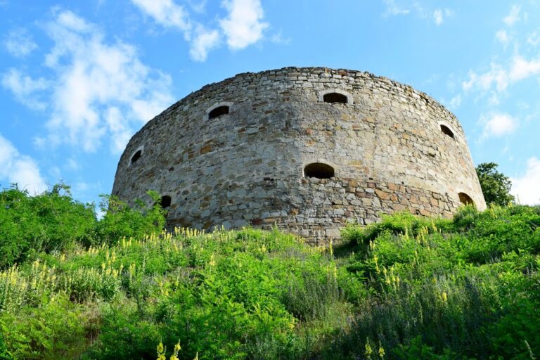
Walls up to 6 metres high and about 2 metres thick enclosed the complex. Four five-sided, five-storey towers strengthened its corners and were oriented toward the cardinal directions. Their high hipped roofs were covered with red ceramic tiles after restoration. The towers protected the approaches in a manner comparable to projecting gun platforms. Loopholes, narrow openings for weapons or observation, were arranged across four levels. The third level carried machicolations, projecting defenses with openings through which defenders could attack people below, while the fourth-level loopholes had keyhole shapes.
Moats and earthworks
The original defenses incorporated wetlands and small deep bodies of water. Water-filled moats, reportedly reaching 2 metres in depth, ran along the northern and southeastern sides and were connected by a dam to a pond. A broad dry moat, up to 3 metres wide, survives on the southeastern side. Earthworks within the grounds point to the possibility of an earlier wooden fortress on the same elevated site.
Interior buildings and underground features
Palace and service buildings
A residential palace stood against the inner side of the eastern wall and housed the noble family. After its destruction, a poorer building with lower or ground-level storeys was erected there. On the opposite side of the enclosing wall, a separate group of service and utility rooms supported the garrison and its military activities. A well-maintained garden existed within or beside the castle shortly before the First World War.
Underground galleries
Underground galleries allowed defenders to communicate with the outside world during a complete encirclement, and fragments of these passages survive. Local tradition holds that passages from at least two towers met beneath the center of the complex in a room containing a stone table. Metal hooks and chains fixed to its walls have prompted the suggestion that the room served for confinement. A further underground route said to extend toward Hrymailiv belongs to local historical tradition.
Entrance gate and inscriptions
The southeastern entrance was reached by a single approach road. Built of stone, the gate included two smaller wickets and had the character of a seventeenth-century palace entrance more than that of a strictly defensive gateway. Stone figures and vases decorated it. Above the entrance stood a helmeted stone knight leaning on an oval shield bearing the Jelita, Rawicz, Leliwa, and Scipio coats of arms.
The surviving gate section is dated to 1795. Stone plaques and inscriptions on and above the gate preserve the names of owners and patrons and refer to episodes in the castle’s history. Another inscription states that Weronika Wichrowska, the wife of Jan Firlej, repaired the completely collapsed structure at her own expense on 12 June. A damaged inscription over the other wicket preserves the words “Familiae Deo Maximo” and the date 1706. The present visible fabric consists chiefly of reconstructed towers, copied wall sections, surviving wall fragments, the entrance gate, and the southeastern dry moat.