Samson Fort: A Roman and Medieval Frontier Fortress in Belgium


Site at a Glance
- Rating
- 3.8
- Popularity
- Very Low
- Country
- Belgium
- Primary era
- Medieval
- Eras represented
- Medieval
- Civilizations
- Holy Roman Empire
- Site type
- Military
- Remains
- Castle
On this page9 sections
History
Samson Fort is a ruined Roman and medieval fortress site in Belgium, near Andenne, overlooking the Samson River and the Meuse. Its earliest military phase probably dates to the mid-fourth century, when a small Roman fort, or oppidum, a fortified settlement or defensive enclosure, stood on the rocky summit.
Roman and Frankish occupation
The Roman fort occupied a populated frontier zone between the Atuatuci and the Condrusi. Its Roman name is unknown. A cemetery was established beside the fort from the end of the fourth century, linking the military position with the surrounding community.
Frankish forces took control of the site during the fifth century. The cemetery was enlarged with graves containing weapons, and Samson remained under Frankish control until approximately 640. Tradition later named Auberon, said to be the son of Clodion the Hairy, as the founder of the fortress. This connection belongs to foundation tradition rather than certain history.
The County of Namur
From about the tenth century, Samson became a fortress of the County of Namur, a medieval territorial principality centred on Namur. The counts strengthened the position along the Meuse in response to Norman incursions and developed it as part of Namur’s defence.
The Normans besieged Samson during the ninth century but failed to take it. In the medieval defensive network of the County of Namur, the fortress stood alongside Poilvache, Bouvignes, and Montaigle. Count Philip I of Namur, also known as Philip the Noble, carried out much of its construction and development.
Samson and Andenne lay on the boundary between the County of Namur and the neighbouring Prince-Bishopric of Liege, an ecclesiastical principality ruled by a prince-bishop. Raids came into the frontier zone from Huy. In 1466, Huy’s militia burned the farmers’ harvest while the farmers watched from the fortress.
Attacks and destruction
The fortress resisted several later attacks. Luxembourg troops occupied it from 1216 to 1222, the only occasion on which Samson was captured. Its final siege took place in the sixteenth century.
During the seventeenth century, Spanish authorities judged that Samson could not withstand an artillery assault. King Charles II of Spain ordered its demolition in 1690, and by 1691 the fortress had been destroyed. The Samson rocks have been protected as classified built heritage in Andenne since 12 May 1944.
Remains
Rocky spur and defensive enclosures
The fortress occupied a limestone spur about 140 metres above sea level. Cliffs approximately 60 metres high descended toward the Samson River to the south and the Meuse to the north, near the Samson’s confluence with the Meuse. The position dominated the village of Samson in the Samson valley.
The roughly triangular defensive position used the rivers and the rocky escarpment to protect two sides. The eastern side was the principal approach requiring fortification. Three terraces or enclosures extended across the hill. The lower enclosure was reached from the upper part of Thon village, the second contained the bailey, an enclosed courtyard or lower defensive area, and the upper enclosure surrounded the castellan’s residence and service buildings. A castellan was the official responsible for administering and defending a castle, and the upper enclosure also contained defensive towers.
Upper enclosure
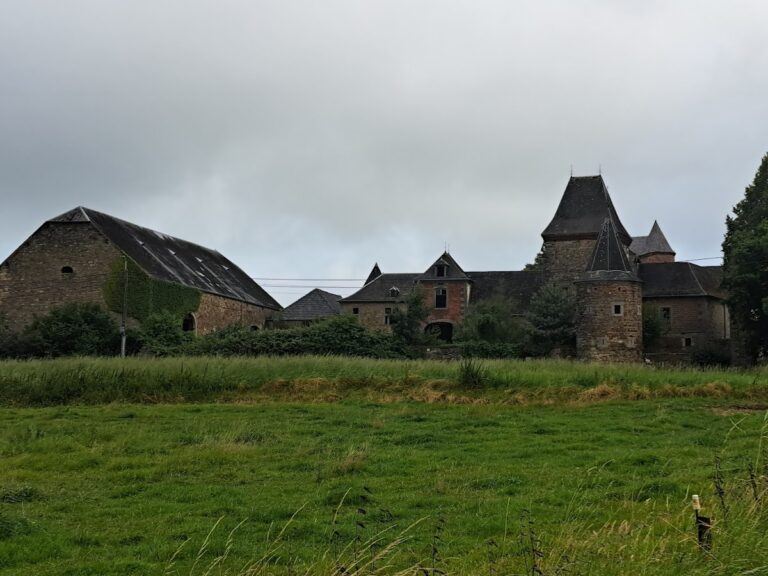
At the summit, surviving masonry includes part of the southern walls and the base of a round turret at the south-eastern corner of the upper enclosure. Another description divides the hill into three principal constructions, with the highest standing behind a drawbridge that crossed a deep ditch.
Lower terraces
The first of the three hilltop constructions occupied the area where Frankish graves were found, while the second contained a farm. Together with the upper enclosure, these terraces formed the principal spatial organization of the fortress.
Lapidon Tower
Lower down and to the west stands Lapidon Tower, a fairly well-preserved round tower flanking the cliff on the Samson side. The tower contains the castle well and remains one of the clearest surviving elements of the former fortress.