Castell de Camarasa: An Andalusi Territorial Castle in Spain

Site at a Glance
- Rating
- 4.2
- Popularity
- Very Low
- Country
- Spain
- Primary era
- Medieval
- Eras represented
- Medieval
- Civilizations
- Crown of Aragon
- Site type
- Military
- Remains
- Castle
On this page11 sections
History
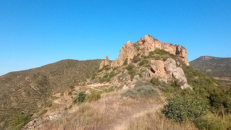
Castell de Camarasa is a territorial castle in Spain, situated on the highest part of the hill north of Camarasa in the Noguera region. It developed from a major Andalusi fortified stronghold, or hisn, that controlled the Segre River passage and the route toward Cubells. The site is now recognized as a Cultural Asset of National Interest and a Spanish Cultural Asset of Interest, classified as a historic monument.
An Andalusi stronghold and its transfer
The castle dominated the crossing of the Segre and the approaches to the plains of Llorenç and Cubells. The name Camarasa may derive from kum ruàsa, interpreted as “residence of leaders,” although no direct reference to the castle is known from Islamic sources. Its elevated position and control of movement through the river corridor gave the fortification an important territorial role.
In 1050, a document recorded the transfer of Camarasa and Cubells to Ramon Berenguer I, Count of Barcelona, from Yusuf al-Muzzafar, a leader of Lleida. Within a few months, Ramon Berenguer I granted both castles to Arnau Mir de Tost, lord of Àger, in return for service and allegiance. In 1056, he assigned them to his bride, Countess Almodis de la Marca, as part of their marriage settlement.
Medieval lordship and royal authority
Arnau Mir de Tost’s testament, dated 11 August 1072, left Castell de Camarasa, its territorial jurisdiction, and its castellanies, meaning the administrative territories governed from the castle, to his grandson Guerau II de Cabrera and his daughter Letgarda. The testament stated that Ramon Berenguer I had entrusted the castle to Arnau. Ramon Berenguer I’s own testament also mentioned Camarasa and left it to his sons, Ramon Berenguer II and Berenguer Ramon II.
In 1106, Guerau II de Cabrera, Viscount of Àger, and Ramon Berenguer III, Count of Barcelona, signed an agreement recognizing the count’s authority over the castle. The connection between the Cabrera lineage and the counts of Barcelona continued through the twelfth century. In 1196, Ponç Guerau III promised Castell de Camarasa to King Alfonso I if the king demanded its surrender.
The Marquisate of Camarasa
In 1330, King Alfonso III created the Marquisate of Camarasa for his son Ferran. The new marquisate included Castell de Camarasa together with the castles of Alòs de Balaguer, Meià, Vilanova de Meià, Cubells, Santa Linya, Mèrita, Orenga, la Nou, Puig de Meià, Vernet, Ariet, Baldomà, Ivars de Noguera, Montgat, and Fontllonga, among others.
During the territorial partition carried out by Ferdinand of Antequera in 1414, Castell de Camarasa was granted to Jofre de Barcelona, a member of the Barcelona dynastic house. The surviving fabric preserves three distinct elements associated with successive phases in the site’s history, including an elevated structure that may have reused an earlier building connected with the castle’s role as a guard post and control point over the Segre crossing.
Remains
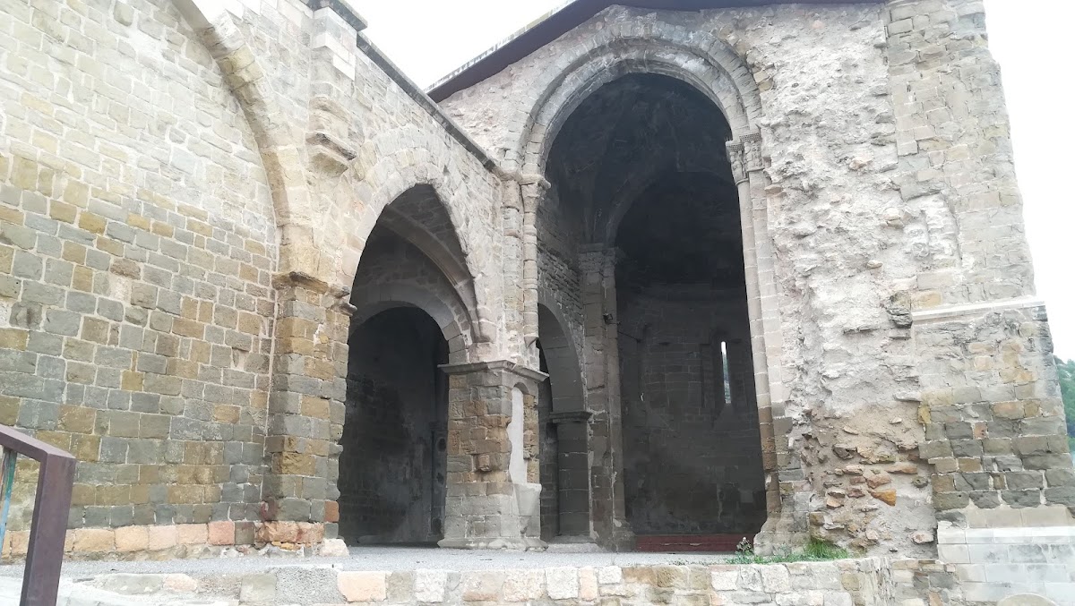
The remains stand on Turó del Castell, at an elevation of about 330 metres. Three distinct elements occupy the hill and its built-up surroundings. They include an elevated rectangular structure with a semicircular apse, early defensive masonry northeast of the summit, and towers farther west. Their construction combines irregular limestone masonry, lime mortar, rammed earth, rubble, and carefully squared limestone blocks.
Summit and early defences
Summit building
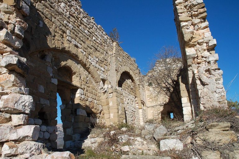
The structure on the summit has a rectangular plan, a single nave, and a semicircular apse. Its date appears relatively late, while its form may incorporate an earlier building. The earlier phase may have been associated with the strategic function of the site as a guard post and as a point controlling the Segre crossing.
Northeastern wall and tower
The oldest remains lie northeast of the summit. They include a 22.5-metre length of wall and a rectangular tower whose frontal face measures 8.70 metres. Its side faces measure between 1.95 and 2.90 metres. Irregular masonry forms the structure, while the interior contains rammed earth and rubble. This construction may belong to the former Andalusi castle.
Western towers
Rectangular tower near Sant Miquel
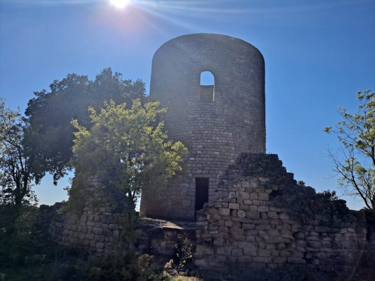
A second rectangular tower stands 30 metres west of the Church of Sant Miquel. It measures 7.80 by 6.20 metres, with a preserved height of 3 to 4 metres on the north side and 7 metres on the south. Its structural core remains visible within a block of houses. The tower was built from irregular limestone masonry and lime mortar formed in shuttering. The surviving wall is 0.90 metres thick, while its original thickness was probably 1.30 metres. Its connection with the wider fortification remains uncertain. It may have belonged to the walled enclosure or may have stood outside it as an albarrana, a tower positioned apart from a main fortification to observe and protect its approaches.
Albarrana tower on Carrer del Castell
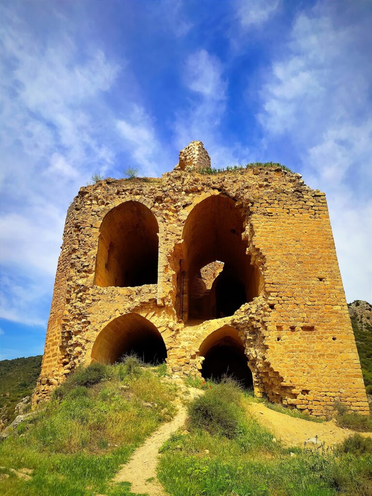
At the western end of Carrer del Castell stands an albarrana tower aligned north to south. It has an almost square plan, measuring 6 by 5.80 metres, and rises 12 metres high. Its walls are 1.50 metres thick. The tower preserves three levels, with the first floor containing a northern doorway topped by a semicircular arch made with wedge-shaped stones, a southern opening, three complete arrow slits, and one partial arrow slit.
The second floor has another northern opening with a similar semicircular arch, together with two complete arrow slits and one partial slit. Holes for construction scaffolding remain visible on the exterior. The tower’s exterior, interior, doorways, and arrow slits use small, rectangular limestone ashlar blocks that were carefully squared. Its structural core consists of irregular masonry set in lime mortar within shuttering. The treatment of the stone is consistent across the tower except at the first-floor relieving arch. The building appears to date from the thirteenth century.