Tarbert Castle: A Medieval Royal Stronghold in Scotland


Site at a Glance
- Rating
- 4.5
- Popularity
- Low
- Country
- United Kingdom
- Primary era
- Medieval
- External website
- Open
- Eras represented
- Medieval, Early Modern
- Civilizations
- Kingdom of Scotland
- Site type
- Military
- Remains
- Castle
On this page9 sections
History
Tarbert Castle is a medieval Scottish fortress at Tarbert in the United Kingdom, occupying a strategic position at the northern end of the Kintyre peninsula. The present castle originated in the thirteenth century as a fortified ring-wall castle, although its construction is attributed uncertainly either to the MacDonalds of Islay or to the Scottish kings Alexander II and Alexander III. It developed into a royal stronghold during the Middle Ages and later became part of the struggle between the Scottish Crown, the Lords of the Isles, and powerful western families.
Earlier fortifications and Norse ambition
The castle stands on the site of an earlier fortification associated with Dál Riata, a Gaelic kingdom whose territories included parts of western Scotland and northeastern Ireland. Selbach mac Ferchair, king of Cenél Loairn and Dál Riata, burned the site in 712. His son, Dúngal mac Selbaig, ordered its destruction again in 731. Another tradition recalls that the earlier fort was captured and burned at least once.
Around 1098, Magnus III of Norway used the Tarbert isthmus to demonstrate Norwegian control of the islands and Kintyre. Magnus, king of Norway from 1093 to 1103, had a Viking ship dragged across the narrow land bridge, thereby showing that he could sail around the peninsula. The episode expressed the importance of Tarbert as a point between the western Scottish mainland, Kintyre, and the islands.
Royal fortress and burgh
The thirteenth-century castle was built as a ring-wall fortress, with buildings set into the enclosing wall around a central courtyard. In 1292, Edward I of England transferred control of the castle to John II de Balliol, king of Scots from 1292 to 1296. Tarbert was one of three castles at the settlement and served as a strategic royal stronghold.
Robert the Bruce expanded and strengthened the castle in the early fourteenth century. He apparently repeated Magnus III’s symbolic crossing of the isthmus to affirm his rights over Kintyre. The enlarged fortress helped defend against attacks by the Lords of the Isles, the MacDonald-led rulers of a powerful lordship across much of the western Scottish Highlands and Islands. Records from 1325 and 1326 show royal payments for masonry as well as wooden and clay structures. Tarbert became a royal burgh in 1329, giving the town legal privileges and a direct relationship with the Scottish Crown.
MacDonald, Campbell, and royal control
The MacAllisters served as keepers of the castle until its administration passed in the first half of the sixteenth century to the MacLeans and then to the Campbells, earls of Argyll. John de Lany held the office in 1326, while Charles MacAllister was keeper in 1481.
In 1494, James IV captured the castle from John MacDonald of Islay, Lord of the Isles, during a campaign intended to strengthen royal control over the western Highlands and Islands. A four-storey tower house, a fortified residential building combining domestic accommodation with defensive features, was begun at this time.
Later occupation and abandonment
In 1687, Walter Campbell of Skipness seized the castle from the Campbells, earls of Argyll, who were in rebellion. He used it as a stronghold for Archibald Campbell, 9th Earl of Argyll, in support of the Monmouth Rebellion in England. Around 1750, administration passed to the Campbells of Stonefield, and the castle was abandoned by the middle of the eighteenth century.
Tarbert Castle has been a protected monument in the United Kingdom since 1935. It is managed by the Tarbert Castle Trust, is community-owned, and forms part of a volunteer-maintained heritage park.
Remains
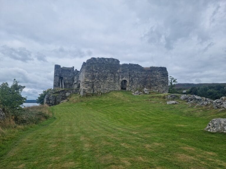
The ruin occupies a naturally defensible rocky plateau about 30 metres above the southern shore of East Loch Tarbert. From this position, it overlooks the harbour, Loch Fyne, and the approaches towards the Firth of Clyde. The surviving layout reflects three principal building phases, beginning with a thirteenth-century enclosure and expanding across the rocky summit before the addition of the late medieval tower house.
The thirteenth-century enclosure
The first castle occupied the south-western side of the plateau. Its roughly square plan measured approximately 41.5 by 37.2 metres, with buildings incorporated into the enclosing wall around a central courtyard. Four rows of low, poorly defined parallel earthworks mark the outline. Gaps in these earthworks indicate doorways, while the principal entrance probably stood on the north-eastern side, where the ground is flattest.
The fourteenth-century expansion
The second phase extended the fortress around the rocky summit and incorporated the north-eastern section of the plateau. Two round towers survive on this side, each measuring 8.7 metres in diameter. The remaining original walling rises slightly more than four metres high, preserving part of the expanded defensive circuit.
The tower house and forework
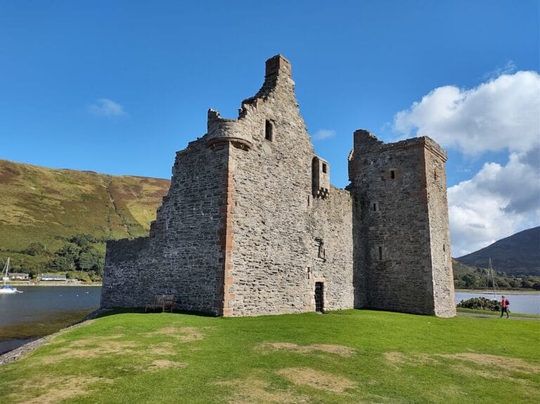
The third phase began in 1494, when a four-storey tower house was built against the south-eastern wall. Its entrance was on the north-eastern side, and the basement has a barrel vault. The surviving fabric includes the basement and sections of the north-eastern and north-western walls. The north-eastern wall retains part of a window and a built-in seat, while the north-western wall contains a fireplace, several window openings, and gun loops.
A forework was added at the base of the tower towards the end of the sixteenth century. Its damaged entrance is flanked by two horizontal gun loops. The tower house forms the most prominent part of the surviving ruin, while the standing masonry elsewhere is limited and some of it is considered unstable.