Castle of Santa Àgueda: A Muslim Fortress on Menorca


Site at a Glance
- Rating
- 4.3
- Popularity
- Low
- Country
- Spain
- Primary era
- Medieval
- Eras represented
- Classical, Medieval
- Civilizations
- Almohad, Almoravid, Roman, Taifa Kingdoms
- Site type
- Military
- Remains
- Castle
On this page13 sections
History
The Castle of Santa Àgueda is a former Muslim fortress in Spain, located above Ferreries on Menorca. Built during the period of Muslim rule, probably over or incorporating an earlier Roman installation, it became one of the island’s principal strongholds and served as a residence for Muslim governors. Its oldest surviving elements date from the tenth or eleventh century, although the construction date of the fortress as a whole remains uncertain.
Prehistoric and Roman predecessors
Excavations on the summit of Puig de Santa Àgueda indicate earlier activity associated with Menorca’s Talaiotic culture, the prehistoric society of Menorca and Mallorca known for its stone monuments and settlements during the Bronze and Iron Ages. Roman occupation followed. A road was built to the summit, where a castrum, meaning a Roman fortified settlement or military camp, stood. Roman pottery, numerous coins, and spearheads have been recovered from the site.
Muslim rule and the fortress
During Muslim administration, the stronghold was known as Sen Ageinz, with Sent Agayz recorded as an earlier form of the name. Menorca was first a taifa, an independent Muslim principality in Iberia, and later became a Muslim vassal state of the Crown of Aragon under the Treaty of Capdepera in 1231. The fortress retained a strategic military role during these changes in political control.
The Almoravids, a Muslim ruling movement that governed parts of North Africa and Iberia, expanded the fortress during the twelfth century. They were succeeded by the Almohads from 1121. In the thirteenth century, the Almohads added the Casa d’Armes, or Armoury, to the complex.
Conquest and later history
In 1287, Alfonso III of Aragon conquered Menorca. The Castle of Santa Àgueda became the last stronghold of Muslim resistance on the island. The emir Abu Umar ibn Said took refuge there and capitulated on 21 January 1287, after which Menorca was incorporated into the Crown of Aragon.
The fortress was partly destroyed under Alfonso III’s successor, Peter IV of Aragon. His only daughter, Princess Eleanor of Aragon, later sought to establish a chapel among the ruins dedicated to Saint Agatha of Catania, also known as Agatha of Sicily. The chapel became a pilgrimage destination for the island and is regarded as the origin of the settlement of Ferreries. The name Santa Àgueda is associated with the saint, while Sen Ageinz and Sent Agayz preserve earlier forms of the place name.
After the fourteenth century, the fortress declined through neglect and looting. The chapel disappeared during the nineteenth century, and the remaining ruins later suffered further deterioration from weather erosion and human damage. The site was recognized as Spanish national heritage in 1987 and recorded as a Bien de Interés Cultural, Spain’s formal designation for a property of recognized cultural heritage importance, on 30 November 1993.
In 2007, the Island Council of Menorca purchased the estate, ending centuries of private ownership. The Association of Friends of Santa Àgueda, established through Ferreries Town Hall, promoted early measures to protect the Roman access road from deterioration and supported the site’s heritage designation and proposed recovery of the enclosure’s integrity. A Menorcan tradition also holds that a golden calf is hidden beneath the fortress walls.
Remains
Summit layout and fortifications
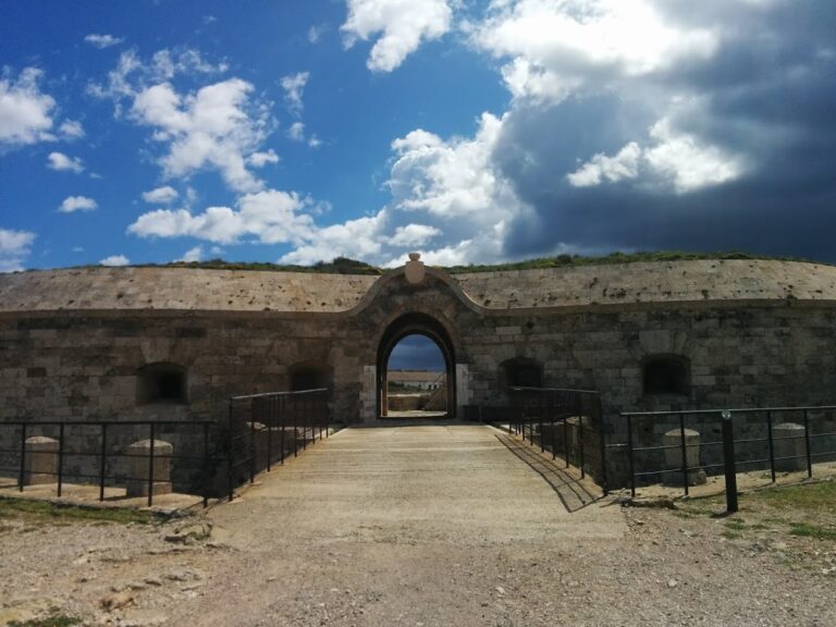
The ruins occupy the summit of Puig de Santa Àgueda, 264 metres above sea level and the third-highest elevation on Menorca. The complex covers approximately 5 hectares and is arranged in three adjoining sections. The central enclosure occupies the hilltop plateau and forms the oldest part of the fortress. Its irregular seven-sided polygonal plan measures approximately 160 by 135 metres and covers about 1.5 hectares. Its construction is associated with tenth-century Muslim architecture.
Central enclosure
At its greatest extent, the central enclosure was defended by sixteen round towers set around its perimeter. Their diameters range from approximately 3.6 to 6 metres. Some were later reinforced or replaced by rectangular towers, attributed to the twelfth-century Almoravid period because of their construction and stone arrangement. A single keep stood at the centre. The enclosure was entered through a southern portal aligned with the ancient Roman road.
Roman approach road
The approach to the fortress follows a narrow, guarded road that winds upward from the valley through a series of bends. This route is associated with the surviving Roman road and continues toward the southern entrance of the central enclosure. A passage west of that entrance may also have provided access to the Castellet.
Side enclosures and water supply
Castellet
The northwestern Castellet, or side enclosure, is rectangular and extends approximately 275 metres by 80 metres across about 2.8 hectares. It contains remains of internal buildings and had its own water supply. Two cisterns survive within it. One measures approximately 28 by 5.9 metres, while the other measures 15 by 9 metres. Parts of their walls and tiled surfaces remain visible.
Casa d’Armes
The northeastern Casa d’Armes, or Armoury, is the newest section of the complex. Built during the Almohad period in the thirteenth century, it has an irregular plan, measures approximately 155 metres in length and 44 metres across at its narrowest point, and covers about 0.8 hectares.
Later religious remains
Chapel of Santa Àgueda
The chapel dedicated to Santa Àgueda was built later among the fortress ruins. It was associated with Saint Agatha of Catania and with the pilgrimage tradition connected to the development of Ferreries. The chapel disappeared during the nineteenth century, leaving the fortified enclosures, towers, road, and cisterns as the principal surviving physical remains.