Burg Waldenfels: A Medieval Tower Castle in Germany


Site at a Glance
- Rating
- 3.5
- Popularity
- Very Low
- Country
- Germany
- Primary era
- Medieval
- External website
- Open
- Eras represented
- Medieval
- Civilizations
- Holy Roman Empire
- Site type
- Military
- Remains
- Castle
On this page11 sections
History
Burg Waldenfels is a small medieval tower castle in Germany, near Malsch, probably built around 1086 by the Reginbodones, a noble comital family associated with the administration of the Ufgau, a medieval territorial district in what is now northern Baden. After Reginbodo I lost his office in the Ufgau in 1086 and withdrew to his estates around Malsch, he probably established the castle to support the cultivation and colonization of the surrounding area.
The Reginbodones and the Ebersteins
Reginbodo II used the title “Count of Malsch” from 1110 and later governed the Ufgau again from Malsch. The Reginbodones disappear from the region after 1115. Malsch, and probably Burg Waldenfels with it, then passed to the Eberstein family, whose territories and influence extended around the northern Black Forest and the middle Rhine.
The Ebersteins reached the height of their power between about 1150 and 1250. Their feudal dependants took their designation from Malsch and, after 1219, can be identified as ministeriales of the margraves of Baden. A ministerialis was a legally unfree but often influential service noble who could serve a higher lord in administrative, military, or courtly roles. It is not known whether these dependants lived at Burg Waldenfels or in the village.
Margravial and monastic ownership
The castle appears in written records for the first time in 1309 as castrum wildenfels, when it was awarded to Frederick II during the division of the Baden margraviate. In 1314, Margraves Frederick II and Rudolf IV granted “the house at Waldenfels” as a life tenancy to their retainer Reinhard of Neuenburg. A life tenancy provided the use or income of property for the recipient’s lifetime without necessarily transferring permanent ownership, and Reinhard probably died soon afterward.
In 1318, the margraves sold Burg Waldenfels and the village of Malsch to Herrenalb Abbey. The purchase document expressly described both the village and the castle as fiefs of Weissenburg Abbey. The castle was mentioned again in 1431, when Margrave James I of Baden and his entourage referred to it during a pause in a hunting expedition.
Ruin, investigation, and legend
By the time Burg Waldenfels was largely dismantled from 1826 onward, it was already a ruin. The dismantling took place in connection with the enlargement of St. Cyriak Church in Malsch. Archaeological investigations and conservation work followed in 2007 and 2008, carried out by the Heimatfreunde Malsch association in cooperation with archaeologist Heiko Wagner. The work also incorporated earlier holes made by unauthorized excavations. The tower foundations and parts of the curtain wall were subsequently marked at ground level, and two information panels explained the castle’s history and excavations.
Burg Waldenfels is also linked to the legend of the knight Beringer of Waldenfels, supposedly its lord in the thirteenth century. According to the story, his only daughter Rosawina married Count Otto of Eberstein and fell into a deathlike trance at her wedding. No Beringer of Waldenfels or daughter Rosawina is historically documented. Otto I of Eberstein did exist, but from 1252 he was married to Beatrix of Krautheim.
Remains
Setting and defenses
Burg Waldenfels occupies a northwestern-projecting spur of a wooded hill at 205 metres above sea level, about 1,450 metres south of Malsch in the territory of Waldprechtsweier. The spur descended from a southern plateau and was bounded on its western and eastern sides by incised stream channels that joined at the tip. This position allowed a small fortified site to be set apart from the higher ground behind it.
Keep
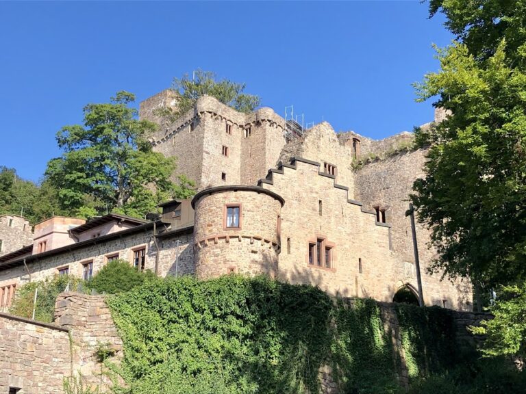
The castle covered less than 400 square metres and was built as a spur castle, a fortified site on a projecting ridge, with a tower as its principal defensive and residential structure. The prominent keep, or main fortified tower, was approximately square, with sides measuring about 12.5 metres. Its foundations had walls at least 2.60 metres thick. Red sandstone was used in the construction.
Curtain wall and neck ditches
A curtain wall, the defensive wall enclosing the castle, measured about 1.30 metres in thickness and incorporated the tower into the enclosure on the north. On the western side, the wall was later enlarged or rebuilt to about 1.70 metres thick. The southern wall probably slipped into the ditch or decayed during the late Middle Ages before being rebuilt farther inward.
Two neck ditches protected the southern approach toward the plateau. A neck ditch cuts across the landward connection between a spur and the higher ground behind it. The entrance is presumed to have been on the southwestern side, where the southwestern corner of the curtain wall could help secure the approach. Only wall remains survive in the western area, while remnants of the ditches can still be recognized southeast of the castle toward the plateau.
Courtyard and inner strip
Castle courtyard
The western part of the castle area is interpreted as the courtyard. Slag found there is typical of a smithy, indicating metalworking activity within this part of the enclosure.
Zwinger
The narrow area south and east of the tower, between the tower and the curtain wall, is interpreted as a zwinger, a defensive or intermediate strip between an inner wall and an outer fortified boundary. Waste deposits in this area contained small quantities of older grey, wheel-made pottery dating from the eleventh or twelfth century, together with domestic pottery from the thirteenth or fourteenth century.
Following the investigations of 2007 and 2008, the tower foundations and parts of the curtain wall were marked on the ground. These visible markers indicate the former arrangement of the principal tower and enclosure within the surviving ruin.