Cáparra: Roman Municipium and Road-Crossing City in Spain


Site at a Glance
- Rating
- 4.5
- Popularity
- Medium
- Country
- Spain
- Primary era
- Classical
- Eras represented
- Classical
- Civilizations
- Roman
- Site type
- City
On this page17 sections
History
Cáparra is a Roman city in Spain, located between the modern municipalities of Guijo de Granadilla and Oliva de Plasencia in the Alagón and Ambroz valleys. Built and developed under Roman rule, it became a Latin municipium during the Flavian period, probably after AD 74, when Emperor Vespasian extended Latin civic rights to communities in the Hispanic provinces. The city occupied a crossroads on the Vía de la Plata, the major Roman north-south route across western Iberia, and grew into an important centre of Lusitania, the Roman province covering much of western Iberia.
Before and during the Roman conquest
The name Cáparra, preserved in forms such as Capara, Capera, Cappara, and Kapasa, is pre-Roman rather than Latin. It is probably connected with the Vettones, and its possible meaning has been associated with exchange, barter, or a market. This interpretation suits the city’s position at a meeting point between routes leading toward the Tagus and the Sierra de Gredos, although the precise meaning of the name remains uncertain.
A settlement existed in the wider area before Roman urban development may have begun, but its character and location are not firmly established. The pre-Roman case rests mainly on the ancient place-name and a small quantity of pottery. Cáparra later became a stipendiary community, a city that retained some local institutions while owing tribute and military obligations to Rome.
The Flavian municipium
In AD 74, Vespasian’s grant of the ius Latii, or Latin civic status, to the Hispanic provinces transformed Cáparra’s position within the Roman system. The community became the Municipium Flavium Caparense, probably during the Flavian period. Its magistrates who obtained Roman citizenship were enrolled in the Quirina tribe, one of the Roman citizen registration and voting tribes. This change was followed by major investment in streets, public buildings, civic institutions, and private construction.
Cáparra’s principal public buildings belong largely to this period of prosperity. Ancient geographical and itinerary writers treated the city as an important population centre between the Tagus and the Sierra de Gredos, alongside Caurium, Augustobriga, and Egitania. Pliny the Elder and Ptolemy mention it, while the Antonine Itinerary and the Ravenna Cosmography preserve its place within the wider road network.
The Vía de la Plata supported the city’s development and continued to require maintenance. Milestones and inscriptions associate repairs to the road with the reigns of Tiberius, Nero, Trajan, Hadrian, Marcus Valerius Maximianus, and the usurper Decentius. A milestone erected under Nero in AD 58 provides a date for one phase of this work. Roads and bridges connected Cáparra with the Jerte valley through the San Gamello pass and with the north, east, and west through crossings over the Ambroz and the Alagón.
Imperial loyalty and later decline
In AD 198, after Septimius Severus defeated Clodius Albinus in the civil wars that followed the disputed succession of AD 193, the Ordo Caparensium, or city council of Cáparra, dedicated an inscription to Julia Domna. The dedication presented her as the emperor’s wife and as the mother of Caesar Caracalla and the army. It may have been accompanied by statues, reflecting the city’s participation in the public expressions of loyalty that followed the victory.
Cáparra gradually declined and became depopulated during late antiquity and the early Middle Ages. Abandonment intensified after the Muslim invasion, and the city was probably deserted by the ninth century. There is no secure evidence for a lasting repopulation after Christian kingdoms reconquered the region. A medieval reference, probably from the twelfth century or earlier, associates Capera with other depopulated cities in the Liber Sancti Iacobi. Later claims of a brief settlement during the Christian reconquest are uncertain, while papal documents of 1144 and 1145 indicate that supposed settlers did not understand the condition of the ancient city.
Ruins and archaeological investigation
From the medieval period onward, the former urban area was divided between the Duke of Alba’s lands north of the road and Plasencia’s royal lands to the south. It was later incorporated into several municipal territories. By 1573, Luis de Toro stated that Cáparra had ceased to function before the foundation of Plasencia and had never been Plasencia’s original episcopal seat.
Renaissance and early-modern writers described the ruins, especially the surviving arch and its inscriptions, and repeatedly referred to a second arch. One of these structures may have been a former town gate, mentioned in 1491 and apparently destroyed by residents of Guijo de Granadilla later in the eighteenth century. In 1730, eight inhabitants were recorded at Cáparra: four innkeepers, a seller of wine and oil, and three farmers, all administratively linked with Guijo de Granadilla. By 1791, Cáparra no longer existed as a settlement, and residents of the local Venta de Cáparra had moved to Villar de Plasencia and Oliva de Plasencia.
The construction of the modern N-630 road in 1855, followed by the railway in the twentieth century, displaced use of the ancient route. Antonio Floriano led two excavation campaigns in 1929. His work identified the building conventionally called the Temple of Jupiter, three necropolises, the approximate city limits, the arch, amphitheatre, reservoir, and houses, and produced an early plan of Cáparra. Archaeological work resumed in the 1960s, especially around the amphitheatre and buildings near the arch.
After the Provincial Council of Cáceres acquired the land in 1988, the University of Extremadura carried out successive surveys. Excavations from 2001 onward exposed or clarified the public baths, a domestic area, commercial premises, the southeast gate, the urban section of the Roman road, and further parts of the amphitheatre. The archaeological zone has been protected as a Spanish cultural-interest site since 3 June 1931. The surviving tetrapylon was separately declared a historic-artistic monument on the same date and is now protected as a Monument within that cultural-interest category.
Remains
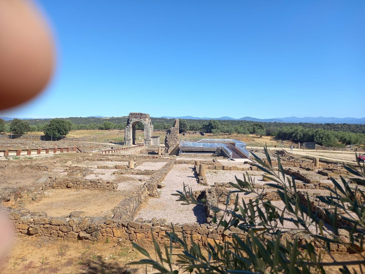
Cáparra occupied a small promontory or acropolis and an adjoining slope above the Ambroz River, also called the Cáparra River in this area. The enclosed city covered approximately 15 to 16 hectares, with an estimated perimeter of about 1,525 metres. Elevations range from about 408 metres at the highest point to 380 metres near the river, while the central tetrapylon stood at approximately 400 metres above sea level. Houses also extended beyond the walls, particularly to the northwest, showing that the settled area reached beyond the fortified enclosure.
Urban plan and principal road
The city followed a regular grid plan. The Vía de la Plata crossed Cáparra from north to south and formed its main urban axis. The cardo maximus, the principal north-south street, and the decumanus maximus, the principal east-west street, intersected within the city. The decumanus maximus was the broadest and most important street, with a roadway almost five metres wide paved in polygonal granite slabs. Water collection and drainage were incorporated into the street, and major public buildings and luxurious houses opened onto it.
Commercial premises occupied the ground floors along the decumanus. The tabernae, small shops or service premises, stood behind porticoes about two metres wide. A low wall supporting columns separated the porticoes from the roadway, with interruptions at house entrances allowing access. A two-arched Roman stone bridge stood about 500 metres north of the tetrapylon. It was rebuilt and repaired repeatedly during its later history, forming part of the routes that connected the city with the surrounding valleys and river crossings.
Civic centre
The tetrapylon
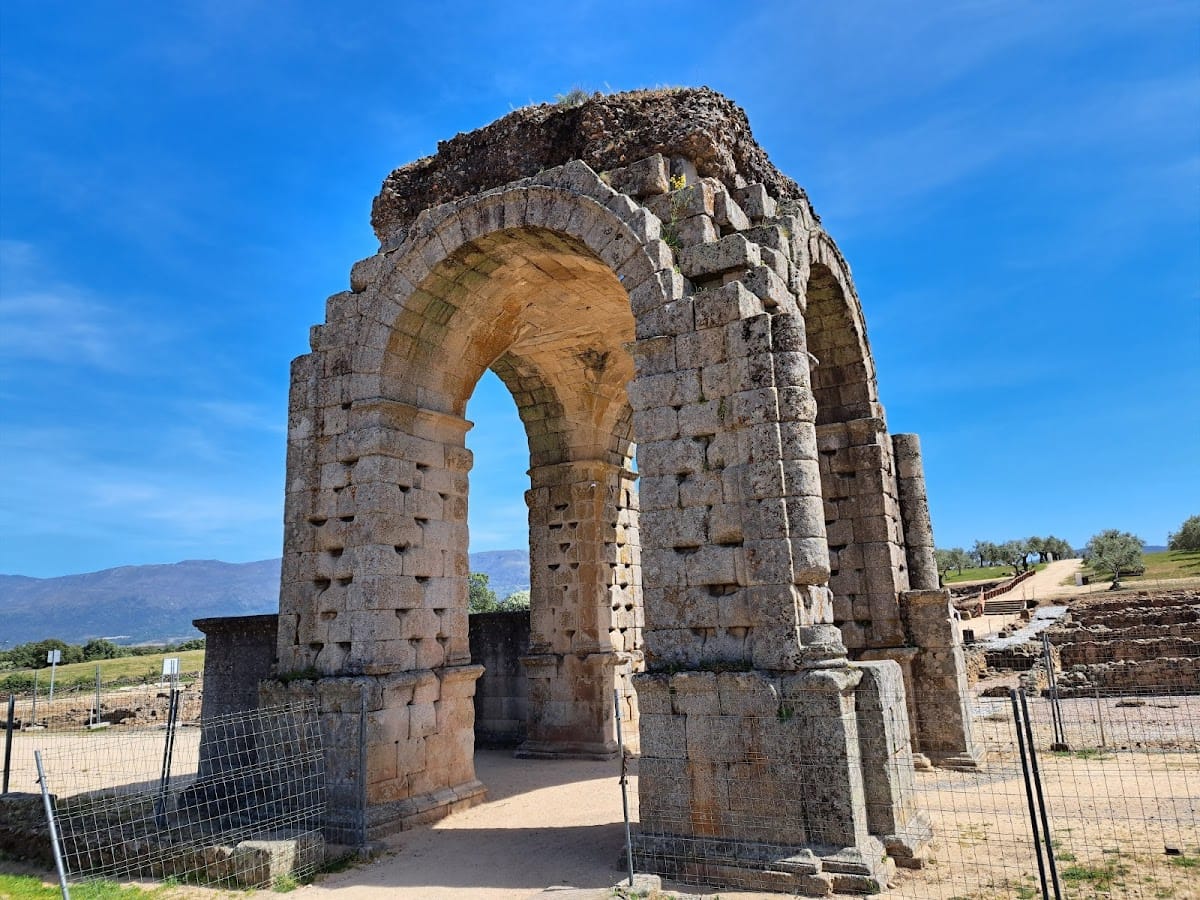
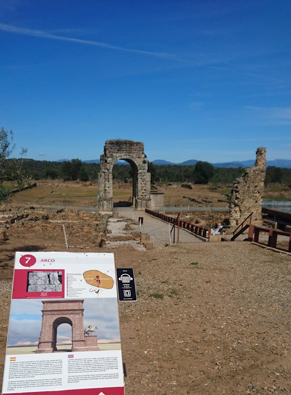
The tetrapylon, or quadrifrons arch, is a monument with four openings arranged around a central crossing. It stands near the centre of Cáparra, at the intersection of the cardo maximus and decumanus maximus, close to the forum, public baths, and other principal monuments. The structure is generally dated to the late first century, during the Flavian period, and is described as the only surviving Roman arch of this type in Spain.
The arch measures 8.60 by 7.35 metres in plan and is estimated to have reached 13.30 metres in its original form. Four pillars support four semicircular arches, each surrounded by an archivolt, a moulded frame following the curve of the outer arch. The pillars rest on bases finished with strongly projecting cornices. Two attached pedestals stand on both the northern and southern fronts. They were probably intended for statues of the couples named in the inscriptions, while the northern pedestals may have supported equestrian portraits, although that identification remains a reconstruction.
Inscriptions identify Marcus Fidius Macer, his wife Bolosea, daughter of Pellus, and another Fidius Macer. One inscription states that Marcus Fidius Macer commissioned the arch in fulfillment of his parents’ testament. Other inscriptions describe him as a three-time magistrate, twice a duovir, one of the two chief municipal magistrates, and praefectus fabrum, the supervisor of public or military technical work. A further inscription names his wife Julia Luperca. Together, the texts connect the monument with the city’s leading civic family.
The forum
The forum lay close to the tetrapylon and formed part of the city’s civic centre. Its buildings included a curia, the meeting place of the city council, and a civic basilica on the southern side. The forum’s position beside the principal crossing placed municipal government and public activity within the central urban layout.
Baths and amphitheatre
Public baths
The public baths stood at the northwestern edge of the city beside the decumanus maximus. Their first construction phase belongs to the Flavian period, when Cáparra became a municipium. The north-south-oriented building formed a square measuring approximately 33 by 36 metres. Bathing rooms occupied the centre, with annexes on both sides. A palaestra, an exercise area associated with Roman baths, lay to the south, while several tabernae on the north may have held firewood or served as administrative offices.
Access was provided from the west through a street running parallel to the principal cardo and joining the decumanus. An external ceramic-pipe conduit carried water along the pavement of the decumanus to a fountain in the palaestra. The water supply is thought to have come from the Casa Blanca reservoir south of the settlement, although the complete system remains uncertain.
Amphitheatre
An amphitheatre stood southeast of the walled city, outside the fortifications. Its structure consisted of two concentric oval walls with an earth fill supporting the spectators’ seating. Excavations begun in the twentieth century and continued in later campaigns have clarified parts of this building and its relationship to the wider urban area.
Domestic, religious, and funerary remains
Houses and necropolises
Excavations have revealed domestic buildings, luxurious houses opening toward the decumanus, and three necropolises. These remains extend the picture of Cáparra beyond its monuments and civic buildings, showing the residential and funerary areas associated with the Roman city.
Temple of Jupiter and Christian building
A building identified conventionally as the Temple of Jupiter was located during Antonio Floriano’s excavations, in association with an inscription found there. The identification connects the structure with the Roman religious landscape of Cáparra.
After the Christian reconquest, a building dedicated to the Virgin of Bella Flor was constructed near the former tetrapylon. Its date, exact position within the ancient city, and possible reuse of Roman foundations remain uncertain.
Southeast gate and Roman road
The excavated remains include the southeast gate, from which the cardo maximus began, together with an urban stretch of the Roman road. These features clarify how the principal route entered the city and joined the orthogonal street plan. Early-modern observers also recorded a second arch, one of which may have been a monumental entrance or town gate. That structure no longer survives.