Threecastles Castle: A Sixteenth-Century Tower House in Ireland


Site at a Glance
- Rating
- 4.3
- Popularity
- Very Low
- Country
- Ireland
- Primary era
- Early Modern
- External website
- Open
- Eras represented
- Early Modern
- Civilizations
- English
- Site type
- Military
- Remains
- Castle
On this page6 sections
History
Threecastles Castle is a ruined sixteenth-century tower house in Ireland, probably built for Gerald FitzGerald, 8th Earl of Kildare, who served as Lord Deputy, the English Crown’s principal representative and governor in Ireland. The castle overlooked a ford of the River Liffey and became involved in the conflicts that shaped English control of land in the Wicklow region.
Sixteenth-century conflict
The castle’s history is uncertain, but it was involved in several battles during the sixteenth century. English garrisons contested control of the surrounding territory with the O’Toole and O’Byrne clans, Gaelic Irish lineages with established interests in Wicklow. These struggles formed part of wider efforts to defend English settlements and to expel English settlers from contested lands.
The name and later landscape
The name Threecastles has two main interpretations. It may indicate that three castles once stood in the surrounding townland. A nineteenth-century Ordnance Survey map, produced by the state mapping organization, marks the location of one additional castle, while the third site remains unknown. Alternatively, the word “three” may refer to the castle’s division into three parts.
The landscape around the castle changed substantially in 1940, when the River Liffey was dammed at Poulaphouca. Flooding raised the water level around the castle, making the former river crossing unusable. The land south of the building became largely marshland extending toward the lakeshore. Threecastles Castle is protected as a National Monument of Ireland under its official name and reference number 491.
Remains
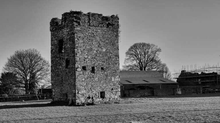
The surviving site consists of a rectangular, three-storey tower house on an east-facing slope approximately 183 metres above sea level. It overlooks the former ford of the River Liffey. The ruined tower is built with walls about 1.2 to 1.5 metres thick, faced with dressed or cut granite. Its defensive residential form combines domestic rooms with features intended to protect the building.
Tower house
A stair turret projects from the tower’s north-eastern corner. The first upper storey contains an open fireplace and a projecting garderobe, a latrine built into or extending from a fortified structure. A vaulted ceiling survives in the upper storey, while the remains of a barrel vault on the western side indicate that an additional structure was once attached to the tower.
Former river crossing
The castle’s position was connected to a crossing of the River Liffey. Stepping stones near the ford were marked on an early twentieth-century map, but the crossing is now too deep to use because the Poulaphouca dam increased the river’s depth and caused flooding around the site.
Nearby sites