Burg Camburg: A Medieval Hilltop Castle in Germany



Site at a Glance
- Rating
- 4.4
- Popularity
- Very Low
- Country
- Germany
- Primary era
- Medieval
- External website
- Open
- Eras represented
- Medieval
- Civilizations
- Holy Roman Empire, Margraviate of Meissen
- Site type
- Military
- Remains
- Castle
On this page10 sections
History
Burg Camburg is the ruin of a medieval hilltop castle in Germany, situated on a spur above the Saale in what is now Dornburg-Camburg, Thuringia. Its foundation is generally placed no earlier than the second half of the eleventh century, and its position was connected with a river crossing on the salt route from Sulza on the Ilm via Schmiedehausen. The castle later became a Wettin possession and remained tied to the territorial history of central Germany until its destruction in 1450.
Origins and early lords
A seat of a collateral branch of the Wettin dynasty at Camburg during the second half of the eleventh century has been proposed, but documentary evidence for such an early seat is lacking. A later chronicle names Count Wilhelm of Camburg after 1089. He was probably the middle son of Count Gero of Brehna and the brother of Günther I of Wettin, who became bishop of Naumburg in 1079.
Wilhelm’s male line ended before 1116. His possessions apparently then passed to Conrad the Great, the Wettin margrave of Meissen, although the document describing this transfer is regarded as a forgery probably produced at Reinhardsbrunn Abbey in the mid-twelfth century. The Wettin margraves are securely associated with Camburg from 1149, while a margrave’s castle there was first mentioned in 1166.
An aristocratic family using the Camburg name appears in documents of the bishops of Naumburg from 1133 to about 1170. The family of Gerhard of Camburg is recorded from the 1130s and was classified by the late twelfth century as Wettin ministerials, members of the medieval service nobility who served a lord in administrative or military roles. Some descendants were also described as imperial ministerials.
Wolfgang Hartmann proposed that these families descended from Count Dietmar of Selbold-Gelnhausen, a member of the Reginbodonid noble family. His interpretation connects Dietmar’s wife Adelheid with Wilhelm of Camburg or Wilhelm’s wife Gepa, and associates Adelheid with burial at the Camburg Cyriacus Chapel. It further suggests that the division of Burg Camburg may have originated in separate property rights held by Wilhelm and Dietmar. These relationships remain a hypothesis rather than an established fact.
Wettin conflicts and medieval destruction
Camburg gained particular importance during the conflict between Margrave Albert I the Proud and his brother Dietrich. In 1191, Landgrave Hermann I of Thuringia, allied with Dietrich, besieged and captured the castle. Albert apparently enlarged it again in 1194 and 1195. A castle chaplain is recorded in 1170, and the castle chapel was first mentioned in 1213.
Count Günther of Kevernburg allegedly failed to take Camburg in 1280 during the conflict between Albert II the Degenerate and his sons. The castle has also been proposed as one of approximately 60 fortresses destroyed in 1290 and 1291 by King Rudolf of Habsburg and the city of Erfurt, although this identification has not been established.
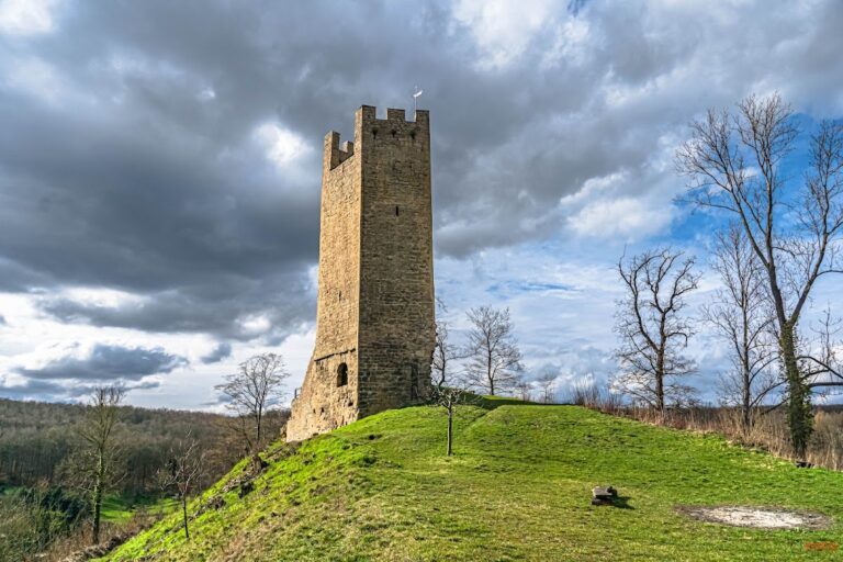
Ownership changed frequently during the fourteenth century. In 1439, the castle was sold to the Vitzthume family. During the Saxon Fratricidal War, a Wettin conflict from 1446 to 1451 over the division and control of Wettin territories, Elector Frederick II the Gentle destroyed Camburg in 1450. Only the main defensive tower, or bergfried, remained, and the castle was not rebuilt.
Wettin ownership and modern transformation
The ruin remained in Wettin possession after the destruction. The territorial division of 1485 initially assigned it to the Albertine line, in 1573 to the Ernestine line, and in 1603 to the Ernestine Duchy of Saxe-Altenburg. It subsequently passed through other Ernestine duchies.
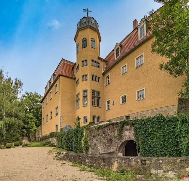
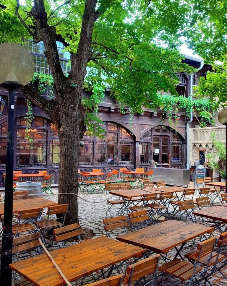
A restaurant was established within the ruin at the end of the nineteenth or the beginning of the twentieth century, and the grounds were turned into a park. The restaurant was demolished in January and February 1935. The lower castle was then developed into a youth castle for the Hitler Youth and the League of German Girls.
Construction work in 1935 exposed medieval walls and recovered archaeological finds. The architect and construction manager directed the exposure and collection of the material, so the work was not a regular scientific excavation. It is nevertheless regarded as one of the earliest medieval-archaeological interventions at a castle in central Germany. The exposed remains showed that a substantial, probably representative building south of the bergfried had been destroyed by fire.
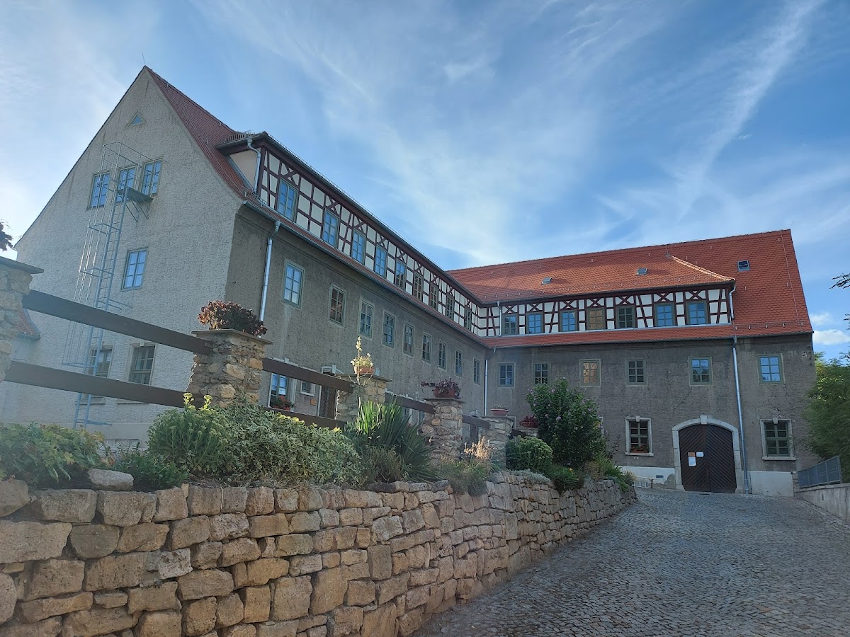
The complex was used as a youth hostel in 1945, followed by use as a school of the Free German Youth and the Socialist Unity Party of Germany in 1951. In 1967 it became a student residence for students of the Zeiss technical school. The municipality acquired the entire complex in 1998. Extensive renovation was completed before the bergfried opened as a museum in 2006, and the tower also serves as a lookout. Another building in the complex houses a registry office. Burg Camburg is designated a heritage monument in Thuringia.
Remains
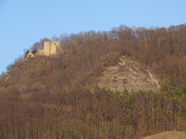
Burg Camburg occupies the right bank of the Saale on the side of Camburg historically known as the Meissen town side. The north-south spur measures about 285 metres in length and between 25 and 75 metres in width, at approximately 179 metres above sea level. A broad, deep neck ditch divides the hill into two areas. The present B 88 follows the ditch, probably along its original course, while the broad straight road on the eastern slope was created during road construction at the end of the eighteenth century.
Lower castle
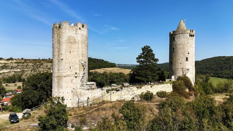
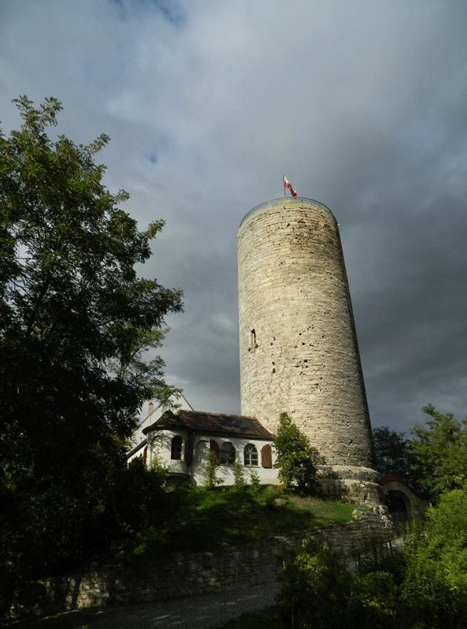
The lower castle, now called Turmberg, occupied an approximately quadrangular area. The remains surviving from the castle destroyed in 1450 consist mainly of the 37-metre-high bergfried and limited sections of the enclosing wall.
Bergfried
The bergfried, the principal defensive tower of a medieval German castle, has an external diameter of 11 metres. It probably dates from the second half of the twelfth century or the beginning of the thirteenth century. The renovated tower now contains a museum and also functions as a lookout. A curved section of castle wall extends from it.
Representative building
Investigations in 1935 revealed several wall lines along the western edge of the hill. Beneath the present L-shaped residential wing lay a slightly trapezoidal cellar measuring 5 by 6 metres, together with further foundation remains. These walls belonged to a larger building, probably representative in character, positioned south of the bergfried.
The rooms contained traces of fire and construction debris. Associated finds indicate that the building was destroyed by burning, a damage event that may be connected with the recorded destruction of the castle in 1450.
Upper castle earthwork
Medieval written references distinguish an “upper castle” at Camburg. This may indicate a separate lower castle, although the expression may instead have referred to the higher parts of the spur. The upper area has also been placed speculatively on one of the neighboring hills. It is now called Matzberg and retains a massive earthwork that closes the spur to the south. The earthwork measures about 45 metres in length, 25 metres in width, and 15 metres in height, while the upper and lower areas are separated by a considerable difference in elevation.
The date of this earthwork remains uncertain. It may have been built in sections during the Middle Ages, or it may belong to a fortified settlement of the Bronze Age. Finds from the lower-castle area include pottery fragments from the Urnfield period. Material recovered during the park conversion at the beginning of the twentieth century included a steep-sided bone comb generally dated from the twelfth to the fourteenth centuries, a lancehead, and six crossbow-bolt heads. These objects are known through drawings, and their relationship to the upper complex cannot establish its age or its connection with the lower castle.
Archaeological finds
The oldest finds from the castle area date from about 1080 to 1220 or 1225. Together with the surviving structures, they place the establishment of the castle no earlier than the second half of the eleventh century and securely demonstrate its existence around 1200 or during the first quarter of the thirteenth century. Most pottery consists of grey or blue-grey earthenware from the thirteenth to fifteenth centuries. Stoneware vessels include a so-called Jacoba jug probably made in Waldenburg, with most of the stoneware dating to the fourteenth century. A small handled pot and the remains of a stoneware mineral-water bottle belong to the modern period.
Several ceramic pieces are especially distinctive. They include part of an aquamanile, a vessel for pouring water that was often shaped as an animal or human figure, in the form of a horse’s head, along with the torso of a rider and a mask probably representing a lion’s head. Fragments of a ribbed glass beaker date from the mid-fifteenth century. Coins include a Prague groschen and the lid of a box for Meissen groschen.
Other recovered objects include inscribed copper fittings that may have formed part of a book clasp, copper or brass strap fittings, an earring probably made to hold a pearl, gilded beaded wire, and an eight-pronged bone comb. Metal finds comprise a bolt head, the brass nut of a crossbow, two trapezoidal stirrups, wave-shaped and slipper-shaped horseshoes, a donkey shoe, chain links, a door strap, numerous fittings, a manure fork, and a meat fork. A fragment of a spike spur can be dated only broadly to the tenth or eleventh century.
A poultry bone with a central perforation may have served as a toggle or as a buzzing toy, with a twisted cord producing the sound. Because the finds were not recovered with precise stratigraphic information, their chronological and interpretive value is limited. Later material shows that the site continued to be visited occasionally and used for different purposes after the castle’s destruction.