Pieniński Castle (Zamek Pieniński): A Medieval Mountain Refuge in Poland


Site at a Glance
- Rating
- 4
- Popularity
- Low
- Country
- Poland
- Primary era
- Medieval
- External website
- Open
- Eras represented
- Medieval
- Civilizations
- Unclassified
- Site type
- Military
- Remains
- Castle
On this page15 sections
History
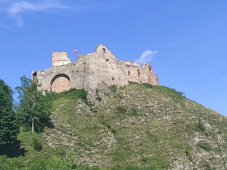
Pieniński Castle, known locally as Zamek Pieniński, is a ruined medieval mountain stronghold in Poland above Krościenko nad Dunajcem. It was probably built in the early 1280s, during the second half of the thirteenth century, and is traditionally associated with Kinga, Duchess of Kraków, later venerated as a Catholic saint. The castle was designed as a temporary refuge rather than a permanent residence, and its position made it a defensive shelter during periods of invasion.
Foundation as a fortified refuge
Construction is traditionally connected with Kinga, who probably commissioned the stronghold to shelter the Poor Clares of Stary Sącz. The Poor Clares were a contemplative Catholic order of nuns within the Franciscan tradition. The refuge could accommodate about 100 people and several dozen soldiers, allowing the duchess, the nuns, and their protectors to withdraw into the mountains during an attack.
A tradition recorded by Jan Długosz claimed that Bolesław the Chaste visited the stronghold during the Mongol invasion of 1241. This identification is probably mistaken and may refer to another fortification in the Pieniny. The castle itself is generally dated to the later thirteenth century, most probably the early 1280s and possibly before 1287.
In early December 1287, during the Mongol invasion led by Nogai, Kinga reportedly took refuge there with her court, priests, knights, and 70 Poor Clares, including her sisters Jolenta and Konstancja. The attackers failed to seize the stronghold. After trying to set it on fire by bombardment, they withdrew when relief forces arrived from Hungary.
Later medieval use and destruction
The castle’s fourteenth-century history is poorly known. It probably declined into a small local watch post because it stood away from the main trade routes while the larger castle at Czorsztyn was being expanded. Archaeological investigations in 2020 and 2021 nevertheless indicate that the stronghold continued to be used during the fifteenth century.
The date and cause of its final destruction remain uncertain. One possibility is that troops commanded by Ścibor of Ściborzyce destroyed it in 1410. Ścibor was a powerful Hungarian magnate and military commander serving Sigismund of Luxembourg, who sent forces during the conflict between Poland and the Teutonic Order. Another explanation attributes the destruction to Hussite forces in 1431 or 1433. The ruins may still have served as a base for Hussite or Hungarian troops under Matthias Corvinus in 1474.
The stronghold was probably never substantially rebuilt during its short period of active use. Its masonry is relatively uniform, suggesting that most of it was constructed during the same period. Poor Clares were also said to have sheltered among the ruins during a plague in the seventeenth century.
Settlements, memory, and investigation
Pieniński Castle was associated with the development of Sromowce and Krościenko. A larger settlement probably grew nearby to supply the garrison and visitors, while the medieval settlement called Crosno may originally have stood near the road leading to the castle.
From the seventeenth and eighteenth centuries, geographical works described the castle as an exceptionally defensive stronghold. In the nineteenth century, the ruins became a pilgrimage destination, including for visitors from Szczawnica. Treasure hunters carried out amateur excavations, and the remains were sometimes incorrectly identified as a monastery connected with Saint Kinga.
F. J. Szczęsny Morawski published the first scholarly description in 1863. The Tatra Society established an official path to the ruins in 1894 and marked it with paint in 1906. A hermitage was built at the site in 1904, and Władysław Druciak’s statue was installed in Saint Kinga’s grotto below the castle. An iron barrier was added along the ridge of Zamkowa Mountain in 1925.
Tomasz Szczygielski of the Pieniny Museum began the first archaeological investigations in 1938 and 1939. The Second World War halted the work. Szczygielski was killed at Auschwitz, and much of the excavation documentation and many of the finds disappeared. Research resumed after 1953 under the Carpathian Archaeological Expedition led by Andrzej Żaki, followed by further investigations in 1976 to 1978 under Maria Cabalska and Stanisław Kołodziejski.
Early interpretations proposed that the stronghold originated under Bolesław I the Brave, Poland’s first king, that Roman legionaries built it near the Amber Road, or that it served as a refuge for robber knights. These theories relied partly on pottery thought to date from the turn of the tenth and eleventh centuries and on a coin of Constantius II. Later research rejected these explanations in favor of a thirteenth-century date.
Conservation and continuing tradition
The ruins were included in the Catalogue of Artistic Monuments in Poland in 1951 and entered in the Polish register of monuments in 2003 after efforts by the administration of Pieniny National Park. They lie within the park’s boundaries. Conservation between 2003 and 2007 cleared vegetation, improved drainage, stabilized the walls, replaced missing stonework, repaired stairs and paths, and exposed the cistern and its floor. A two-metre-deep well was excavated and the site was drained.
The ceiling of the gate building’s basement collapsed in 2017. Research by Daniel Gazda began in 2018, and the Pieniny Archaeological Mission conducted further investigations in 2020 and 2021. During this work, the walls and vault were reconstructed and covered with a new platform. The castle reopened on 1 December 2020.
Saint Kinga’s grotto below the castle remains a pilgrimage and religious site. A local legend says that prayers by the Poor Clares brought clouds and dense fog during the Mongol siege, concealing the stronghold and causing attackers to fall into the precipices. The castle also inspired Konstanty Maniewski’s poem At the Ruins of the Castle of Saint Kunegunda in the Pieniny.
Remains
Mountain setting and defensive walls
The ruins occupy a concealed and naturally defensible position on the northern slope of Zamkowa Mountain, within the Trzy Korony massif. They lie between approximately 740 and 760 metres above sea level, while another description gives the mountain’s height as 799 metres. The site stands above the Huliński Stream. The Pieniński Stream valley borders the massif to the southeast and northeast, and Zamkowa Pass leads southward toward Ostry Wierch and the main massif, including Trzy Korony.
Rocky precipices restrict the castle area to the east, south, and west. The position was difficult to see from the valleys and surrounding elevations, except from the inaccessible northern summits of the Pieninki. Two approaches served the stronghold. The western main entrance led toward Krościenko through Szopka Pass, while the eastern route ran through the Pieniński Stream valley toward the Dunajec gorge.
Main curtain wall
The castle covered approximately 0.4 to 0.6 hectares. Its principal curtain wall, a main defensive wall joining fortified points, followed a gentle curve between two rock outcrops for about 80 metres. It was originally about 160 centimetres thick immediately above its footing, while the surviving sections are now approximately 100 to 120 centimetres thick. The wall survives along almost its entire length, although vegetation covers part of the eastern section. It may once have supported a wooden upper structure.
The wall was built from locally quarried limestone blocks bonded with lime-sand mortar. Its elongated blocks resemble Romanesque masonry and the technique called appareil allongé, in which long stones are laid in horizontal courses. The absence of levelling courses, which occur in fourteenth-century masonry, supports the thirteenth-century date.
Cross walls and eastern approach
Transverse walls closed natural clefts on the eastern and western sides of the complex. The western wall survives to about 5.5 metres high. It is more than 2.5 metres wide at basement level and approximately 1.8 metres wide at the top.
Two eastern walls, separated by roughly 5 to 6 metres, are difficult to see beneath vegetation. Each was attached to only one rock outcrop, and the pair faced one another across the approach. Their arrangement may indicate a gateway with a right-turning entrance, a design that could have hindered attackers carrying shields on their left arms. A gap about 86 centimetres wide interrupts the wall beside the present walkway. Dressed stones edge it, and it may have served as a drainage outlet or a small concealed entrance, although its function cannot be established because its middle and upper portions are missing.
Short walls on the inner side of the main curtain wall probably formed parapets protecting the rocky edges of the mountain. Similar traces were identified along the southern ridge during twentieth-century research. One interpretation places an additional wall on the summit to protect the castle from Ostry Wierch, but that proposal had not been verified by 2006.
Buildings and water supply
Several buildings adjoined the main curtain wall. Their walls were much thinner than the principal defenses, measuring about 100 centimetres across. The site’s low profile is uncertain because no illustrations show the castle before the nineteenth century, but it probably lacked tall towers. High towers would have made the stronghold easier to detect, and the buildings probably did not rise above the curtain wall. The western structure may nevertheless have resembled a squat tower.
Western square building
A square building measuring 11 by 11 metres stood on rock where it joined both the main curtain wall and the western wall. Its basement had a barrel vault made of broken stone and a stone floor. It may have been a gate building with crenellation, the alternating raised sections and openings of a battlement, together with a projecting wooden defensive gallery called a hoarding. Another interpretation identifies it as a square tower that was entered using a basket on a windlass.
An opening above the rock led into the basement. Measuring 93 by 46 centimetres and fitted with a stone lintel, it resembles a postern, a small secondary entrance used for controlled access. Its form may indicate that the building served as a final defensive tower. A second entrance to the basement approached from the east by primitive stone steps.
Adjacent western structure
A smaller building, approximately 5 by 6 metres, adjoined the square western building. An earthen embankment obscures its remains, preventing detailed examination. The structure has been interpreted as the foundation of either a tower or a chamber.
Cistern and well
Another structure had an internal area of approximately 4 by 6 metres. Its walls survive without their outer facing, and a lined depression within it is interpreted as a cistern. The cistern has a red floor made from irregularly arranged tile halves, carefully laid masonry, and a thin layer of fired clay that made the surface watertight.
A two-metre-deep well occupies one corner and collects water from a spring that periodically dries and is associated with Saint Kinga. In this area, the curtain wall is about 260 centimetres thick at its base and has a clearly visible footing ledge approximately one metre wide.
Additional masonry and wooden structures
Two more structures stood beside the curtain wall. One was a poorly preserved room with an internal area of about 2 by 4 metres. The other is represented by two transverse wall fragments, each up to 2.5 metres long and approximately two metres apart.
Wooden structures once stood near the walls and probably on the slope, although no remains of them survive. Natural or artificial cuttings on the steep slope indicate places where buildings may have stood, perhaps connected by wooden walkways. Such additions would have been necessary because the masonry buildings alone could not have accommodated a permanent garrison, Kinga’s court, the nuns, and the required service rooms.
Archaeological evidence and landscape
Excavations in 1938 and 1939 and again between 1976 and 1978 traced the walls, identified the cistern, and revealed masonry in the southern part of Zamkowa Mountain. Finds included arrowheads, spearheads, pottery fragments, nails, metal vessels, a belt buckle, and a bronze mace. Individual artefacts are held by the Józef Szalay Pieniny Museum in Szlachtowa.
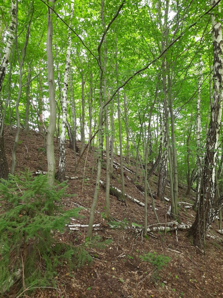
The slopes were covered by pine forest until a two-week fire in 1915 destroyed it. They are now mainly covered by sycamore forest, while mixed beech and fir forests grow within the castle complex. Mountain vegetation at the ruins includes carnations, alpine asters, rock alyssum, Zawadzki’s chrysanthemums, and a stand of edelweiss that may reflect nineteenth-century transplanting by the Tatra Society.
Stone steps leading from the trail to the ruins were built during the excavation of Saint Kinga’s grotto at the beginning of the twentieth century. The builders used stone taken from the castle walls.