Veste Landskron: A Renaissance Water Castle in Germany
Site at a Glance
- Rating
- 4.8
- Popularity
- Low
- Country
- Germany
- Primary era
- Early Modern
- Eras represented
- Early Modern
- Civilizations
- Duchy of Pomerania, Holy Roman Empire
- Site type
- Military
- Remains
- Castle
On this page11 sections
History
Veste Landskron is a Renaissance lowland water castle in Germany, located in Neuendorf B near Janow in Mecklenburg-Western Pomerania. It was built between 1576 and 1579 by Ulrich II von Schwerin as a fortified residence combining moats, towers, walls, and a substantial residential complex. The castle stood in the Großer Landgraben valley in Vorpommern-Greifswald and became the seat of a branch of the von Schwerin family.
Construction and the von Schwerin family
Ulrich II was the son of Ulrich von Schwerin, chief steward at the Pomeranian ducal court. He financed the castle from income earned through military service for the Duke of Mecklenburg. The construction cost about 40,000 gulden, an early modern currency. The name Landskron means “Land’s Crown.” Tradition holds that the Pomeranian duke disliked the name and promoted the alternative form Lanzkron, but that change apparently did not prevail.
A large stone tablet dated 1586 was originally placed above the entrance gate. It showed Ulrich II and his wife, Katharina von Waldenfels, together with the arms of both families. The tablet also carried a German foundation poem, a religious admonition to Ulrich’s sons headed “Pater Udalricus ad filios 1586,” and prayers for the protection and prosperity of the family and its rulers. It fell around 1860 and has since been missing.
Inheritance and decline
After Ulrich II’s death, the castle passed to his son Georg Ernst von Schwerin and then to Georg Ernst’s son, Ulrich Wigand von Schwerin. When Ulrich Wigand died without heirs in 1651, ownership passed through his sister Anna to her husband, the Swedish councillor von Anrieppe. Their daughter later brought the property by marriage to Jürgen von Pentz.
Heavy indebtedness left Jürgen von Pentz unable to carry out the necessary maintenance. An Ivener visitation report from 1661 described the castle chapel as decaying. The castle was apparently still inhabited around 1668, when the Ivener church register recorded the birth of Jürgen von Pentz’s son at Landskron. By 1683, however, the von Pentz family had abandoned the castle and moved to Neuendorf. The ruins, already uninhabitable after fewer than a hundred years, passed to the owner’s creditors. It remains uncertain whether the Swedish-Brandenburg War of 1674 to 1679 contributed to the abandonment. This conflict was a European war involving Sweden and Brandenburg during the later seventeenth century.
Later history
In 1699, the castle and its surrounding lands returned to the von Schwerin family for 13,000 thalers. The family continued to leave the ruins largely neglected. Philipp von Schwerin did not rebuild the castle and moved his residence to nearby Rehberg.
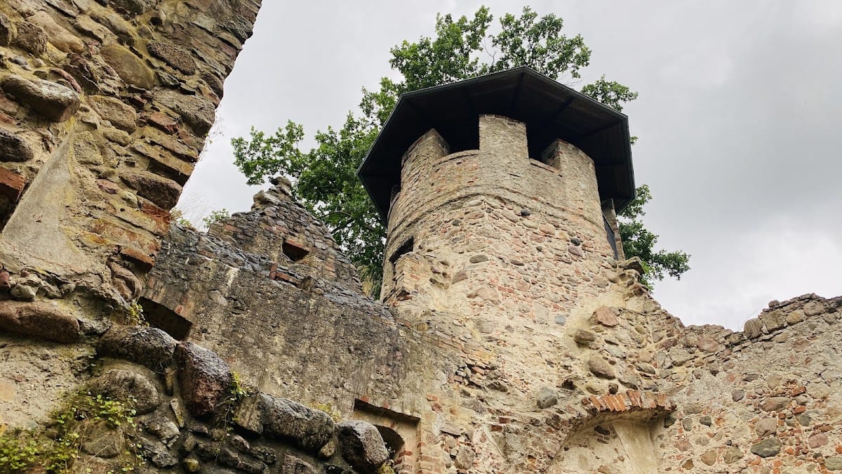
During the nineteenth century, the ruins became a popular excursion destination. A tavern was built in 1852 on the eastern side of the outer bailey, apparently replacing the former servants’ kitchen. It remained in use until the 1960s and was later demolished. Since the early twentieth century, the southeast tower has been used as a lookout tower, with a balcony, roof, and leaded-glass windows. The ruins are also used for concerts and other cultural events.
A Slavic fortified settlement dating to the seventh century lies near Landskron. The same earthwork has also been described as a Swedish fortification associated with the Thirty Years’ War, the major European conflict fought from 1618 to 1648. This settlement or earthwork is identified separately from the castle.
Remains
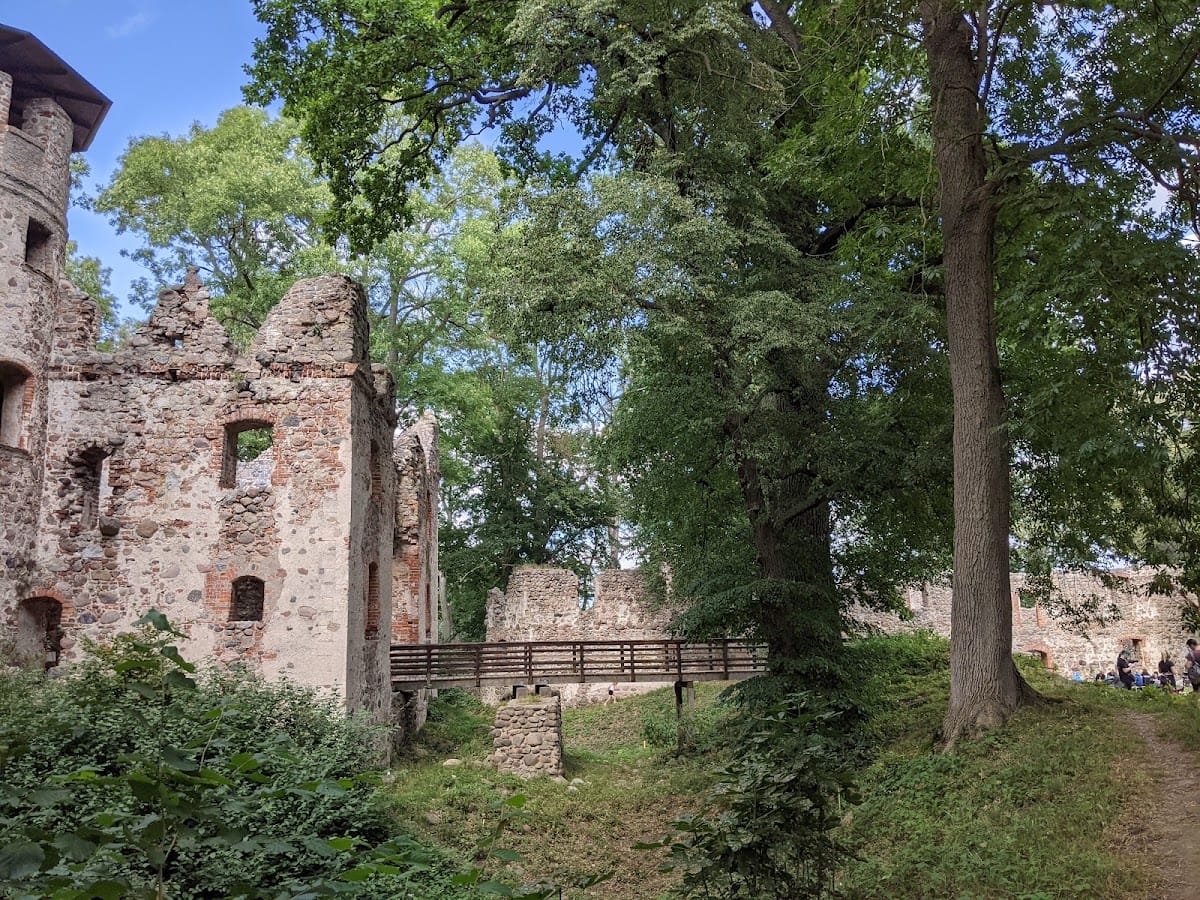
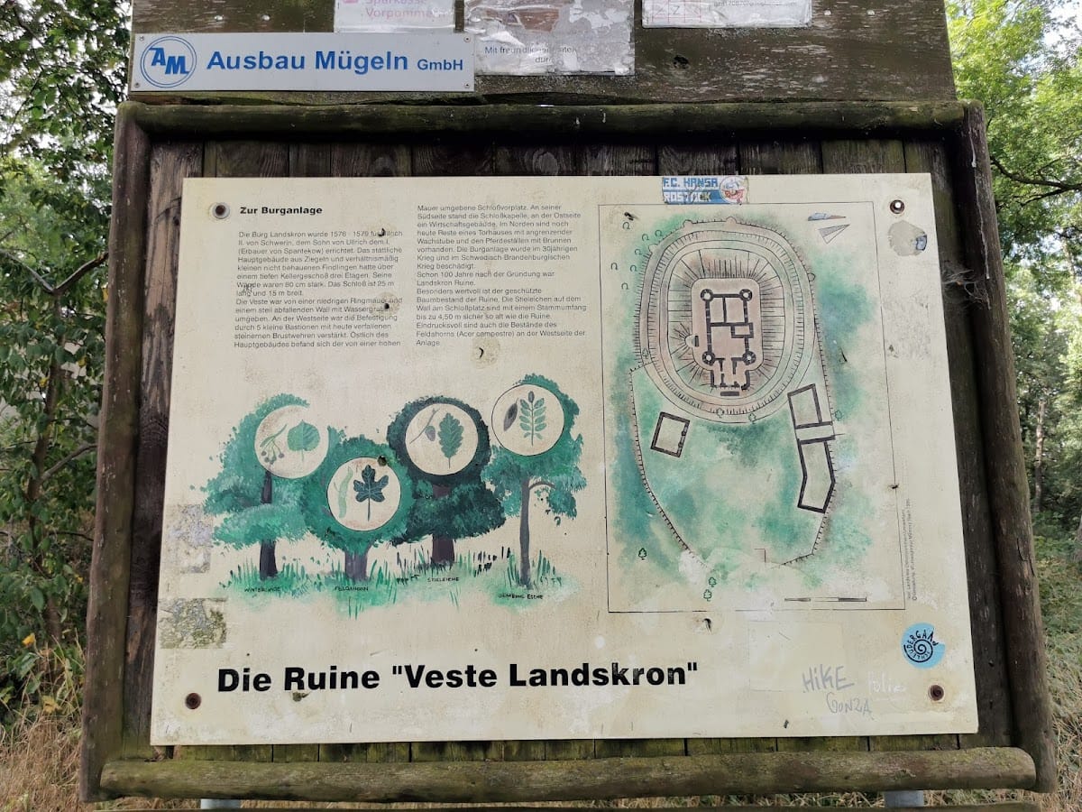
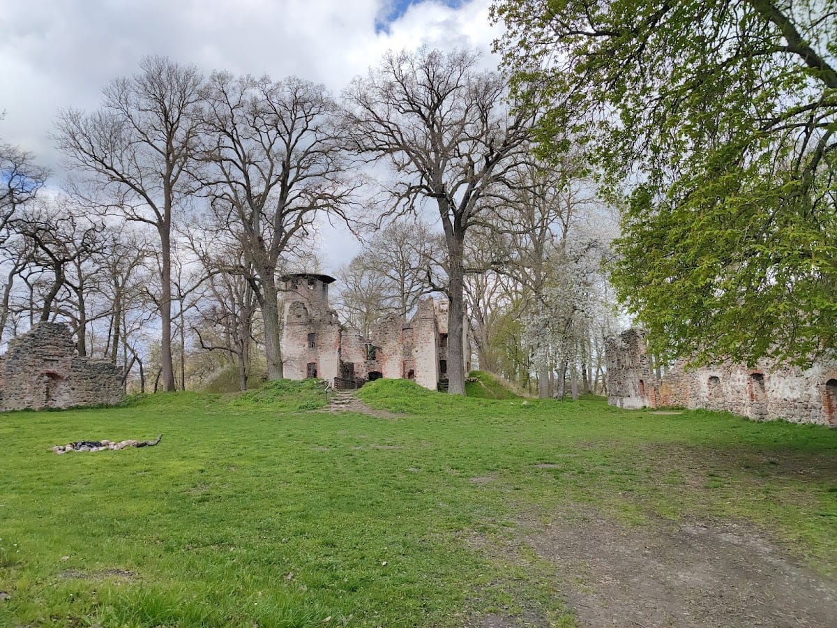
Veste Landskron occupies elevated, relatively dry ground within the swampy meadows of the Großer Landgraben valley. The complex is divided into an eastern outer bailey and a western main castle. Fieldstone or glacial boulders form most of the surviving buildings and walls, while brick was used around window openings and passageways. A water-filled moat originally surrounded the site and was supplied by the Landgraben. After the watercourse was straightened toward the end of the eighteenth century, its channel lay farther from the ruins.
Outer bailey
Gatehouse and service buildings
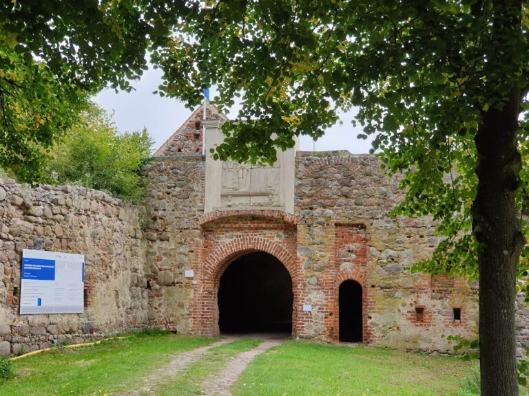
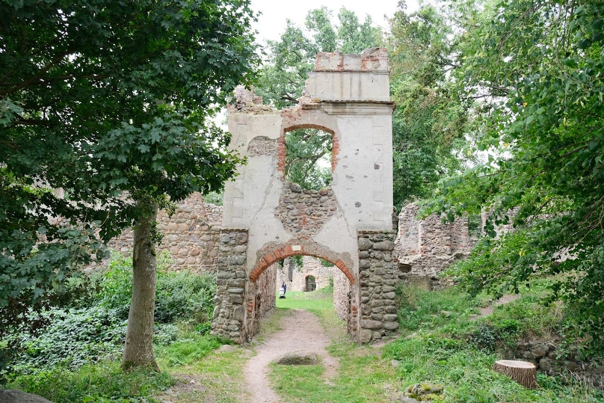
The outer bailey was enclosed by a wall that reached approximately 3 metres in height. Entry was through a gatehouse on the north side, whose deep passage led into the enclosed area. The 1586 stone tablet was mounted in an opening above this passage. A building west of the gatehouse probably served residential purposes and may also have housed guards.
The former stable stood east of the gatehouse. Its upper floor contained additional storage rooms, and a well was located within the building. In the eastern part of the bailey, the servants’ kitchen was later replaced by the nineteenth-century tavern. The tavern no longer survives.
Chapel and western building
The ruined castle chapel stands in the southern part of the outer bailey, directly opposite the entrance. A fourth building shown on Swedish cadastral maps from the late seventeenth century stood along the western edge of the bailey, opposite the entrance to the main castle. Cadastral maps were detailed property maps used to record landholdings and boundaries. The building’s function is unknown, although it may have been another gatehouse.
Main castle and defenses
Central building and corner towers
The main castle had a rectangular plan measuring about 15 metres in width and 25 metres in length. Its central building originally rose three storeys and included a basement. Four round corner towers, each about 3.5 metres across, strengthened the structure, whose walls averaged approximately 80 centimetres in thickness. Cellar walls survive inside the main building, and the remains of a stair tower stand at the centre of its north side.
Surviving plaster preserves traces of rusticated corner-work, a finish that gave the corners the appearance of large, roughly cut blocks. One corner tower was used as a dungeon for people who had been abducted and held for ransom, adding a grim aspect to the castle’s later historical associations.
Moats, bridge, and perimeter wall
The main castle was protected by the outer moat, an inner edge lined with fieldstone, and a second moat inside the perimeter wall. The perimeter wall originally formed a continuous breastwork nearly 2 metres high. A breastwork is a low defensive wall or parapet intended to shield defenders. Five projecting bastions survive along the western side. These structures strengthened the wall and provided positions from which the adjoining perimeter could be protected.
The original route from the outer bailey to the main castle crossed an eastern drawbridge. The present connection is a solid bridge. Together with the moats, perimeter wall, towers, and bastions, these surviving elements show how the residence was organized around a fortified central core and an enclosed service area.
Nearby sites