Old Navarino Castle: A Medieval Fortress at Pylos, Greece


Site at a Glance
- Rating
- 4.7
- Popularity
- Low
- Country
- Greece
- Primary era
- Early Modern
- External website
- Open
- Eras represented
- Classical, Medieval, Early Modern
- Civilizations
- Ancient Greek, Byzantine, Crusader, Ottoman, Principality of Achaea, Roman, Venetian
- Site type
- Military
- Remains
- Castle
On this page14 sections
History
Old Navarino Castle is a medieval fortress at Pylos in Greece, built by the Franks in the late thirteenth century on the ancient acropolis of Pylos. It stands on the Koryfasion peninsula above the northern entrance to Navarino Bay and should be distinguished from New Navarino Castle, the Ottoman fortress later built at the bay’s southern entrance. The site developed from an ancient stronghold into a fortified settlement and remained contested by Byzantine, Frankish, Venetian, and Ottoman powers.
The ancient acropolis
The hill was occupied long before the medieval castle was built. Archaeological investigations have identified traces of an Early Helladic settlement from the third millennium BC, together with two Middle Helladic burial mounds dating to around 2000 BC. In Classical antiquity, the elevated site formed part of the history of Pylos during the Peloponnesian War, the conflict between Athens and Sparta and their allies.
In 425 BC, Athenian forces led by the general Demosthenes fortified the then-unoccupied hill of Koryfasion as an advanced base. The Athenians repelled a Spartan attack, while an Athenian naval victory left Spartan troops isolated on the island of Sphacteria. About 300 prominent Spartan prisoners eventually surrendered. After the Peace of Nicias in 422–421 BC, the fortification passed to the Spartans.
Pylos was refounded in the fourth century BC after Messenia was freed from Spartan rule. The ancient acropolis then followed the wider region through the Hellenistic, Roman, and Byzantine periods. The hill later became known as Zonglos. Its temporary occupation by the Avars around the sixth century contributed to the names Avarino and Navarino that were subsequently associated with the area.
The Frankish foundation
During Frankish rule in the Principality of Achaea, a Crusader state established in the Peloponnese after the Fourth Crusade, the present castle was constructed in the late thirteenth century. The Franks called the site Port-de-Jonc or Port-de-Junch, a name meaning “Harbor of Mastic Shrubs” and referring to the coastal vegetation. The castle is traditionally attributed to Nicholas II de Saint-Omer, a Flemish nobleman who held the lordship of Thebes and served as bailiff, a senior governing official, of Achaea.
The precise beginning of construction remains uncertain within this period. Tradition places it in 1278, while a date between 1287 and 1289 is considered more probable. Nicholas II established the fortress on lands acquired in Messenia and intended it for his nephew and heir, Nicholas III. Over time, the site developed beyond a purely military role, becoming a fortified settlement with associated habitation and port activity.
Late medieval lordship and Venetian control
After Nicholas III died in the early fourteenth century, Navarino passed among several lords. The castle was drawn into the political struggles surrounding Maria of Bourbon’s claim to the Principality of Achaea. Maria held Navarino, together with Kalamata and Mani, from 1358 until her death in 1377. A castellan loyal to her briefly imprisoned Simon del Poggio, the new bailiff. Albanian settlers appeared in the region around 1381–1382.
In 1381, the Navarrese Company seized the castle. This fourteenth-century mercenary force, composed mainly of soldiers from Navarre and Gascony, had taken control of much of Achaea. Venice captured Navarino in 1417 and secured formal recognition of its possession in 1423 from Centurione II Zaccaria, ruler of the Principality of Achaea.
Venetian control continued after the Ottoman conquest of most of the Peloponnese, then commonly called the Morea, in 1460. During the Ottoman-Venetian War, however, the Venetian garrison surrendered after the defeat at Modon in August 1500. Venetian forces briefly recovered the fortress in December of that year, but Ottoman troops commanded by Kemal Reis and Hadim Ali Pasha retook it on 20 May 1501.
Ottoman transformation and decline
In 1572–1573, the Ottoman commander Uluj Ali Reis built New Navarino Castle at the southern entrance to the bay. The new fortress controlled that entrance more effectively and had a more secure water supply. The northern entrance had also been obstructed in 1571 by ships sunk after the Battle of Lepanto. Old Navarino consequently lost much of its defensive importance and was reduced to a small garrison while its fabric gradually deteriorated.
During the Morean War, the Ottomans concentrated their defenses in New Navarino. A garrison of about 100 men surrendered Old Navarino without a fight to Venetian forces commanded by Francesco Morosini on 2 June 1686. Venice held the castle until 1715, when the Ottomans reconquered the Peloponnese. Venetian plans to strengthen or demolish the fortress produced only limited modifications, and the Ottomans carried out no substantial reconstruction.
The area was temporarily held by pro-Russian forces between April and June 1770 during the Russo-Turkish War of 1768–1774 and the Greek uprising known as the Orlov Revolt. Greek revolutionaries later occupied Old Navarino during the Greek Revolution and used it as a base. Ibrahim Pasha captured the castle after a siege on 29 April 1825. The Ottoman-Egyptian garrison remained there until it was transferred to French forces under General Nicolas Joseph Maison in spring 1828.
Abandonment and archaeological protection
With the establishment of the Greek state, Old Navarino lost its military function and was abandoned as a fortress. A French scientific expedition to the Morea found it substantially ruined in 1828. Heinrich Schliemann investigated the castle and its surroundings in 1874, followed by work by W. A. McDonald and Dimitrios Theocharis in 1952 and by George S. Korres and Adamantios Sampson in 1980, among others.
Old Navarino was declared a historically preserved monument in 1932. Decisions issued in 1981, 1987, and 1992 extended protection to the castle and the wider Koryfasion, Voidokilia, and Divari area. The protected landscape includes the castle hill, the rocky mass north of Sphacteria, the Divari wetland, Voidokilia Bay, and Koukouras Hill, encompassing evidence of continuous cultural presence from the third millennium BC through the late Roman and Byzantine periods. The Ephorate of Antiquities of Messenia, under the Ministry of Culture and Sports, is responsible for the investigation, protection, promotion, and conservation of the site.
Remains
Hilltop fortress and setting
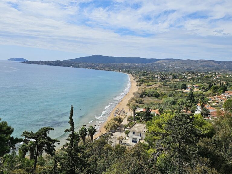
The fortress occupies approximately 50 stremmata, or about 50,000 square metres, in a roughly trapezoidal plan on a rocky summit around 200 metres above the northern entrance to Navarino Bay. Steep cliffs and the sea protect most sides of the position. The hill overlooks the bay’s northern entrance, the Sykia Strait, Voidokilia Bay, the Divari or Osmanaga lagoon, and the northern end of Sphacteria. The peninsula is bounded by the Ionian Sea to the west and south, Voidokilia Bay to the north, and the lagoon to the east.
The medieval fortress was built over the Classical acropolis of Pylos. Sections of the ancient walls survive, and masonry from the earlier acropolis was reused in the castle. The original Frankish citadel appears to have occupied the northern end of the summit. The settlement extended beyond the defensive enclosure, particularly toward the west, where scattered remains indicate associated habitation and port installations along the shore.
Walls, entrances, and internal settlement
Outer walls and citadel
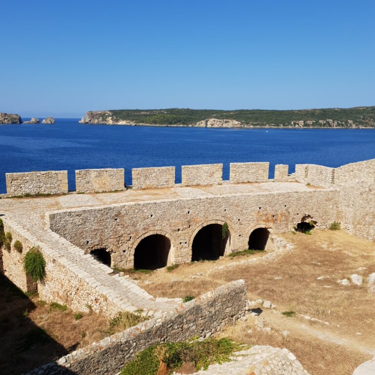
The outer perimeter wall encloses the summit and is divided by a transverse wall into a larger southern section and a smaller northern citadel, the strongest part of the fortress. Ruins of public and private buildings, a Catholic church, and underground water cisterns remain within the enclosure. The visible upper structure chiefly reflects the Venetian occupation of 1423–1500 and Ottoman construction or alteration during the sixteenth century. Much of the present ruin belongs to the late sixteenth century, while the southern enclosure was probably added by the Venetians or Ottomans.
Southern entrance and defensive masonry
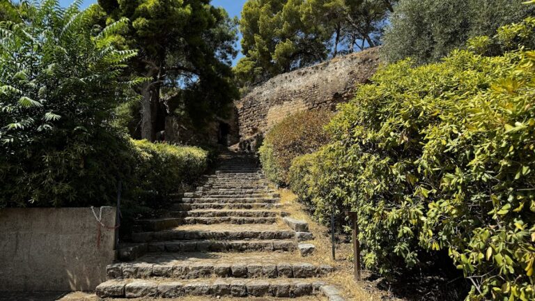
The principal entrance lies on the southern side, at the end of the approach from the Sykia Strait. A substantial portion of the gateway has collapsed. The approach passes ancient walls, Ottoman graves, and remains of more recent habitation. Three courses of masonry survive in the middle of the southern outer enclosure, while the lower parts of the northeastern wall and the foundations of two circular towers can still be traced.
The eastern side was not fully walled because the steep hill provided natural protection. Elsewhere, the walls are generally thin and high, with battlements ending in swallow-tail forms, forked profiles used along the parapet. Their masonry displays several building phases. The external walls are partly preserved, but other elements survive only at foundation level, and sections of the principal remains are ruined and overgrown.
Earlier infrastructure and the Nestor Cave
Pre-Frankish structures
A small rectangular tower at the western end of the western outer wall probably predates Frankish rule. Its brick-framed masonry is associated with Byzantine construction. Other pre-Frankish infrastructure includes remains of an aqueduct on the beach and a surviving bridge over the Tyflomytis River between Romanos and Tragána.
Nestor or Neleus Cave
The Nestor or Neleus Cave lies on the castle hill. Greek tradition identifies it as a cattle stall for the herds of Neleus and Nestor. Nestor was the legendary king of Pylos in Greek epic tradition, while Neleus was traditionally regarded as his father. Heinrich Schliemann explored the cave in 1874, and later archaeological investigators also examined it.
Nearby sites