Calatrava la Vieja: An Andalusi Frontier City and the First Headquarters of the Order of Calatrava

Site at a Glance
- Rating
- 4.5
- Popularity
- Low
- Country
- Spain
- Primary era
- Medieval
- External website
- Open
- Eras represented
- Medieval
- Civilizations
- Almohad, Crusader, Knights Templar, Order of Calatrava, Umayyad
- Site type
- City
On this page18 sections
History
Calatrava la Vieja is the ruined former city of Calatrava in Spain, founded by the Umayyads in the late eighth century during the Islamic medieval period. Its remains lie in the municipality of Carrión de Calatrava, in Ciudad Real. First mentioned in 785, the settlement belonged to the Emirate and later the Caliphate of Córdoba for about four centuries. During the Early Middle Ages, the first part of the medieval period, it was the principal city of al-Andalus in the middle Guadiana valley and controlled the route between Córdoba and Toledo, as well as communications across the Iberian Peninsula.
Umayyad foundation and expansion
The name Calatrava comes from the Arabic place-name Qal’at Rabah, meaning “fortress of a ribat.” A ribat was a fortified religious or military establishment. After the area came under Castilian rule, the name was adapted into Castilian. Calatrava later gave its name to the Campo de Calatrava region and to the Order of Calatrava.
The city was rebuilt according to a new plan during the reign of the Cordoban emir Muhammad I. Its position allowed the Umayyad government to confront rebellious Toledo and supervise the route between Toledo and Córdoba. Conflict between Toledo and the Emirate of Córdoba led to the partial destruction of Calatrava in 853. Muhammad I’s brother, al-Hakam, then reconstructed the city, beginning its greatest period of prosperity.
From 853 to 1147, Calatrava served as the capital of an extensive region. After the Caliphate of Córdoba collapsed during the first half of the eleventh century, control of the city was contested by the taifa kingdoms of Seville, Córdoba, and Toledo. These smaller successor states had emerged from the breakup of the caliphate.
Frontier stronghold and Christian conquest
The Christian conquest of Toledo in 1085 and the arrival of the Almoravids in Iberia in 1086 increased Calatrava’s military importance. The Almoravids were a North African Islamic dynasty that intervened in Iberia. Calatrava became al-Andalus’s most advanced stronghold facing the Christian territories and played a major part in the continuing conflict with Castile.
The city’s intellectual and literary life is associated with the Andalusi poet Abu Tammam ibn Rabah, who was born at Calatrava in the tenth century. He praised his birthplace in his poetry, although he probably lived in Seville or Zaragoza.
Alfonso VII of León and Castile captured Calatrava in 1147, turning it into the leading Christian stronghold on the frontier with Muslim territories. The city was then entrusted to the Knights Templar, a Christian military order founded during the Crusading period, but they abandoned it soon afterward.
In 1158, Sancho III of Castile granted Calatrava to Raimundo de Fitero, abbot of the Cistercian monastery of Fitero. The Cistercians were a reform branch of Western monasticism that followed the Rule of Saint Benedict and emphasized austere communal observance. Raimundo founded the Order of Calatrava at the city, making it the order’s first headquarters and place of origin.
Almohad reconquest and later abandonment
The Almohads recaptured Calatrava in 1195 after defeating Alfonso VIII at the Battle of Alarcos. The Almohads were a later North African Islamic dynasty that contested control of Iberia with the Christian kingdoms. They held the city for seventeen years. In 1212, the Castilian king recovered it during the campaign that culminated in the Battle of Las Navas de Tolosa.
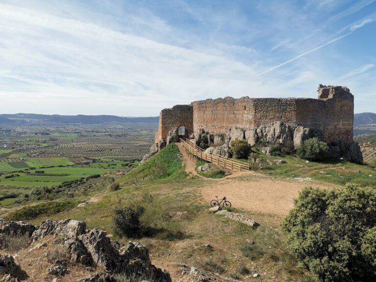
In 1217, the headquarters of the Order of Calatrava moved to the Castle of Dueñas, about 60 kilometres to the south. The new centre became known as Calatrava la Nueva, while the former city acquired the name Calatrava la Vieja. The older settlement remained the head of a commandery based in its former Islamic alcázar. A commandery, or encomienda, was an administrative and territorial unit managed by a military order.
At the beginning of the fifteenth century, the local commander moved his residence to nearby Carrión de Calatrava. This caused the definitive abandonment of the old city, which was already practically depopulated by the beginning of the sixteenth century. The surrounding settlements of Campo de Calatrava remained linked to the Order of Calatrava, a relationship preserved in the names of many localities.
Calatrava la Vieja is regarded as one of Spain’s important archaeological sites of Islamic origin. Excavation and restoration continued during the 2010s, and the site forms part of the archaeological parks of Castilla-La Mancha. Its archaeological zone was declared a Property of Cultural Interest, under the category of archaeological area, on 20 May 1992.
Remains
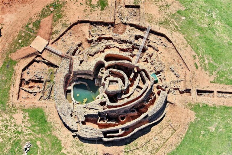
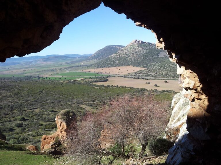
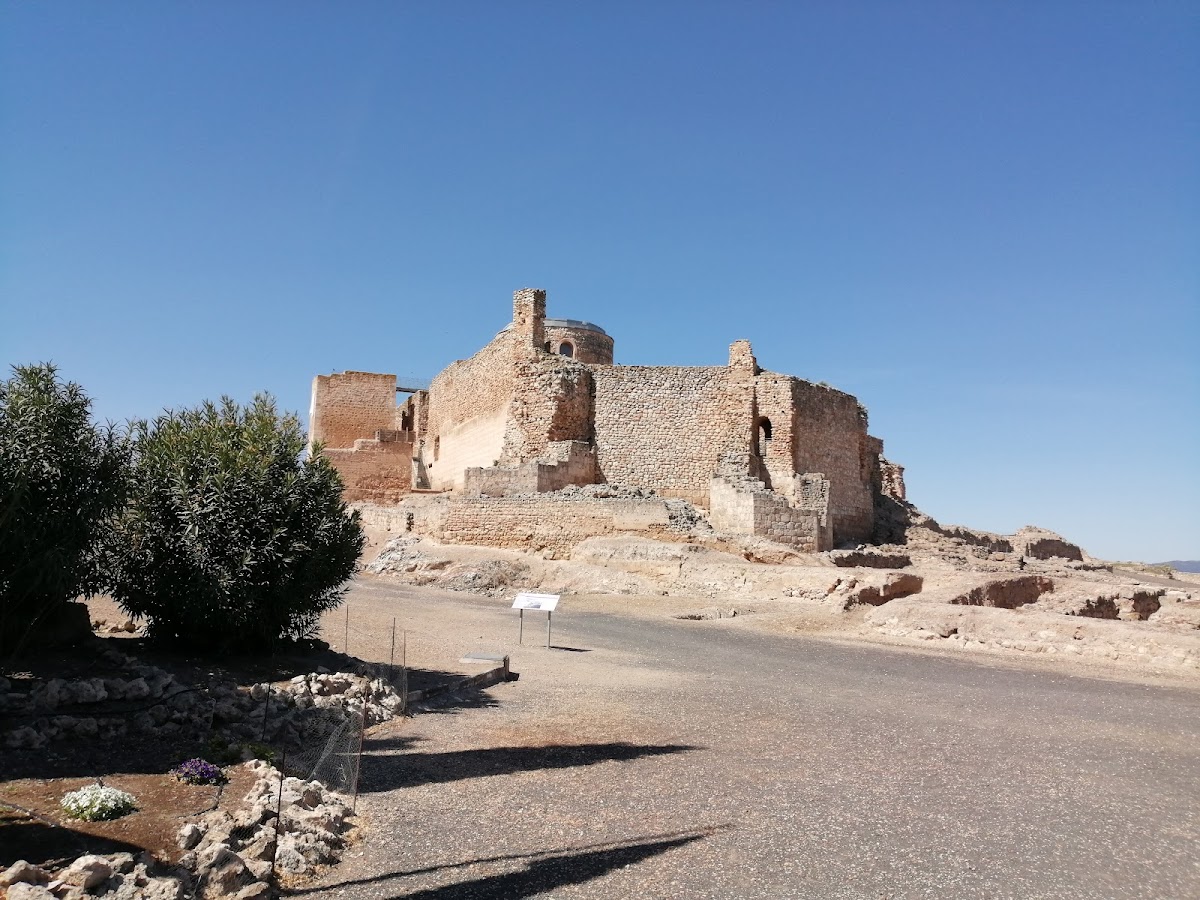
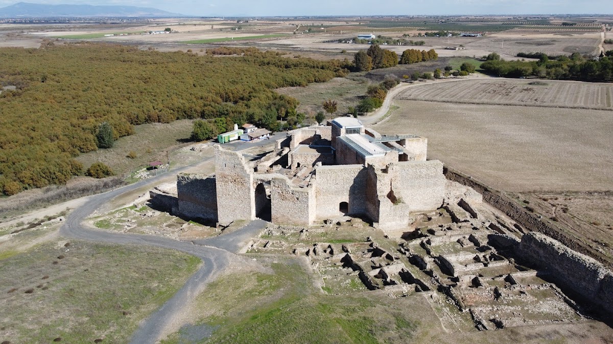
Calatrava la Vieja occupies an approximately five-hectare oval plateau on the left bank of the Guadiana, where the river meets the Valdecañas stream. The flat-topped hill overlooks the river crossing and the surrounding area. The river and formerly broad marshy ground provided natural protection on the northern side, while the site lies west of the wetlands of the Tablas de Daimiel. The settlement is divided by a substantial internal wall into the eastern alcázar, a fortified palace or citadel, and the medina, the principal urban sector of an Islamic city. Suburbs extended beyond the main enclosure.
Walls, moat, and entrances
Fortified enclosure
The fortified enclosure extends for approximately 1,500 metres and includes at least 44 flanking towers. Nearly all the walls are attributed to the Umayyad period, although much of their fabric remains covered by rubble. Two flanking towers are albarranas, projecting defensive towers set apart from the main wall and linked to it by a narrow connection. The other towers are generally quadrangular, with both hollow and solid examples. The southern front has larger, more numerous, and more widely spaced towers, while the towers on the western spur are smaller, solid, and closer together. Most towers facing the river are hollow. Two pentagonal towers with projecting prows stand at the eastern end of the alcázar.
Moat and gates
Except on the river-protected northern side, the enclosure is surrounded by a dry moat. Cut mostly into the hill’s bedrock, it extends for more than 750 metres and averages 10 metres in depth, making the fortified settlement functionally island-like. Remains of a bridge survive opposite the principal southern gate.
Two ninth-century gates have elbow-shaped plans that made direct access more difficult. The principal southern gate was reached across the moat by the bridge and opened onto a ramp paved with large stone slabs leading into the medina. A nearby smaller postern may have been used more frequently because it allowed tighter control of entry. The alcázar had another elbow-shaped gate, reached from the river by an external ramp. A postern between the medina and alcázar was blocked when the alcázar audience hall was constructed.
Hydraulic defences
Alcázar towers
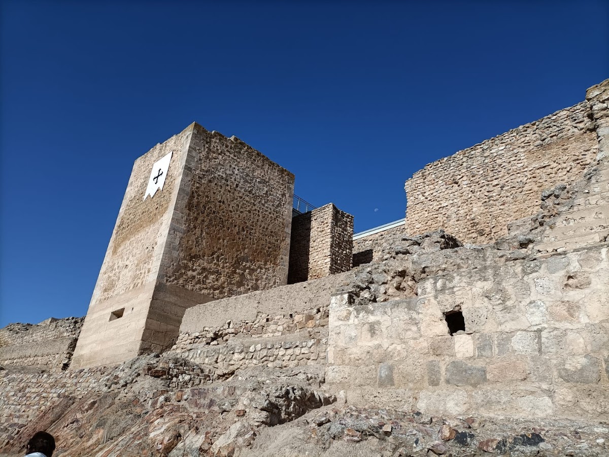
Two closely spaced projecting towers stand in the alcázar. The taller and larger tower is hollow, with a lower section built of regularly cut stone blocks and an upper section of rubble masonry. It dates to about 854, when the adjoining wall was refaced. Nearer the river are the remains of a second, Almohad-period albarrana tower. It combines reused stone blocks with rammed-earth construction, in which compacted earth was formed within a framework.
A third albarrana tower once stood on the southern exterior wall between the alcázar and the medina gate. It was later filled in and changed into a pentagonal tower, possibly to support large war machines such as mangonels on its terrace. Three associated towers formed part of the hydraulic defensive system. Two hollow towers at the eastern end of the alcázar date to about 854. The one farther from the river, inaccessible from the alcázar and pierced by ceramic pipes, may have been a water tower. The nearer tower had direct access from the alcázar and may have served as a control post.
Corachas and water supply
Four corachas, fortified structures or passages giving protected access to water beyond a fortification, have been identified at Calatrava la Vieja. The oldest predates 853 and was partly destroyed when the water tower was built. Some of its remains later supported Almohad structures beside the river. A second coracha lies in the suburbs and remains partly covered by rubble.
The medina coracha extends almost 80 metres into the river and is marked by five counterfort towers positioned upstream. A relay system of waterwheels drew water at the terminal tower and raised it into the medina for its supply. The alcázar coracha and water tower formed the core of a hydraulic defensive system established during the reconstruction of 854. Water was raised from the river to the top of the alcázar’s eastern wall and distributed through channels into the alcázar and toward the water tower in the southern pentagonal tower. From there, it flowed back into the moat under pressure through numerous ceramic channels or outlets piercing the walls.
The system supplied the moat when the river was low and presented Umayyad control of water as an expression of political authority. During the Almohad period, it was altered by the addition of a heavily perforated wall with several levels of ceramic outlets, supported by the neighbouring albarrana tower.
Medina and suburbs
Urban centre
The medina was the centre of urban life and was enclosed by a solid wall with more than forty towers. Written descriptions associate the city sector with mosques, baths, shops, ovens, and strong earthen houses. Archaeological remains include domestic rooms and a paved street dating from the Almohad period.
Outer settlement
The extensive suburbs contain areas of craft and industrial activity, a cemetery of Almohad date, scattered house remains, and a mosque incorporated into the area of the present-day Chapel of the Incarnation. Prehistoric and important Iberian occupation levels lie beneath the medieval remains, showing that the hill was used before the Islamic city was established.
Alcázar buildings
Early and Umayyad phases
The alcázar occupies the eastern end of the city at the beginning of the moat. It has a triangular plan and covers approximately one hectare. Its earliest phase includes the former western closing wall, with a still-hidden gate and several towers built using adobe, brick, rammed earth, rubble masonry, and other techniques.
The reconstruction associated with Muhammad I included large entrance towers built over earlier towers, a monumental triumphal arch in front of the former gate, and sections of the western and southeastern walls. The primitive albarrana tower and the pentagonal projecting towers are also attributed to this phase. Islamic structures of uncertain date include a freestanding cistern in front of the principal gate and a large hall with several large horseshoe arches. The hall is identified as an audience chamber connected with a pool and garden, whose arrangement associated rulership with control of water.
Templar church
The Templar phase is represented by the unfinished apse of a church dating from 1147 to 1158. An apse is the usually curved or polygonal end of a church containing its sanctuary. This apse has a twelve-sided plan and is one of the few surviving constructional remains associated with the Knights Templar in Castile.
Calatrava commandery
The church and adjoining buildings of the Calatrava commandery occupy much of the alcázar. Constructed over earlier structures during the thirteenth and fourteenth centuries, they were repeatedly built, altered, and reused. Surviving features include a smithy and vaulted rooms beside the church. Much of the site remains ruined or partly covered by rubble, while other areas continue to be investigated and restored.