Cerro de las Cabezas: An Ibero-Oretani Walled Settlement in Spain
Site at a Glance
- Popularity
- Medium
- Country
- Spain
- Primary era
- Classical
- Eras represented
- Iron Age, Classical
- Civilizations
- Iberian
- Site type
- Settlement
- Remains
- Town
On this page14 sections
History
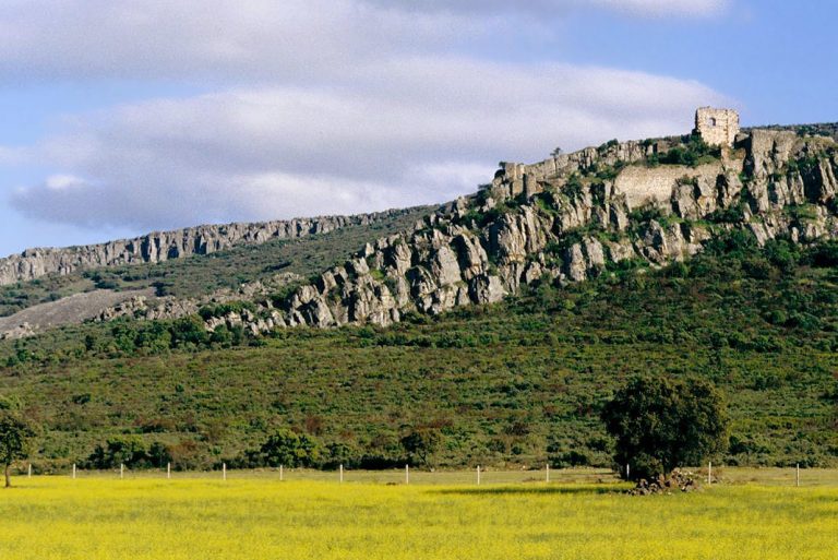
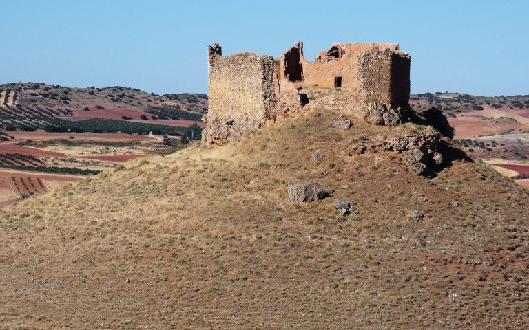
Cerro de las Cabezas is an Ibero-Oretani walled settlement about eight kilometres south of Valdepeñas, Spain, occupied from the sixth to the second century BC. Its hilltop position was chosen to control a route connecting the Guadalquivir Valley and Andalusia with the southern Meseta. The Oretani were an ancient people of the southern Meseta, the elevated central plateau of the Iberian Peninsula, and nearby areas.
Community and regional connections
Cerro de las Cabezas should not be identified as the ancient city of Edeba. An inscription naming Edeba was found in the late nineteenth century on a Roman decempondo, a weight measure, at Virgen de la Cabeza, elsewhere on the road between Valdepeñas and Torrenueva.
The settlement’s position connected its inhabitants with nearby communities and, through wider routes, with Mediterranean communities. Its economy included dry farming and pottery-making, while traders exchanged grain and pottery. More than one excavated house may have belonged to an aristocratic family. A proposed social hierarchy also includes free craftspeople, potters, herders and warriors, with peasants forming most of the population and enslaved people and servants lower in the social order. Some peasants may have lived in huts beyond the walls.
Interpretations of graves and other evidence have linked men with warfare and women with personal adornment, partly through comparison with other Iberian communities. Women’s lives were largely domestic, although representations of ritual dances suggest they also took part in public life. The settlement was probably connected with the rock sanctuary of Collado de los Jardines at Despeñaperros, which attracted worshippers from other Oretani cities, including Cástulo and Giribaile.
Excavation and preservation
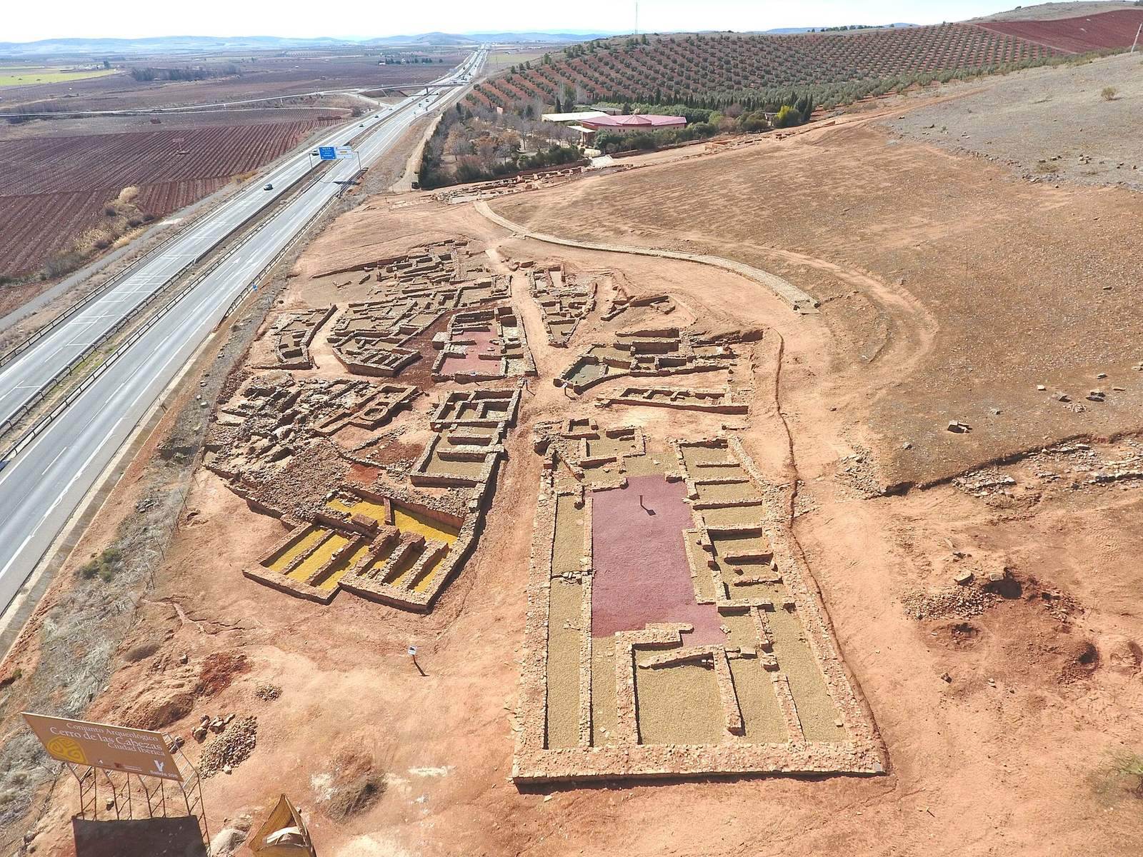
Small test excavations began in 1984 and 1985 with support from the Bernardo Balbuena secondary school in Valdepeñas. Motorway construction damaged part of the site, but two intensive excavation campaigns in 1986 led to the route being diverted, preserving about 20,000 square metres. A further phase began in 1995 as a joint effort by the regional government of Castilla-La Mancha and Valdepeñas Town Council. Excavation and conservation proceeded together, with sustained work on the southern defenses.
Further campaigns expanded the excavated area, and archaeological work continued in 2010. A cemetery associated with the settlement was discovered in 2013 during archaeological protection work ahead of a high-voltage power line. Two decapitated bodies found in 2010 were initially thought to be children; analysis in 2014 established that they were adults aged about 30 to 50.
Remains
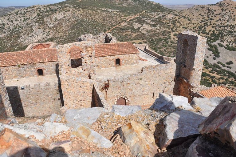
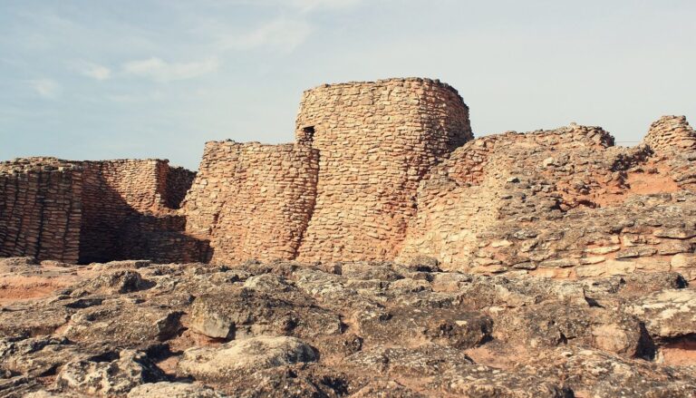
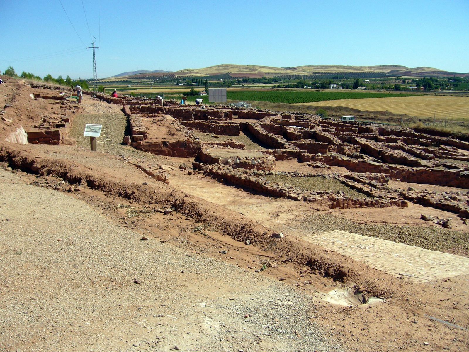
The settlement occupied ground from the summit down the eastern slope of a hill about 800 metres high. Excavations cover about 14,000 square metres, roughly one tenth of the site. A perimeter wall and watchtowers enclosed the town. Local quartzite and other nearby stone were used alongside adobe, rammed earth and plant materials, with stone forming the lower parts of buildings and more fragile materials above.
Walls, gates, and urban layout
The outer wall’s surviving lower courses consist of large, closely fitted stone blocks; the adobe walls that rose above them have disappeared. In the southern defensive area, excavators exposed projecting structures called bastions and one of the city’s principal gates. Several bastions were also used to store grain. The northern urban area followed a different layout, with planned streets and designated production areas. Evidence points to a sanctuary at the northern entrance gate, while a second sanctuary near the southern wall has been proposed.
Buildings and domestic facilities
Walls and building methods
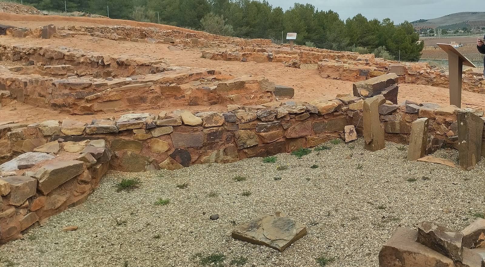
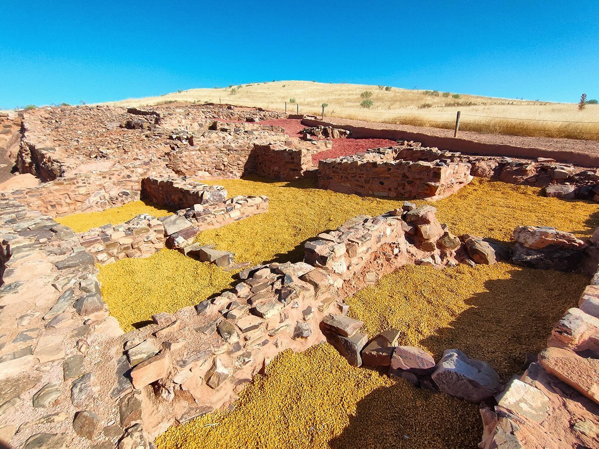
House foundations survive, with stone bases supporting walls made above from adobe, or sun-dried earth bricks, and rammed earth, soil compacted within a frame. Mud from the Jabalón River supplied these materials. Most house walls were thick, had doors as their openings and were intended to retain heat. Some were painted red or white. Wooden doors turned on a trunk used as a pivot and were joined to wooden lintels.
Roofs, floors, and household fittings
Flat roofs used log beams to support reeds and a covering of vegetation, sometimes waterproofed with animal skins. Upright logs served as pillars inside rooms. Earthen floors and streets were usual, although some houses had stone floors. One dwelling had a complete green-slate floor, probably made with slate brought from Sierra Morena for a house of some importance. Houses included kitchens and household ovens.
Production and material finds
Work areas and equipment
Communal ovens provided baking facilities for women whose homes lacked an oven and also served as places to meet. Separate ovens were used for pottery, metalwork and bread, while different mills processed grapes, olives and grain. Finds include substantial quantities of pottery, domestic metal utensils and evidence associated with oil and wine. Copper and iron exploitation points to metalworking, and other evidence indicates textile production.
Stamped pottery
More than one hundred pottery stamps have been found. Their impressions were made while the clay was still wet, possibly with tools made from plant or animal materials such as deer antler. Repeated designs include geometric forms, flowers and fantastic creatures. A five-pointed lotus motif has been linked with Astarte, a goddess worshipped in the ancient Near East, including by Phoenicians, an eastern Mediterranean people. A figure known as the butcher may represent a wolf or lion, but its identity is uncertain. Another design may show a griffin, a mythical creature combining features of a lion and a bird. It may be related to a ring from the site bearing a griffin and three stars, a design compared with a symbol on coins from Cástulo.
The meaning of the stamps remains debated. Decoration is the leading explanation, but they may also have marked an author or owner, or served as a simple means of communication. Their origins may reflect Phoenician influence or local Oretani practice.
Cemetery
The cemetery lay on a low plain 222 metres east of the settlement’s eastern wall, in clear view from the hill. It contained 14 cremation graves and an ustrinum, a place where bodies were burned during cremation. A burial mound held six of the documented graves, with the others nearby. Tomb 1 is the best-preserved burial. It contained cremated remains in an urn, along with spindle whorls used in spinning, fibulae (ancient clothing fasteners), weapons and ceramic vessels. Imported objects included an Italian terra sigillata plate, a fine Roman ceramic ware often marked with a maker’s stamp. Its stamp names the workshop of L. Titivs, and the plate dates to AD 15–40. The cremations indicate that the practice continued in the southern Meseta in the early first century AD.
Burials within the settlement
The two decapitated adults were found in an area thought to have been the main street. Their burial was initially interpreted as a possible human sacrifice connected with the settlement’s expansion toward the river. Other possibilities are that they were thieves or enemies of the community.
Environmental evidence
Regional evidence points to a Mediterranean climate, with mild, rainy winters and hot, dry summers, as well as increased aridity during Bronze Age climatic variability. Plant remains include holm and cork oak, olive, grapevine, barley, wheat, wild asparagus and fig. Yellow-gravel plots have been associated with wheat or other cereal cultivation, and some wild plants may have been used medicinally. Animal remains include cattle, pigs and sheep, along with deer, wild boar, aurochs, horses and rabbits; the wild animals were hunted and eaten. Together, these remains show a mixed livelihood involving farming, herding, hunting, gathering and craft production.