Auerbach Castle: A Medieval Fortress in Germany
Site at a Glance
- Popularity
- High
- Country
- Germany
- Primary era
- Medieval
- Eras represented
- Medieval, Modern
- Civilizations
- German, Holy Roman Empire
- Site type
- Military
- Remains
- Castle
On this page13 sections
History
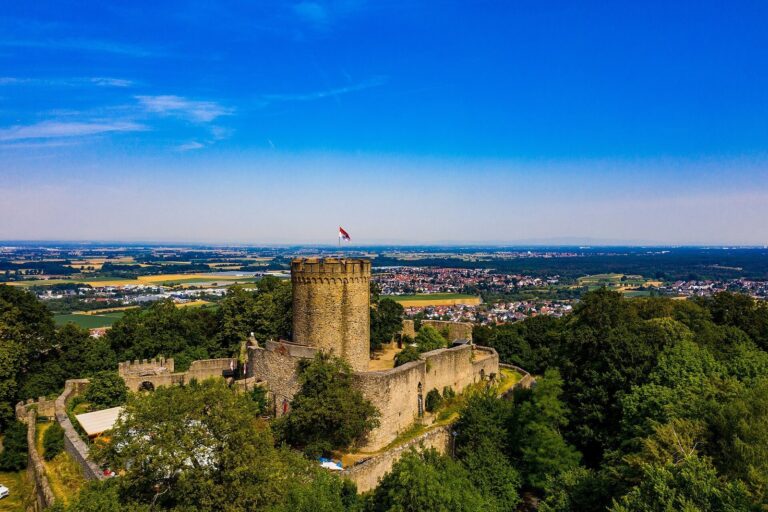
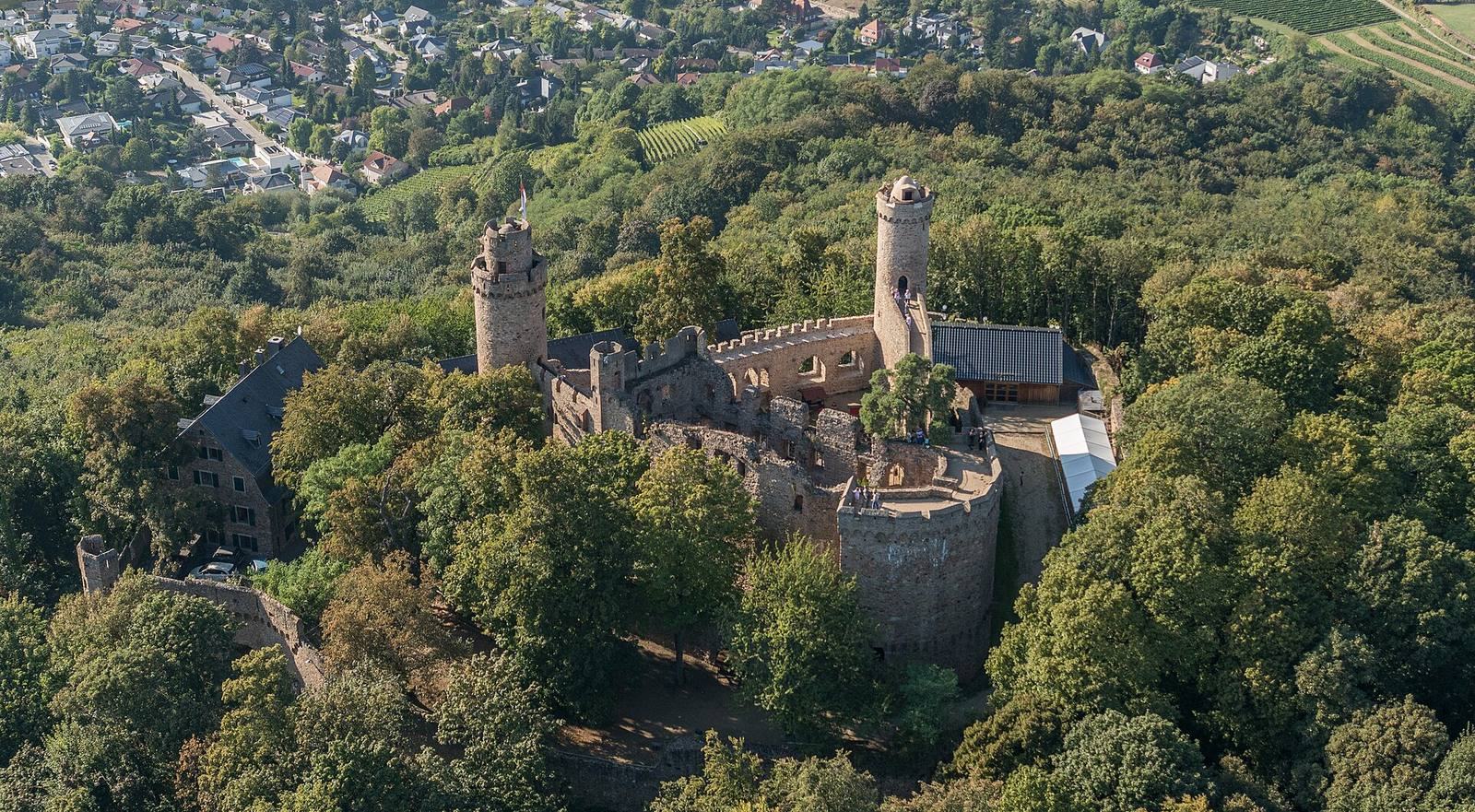
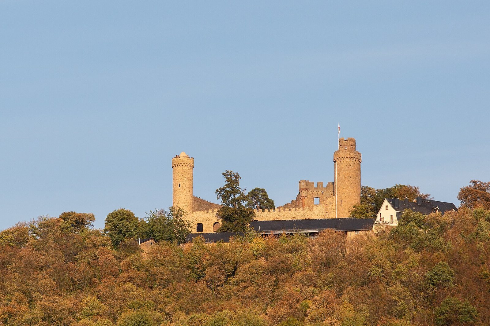
Auerbach Castle is a 13th-century fortress on Auerberg above Auerbach, now a northern district of Bensheim, Germany. The medieval ruling House of Katzenelnbogen built it to defend its lands south of the Main and secure tolls along the Bergstraße, or Mountain Road, a historic north–south route. The castle became the chief fortress of the county’s Upper County in southern Hesse.
Origins and construction
Auerbach itself was recorded as Urbach in the Lorsch Codex around 784, but that reference concerns the settlement, not the castle. Around 1135, parts of the Bergstraße region passed to Henry II of Katzenelnbogen through his marriage to Hildegard of Henneberg. King Konrad III made Henry a count in 1138, and Auerbach then belonged to the County of Katzenelnbogen, whose lands included a Lower County around St. Goar and an Upper County in southern Hesse.
Castle construction probably began around 1222 under Count Diether IV. The fortress is first mentioned in 1247, and the earliest charter drawn up there dates to 1257. It was also known as the Urberg Fortress. In the valley between Melibokus and Auerberg, an earlier hermitage beside a spring believed to have healing properties had been established in the 11th or 12th century. The castle’s builders created a pilgrimage site beside it in the first half of the 13th century, initially called To the Hermits and renamed For God’s Need in 1452.
Winegrowing below the castle appears in records from 1258 and 1318, the latter naming the Reubere vineyard. The grape variety Urbergen Wyne was mentioned in 1410. Vineyards at the foot of Auerberg now form part of the Auerbacher Rott collective vineyard site in the Hessische Bergstraße wine region.
Hessian rule and military decline
After the death of the last Count of Katzenelnbogen, Philipp I the Elder, in 1479, the castle and county passed by inheritance to the Landgraviate of Hesse, a territorial principality ruled by a landgrave. An earthquake on 18 October 1356 had already brought down the keep onto the eastern and southeastern defenses. Major rebuilding and enlargement followed around 1370.
During the 16th century, more powerful artillery and longer-range weapons reduced the castle’s defensive value. Residents of Auerbach and Zwingenberg later sought shelter within its walls, but it was not used as a military stronghold during the Thirty Years’ War, the major European conflict of 1618–1648. In 1634, soldiers burned and removed what remained at the site.
Destruction and later conservation
In 1674, during the Franco-Dutch War, an army led by French Marshal Turenne stormed the castle, killed people sheltering there, and set its buildings on fire. French troops, mainly under General Lorges, returned along the Bergstraße in 1693. Further devastation left the castle in ruins. People took building materials for use in the town, and the abandoned site continued to decay.
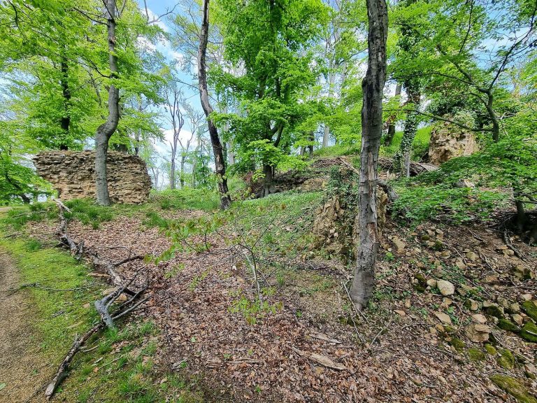
The north tower collapsed in 1820, after which partial rebuilding and stabilization continued. The tower was reconstructed in a slightly altered form, and the inner enclosure was restored. Around 2006, the residential hall’s ground floor collapsed. Its surviving underground vaults were secured in 2011.
Remains
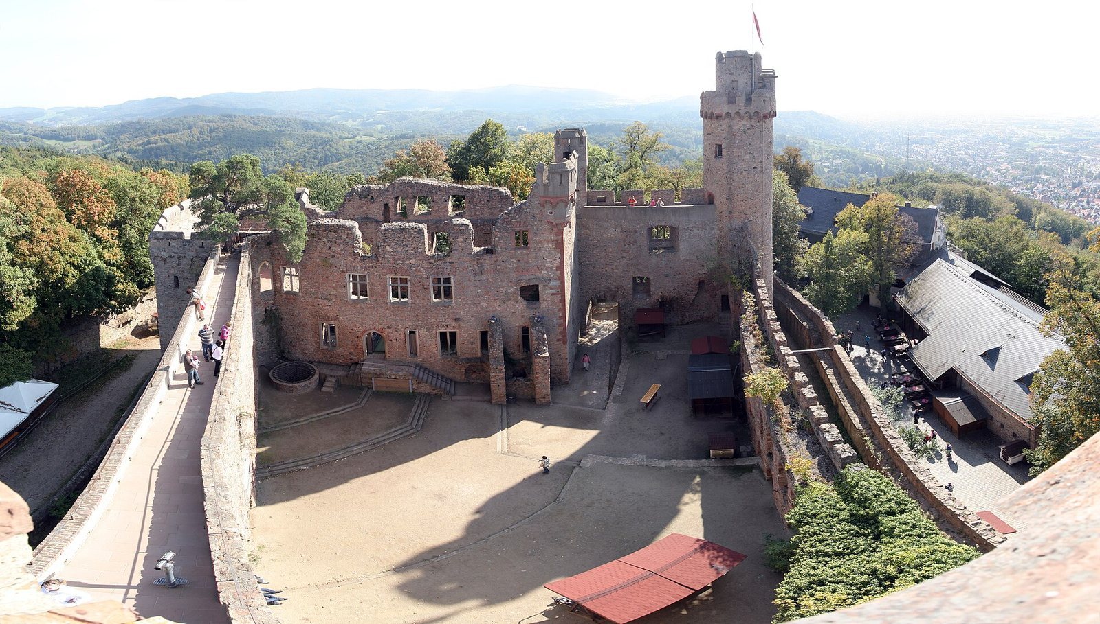
The ruins stand 345.9 metres above sea level on Auerberg, east of the Upper Rhine Plain and on the western foothills of the Odenwald. Auerbach lies below and to the west, while Melibokus, the highest mountain on the Hessian Bergstraße, rises to the north. The surviving castle is organized around a triangular inner enclosure, bounded by a ring wall and set within a second ring wall around the outer forecourt.
Buildings within the inner enclosure
Courtyard ranges
Buildings stood along the courtyard side of the wall between the north and south towers. This range contained the kitchen, quarters for retainers, stables, and a smithy.
Residential hall and chapel
The residential hall stood against the wall between the east and south towers, facing the courtyard. It had a cellar and three storeys, with the castle chapel formerly housed within it. The hall’s ground floor has collapsed, while underground vaults survive and were secured in 2011.
Courtyard well
A well in the eastern corner of the courtyard was cut 62 metres into the bedrock.
Outer defenses and towers
Walls and approaches
The inner enclosure is surrounded by a ring wall, with another wall enclosing the outer forecourt. The outer wall’s southern entrance was protected by an external enclosure and a wing wall on its left. From there, the approach descended northeast toward the gatehouse. A deep ditch and drawbridge defended the northeast ridge, the only level approach to Auerberg.
Towers and artillery defenses
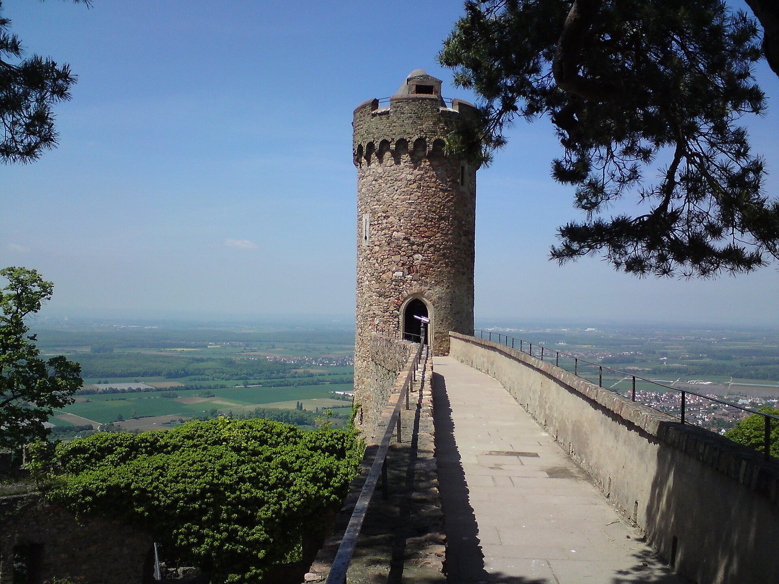
The original entrance to the inner castle pierced the shield wall, a particularly strong wall protecting an exposed side, between the north and east towers. A keep protected the entrance. Around 1370, the entrance was moved to the southern corner, where the south tower and inner enclosure defended it. A quarter-circle bastion, a projecting defensive structure, replaced the east tower. About four metres thick, it was designed to guard against cannon fire from the northeast and has been described as the first structure of its type in Germany. The north and south towers were probably also raised during this rebuilding. The north tower was later reconstructed in a form resembling the south tower, which retains its original form.
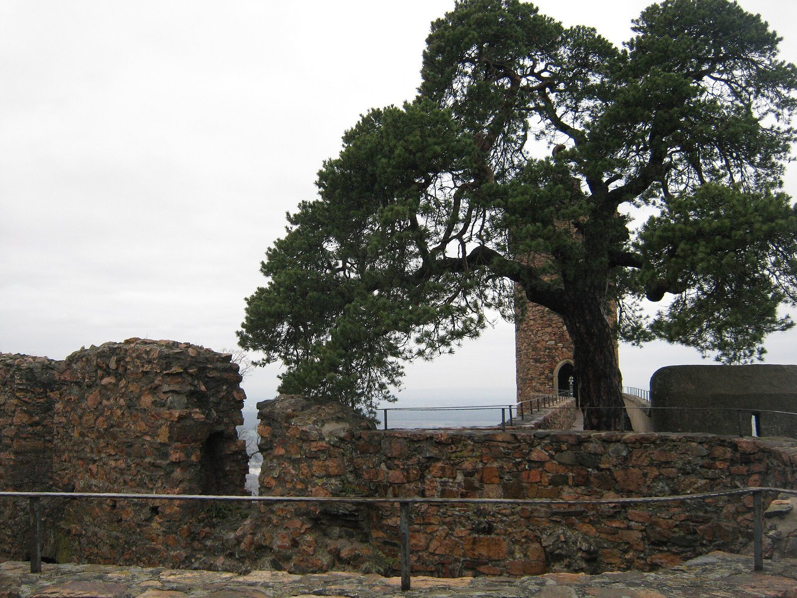
Scots pine on the shield wall
A Scots pine more than 300 years old grows high on one of the shield walls. It is about seven metres tall; harsh growing conditions have kept it small, and some of its water comes from moisture that condenses on its needles. Its growth has been likened to an oversized bonsai.