Santa Criz: An Iron Age Settlement and Roman City in Spain
Site at a Glance
- Popularity
- Medium
- Country
- Spain
- Primary era
- Classical
- Eras represented
- Iron Age, Classical
- Civilizations
- Roman
- Site type
- Settlement
- Remains
- City
On this page12 sections
History
Santa Criz is an archaeological site on Santa Criz hill in Spain, where an Early Iron Age fortified settlement developed into a Roman city. The hilltop community grew during the Late Iron Age into an important fortified center overlooking the Aibar and Aragón valleys. It covered an estimated 1.5 hectares.
From hilltop settlement to Roman city
Around 195 BC, Roman forces in northern Iberia came into contact with the Vascones living at the settlement. After the Roman conquest, its inhabitants moved from the summit to the plain on the hill’s southern side. A larger city was laid out there beside the Iacca–Vareia road, eventually spreading across about 13 hectares. Its Roman institutions and customs do not establish that its inhabitants were ethnically Roman; provincial towns commonly included local people who adopted Roman civic practices.
The city’s character changed under Augustus, Rome’s first emperor, whose reign lasted from 27 BC to AD 14. Santa Criz began as a tribute-paying city and gained municipium status, a recognized position in the Roman civic system, in the late first century AD under Vespasian. The Valerii and Cornelii families, and perhaps the Calpurnii, belonged to its elite. The city flourished in the first and second centuries AD before declining. People continued to live among its ruins in the fourth and fifth centuries, although the scale of this later occupation is uncertain.
Names, inscriptions, and language
The ancient name of Santa Criz is unknown. Nemanturissa and Bituris have both been proposed, but neither identification is certain. In the second century AD, the geographer Ptolemy listed cities with those names among the Vascones, an ancient people associated with the region of modern Navarre.
Inscriptions from Santa Criz and its surroundings form a rich body of evidence from Vasconian territory. Inscriptions at nearby Uxue and Lerga name the deity Lacubegi and record personal names including Abisunharis, Narhungesi, and Umme Sahar. These names have been used to suggest that Basque was spoken in the region. At Santa Criz itself, most recorded personal names are Latin, while others appear Celtic. This pattern has also been interpreted as suggesting that Basque-speaking Vascones were not a majority in the territory.
Rediscovery and archaeological investigation
In 1917, Juan Castrillo, the parish priest of Sada, drew attention to a third-century Roman milestone found in the Artamaleta stream. In 1928, historian and antiquarian Julio Altadill proposed that a road might be associated with it. A second milestone, found nearby in 1971, was attributed to the reign of Probus, a third-century Roman emperor. In 1934, Jesuit Francisco Escalada Rodríguez argued that substantial Roman remains at Santa Criz belonged to a city. Archaeologists Blas Taracena and Luis Vázquez de Parga carried out exploratory work in the area during the 1940s.
Two sandstone grave slabs were reported in 1980 and described in 1994. Their inscriptions, shape, and images have been considered possible evidence for some of the earliest Christianity in Navarre. Preliminary surveys began in 1994–95, and systematic excavation started in 1994 under Rosa Armendáriz, Txaro Mateo, and Pilar Sáez de Albéniz. Work in 1995–96 examined the forum, cemetery, and Iron Age settlement. Later excavations established the development from the earlier settlement to a Roman civic community with a forum and cemetery.
Geophysical surveys in 2022 and 2024 helped identify buried structures and inform excavation planning. The 2022 survey indicated numerous residential buildings and routes toward Gallipienzo and Eslava, as well as possible continuation of the cemetery beyond the area excavated. Excavations begun in 2024 have been led by María García-Barberena, Leyre Arróniz, and Luka Iona García de la Barrera, with Javier Andreu Pintado as scientific adviser. In 2025, excavators identified the Iron Age settlement wall; test trenches in that area yielded no evidence of Romanization.
Santa Criz lies within the Roman province of Tarraconensis and the conventus Caesaraugustanus, a regional administrative district. In 2016, the Government of Navarre designated the archaeological zone an Asset of Cultural Interest, citing the scale of its remains and its inscriptions.
Remains
The archaeological area covers about 12–13 hectares, including Santa Criz hill and adjoining land. The hill rises to 544 metres on the right bank of the Indusi stream. The Iron Age settlement occupied its steep summit, while the Roman city stood several metres lower on the southern slope. Identified areas of the city include residential zones, an acropolis, a public square, and a cemetery.
Iron Age defenses
The first enclosure at the summit was triangular and protected by a wall. A narrow spiral ramp ran clockwise beneath the wall and entered at the north-west corner. A later defensive enclosure followed the natural rock eastward, covering more than 9,000 square metres. In places, builders cut into the sandstone to make the approach harder. One or more ditches have also been proposed as part of the defenses.
Roman city
Forum
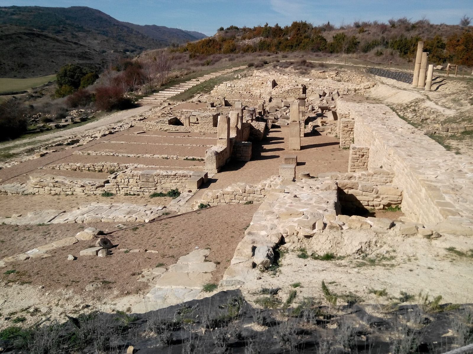
The forum, the city’s principal public square and civic center, occupied a broad terrace on the southern slope. Part of the square’s paving and a street leading to it have been excavated. Along its southern side, a partly enclosed gallery beneath ground level measures 40 by 8 by 4.3 metres. It helped support or level structures above. Its substantial retaining wall consists of regularly laid small stones and has buttresses to resist the hillside’s weight. The opposite wall uses the same construction and has vertical supports. The gallery collapsed more than once and was rebuilt. A large public building used for civic and legal activities is thought to have stood above it.
Principal temple
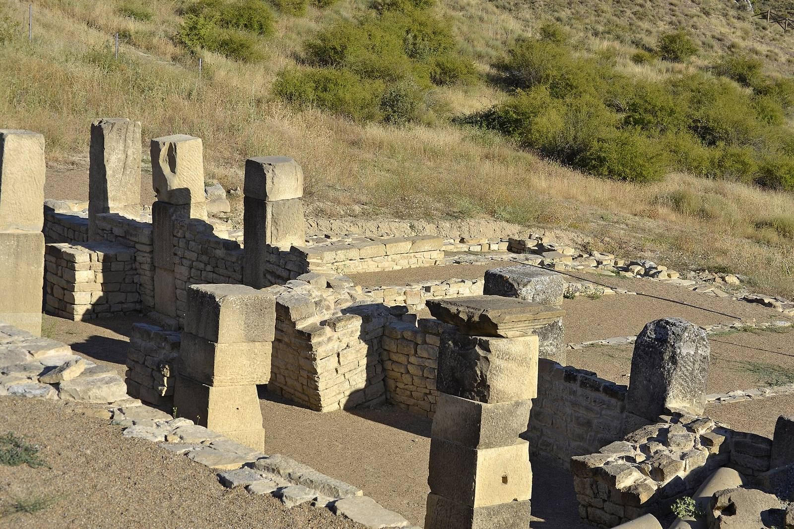
East of the forum, excavations in 2023 revealed the city’s principal temple. Its walls were built from large, squared sandstone blocks. Although excavation remains incomplete, the exposed masonry indicates a monumental structure.
Colonnade
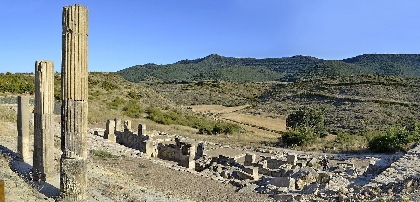
West of the gallery, excavators uncovered the fallen colonnade that surrounded the forum square. Finds among the columns include ten Corinthian capitals and fragments of three sculptures, one of them a marble torso depicting a figure in a toga.
Necropolis
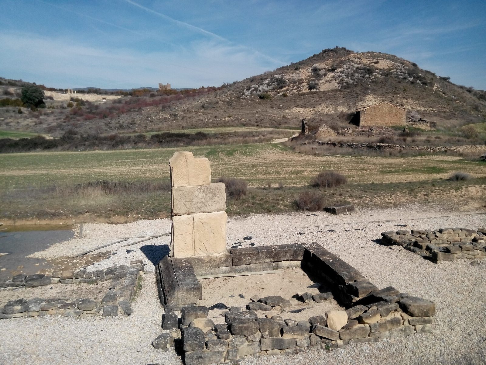
The cemetery lies south of the city at the foot of the hill, beside the old road to Gallipienzo. This road may have branched from the Iacca–Vareia Roman road. The excavated area covers more than 2,000 square metres and includes monumental tombs, burial pits, open-air cremation graves, grave monuments, stone slabs, and altars. The cemetery was used from the first through the fourth centuries AD, and the dead were cremated. Seeds, pottery fragments, dice, and other everyday objects found in graves shed light on funerary customs.
Other excavated material
Finds from the site include pottery, bone tools, inscriptions, and fragments of bronze and marble sculpture. Early observations also noted column shafts, capitals, and squared stone blocks carved with vine motifs. The milestone found in the Artamaleta stream was transferred to the Navarre Museum.