Lübecker Kreuzweg: A Medieval Stations of the Cross Route in Lübeck
Site at a Glance
- Popularity
- Medium
- Country
- Germany
- Primary era
- Medieval
- Eras represented
- Medieval, Modern
- Civilizations
- German, Holy Roman Empire
- Site type
- Religious
- Remains
- Sanctuary
On this page9 sections
History
The Lübecker Kreuzweg is a late-medieval Stations of the Cross route in Lübeck, Germany, conceived after a pilgrimage in 1468 and completed in 1493. It is one of Germany’s oldest routes of this kind. Its stations recalled episodes from the Passion, the Christian account of Jesus’s suffering and death, and were inspired by the Via Dolorosa, the traditional Jerusalem route associated with his journey to crucifixion.
Constin’s route and its legend
According to the Rehbein Chronicle, Lübeck merchant and city councilor Hinrich Constin visited the Holy Land in 1468 and measured the Via Dolorosa. After returning, he arranged for a seven-station route to be created in Lübeck. Constin died in 1482, before the work was finished, and left his fortune to the city on the condition that it complete the route. The project reached completion in 1493.
A local legend gives Constin’s undertaking a more dramatic origin. It says he built a hill representing Golgotha at Eichholz, before the Burgtor, in a place once called Jerusalem. After an angry outburst had caused his wife deep distress, he supposedly traveled to the Holy Land to do penance. The tale says that his courage in fighting non-Christian opponents earned him the title Knight of Jerusalem, and that he measured the route before arranging stations at corresponding points in Lübeck. It associates the marker in St. Jakobi’s wall with the moment Jesus began carrying the cross, and the distance from the first Burgtor to Jerusalem with the point at which Simon of Cyrene, the figure who helped Jesus carry the cross, took it from him. The story continues that Constin’s daughter returned from Novgorod by ship on the Trave with her husband and child, whose likeness reminded him of his deceased wife. Constin is said to have died peacefully after seeing them. In another part of the legend, lightning splits the crucifixion stone while leaving the bones whole.
The Reformation and loss of stations
Lübeck’s Reformation, introduced through a 1531 church ordinance by Protestant reformer Johannes Bugenhagen, caused the route to fade from civic awareness. The second station still stood in 1615, when it was incorporated into the newly built New Chamber during an extension of the chancellery; it disappeared soon afterward. Alterations to the Burgtor in 1623–24 destroyed the third station. Remains of stations four through six were seen in 1713 and may have been cleared in 1798.
Later alterations and renewed observance
The relief at the final station underwent major restoration in 1680. During Lübeck’s French period, part of the Jerusalemsberg complex was removed to open a clear field of fire in front of the Burgtor. The relief was restored again in 1882, and city gardener Metaphius Theodor August Langenbuch redesigned the surrounding green space in 1896. In Constin’s memory, the path descending toward the Trave was named Konstinstraße; the nearby Konstinkai and Konstinbahnhof of the harbor railway also bore his name. On 3 December 1936, the Nazi regime renamed Jerusalemsberg Kreuzberg. The former name returned after 1945.
In the early 1990s, Helmut Siepenkort, then provost of the Roman Catholic Herz Jesu church, initiated the revival of the Good Friday procession. Held again from 1994, it became an ecumenical observance, bringing together different Christian traditions with support from the Protestant congregation of St. Jakobi. Participants carry a cross between stations, with songs, readings, and short addresses connecting the suffering and message of Jesus with present concerns. The addresses often refer to the Lübeck Martyrs, four local clergy executed by the Nazi regime in 1943. The five contemporary station locations were redesigned after a sculptors’ symposium in 2013.
Remains
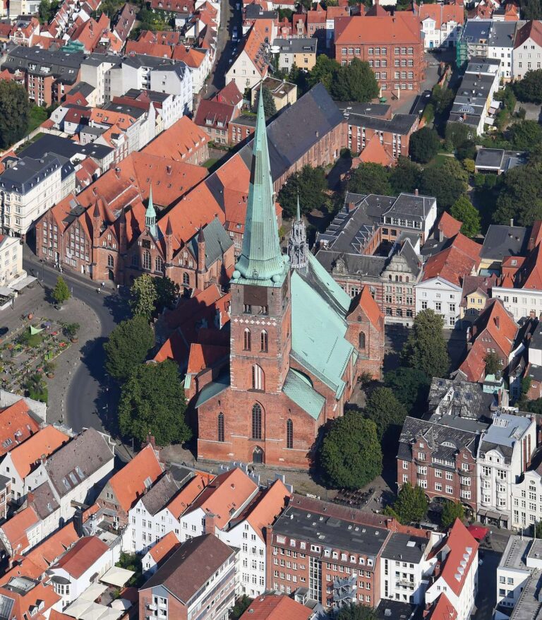
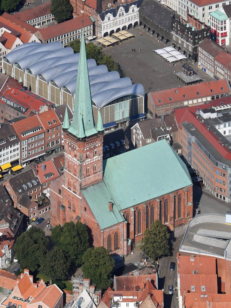
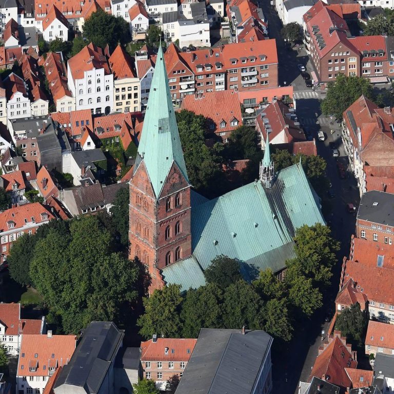
The historic route covered 1,650 metres between St. Jakobi and its final station on Jerusalemsberg. From the church it ran south along Breite Straße to the chancellery, then turned north through Koberg and Große Burgstraße before leaving the old town. The surviving medieval works mark the route’s beginning and end, while five contemporary stations occupy locations along its course.
Medieval stations
The relief at St. Jakobi
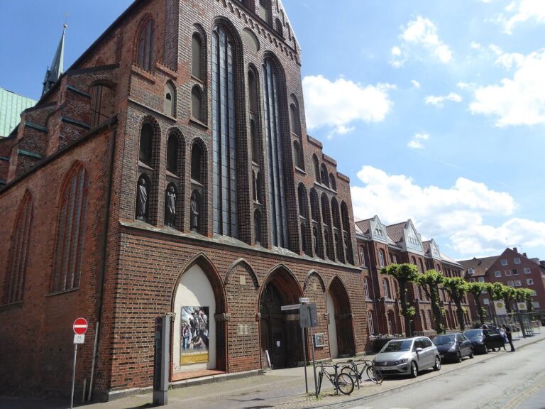
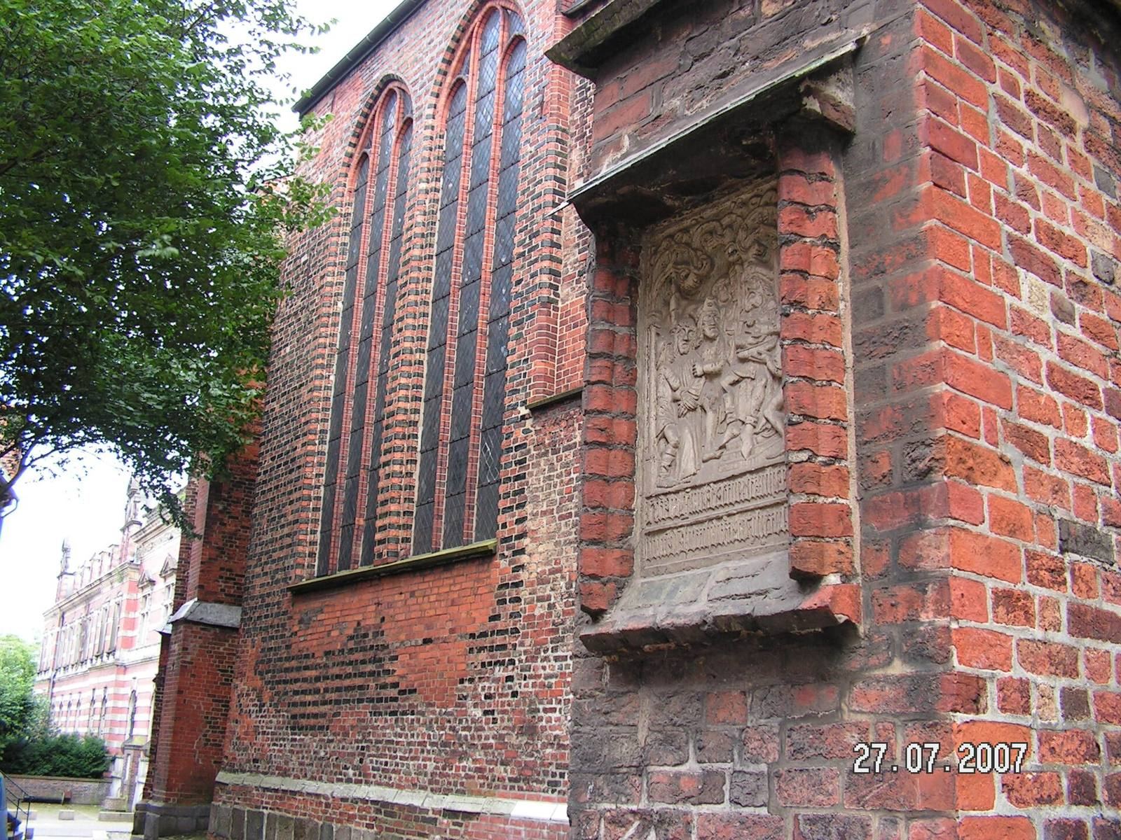
The first station is a sand-lime stone relief on the church’s north side. It depicts Jesus brought before Pontius Pilate, the Roman prefect who presided over his trial in the Passion narrative. Pilate washes his hands in the scene. An inscription beneath the relief, written in medieval Low German, identifies the spot as the start of Jesus’s cross-bearing journey through the Burgtor toward Jerusalem.
The Calvary on Jerusalemsberg
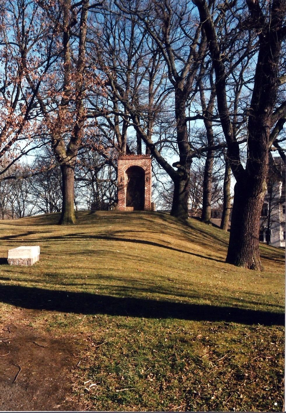
The final station stands on Jerusalemsberg, an artificial hill shaped like a ramp and laid out as a Calvary, the place of Jesus’s crucifixion. It measures about four metres high, forty metres wide, and sixty metres long. A Gothic shelter on the hill contains a rough Gotland limestone relief, 3.30 metres high and 1.77 metres wide. Jesus appears on the cross with Mary and John; hovering angels catch the blood from his wounds in chalices. Bones cover the cross hill, and Constin’s coat of arms stands in front. The shelter formerly had a stepped gable, and an inscription on its frame can no longer be deciphered.
The contemporary stations
The five present-day stations are at St. Jakobi, the Burgtor passage, Burgfeld at Gustav Radbruch Square, the youth hostel, and Jerusalemsberg. Their artwork uses interlocking blocks to suggest connections between lives. Together, the elements form cross shapes and challenge the idea that the powerful have the right to dominate others.