Nim Li Punit: A Classic Maya City in Belize
Site at a Glance
- Popularity
- High
- Country
- Belize
- Primary era
- Medieval
- Eras represented
- Classical, Medieval
- Civilizations
- Maya
- Site type
- Settlement
- Remains
- City
On this page16 sections
History
Nim Li Punit is an ancient Maya city in the foothills of the Maya Mountains in Belize. Established around the mid-fourth century AD, it flourished during the Classic Period, an era of Maya city-state development conventionally dated to about AD 250–900. Most of the structures visible today date to the Late Classic period, around AD 600–900.
Early settlement and political change
People lived at the site during the Late Preclassic period, from about 300 BC to AD 250, before the city was established several centuries later. Early residents may have migrated from what is now Guatemala, and they are thought to have spoken a dialect from the Cholan branch of the Mayan language family. The city’s ancient name is uncertain. Some scholars consider it possible that Nim Li Punit shared a name with the kingdom that formed around it.
Nim Li Punit’s political ties shifted over time. Teotihuacan, a major city in central Mexico, influenced the city in the late fourth century. A Maya kingdom exerted influence in the fifth century, before Nim Li Punit’s allegiance changed to another kingdom. From the seventh century, the city maintained dynastic ties with a further kingdom, while cultural influence from another Maya polity was also apparent. The population may have been aligned with Maya centers such as Tikal, in present-day Guatemala. After a powerful kingdom was defeated in the 690s, Nim Li Punit and its kingdom were not harmed.
Fertile soils, forests, nearby water, and regional exchange supported the city’s prosperity. Obsidian, a volcanic glass used for tools and valued objects, came chiefly from El Chayal and Ixtepeque in present-day Guatemala. Nim Li Punit received about twice as much obsidian from Ixtepeque as nearby Lubaantun, and its ratio of obsidian mass to pottery mass was also about twice Lubaantun’s. In Classic Maya society, obsidian signaled status and was principally available to royalty. The precise political and economic relationships between Nim Li Punit and nearby Maya centers remain uncertain.
Rulers, monuments, and the end of the city
The population is estimated to have reached 5,000 to 7,000. A renewed period of prosperity and monument-building took place under a ruler between 721 and 741, and another revival began around 790. Inscriptions record activity between 721 and 790; a date on Stela 7 indicates that activity continued in 810.
Stela 1 records a ritual scattering carried out by Nim Li Punit’s king, Lajun Ka’an, to mark the completion of a cycle in the Long Count, the Maya system for counting days over long periods. The event corresponds to June 26, 741. Stela 2 records events involving foreign lords. One date has been reconstructed as December 16, 726, and the inscription also gives a Calendar Round date, which combines cycles of 260 and 365 days, corresponding to July 12, 738. Its lower text describes an accession involving Nim Li Punit’s king, who held the unusual title Lord of the Tree, in the presence of a lord from a place called Water Scroll, probably Altun Ha.
The same inscription refers to a cycle-ending ceremony on August 18, 731, and to a commemorative stone-planting with Ek’ Xukpi Ajaw, translated as Black Lord of Copan. It places an event in a sixth province under Ek’ Xukpi’s supervision. A figure from Quirigua may have been that province’s regent or local lord. The final column of Stela 2 is badly worn. A surviving phrase, translated as took pakal, may refer to war; another interpretation treats the mention of flints and shields as a possible reference to warriors or an army. If so, it may be Nim Li Punit’s earliest inscriptional reference to warfare.
Occupation ended around AD 830, during the decline of the Classic Maya civilization. The abandonment appears to have happened rapidly. Regional population growth may have exceeded the capacity of the prevailing milpa system, in which fields are cleared and cultivated, often in rotation.
Archaeological study and naming
Maya people in the area knew the site before archaeological investigations began. Petroleum explorers brought it to wider attention in 1976, and archaeologist Norman Hammond then mapped it and excavated part of the central plaza. Barbara McLeod studied the inscriptions; Richard Leventhal carried out surveys and test excavations from 1983, and Nikolai Grube also conducted research in 1986. Department of Archaeology excavations followed in the 1990s under John Morris and Juan Luis Bonor. In 2015, Geoffrey Braswell led investigations that excavated tombs, recovered objects, and consolidated several structures.
The name Nim Li Punit means “Big Hat” in Kekchi Maya. It refers to the elaborate headdress shown on a carved monument depicting an ancient ruler. Belize’s Archaeological Commissioner, Joseph O. Palacio, gave the site this name in 1976 after the headdress image was identified.
Remains
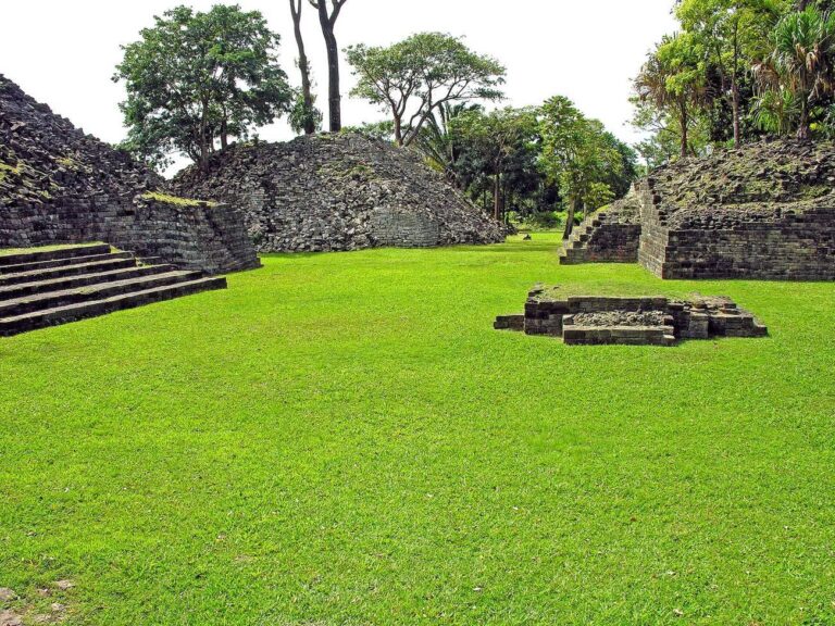
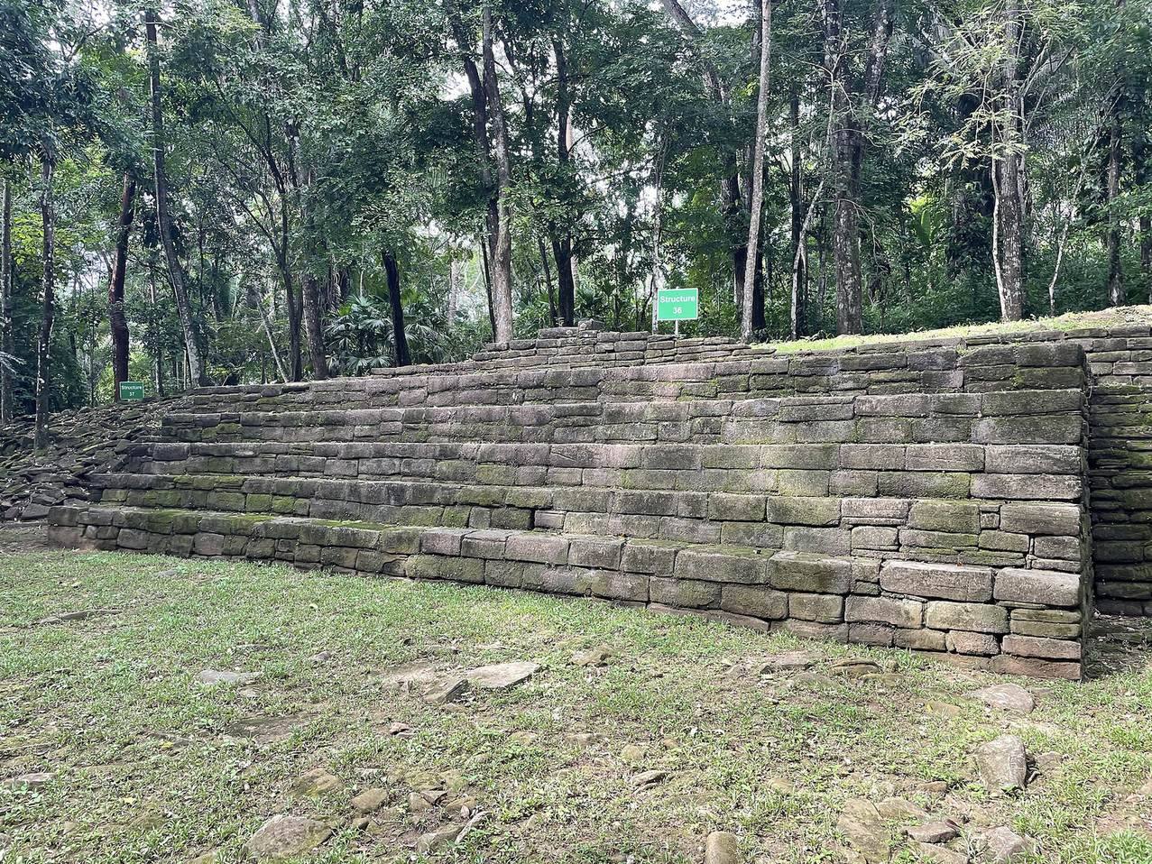
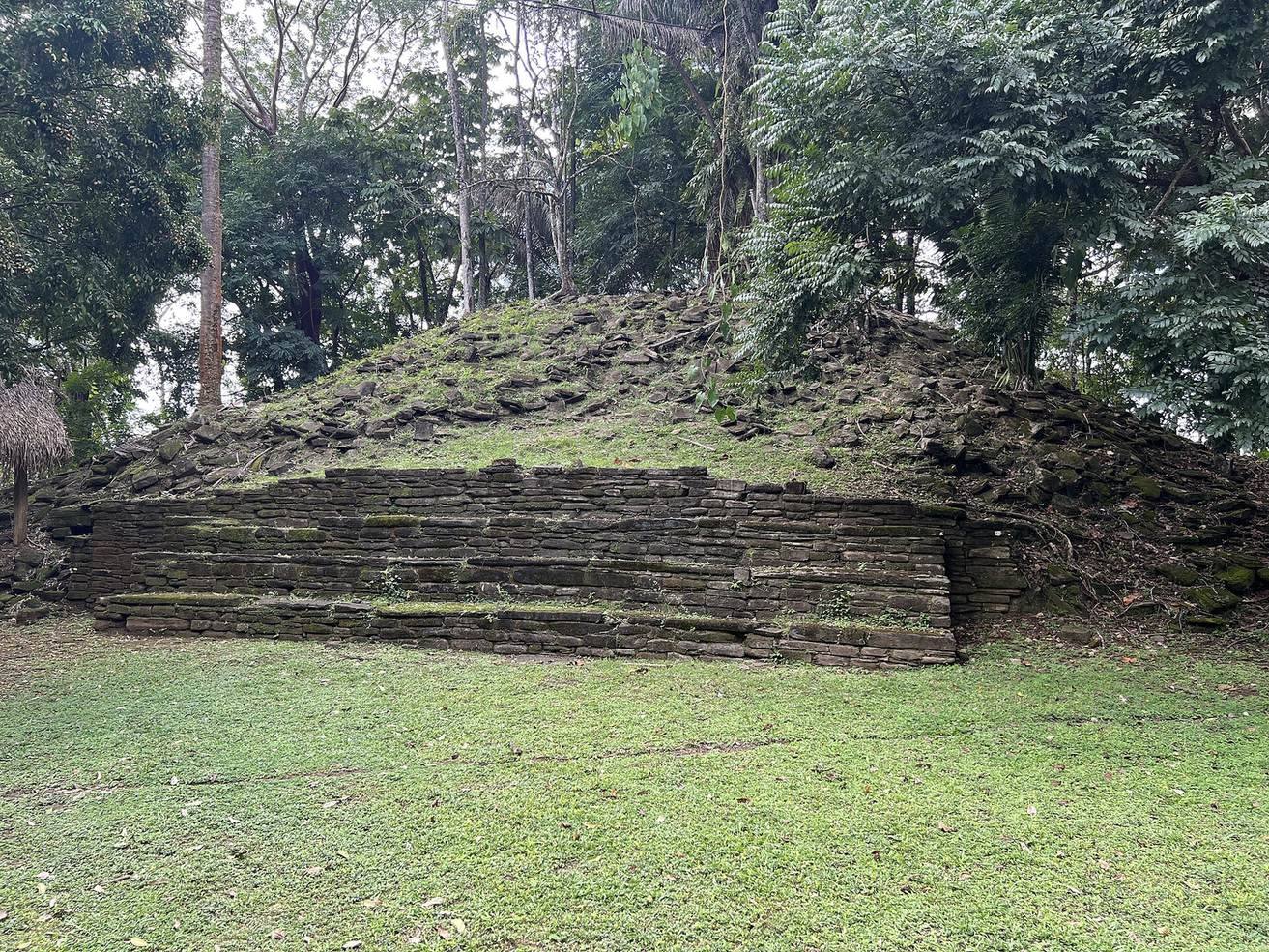
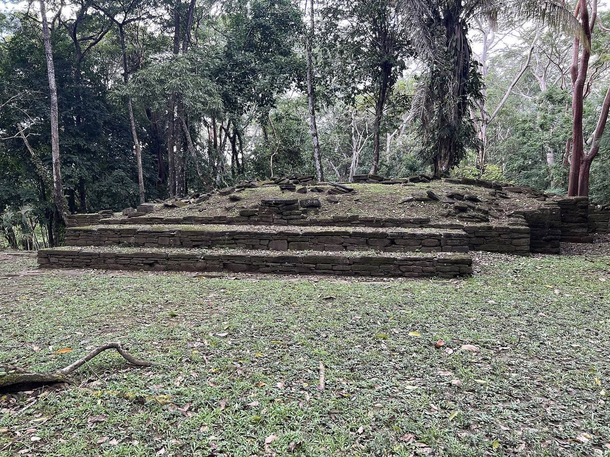
The settlement is arranged around three plazas and includes stepped pyramids, terraces, a palace, and a ballcourt. Builders used substantial fill to form broad plazas and terraces within a geometric plan characteristic of Classic Maya lowland sites. Local sandstone from nearby streams and riverbeds supplied most building stone for structures and monuments. Buildings used Maya mortar; they were not dry-stone constructions like those at Lubaantun. The site lies among mountain streams and tropical forest, with swampy coastal lowlands to the east and wetlands to the south.
Plazas and architectural groups
Northern ceremonial and administrative center
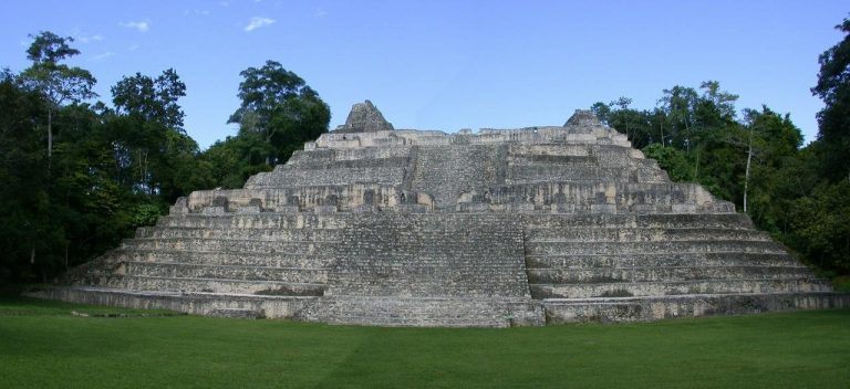
The northern part of the site contains a large plaza, a stepped pyramid, and a royal palace. The largest pyramid at Nim Li Punit rises about 12.2 metres. These buildings form the settlement’s northern ritual and administrative center.
Southern temple and stela plaza
A temple-pyramid in the southern part of the site belongs to an early phase of the city. Its E-Group arrangement, a Maya architectural plan associated with astronomical observation, also served for observing the sky. In the South Group’s Plaza of the Stela, monuments positioned before the long terrace of Structure One are thought to mark the solstices and equinoxes.
Ballcourt and connecting plazas
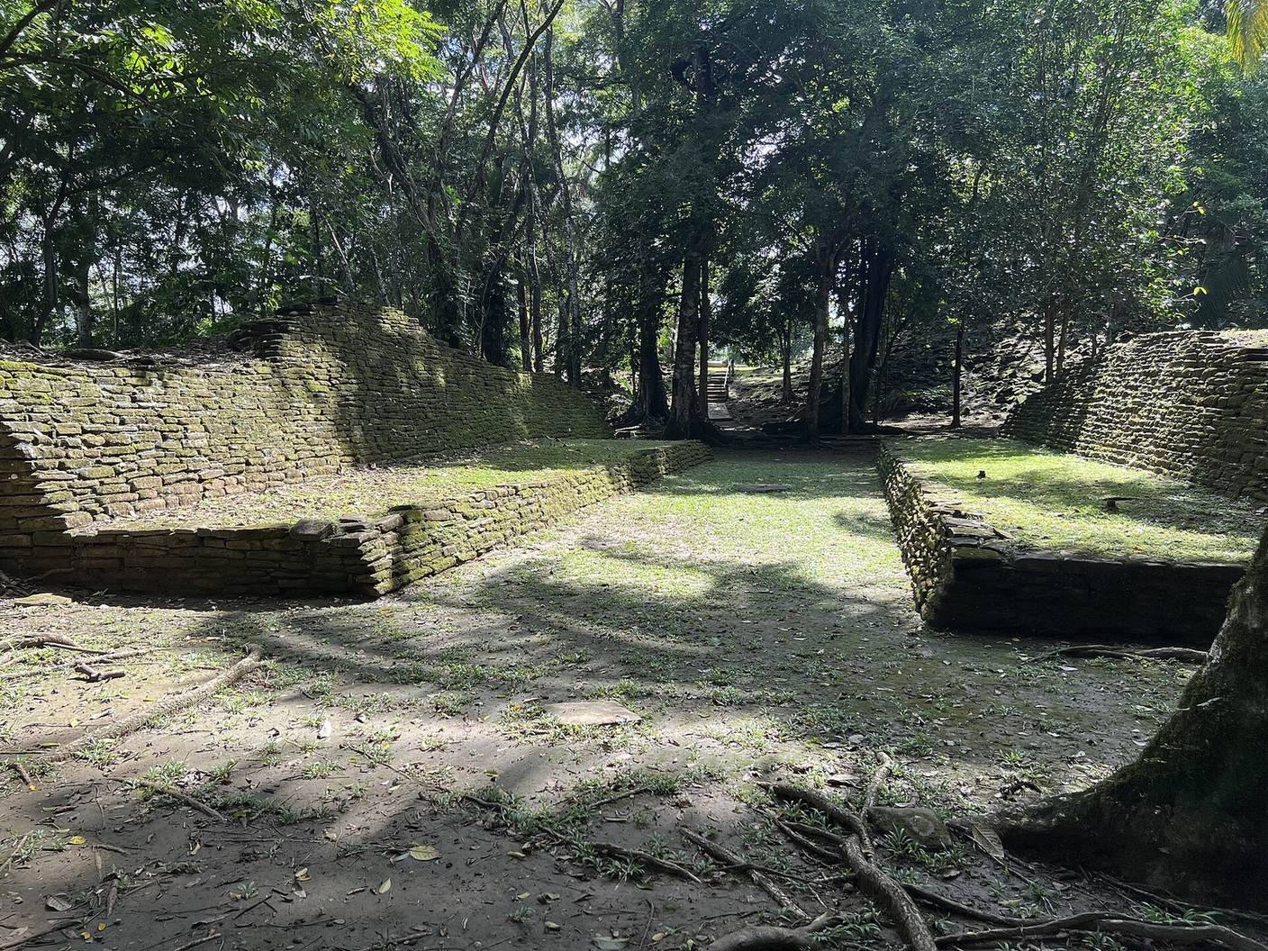
Two additional plazas and further stepped pyramids form other parts of the settlement. A ballcourt lies between the northern and southern sections.
Stone monuments
Several dozen stelae, upright stone monuments often carved with images or inscriptions, and fragments have been found at Nim Li Punit. Only some carry hieroglyphic writing, and many were left unfinished, suggesting that their carving was interrupted. Stelae 1 and 15 are especially notable.
Stela 1
Stela 1 was found in place in the main stela plaza, at the southeast corner of Structure 2 and just south of its central stairway. It is made from fine-grained calcareous shale, a lime-rich stone, and has shallow relief carving on its front. The scene shows two figures performing a scattering rite above a Witz Monster, a supernatural being associated with mountains. Two profile heads form the pedestal, combining into a larger image, with a large mat symbol below. The text is arranged in three columns and contains 12 glyphs, or written signs. The monument broke in two, although its end remains in place. Erosion and cracking threaten to separate part of its central text.
Stela 2
Stela 2 has a smoothed upper surface and an inscription on its lower portion. Its final text column is severely eroded.
Stela 7
The upper text on Stela 7 gives an Initial Series, a formal presentation of a Long Count date. The lower text begins with a Calendar Round date, but the date cannot be established because the intervening distance number has not survived and the lower half is heavily eroded. One sign at position A6 may be a K’uhul Ajaw title, often translated as “holy lord,” or part of a name. Another resembles a head-shaped form of huun, and two final signs may refer to a place of the mountain patron. Concentric circles cover the lower part of the monument; their purpose is uncertain.
Palace and burials
Structure 7 and the early tomb
Structure 7 is thought to have served as a royal palace. Excavation revealed a tomb dating to around AD 400, containing numerous ceramic vessels. Some vessels came from beyond the Maya region, including from Teotihuacan.
Tomb from the period of collapse
A tomb dating to the period of the Classic Maya collapse contained numerous objects, including a large carved jadeite pendant. Jadeite is a hard green mineral used for prestigious ornaments. The pendant was the second-largest carved jadeite object found in Belize and may have been the largest in the Maya region. Rulers of the kingdom associated with Nim Li Punit wore such pendants on the chest during ritual bloodletting.