Castra Regina: Roman Legionary Camp at Regensburg
Site at a Glance
- Popularity
- High
- Country
- Germany
- Primary era
- Classical
- Eras represented
- Classical, Medieval
- Civilizations
- Duchy of Bavaria, Merovingian, Roman
- Site type
- Military
- Remains
- Fort
On this page23 sections
History
Foundation and frontier role
Castra Regina was a Roman legionary headquarters and fortified camp in present-day Regensburg, Germany, built from about AD 175 for Legio III Italica, the Third Italic Legion. It stood beside the Danube at the river’s northernmost point and strengthened the frontier of Raetia, a Roman province in the Alpine and upper Danube region. Before the camp was established, auxiliary troops had guarded this stretch of the frontier. Its construction followed the stabilization of the Danube military situation under Emperor Marcus Aurelius.
Earlier Roman forts and civilian settlements at Kumpfmühl and beside the Danube were destroyed around AD 170, probably in a Marcomannic raid. Both forts were abandoned, and their civilian populations joined settlements associated with the new camp. The Kumpfmühl fort lay about two kilometres south of the river, beside a north–south road linking Augsburg with the Danube. A crossing near the later site of St. Oswald’s Church is considered possible.
A building inscription records that Marcus Aurelius and his son Commodus commissioned the camp’s walls, gates, and towers for the legion. The work was supervised by Marcus Helvius Clemens Dextrianus, the legion’s commander and the provincial governor. The imperial titles in the inscription date it to AD 179, when the defenses were largely complete.
Third-century attacks and rebuilding
A civilian settlement developed beside the camp, especially to its west, and flourished in the first half of the third century. Germanic incursions from around AD 250 damaged it severely. Many residents later moved within the camp walls, although construction in the civilian area continued into the fourth century.
Fire and destruction layers point to several episodes of damage. A major attack in AD 254 is possible but unproven; a clearer destruction horizon probably belongs to the 270s or early 280s, and another raid has been proposed around AD 288. The camp and settlements were rebuilt in the late third and early fourth centuries. As the legion was reduced, the external civilian settlement was largely abandoned and people resettled inside the walls. A smaller military enclosure may also have been established.
Late Roman withdrawal and continued settlement
Castra Regina was probably destroyed again around AD 358, during the Juthungian plundering of Raetia. By then the legion had been substantially reduced, perhaps to about 1,000 men. In the fifth century, its units were distributed among several locations. The late Roman administrative record known as the Notitia Dignitatum places a unit associated with Castra Regina elsewhere at that time. Other armed forces may have continued to defend the site, while regular Roman troops probably withdrew by the end of the century.
Roman rule in the region appears to have ended later in the fifth century, though its precise end is uncertain. Settlement continued, with Roman-influenced material culture alongside an increasing number of Germanic finds. The Germanic groups were probably Roman-allied troops rather than hostile occupiers. The area came under Alamannic influence and then Frankish control. Building activity is known around the transition from the fifth to the sixth century, a wooden palisade was built around 600, and medieval buildings are evident from about 700. The site appears to have remained inhabited throughout these changes.
From ducal residence to medieval town
After the Roman withdrawal, the former camp became the principal residence of the Agilolfing dukes of Bavaria, an early medieval ruling dynasty. From about 900, under Duke Arnulf I, the camp and its associated settlements grew into a larger town protected by new defenses, forming the nucleus of Regensburg. Around 920, expansion west, south, and north involved the demolition of the camp’s western gate and wall. The new town defenses also extended the eastern wall towards the Danube and added an eastern entrance.
The settlement’s name changed over time. It may first have been called simply legio; the forms Regino and Reginum are recorded before Castra Regina, which appears around AD 400. Regino, Reginum, and Regina probably derive from the nearby River Regen. Radaspona, known from around 770 and later associated with the name Ratisbona, may be a medieval pseudo-Celtic formation or an older local name with an uncertain original meaning. The different forms may also reflect the presence of several Roman settlement centers in the area.
Excavation and preservation
Investigations connected with railway construction began after 1870, when Joseph Dahlem led work at cemeteries. Later excavations examined the eastern gate in 1873 and again in 2012–13, the area beneath Niedermünster in 1964–68, and the camp wall at Dachauplatz in 1972. Postwar building work revealed further wall remains, while investigations in 1955 and 1961 clarified the southeastern corner. After 1955, Horst Bergschneider campaigned for the preservation of visible Roman walls. The surviving Roman remains of the camp and associated archaeological sites form part of the Danube Limes UNESCO World Heritage property, inscribed in 2021.
The camp’s gates also experienced later conflict and rebuilding. The Roman eastern gate was badly damaged during the Battle of Regensburg in 1809 and demolished in 1812. The medieval Peterstor, built at the site of the southern gate, was destroyed in the same battle.
Remains
Camp plan and defenses
Setting and layout
The camp occupied an uneven, marshy site south of the Danube, extending from the area of today’s Bachgasse and Wahlenstraße in the west, west of Neupfarrplatz, to the eastern side of Dachauplatz. Its rounded-corner rectangle measured about 540 by 450 metres and covered roughly 24.5 hectares. A gravel layer about a metre deep stabilized the building ground. Wet land to the east was kept damp as a defensive obstacle, while marshy ground to the west was gradually drained for civilian settlement.
Water management
The Vitusbach still flows through an underground conduit in the western part of the former camp. The Romans diverted it to supply service water, carrying much of the stream over a depression about 50 metres wide and two metres deep on a raised dam. The water entered the camp at its southwestern corner and left through two drains leading to the Danube. This arrangement helped separate drinking-water wells from wastewater and gradually dried the western ground.
Walls, towers, and ditch
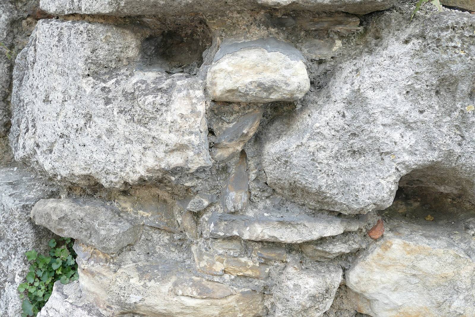
The earliest camp wall was built from regularly cut stone blocks. Identified materials include Kelheim limestone, Regensburg greensandstone, Reinhausen calcareous sandstone, and Solnhofen slab limestone, which was used for floors and the building inscription. Principal quarry areas lay near Kapfelberg and Bad Abbach. Estimates for the stone used in the wall range from about 20,000 cubic metres, considered too low, to about 30,000 cubic metres for the above-ground masonry, considered too high. Stone blocks recovered from the Danube during construction of the Iron Bridge indicate that river transport was used.
A ditch in front of the wall was about six to seven metres wide and 2.5 to three metres deep. The wall stood about 6.2 metres high without battlements; another estimate gives eight to ten metres to the top of the battlements. Soil excavated for the ditch formed a bank against the inner face, reinforced with turf. The defenses included four gates with bridges across the ditch, eight gate towers, four projecting square corner towers measuring eight metres on each side, and 18 square towers built against the inner wall. The towers are described as three or four storeys high and about 11 metres tall.
Gates and roads
The principal east–west road, the Via Principalis, ran from the eastern gate near today’s Drei-Kronen-Gasse across Alter Kornmarkt and Am Frauenbergl to the western gate at the west end of Neupfarrplatz. The north–south route linked the Porta Praetoria with the southern gate, following the Via Praetoria near Domplatz and the Via Decumana near Fröhliche-Türken-Straße. The alignments of Obere and Untere Bachgasse mark the former western wall.
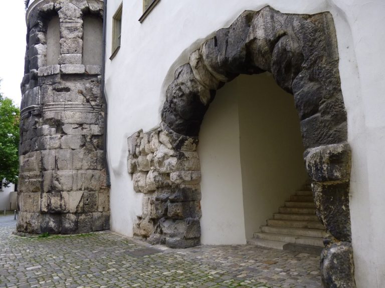
The northern gate, the Porta Praetoria, is partly preserved on Unter den Schwibbögen. It was covered over in 1650 and rediscovered in 1885. The southern Porta Decumana stood at the southern end of today’s Fröhliche-Türken-Straße. It was altered as the medieval St. Paul’s Castle Gate, followed by the Peterstor at the same site. The eastern Porta Principalis Dextra stood where Drei-Kronen-Gasse meets Dachauplatz and was adapted as the medieval Schwarzes Burgtor.
Surviving walls and excavated structures
Eastern wall and southeastern corner
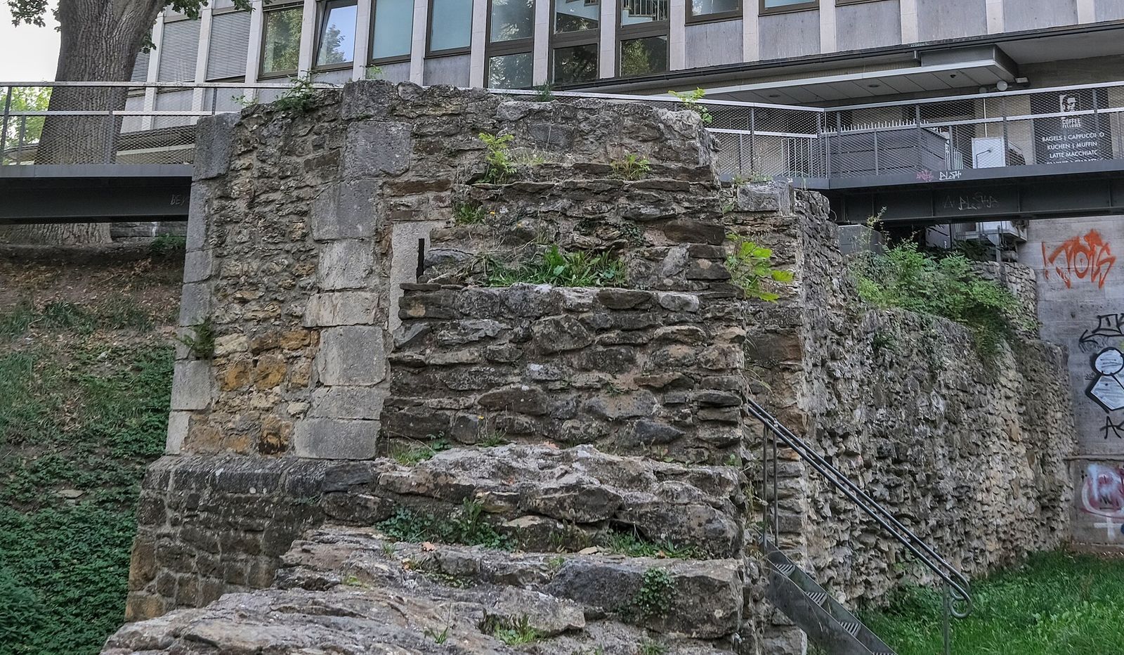
The eastern side preserves the camp wall over its greatest surviving stretch, from the southeastern corner near Ernst-Reuter-Platz towards the rounded northeastern corner at St.-Georgen-Platz. Sections remain within property walls along Adolph-Kolping-Straße and at St.-Georgen-Platz. A small fragment of the western wall is incorporated into the wall of Unter den Schwibbögen 2. Roman wall remains have also been found at scattered points in Regensburg’s Old Town.
Dachauplatz wall and building
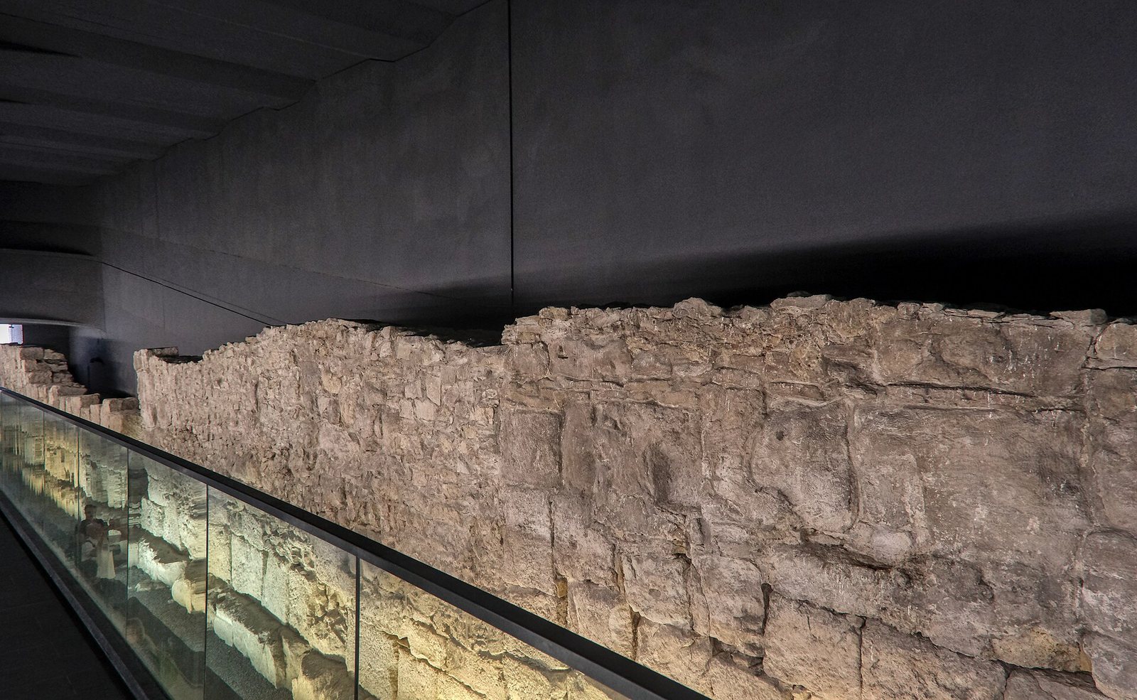
A 60-metre length of wall survives beneath Dachauplatz. A building measuring 60 by 10 metres was attached to its inner side. It was first divided into three aisles by wooden posts, then altered around the middle of the third century to two aisles, with the space between the building and the wall filled with stone. Its rear wall was 1.31 metres thick and made of brick, and it had a pitched, tiled roof. Once interpreted as a forge, the structure is now more often considered a weapons store. Fire destroyed it late in the third century, possibly during a Germanic attack. The building remains lie below ground; the wall can be reached in the basement of a car park.
Eastern gate foundations
Excavations in 1873 found the eastern gate’s foundations, Roman stone blocks, and a fragment of the camp inscription. Further work in 2012–13 established that most of a 2,000-square-metre construction area had already been disturbed, while 245 square metres remained intact. A well-preserved bronze horse was recovered there, a find interpreted as evidence that wealthy military officers lived in that part of the camp.
Buildings within the camp
Barracks
Excavations beneath Niedermünster in 1964–68 reached layers about five metres deep and revealed soldiers’ barracks, first built of wood and later of rubble stone. Each barrack accommodated about 100 men, with the centurion’s quarters at one end. The legion’s nominal strength in the second century was about 6,000, though the number actually present at the camp is uncertain. Parts of the excavated area can be seen in the Niedermünster documentation center.
Baths and residences
Remains interpreted as at least two bath buildings were found in the camp’s central area. A structure uncovered at Alter Kornmarkt in 1901 is understood as a bath that was later replaced by a palace-like residence in late antiquity. The headquarters and commander’s residence are thought to have stood around Weißbräuhausgasse and Weiße-Lilien-Straße. Scattered masonry, column bases, and other architectural fragments point to an elaborately finished area, while Roman wall fragments beneath Neupfarrplatz may have belonged to staff officers’ residences.
Settlement, cemeteries, and sanctuaries
Western civilian settlement
A civilian settlement almost as large as the camp lay to its west. Excavations at today’s Arnulfsplatz uncovered a substantial residence with rooms heated by a hypocaust, an underfloor system that circulated hot air, as well as a courtyard garden and a bath. The legion supplied the building’s bricks, prompting its interpretation as an officer’s town house. Residential buildings and workshop remains were also found at today’s Bismarckplatz, where the street may have had a covered walkway.
Cemeteries
The principal cemetery lay southwest of the camp along the ancient road to Augsburg, now Kumpfmühler Straße and Schottenstraße. It extended for at least 600 metres and may have covered about 10 hectares, with an estimated 30,000 to 40,000 burials. Investigations uncovered about 5,000 cremation and inhumation burials, of which about 1,100 were recovered. Grave markers, inscribed stone coffins, and relief-decorated blocks indicate that the cemetery included monumental tombs. Most recovered objects are held by the Regensburg Historical Museum, with a smaller number in the Archaeological State Collection in Munich. Another cemetery lay south of the camp.
Sanctuaries
A sanctuary of Mercury stood about three kilometres south of the city on Ziegetsberg, beside the ancient road from Augsburg. It included a Gallo-Roman temple surrounded by a walkway and two smaller chapel-like buildings. The remains indicate at least six cult statues. A 92-centimetre statue of Mercury was found there, along with fragments of divine images and inscribed votive stones.
A sanctuary of Liber Pater, a Roman deity associated with fertility and wine and identified with Bacchus, is indicated by a votive inscription and architectural fragments west of the civilian settlement near today’s Weinweg. It probably belonged to a nearby rural estate. Other finds from Regensburg include an inscription concerning the restoration of a temple to Mars and Victoria, bronze figurines of a goat, Amor, and three figures of Mercury, and Roman incense burners.